Environmental Research
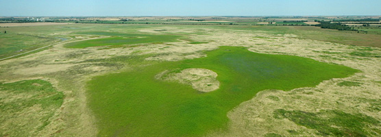
Cheyenne Bottoms, Kansas

James S. Aber, Susan E.W. Aber
and Robert L. Penner II

Table of Contents
Introduction Vegetation
2002 – 2005 2005 – 2007
2008 – 2011 2012 & 2013
2014 – 2017 2018 – 2020
2021 & 2022 Bird's-eye views
2023 status Authors & references

Introduction

Cheyenne Bottoms is the premier wetland of Kansas. Located in the center of the state, it is considered to be among the most significant sites for shorebird and waterfowl migration in the United States (Zimmerman 1990). At least 356 bird species have been spotted at Cheyenne Bottoms, some of which are threatened or endangered—whooping crane, peregrine falcon, piping plover and least tern (Penner 2010).

The site is an important point for rest and nourishment for hundreds of thousands of birds in their seasonal migrations between Arctic summer breeding grounds and southern winter ranges along the Gulf Coast, Caribbean and South America. Cheyenne Bottoms is considered by many to be the single most important wetland for migrating shorebirds in North America, and it is designated as a Ramsar wetland of international importance.

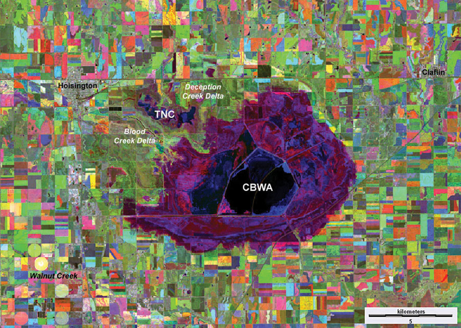
Multitemporal satellite image based on 2006 (drought), 2007 (flood) and 2009 (normal). Bright colors represent significant changes in land cover from year to year; dull-gray colors indicate little change in land cover. The broad maroon-purple zone shows the extent of high water in 2007; black and dark blue show perennial water bodies. CBWA - Cheyenne Bottoms Wildlife Area; TCN - The Nature Conservancy. Adapted from Aber, Pavri and Aber (2012, fig. 16-20).

Beginning in 2002, we started research at Cheyenne Bottoms in cooperation with the Nature Conservancy. Our primary methods are various forms of remote sensing—satellite imagery and aerial photography, combined with ground observations. Specifically we have developed techniques and utilized low-height kite and blimp aerial photography to acquire vertical and oblique views that depict the landscape in great detail. Our goal is to document, analyze, and understand climatic and human impacts on this dynamic wetland environment (Aber et al. 2016, 2021).


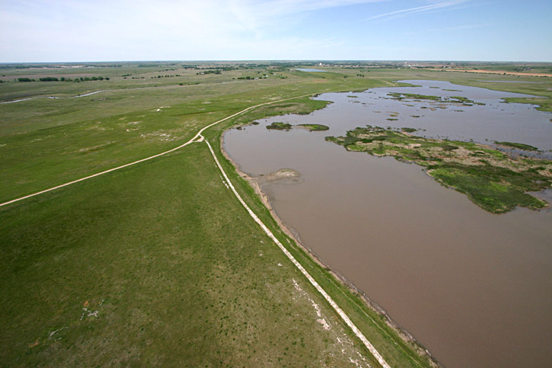
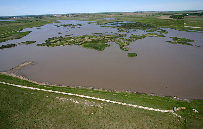
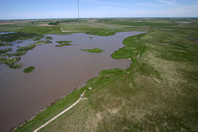
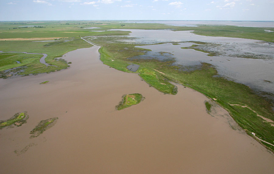
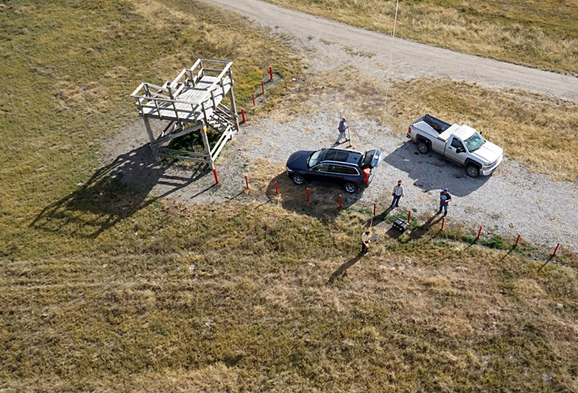
The following kite aerial photographs were taken in mid-May 2005. At this time, the marshes contained substantial water, and wetland vegetation was greening up nicely. The images are arranged to provide full 360° panorama of the Nature Conservancy marsh complex at Cheyenne Bottoms.


View westward

View toward NW

View northward

View toward NE


View eastward

View southward

View toward SW

Wetland vegetation

During our investigations we have identified three key emergent wetland plants that are indicators for wildlife habitat conditions in the Nature Conservancy marshes: bulrush, spike sedge, and cattail. These plants thrive or diminish with climatic variations, particularly drought and flood cycles. The marshes were heavily infested with cattail as a consequence of relatively abundant rainfall and high water during the 1990s. When we began our initial observations in 2002, most of the marshes were filled with cattail thickets. However, the status of cattail has since fluctuated substantially.

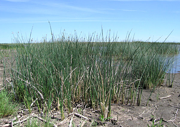
Great bulrush (Schoenoplectus tabernaemontani), also known as softstem bulrush and grey club rush. Bulrushes are among the most beneficial emergent wetland plants (Whitley et al. 1999). They may form dense thickets along the margins of water bodies. The seeds are particularly valuable for ducks; bulrush provides nesting habitat, and it binds wet soils quite effectively.
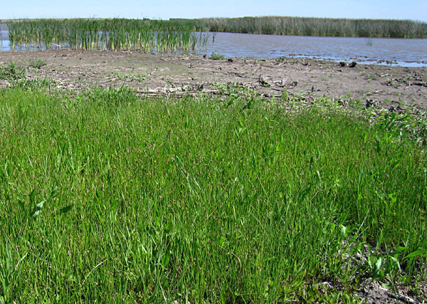
Blunt spike rush (Eleocharis obtusa). Spike rushes are quite common in and diagnostic of wetland environments in temperate regions around the world. They provide shelter for fish, amphibians and insects, and are a food resource for many wetland birds and mammals.
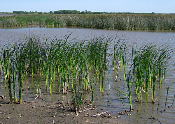
Common cattail (Typha latifolia) and narrow-leafed cattail (Typha angustifolia) have hybridized in the Cheyenne Bottoms vicinity (Zimmerman 1990). Among the most common wetland plants worldwide, cattails are invasive in the Great Plains and are able to displace more desirable wetland plants.

Cattails are considered undesirable for wetland marshes in the central Great Plains. Cattails generate persistent seed banks and may quickly colonize disturbed wetland soils. Furthermore cattail expands rapidly through clonal growth (Gucker 2008). In some situations, cattail is considered a weedy or invasive plant. Their expansion converts open pools and mudflat habitats into dense overgrown thickets, which are unattractive for many migrating shorebirds and waterfowl. Cattails may slow or stop the spread of other wetland plants by secreting chemicals that inhibit germination of seeds.

Return to beginning.

Initial research 2002 – 2005

We began kite aerial photography of Nature Conservancy wetlands in the spring of 2002, which happened to be the end of a wet climatic phase and the beginning of a drought cycle. We have since returned repeatedly to the nature-trail site to acquire kite and blimp airphotos in different seasons and from year to year.

Kite aerial photographs

Left: healthy cattail beds prior to drought, May 2002.
Right: mostly dead cattails during drought, June 2003.

Upon the demise of cattails in early spring 2004, the Nature Conservancy began an experiment in cattail control. Three treatments were applied to different sections of dead cattail thatch. Some areas were mowed, some were burned, and some were left untreated. Since heavy rain refilled the marshes in June 2004, wet weather continued to support regrowth of wetland vegetation through 2005. Bulrush and spike rush spread rapidly to replace cattail in many portions of the marsh, and some small stands of cattail began to come back as well. This resulted in a mosaic of emergent wetland vegetation during the summer 2005.

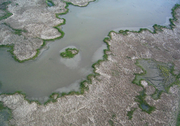
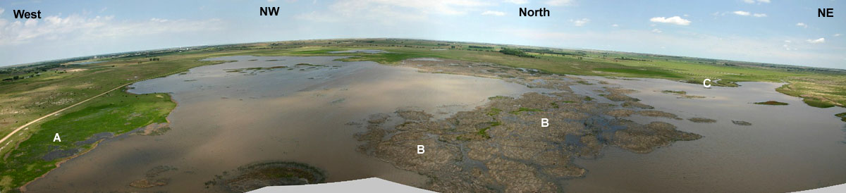
Above: panoramic view assembled from four wide-angle photographs, July 2004. A - former mudflat, now vegetated with blunt spike rush, B - former cattail beds, largely dead following drought, C - delta of Deception Creek.

Below: panoramic image assembled from two wide-angle photographs taken in May 2005. A mosaic of emergent wetland vegetation is evident; darkest green patches in marsh are bulrush.

Return to beginning.

Continuing research 2005 – 2007

It was our intention to pursue additional research on climatic and human impact on vegetation and water at Cheyenne Bottoms through a variety of ground-based and remote sensing techniques (Aber et al. 2006). In particular, we continued to monitor details of marsh habitat using small-format aerial photography on a seasonal and yearly basis. The late summer of 2005 began to show signs of diminishing surface water and the potential for drought conditions to develop.

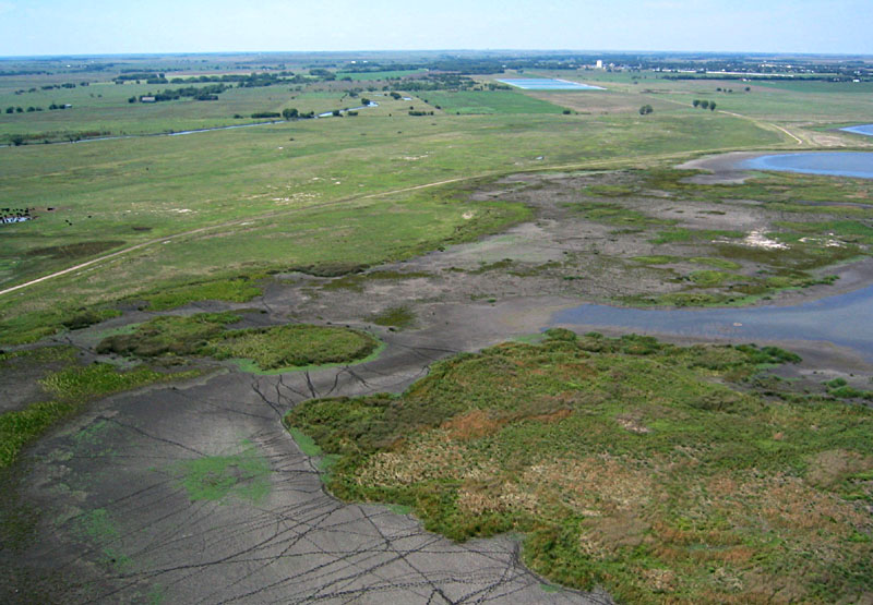
Dry mudflats with cattle tracks (left foreground) and residual water pools (right side) are typical in late summer. Cattle graze on wet meadow in left background. Image date Aug. 2005.

The winter and spring of 2006 were unusually warm and dry. Temperature exceeded 95 °F (35 °C) already in April, and little precipitation fell through the month of June. As a consequence, Nature Conservancy marshes were completely dry, the state wildlife area had little water, and most inlet creeks and canals were dry. This signaled the beginning of another drought.

View toward northeast over Nature Conservancy marshes. The dry channel of Deception Creek and its delta are visible in upper left portion of scene. Vegetation has spread over dry mudflats in lower left corner. Image date May 2006.
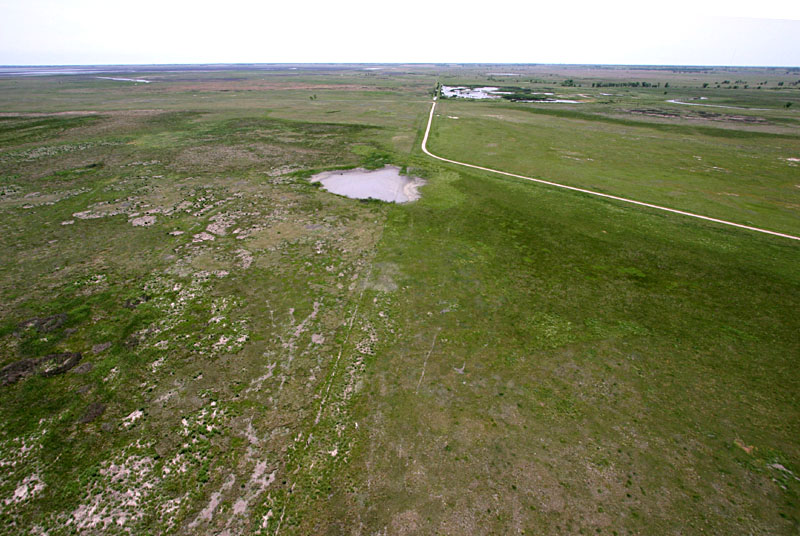
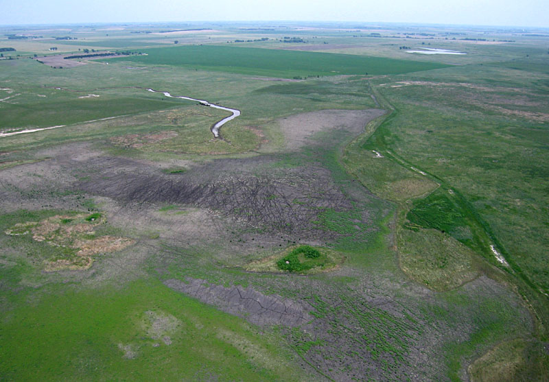
View toward northwest with Hoisington in the far background. All mudflats are dry and vegetation displays limited growth in this scene. Image date May 2006; compare with May 2005 pictures above.

In August of 2006, heavy thunderstorms rumbled across central Kansas, resulting in significant runoff in the vicinity of Great Bend. Flood water was directed via canals and ditches into the state wildlife area of Cheyenne Bottoms, but no recharge happened for marshes in the Nature Conservancy portion of the bottoms. Dry conditions continued there into autumn.

In October 2006, the Nature Conservancy began a systematic effort to control marsh vegetation in mudflats and thickets. Mechanical means were employed; herbicides were considered unsuitable to use for sensitive wetland habitat at that time. Dry mudflats were plowed (disked) in order to remove opportunistic weeds, such as bull thistle and cocklebur. Thickets were mowed to cut down the standing thatch of cattail, bulrush, and other emergent wetland plants. The idea was to simulate heavy buffalo grazing on the dry marsh environment.

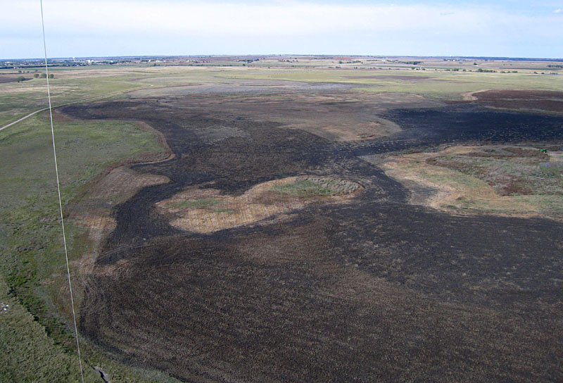
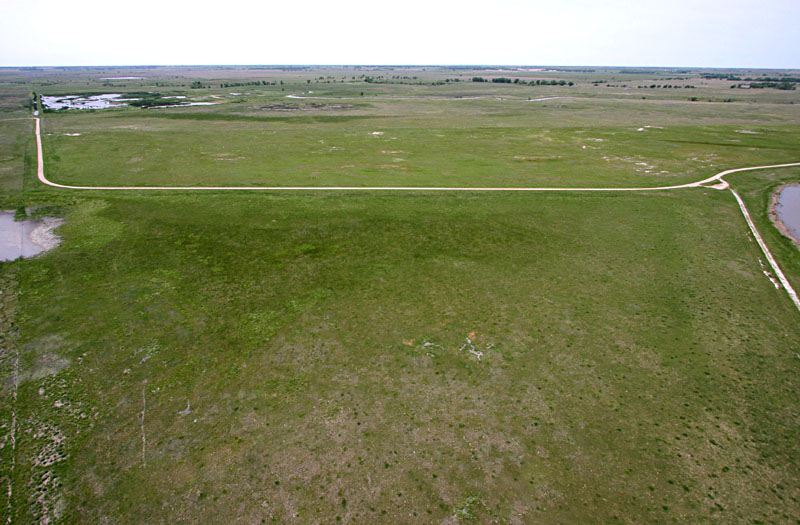
View toward northwest with Hoisington in the far background. The marsh is completely dry and substantial portions have been plowed or mowed. Image date Oct. 2006.
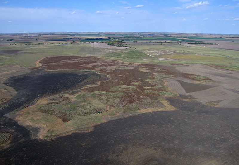
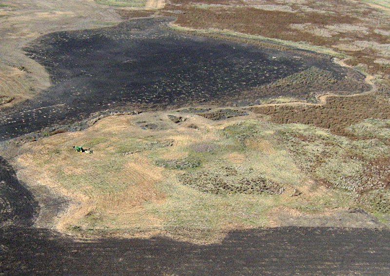
View northward over dry marsh. Bare soil has been plowed and vegetated portions are partly mowed (note tractor). Reddish-brown vegetation is unmowed thickets of cattail and bulrush. Image date Oct. 2006.
Closeup view of tractor mowing down vegetation thicket in raised portions of the marsh. Image date Oct. 2006.

The winter and spring of 2007 were wet. Repeated, heavy rains resulted in flooding of Cheyenne Bottoms in May, when water spread over large portions of the state wildlife area and Nature Conservancy marshes. Marshes were filled to overflowing, and sites that had been dry for many years were inundated. Long-time local residents claim they have never seen so much water in the bottoms. In order to reach our primary study site, we had to drive through water with a 4WD vehicle. The following superwide-angle images document the extent of open water in the Nature Conservancy marshes in mid May. The direction toward the center of each view is indicated.


View westward

View toward NW

View northward

View toward NE

Heavy rains continued through the month of June. The combined May and June rain exceeded 20 inches (50 cm), which set a historical record. Virtually the whole of the state wildlife area was flooded, and about 20% of Nature Conservancy land was inundated (source NC 2007). Considerable damage occurred to roads and drainage structures, but nesting waterfowls were attracted in record numbers. Our field efforts were suspended for the remainder of the year because of impassable roads in study areas.


Return to
beginning.
Continue to 2008 – 2011.


Author institutions
  1. J.S. Aber – Emporia State University, Kansas, Emeritus.
    E-mail: (jaber@g.emporia.edu).
  2. S.E.W. Aber – San José State University, California, Emerita.
  3. R.L. Penner – The Nature Conservancy of Kansas.

Other contributors: Alivia Allison, Chris Banman, Gayla Corley, Tom Eddy, Paul and Jill Johnston, Tamara Korenman, Toshiro Nagasako, Lida (Buster) Owens, Firooza Pavri, Chris Pettit, Jo Pfaff, Keith Reif, Andy Schmidt, Jean Schulenberg, Marcia Schulmeister, Marshall Sundberg, Elena Volkova, Brenda Zabriskie, and John Zupancic.

Nature Conservancy in Kansas.

References


Note: our initial research was funded by a Kansas NASA EPSCoR
grant (2002-04), the Kansas NASA Space Grant (2009-2010),
and has since continued with support from other sources.

This webpage is presented for general public use and enjoyment.
All rights reserved; text and images © by the authors (2023).

Return to GeoSpectra homepage.