Environmental Research
Cheyenne Bottoms, Kansas

2023 and 2024

Summer 2023 – Deception Creek

Drought conditions from the autumn of 2022 continued into 2023. Main pools at our Deception Creek study site were largely dry by the time of our visit in early August. The Cheyenne Bottoms region was in the extreme drought category. However, recent rains had been sufficient to maintain some green vegetation, and many opportunistic plants—various weeds—had spread over the mostly dry mudflats. We conducted kite aerial photography from the nature trail at the observation tower.

Kansas drought monitor for August 1, 2023.
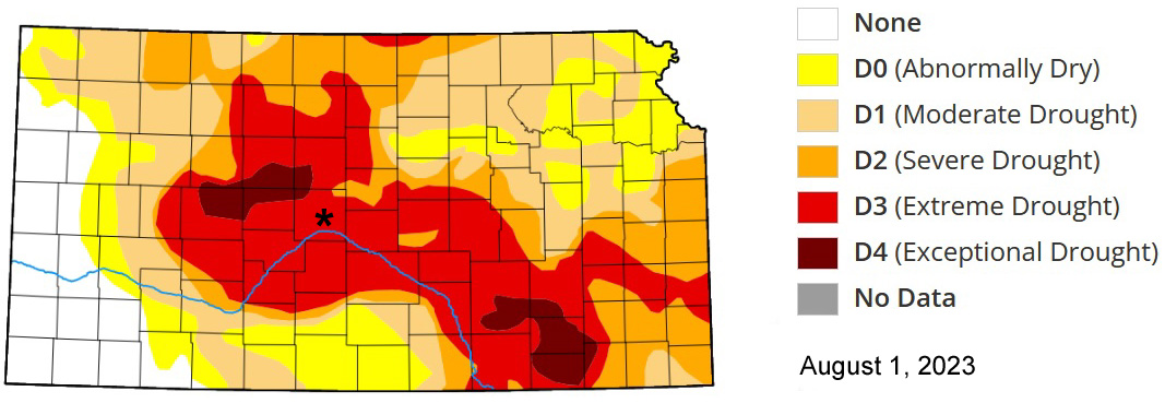
Cheyenne Bottoms (*) is extreme drought.

Kite aerial photographs
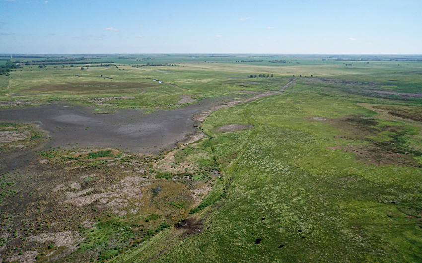
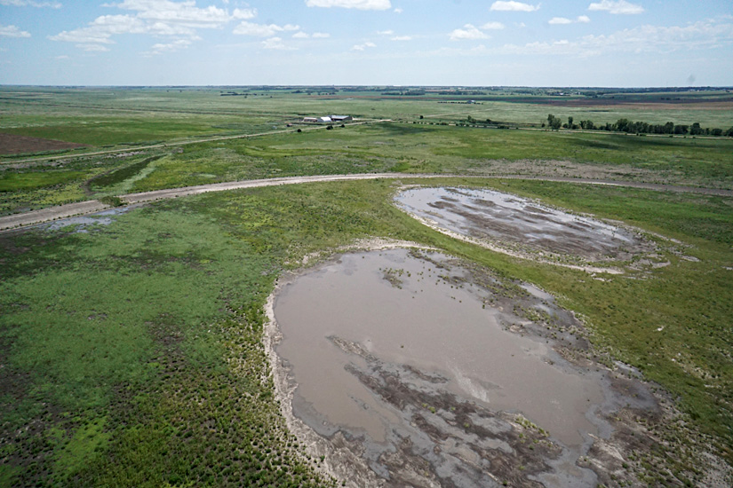
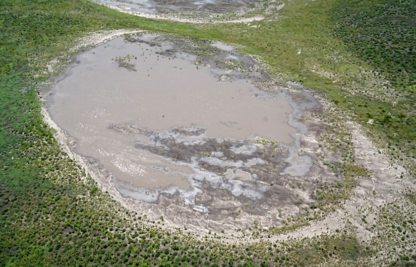
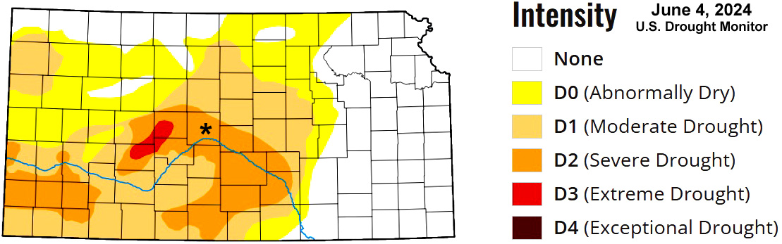
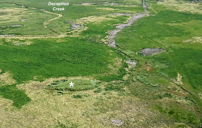
Looking toward the north-northeast over the delta of Deception Creek and dry pool. Overview (left) and closer shot (right). The creek holds water in a few spots, but the channel is dry as it enters the pool and mudflat area.
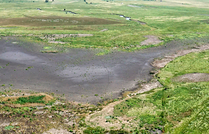
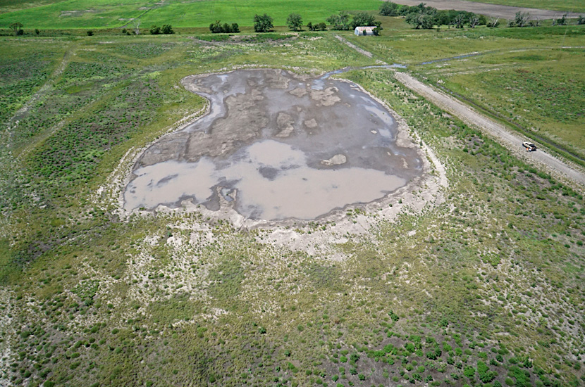
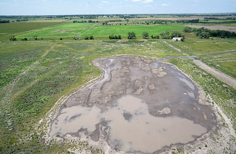
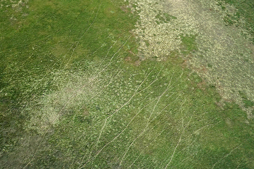
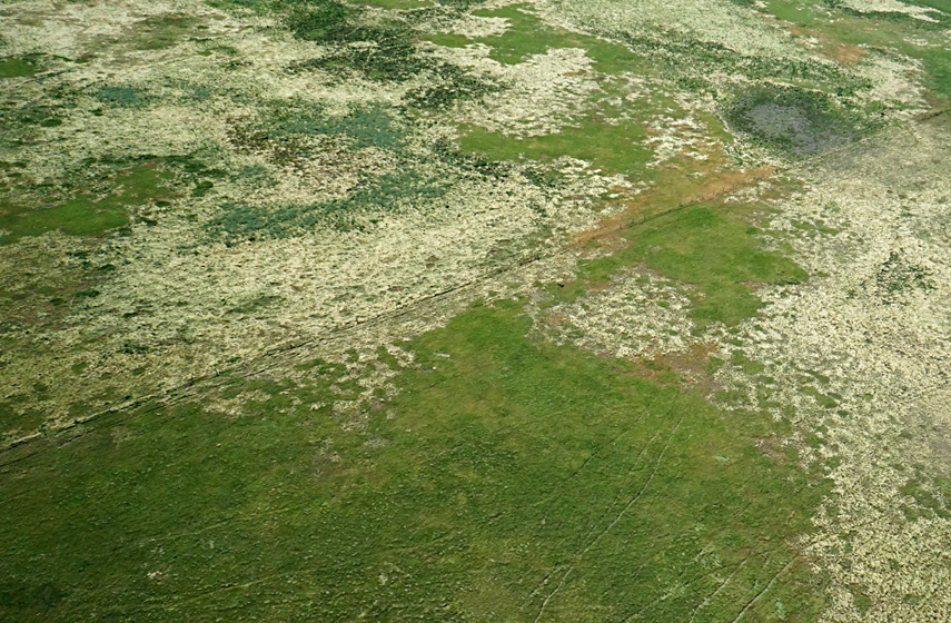
Looking toward the north-northwest over pool complex. Overview (left) and closer shot (right). Note the mosaic of mudflats, active vegetation, and dead cattail thatch (pale tan).
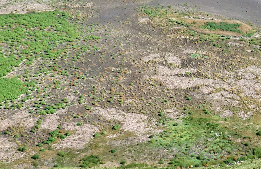
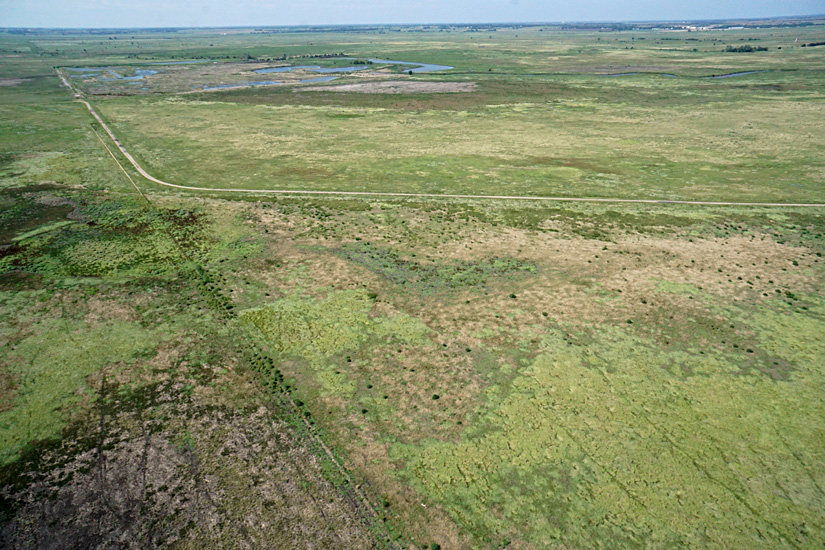
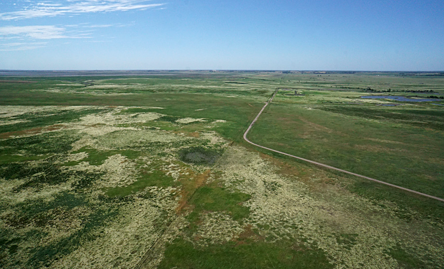
Looking southward (left) toward the Hoisington Gun Club in the distance, where water-filled pools are dammed on Blood Creek. View toward the west (left). Parking area and observation tower at upper left, and kite flyers in lower right corner.
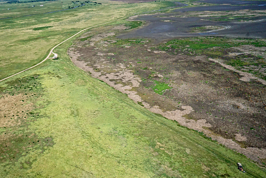
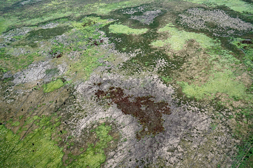
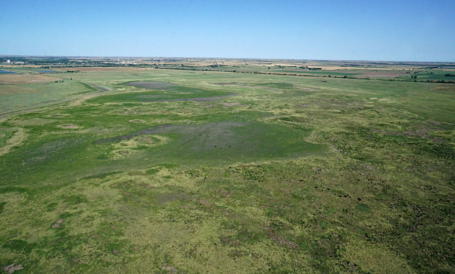
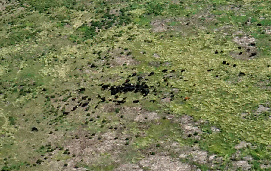
Cattle graze in the southeastern sector; overview (left) and closer shot (right). Cattle are black spots toward the left sides, and their trails criss-cross the area. The rusty brown patch of vegetation is curly dock (Rumex crispus).
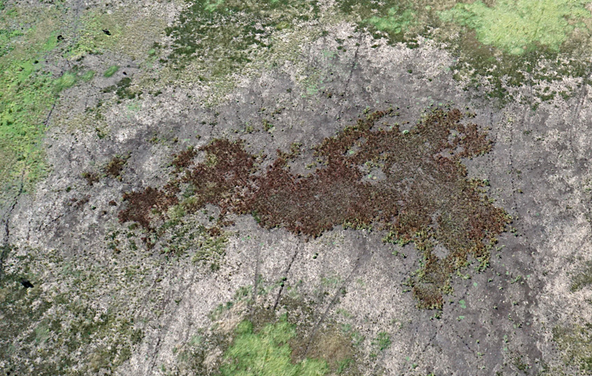
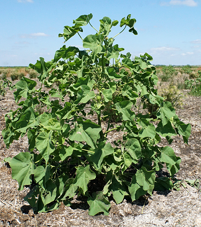
Ground vegetation
Velvetleaf (Abutilon theophrasti)—whole bush (left), approximately 3 feet tall, and close-up of yellow flowers and seed pods (right). A common, invasive weed that came originally from India and southeastern Asia. The seeds may remain viable in soil for several decades. We first encountered velvetleaf here in the summer of 2012.
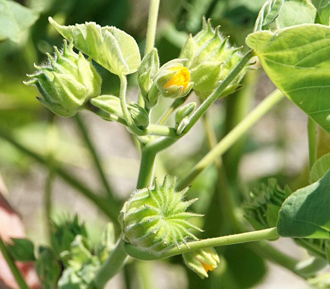
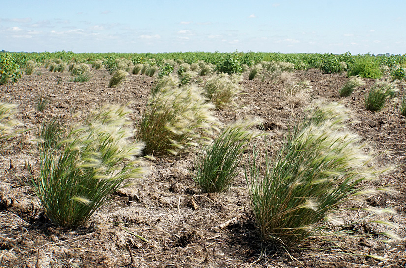
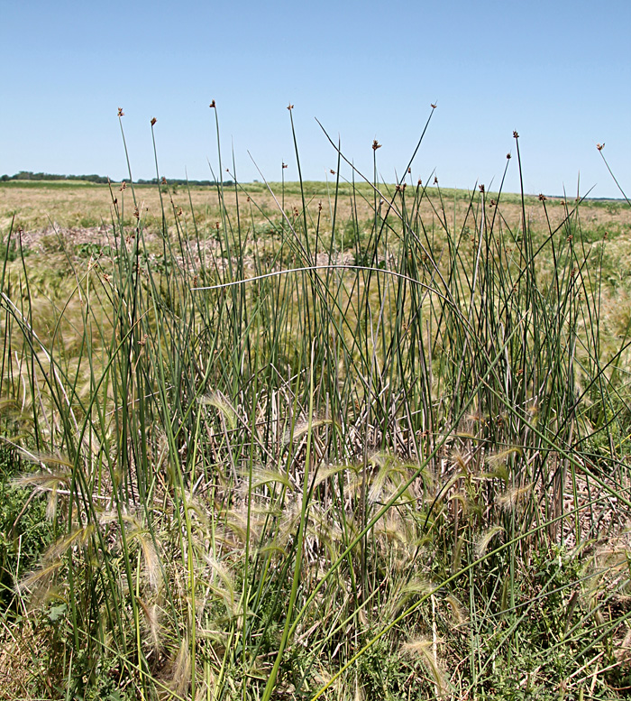
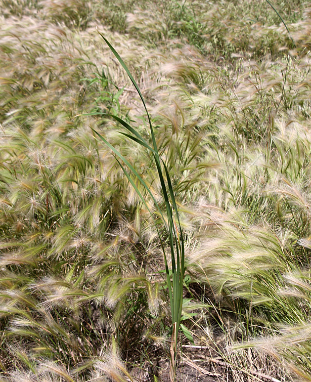
Foxtail barley, Hordeum jubatum (left), is a true grass that favors freshwater habitats throughtout North America. Great bulrush (right), also known as grey club rush (Schoenoplectus tabernaemontani), grows up through dead cattail thatch. It's highly desirable as wetland vegetation for wildlife.
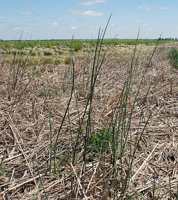
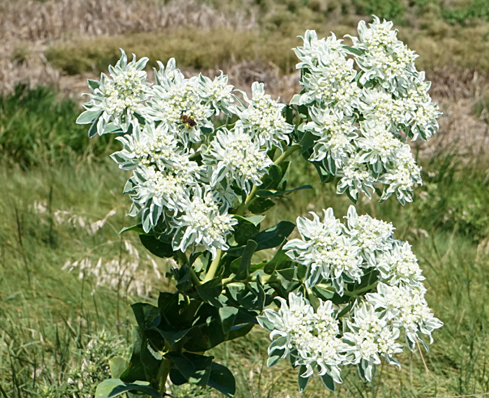
Snow-on-the-mountain, Euphorbia marginata (left), is attractive, but certainly not desirable. It has effects similar to poison ivy, and cattle will not eat it on account of its bitter taste. Common or wild sunflower, Helianthus annuus (right), is the state flower of Kansas.
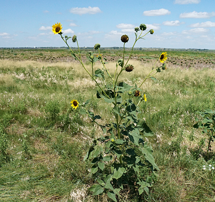
Summer 2023 – Ochs Tract

The Nature Conservancy and Ducks Unlimited acquired the Ochs Tract in 2018 with the goal of restoring former crop land into wetland conditions. This site is located along NE 20 Avenue about 3 miles south of the Deception Creek site. We documented the Ochs Tract with kite aerial photography in April 2018, when its agricultural landuse was still quite evident—see Ochs 2018.

We returned again in early August 2023 to take another look. Three large, shallow, pools have been excavated; two are oval shaped, and one has an irregular outline. These pools intercept natural drainage channels that cross the site, and all three had some standing water and exposed mudflats for our visit. A gravel pad at the entrance provides the public a place to park for walk-in touring within the site.

Kite aerial photographs
Looking toward the southeast (left) over two oval-shaped pools. Buildings in the center distance are part of the state wildlife area. Closer view (right) of oval-shaped pool. Note sun glint from waves on the muddy water surface.
Looking westward over the large pool of irregular shape. Overview (left) with kite flyers on right side; closer shot (right). Water channel draining into the pool at upper right side.


Spring 2024 – Deception Creek

In early June, we returned to our usual Deception Creek study site at the nature trail and observation tower. We were joined by Kari Ames from the Nature Conservancy (TNC). The drought of 2023 continued into early 2024, and the pool-and-marsh complex had no standing water anywhere. This marks the third year in a row for drought conditions at Cheyenne Bottoms.

Kansas drought monitor for June 4, 2024.
Cheyenne Bottoms (*) is severe drought.

Kite aerial photographs
Left: overview toward the northeast and the dry channel of Deception Creek (*). Kite flyers in lower right corner. Right: view looking southward. The straw-colored vegetation in both images is foxtail barley.
Left: overview toward the northwest with Hoisington in the far left background. Right: cattle trails intersect in a branching pattern across the dry marsh surface.

Vegetation

Typical wetland plants, such as bulrush and cattail, were scarce. Most of the mudflats were covered with a variety of grasses and opportunistic plants, that is to say weeds. Cattle graze on some of the mudflat plants, but bypass other vegetation. The species that cattle do not graze, thus, are able to thrive and spread. Foxtail barley,
Hordeum jubatum, is a true grass and covered much of the mudflats. We also identified some undesirable plant species, in particular musk thistle and poison hemlock.

Musk thistle (Carduus nutans L.) is considered a noxious weed in Kansas. It is native to western Europe and was introduced accidently into the U.S. in the early 1900s. The plant can spread rapidly and is unpalatable for livestock. It's an early successional plant that establishes quickly on disturbed sites (FEIS 2024). TNC is conducting a major effort to control this undesirable weed during the summer. This is the first time such musk-thistle control has been necessary.

Musk thistle is also known as nodding thistle because its flower heads droop over. Thicket of thistle (left) and closer view of nodding heads (right).

Poison hemlock (Conium maculatum L.) was imported from Europe in the 1800s, because of its attractive flowers, and now grows wild throughout North America. All parts of this plant are highly toxic to livestock and humans. Poison hemlock is classified as a facultative wetland (FACW) plant, meaning that it ususally occurs in wetlands. This plant is a pioneer species that may rapidly occupy disturbed sites (NPS 2016). Poison hemlock has been seen here in the past on the so-called islands within the marsh complex, but this prolonged dry period has resulted in more invasive plants showing up in TNC wetland basins.

Poison hemlock growing on a small mound just south of the Deception Creek delta. Full bush (left) stands 4-5 feet tall, and detail of small flowers (right) with a bee at lower right edge. Cattle normally avoid this plant when other forage is available.

The poison hemlock formed a dense thicket on a small, teardrop-shaped mound that has been a stable feature in the marsh-pool complex for the past two decades. During high-water stand, this knob forms a small island. When water level is lower, the mound rises some 1-2 m above the surrounding mudflat.

Small knob (*) in the marsh south of the delta of Deception Creek as seen during dry conditions in the spring seasons of 2006 (left) and 2024 (right). The whitish-green color of the knob in 2024 displays poison hemlock in bloom.

Habitat disturbances

Both musk thistle and poison hemlock exploit disturbed habitats, as do many other weedy plants. In this case, cycles of drought and flooding cause repeated disturbances of the marsh-and-pool complex in terms of water-level and soil-moisture conditions. Drought phases allow various undesirable plants to move into the wetland habitat. During the past two decades, three significant drought episodes have led to dry mudflats and pools at the TNC study area.

  1. Second half of 2005 through 2006.
  2. Late 2011 through mid-2013.
  3. Most of 2022 through early 2024, and still continuing.

Previous droughts typically lasted 1½ to 2 years, but the currrent drought has continued into its third year. Previous droughts ended suddenly with flooding of the marsh-and-pool complex, as happened in spring 2007 and summer 2013—see May 2007 and August 2013. As of June 2024, summer drought conditions for central Kansas are predicted to improve or end (Drought 2024), but time will tell.

Another major habitat disturbance was aerial spraying of herbicide followed by mowing to control cattail infestation in 2017 and 2018, but cattail had begun to recover under wet conditions already by 2021, prior to the current drought—see 2021. The current drought has eliminated most bulrush and nearly all cattail from the marsh complex.

Small stand of bulrush (left) and a single cattail (right) amid foxtail barley on the dry mudflat.

Cattle grazing and virtual fencing

Cattle grazing is an integral part of TNC management for wetland habitats at Cheyenne Bottoms. One drawback is numerous barbed-wire fences to control cattle movement and grazing patterns. These fences act as artifical barriers for overland water flow, which result in differences for vegetation cover. TNC is in the process of implementing virtual fencing, and eventually some barbed-wire fences may be removed.

Left: close-up view of cattle herd grazing on dry mudflat near the nature trail. Each animal wears a collar to monitor and control its location. Right: fenceline runs across the scene from lower left to upper right and creates an artificial barrier in the wetland environment.
Solar-powered station for virtual fencing allows TNC to monitor animal locations, to track their movements, and even to dictate grazing behavior. The goal for the future is to remove cross fencing between pastures and to use the virtual fence to keep cattle in the desired pasture areas.


Return to beginning.

Return to Cheyenne Bottoms homepage.
All rights reserved © (2024).