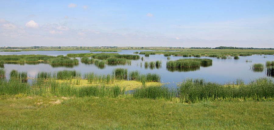
| Views northward from the observation tower in early June (left) and early August (right). Compare these views from the top of the tower with kite aerial photos (below). | 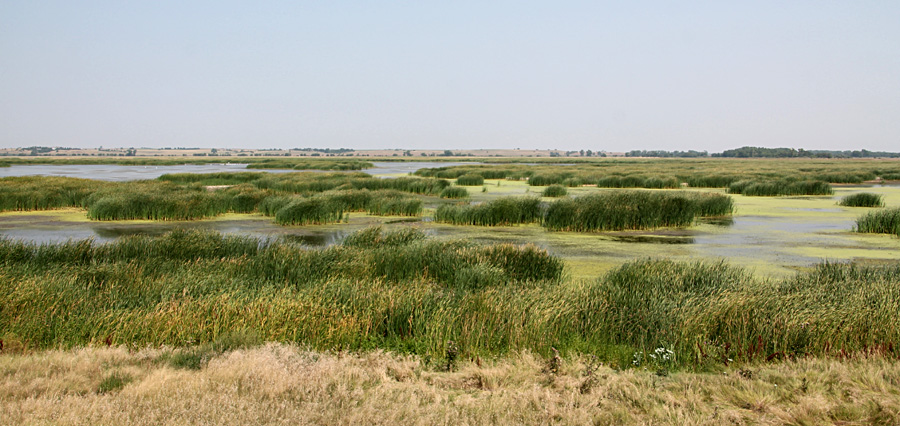
|
|
| Views northward from the observation tower in early June (left) and early August (right). Compare these views from the top of the tower with kite aerial photos (below). |
|
 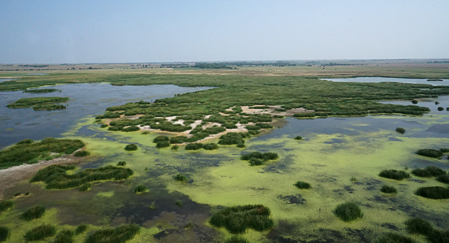  |
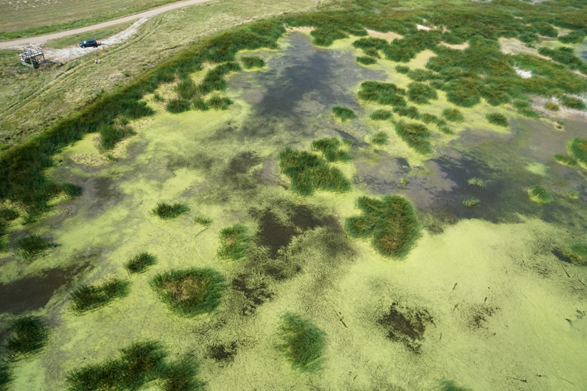
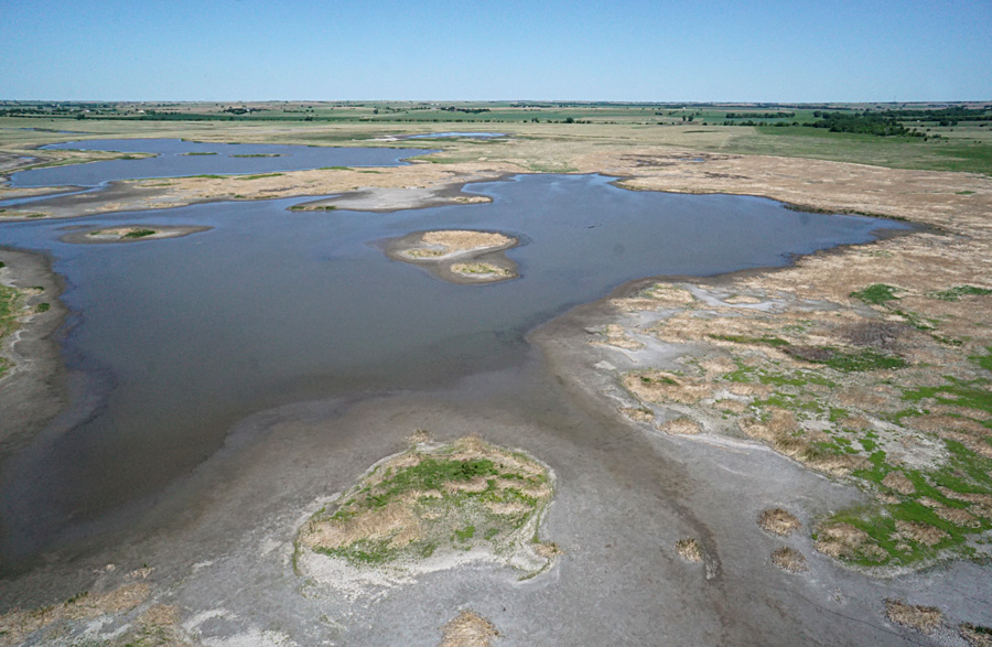
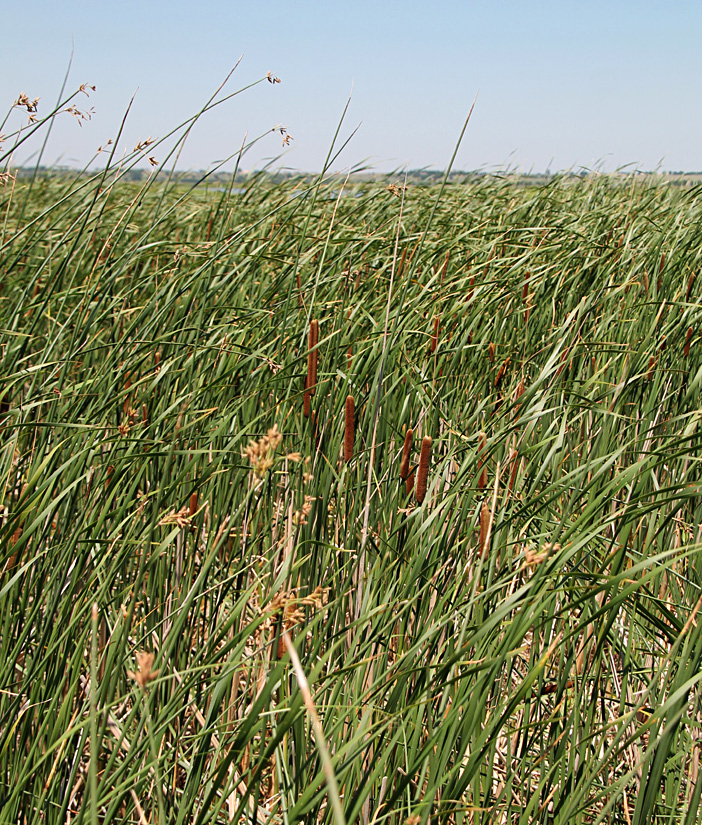
| Closer KAP shots showing details in the pool complex. Kite flyers and observation tower at upper left. Dark green is mostly cattail with some bulrush. Bright yellow-green is duckweed floating on shallow water. Dark gray is wet mud; light gray is dry mud with a lime crust. | 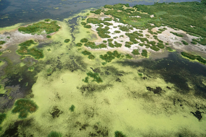 |
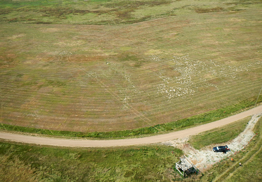
| Wet meadow south of the observation tower and access road was mowed for hay this summer (left) in order to provide stopover habitat for fall migrating shorebirds. This did pay off as some Buff-breasted Sandpipers (Tryngites subruficollis) visited one of the hay fields in late July (right). | 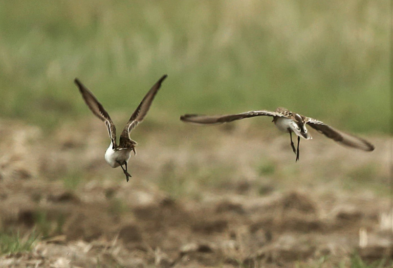 |
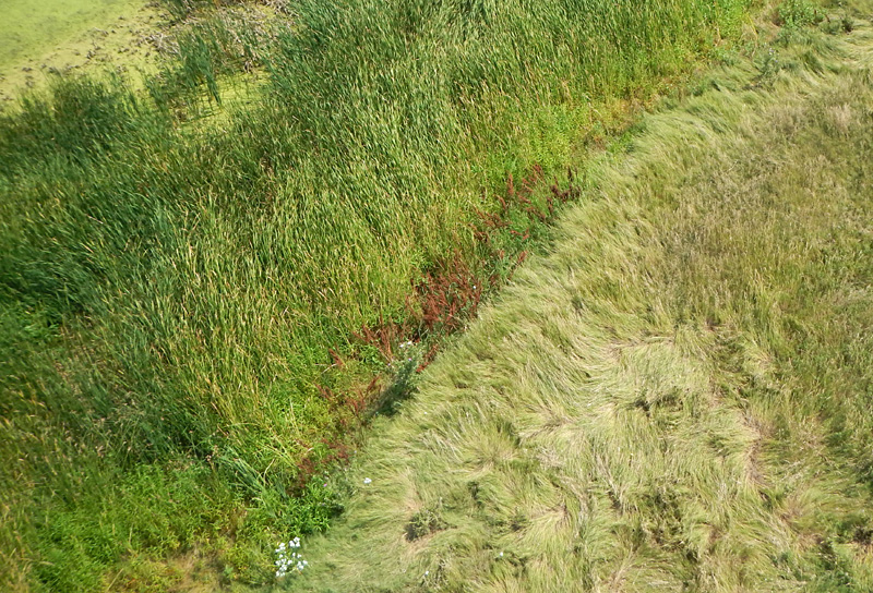
| Close-up KAP detail of pool margin (left); cattail to left and upland grass to right. The pool edge is marked by snow-on-the-mountain (white leaves) and curly dock (brown). The swirling pattern in the grass is known as "cow lick" (right). | 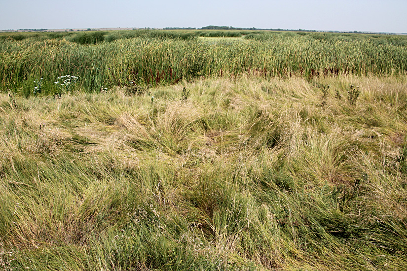 |

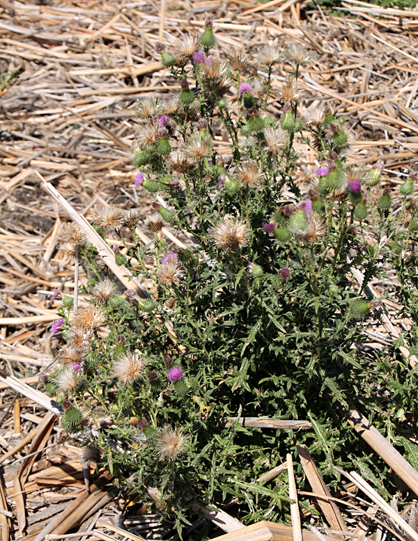
| Left: curly dock (brown), bulrush (round green stems), and smartweed (small white flowers). Right: sulphur butterfly (Phoebis sennae) on thistle flower. | 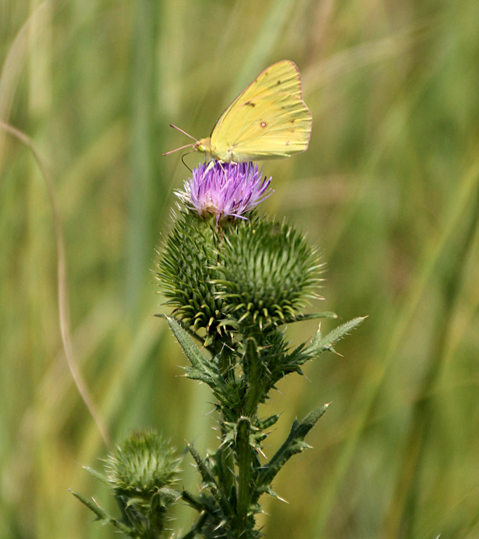 |
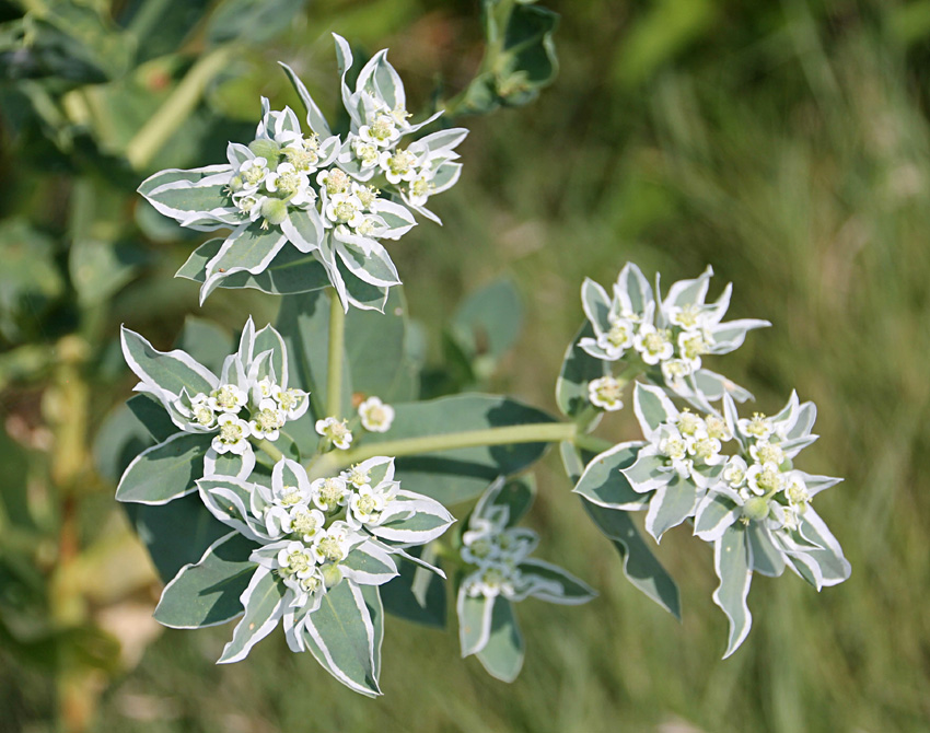
| Detailed view of snow-on-the-mountain (left), which has a bitter taste and may cause skin irritation similar to poison ivy. Duckweed on shallow water surrounded by cattail (right). | 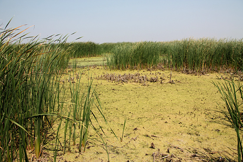
|
 Assembled from two overlapping shots. |
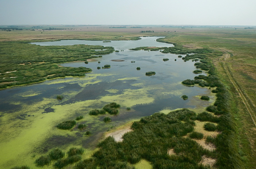
| Looking toward the north (left) and northeast (right) over the full pool. Cattail, bulrush and other emergent wetland vegetation have lost all color and are starting to break down. The water appears relatively clear. | 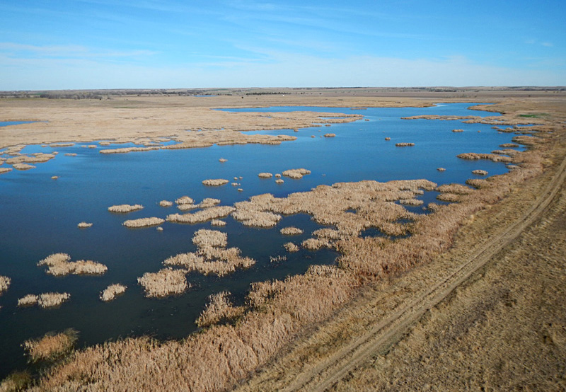 |
| Looking to the southeast (left) over a wet meadow area with disked mudflats in the background. Close-up view (right) of pool margin with kite flyers at the bottom. | 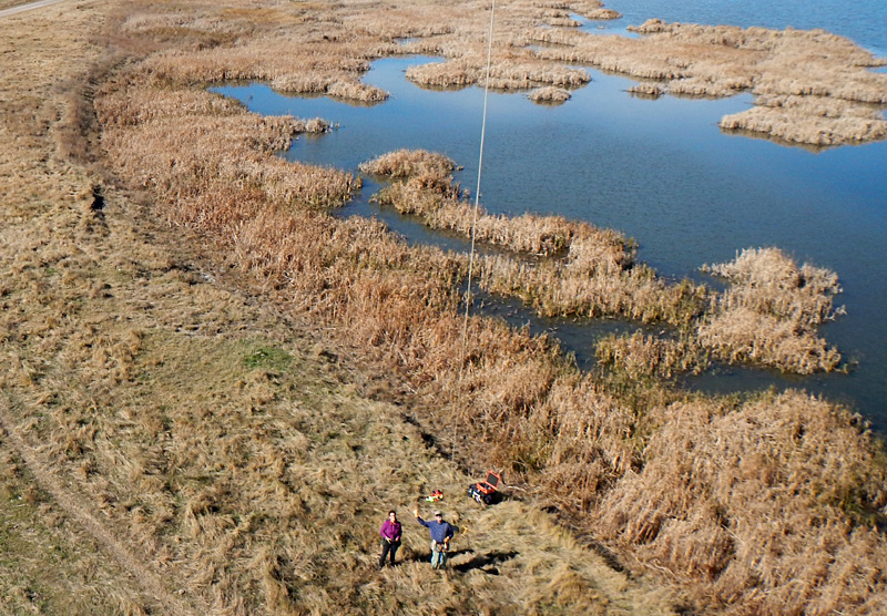
|
![]() 20 years of bird's-eye views (2002-2021).
20 years of bird's-eye views (2002-2021).
Return to Cheyenne Bottoms homepage.
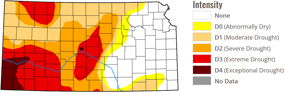
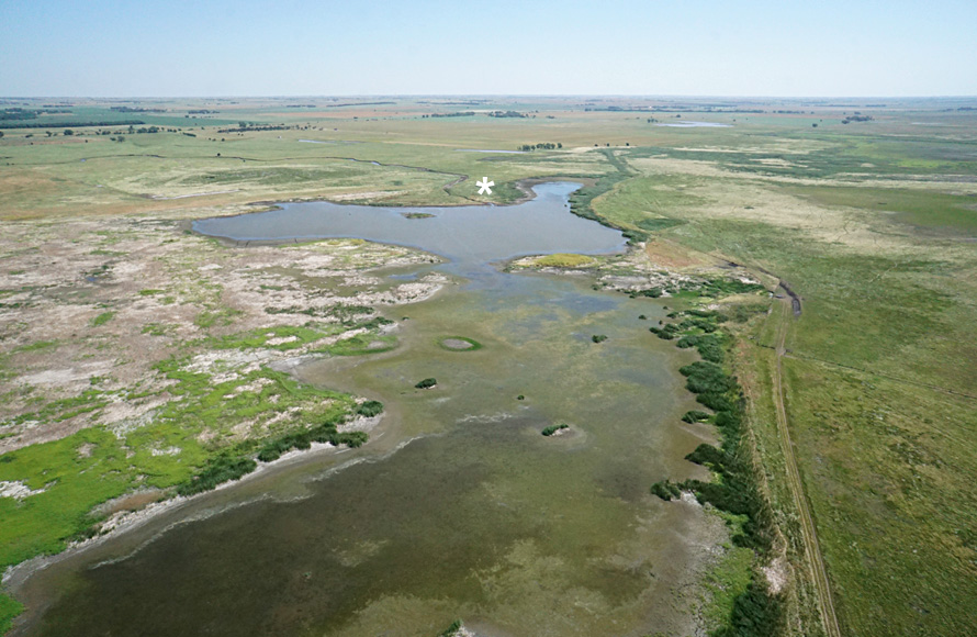
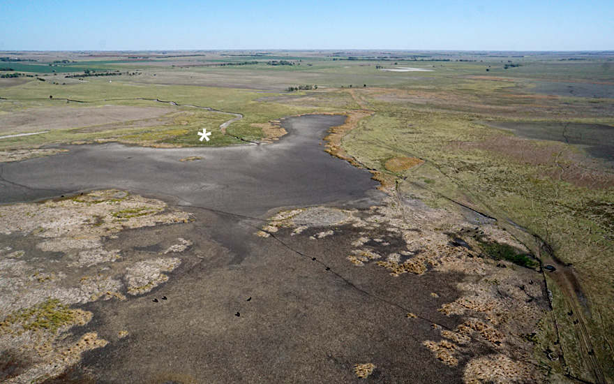
Asterisk (*) marks location of Cheyenne Bottoms.


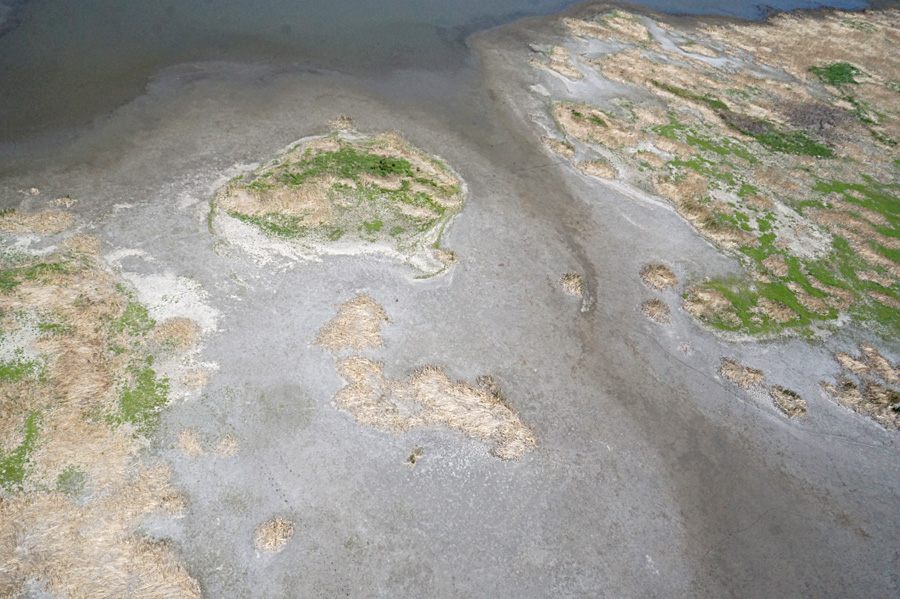
Closer views. Left: pool margin showing dry mudflat, patches of dead cattail, and a narow fringe of emergent vegetation (cattail and bulrush). Observation tower and kite flyers at top. Right: dry channel draining from the central pool. Some green vegetation occupies patches of dead cattail thatch.


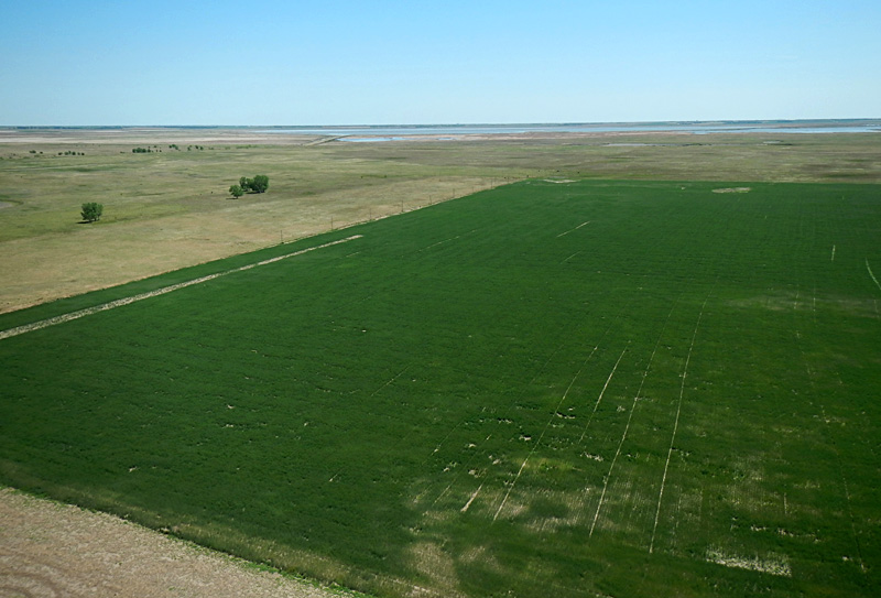
Looking toward the east (left) and southeast (right) with a fallow field on left and green winter wheat to right. The state wildlife area is visible in the far background on right.

Northwestward view (left). Fallow field with an oil well (lower right) and oil storage tanks (upper left). Close-up shot (right) of the kite aerial photographers (JSA & SWA) next to the field of winter wheat.
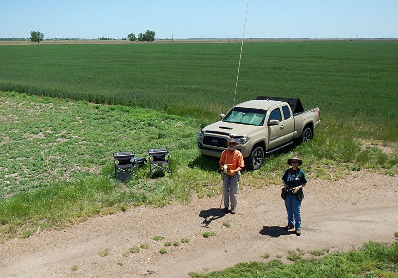
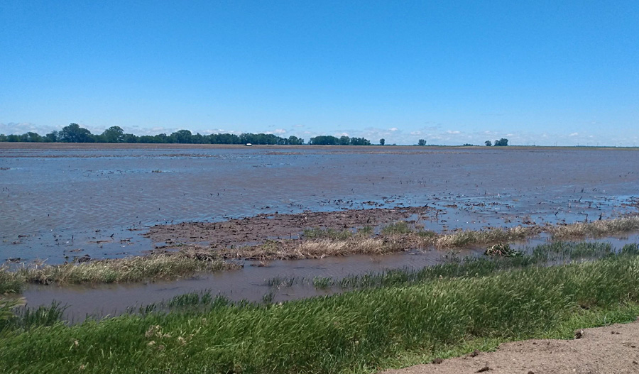
Standing water on the field at the Red Wing site in late May 2022.
Summer 2022
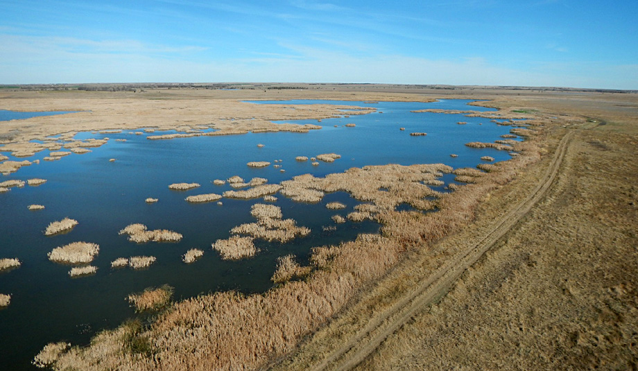
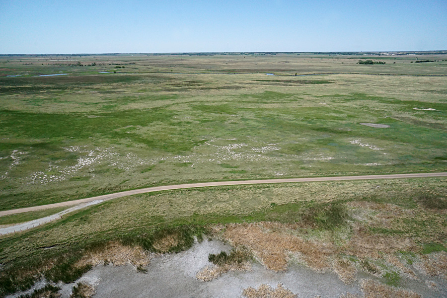
We visited our primary site at the observation tower again at the beginning of summer in late June. Repeated rains of the preceding few weeks had partially, but not fully, refilled the pools and marshes. Shorebirds were numerous, feeding in shallow water and on mudflats, and waterfowl stalked in the deeper pools. Cattle grazed across the mudflats and drier upland prairie areas. Drought conditions had improved considerably from mid-May, and emergent vegetation was beginning to spread over the mudflats and along the marsh margin.
Asterisk (*) marks location of Cheyenne Bottoms.
Compare with extreme drought (above).
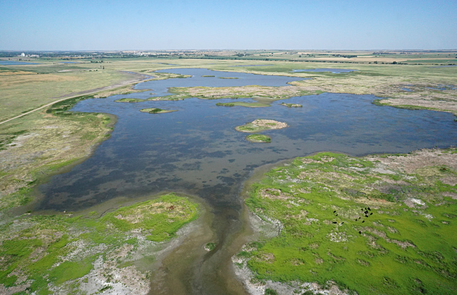
Looking to the northwest over the main pool with Hoisington in the background. Clear water indicates no suspended sediment from recent runoff. Notice the cattle (black dots) in lower right.

View straight northward. A linear break in vegetation runs across the scene. This boundary is a relict of previous aerial spraying to control the spread of cattail (see 2019.) The bright green vegetation in the foreground is mostly foxtail barley and smartweed (see below).
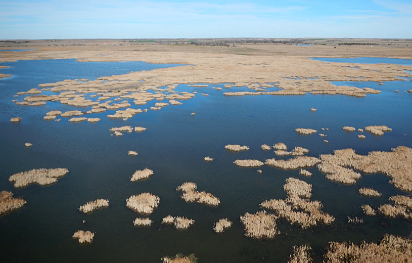
Looking to the northeast. Water is quite shallow in the foreground, and the deeper pool beyond surrounds the delta of Deception Creek (*). The margin of the marsh is marked by thickets of cattail and bulrush.
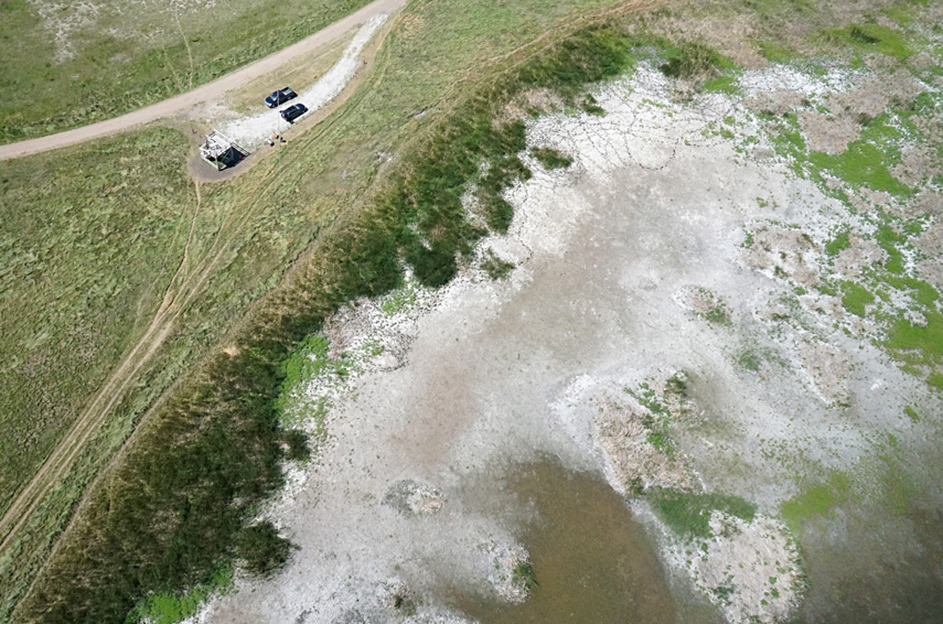
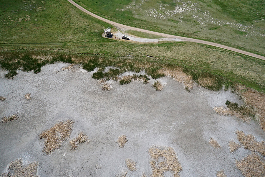
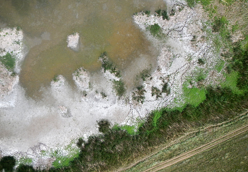
Dry mudflats covered with a gray-white crust of lime. Next to observation tower (left) and vertical shot next to nature trail (right). Note cattle tracks in both views. Bright-green vegetation is mainly foxtail barley and smartweed; dark-green thickets are a mix of cattail and bulrush (see below).
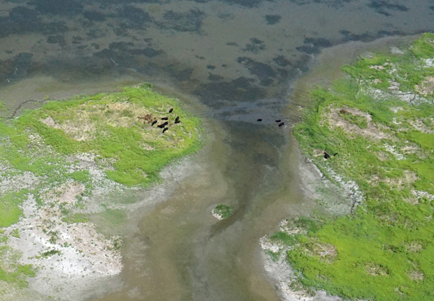
Cattle crossing shallow water out the outlet of the main pool. Moving from right side to a small island on the left. Cattle have never been known to become stuck in the mud.
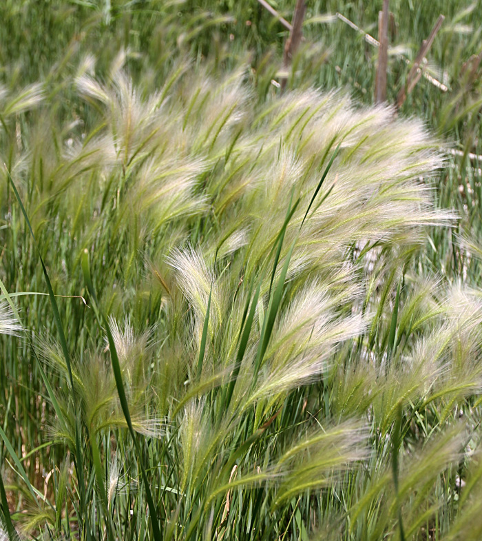
Left: thicket at edge of marsh with bulrush (on left) and cattail (center) growing together. Right: foxtail barley (Hordeum jubatum L.) is a perennial grass that occupies freshwater habitats. In this case, it has rapidly spread across dry mudflats.
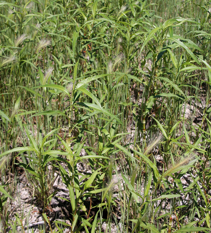
Left: water smartweed (Lahring 2003), also known as water knotweed (Polygonum amphibium L.). It is characteristic of shallow water and moist mudflats. Right: lime crust on vegetation debris on the mudflat surface.
 .
.
Early autumn 2022
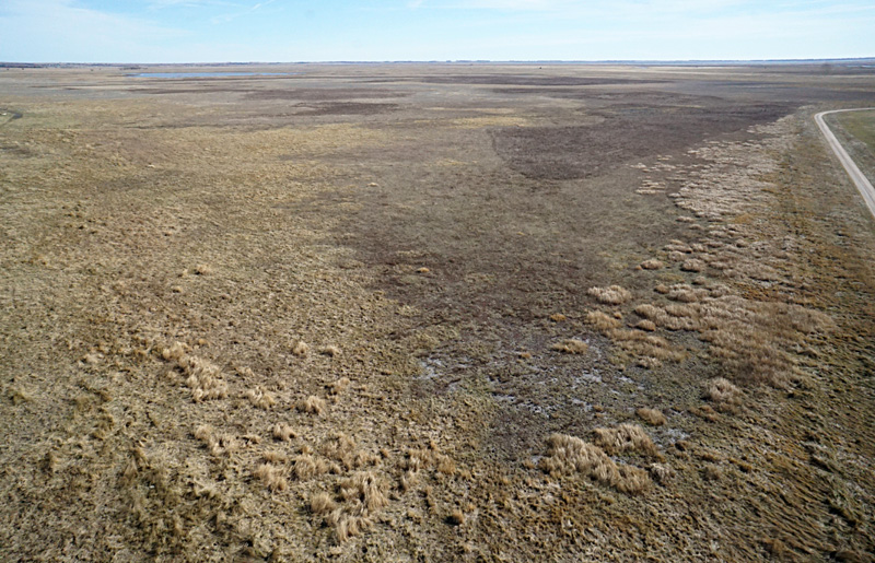
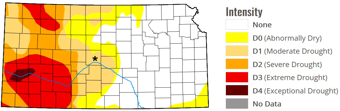
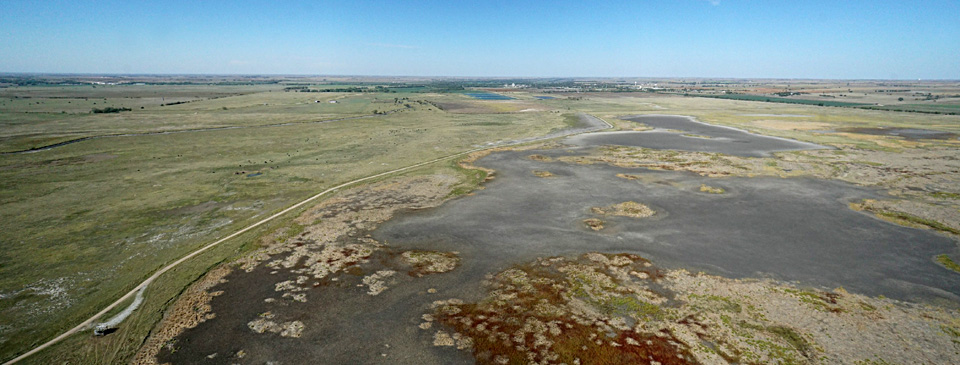
Drought conditions returned in the late summer and early fall. In fact, most parts of western and southern Kansas were in the extreme to exceptional drought categories, including Cheyenne Bottoms. From the ground, it was apparent that marshes and pools had dried up. This impression was reinforced from the aerial vantage. No standing water was present within our field of view. Dry mudflats and dessicated vegetation predominated with just a few stands of green vegetation within the marsh-pool complex.

Asterisk (*) marks location of Cheyenne Bottoms.
Assembled from two overlapping photos.
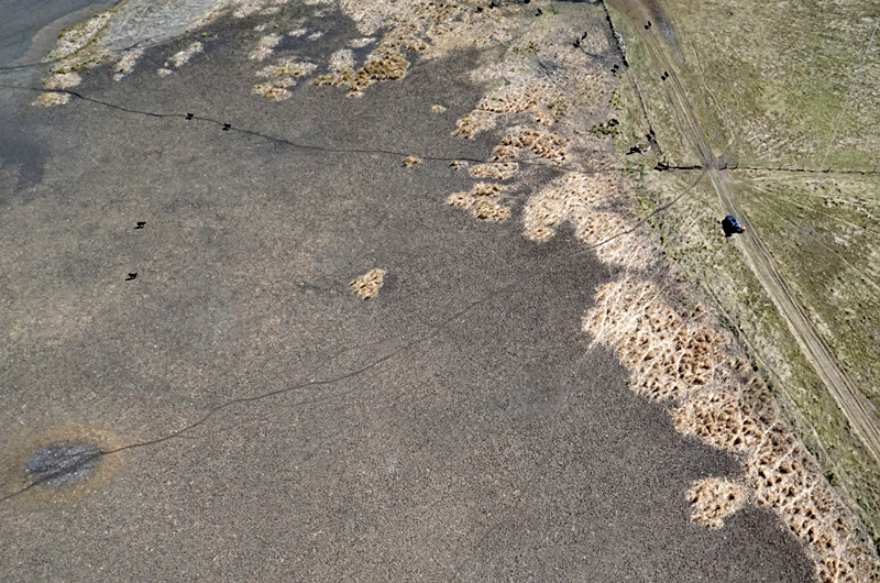
Left: looking to the northeast. Showing the delta of Deception Creek (*) and dry mudflats. Right: close-up shot of the marsh margin with dry mudflat on left. Note numerous trails and cattle (black dots). Kite flyers on right side.
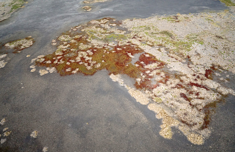
Overview (left) and closer shot (right) of the vegetation thicket surrounded by dry mudflat in the middle of the marsh complex. Vegetation stripes are a relict of aerial spraying done in the fall of 2018, and still quite apparent four years later. The reddish-brown vegetation is emergent water smartweed (see below).
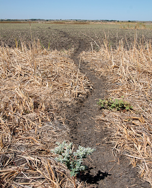
Left: cattle trail across cattail thatch with a snow-on-the-mountain bush in the foreground. The latter is poisonous for cattle. Right: remnant stand of cattail in the dry mudflat.

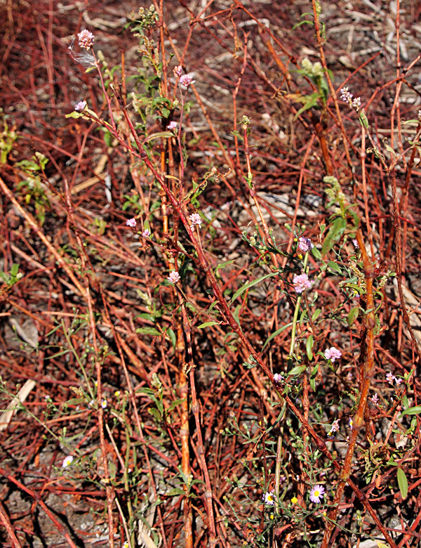
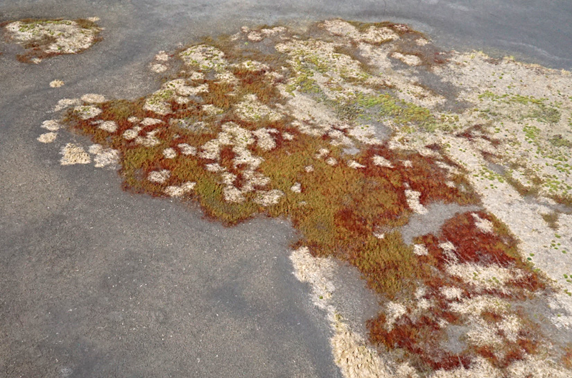
Left: Water smartweed displays exposed reddish-brown stalks with a few green leaves and small pale-pink flowers. Right: spiny cocklebur (Xanthium spinosum L.) amid cattail thatch on the dry mudflat.
![]()
![]() Return to beginning.
Return to beginning.
Continue to 2023 – 2024.
All rights reserved © (2023).