Environmental Research
Cheyenne Bottoms, Kansas

2018 through 2020

2018 Update

The winter of 2017-18 was quite dry with severe/extreme drought
in the vicinity—see drought monitor. Furthermore, spring green-up was delayed by unusually cool weather. Our first visit to The Nature Conservancy (TNC) took place at the end of April.

A new management plan began in the summer of 2017. In order to control cattails, aerial spraying was conducted with herbicide approved for use over water, and dead cattail thatch was subsequently mowed down. This took place over ~300 acres in the eastern portion of the marsh-pool complex. Spraying and mowing will be done later this year for the western side of the marsh-pool area (see below).

April kite aerial photographs
View toward northwest (left) with Hoisington in the background and Blood Creek to far left. Looking toward the northeast (right) showing Deception Creek and its small delta in the marsh-pool complex. Note the rough texture of cattail thatch in foreground. These portions were not sprayed and mowed last year. Compare with next images.
Overview toward the southeast (left) with the state wildlife area in the distance. Aerial spraying and mowing were conducted in the foreground portion of this view. Closer view of sprayed and mowed area (right).
A wet meadow occupies the zone between our primary study marsh and Blood Creek to the south. We recognized a distinct, shallow channel (red dots) that meanders across this meadow, as shown by its vegetation pattern. This channel was not noticeable in previous years. Blood Creek appears in the background of both views.

Color-infrared images
Oblique views to the northwest (left) and northeast (right). Active vegetation is bright orange, including winter wheat fields in the background. Dormant cattail thatch appears pale orange to light gray, and water bodies are dark blue in this false-color format.

We had our first look at a new area recently purchased by Ducks Unlimited (DU) and TNC. Known as the Ochs Tract, this site is located in the southwestern portion of Cheyenne Bottoms adjacent to the canal that diverts water from Walnut Creek into the state wildlife area. This former wetland had been converted for crop agriculture, and now will be returned to wetland status. Our role will be to provide before, during, and after close-up kite aerial photography of the conversion process during the next several years.

New DU/TNC wetland site
View toward east (left) with DU/TNC area in foreground and state wildlife area behind. The inlet canal for the state wildlife area is marked (<). Looking northward (right). DU/TNC area in right foreground and private farmland in background.

The following oblique shots provide an overview of the newly acquired DU/TNC acreage. The images depict a meandering drainage channel (red dots) across wheat fields. This channel was blocked at its upstream (northern) end to divert drainage into an artificial ditch along the western boundary of the fields (marked by a line of trees). In spite of this diversion, the natural drainage channel is still clearly evident in the harvested and fallow fields.


View northward

View to northwest

View westward

View to southeast

We returned at the beginning of autumn in late September 2018. Repeated rains since early August had caused drought conditions to recede completely from central Kansas—see
drought monitor. Aerial spraying took place in July over both eastern and western portions of the marsh complex. Aqua Neat is a aquicide designed for control of emergent weeds and brush in wetland settings, including flowing or stagnant, fresh or brackish water. It specifically targets cattail, reed, saltcedar and willow. Its active ingredient is glyphosate.

September kite aerial photographs
Views toward the northwest. Overview (left) with Hoisington in the far background. Notice difference in water color reflecting recent influx of suspended sediment in far pools. Close-up shot (right) showing area of aerial spraying at scene center in July of 2018.
Views toward the northeast. Overview (left) shows area that was sprayed in August 2017 and again in July 2018 in right (*) background. Area in left foreground was sprayed only in July 2018. Close-up shot (right) displays linear stripes that reflect the pattern of spraying.
Left: overview northward. This portion of the marsh was not subjected to aerial spraying. Right: sun glint reveals standing water under the cover of dead cattail thicket. Kite flyers are at upper left.

September ground photos
Snow-on-the-mountain (Euphorbia marginata, KWG). This plant typically blooms in late summer, and when broken it releases a toxic sap with effects similar to poison ivy. It is considered weedy or invasive (USDA). Left: distinctive white-and-green leaves that surround small flowers. Right: wasp on the plant.
Small trees growing in the farther reaches of TNC marsh area not subject to aerial spraying. Left: eastern redcedar (Juniperus virginiana, USDA). Right: willow (Salix L., USDA). Neither is desirable in this prairie marsh situation.

Return to beginning.

2019 Trends

The wet phase that began in the second half of 2018 continued through the winter and spring of 2019. In fact, the month of May was the wettest on record for Kansas, Missouri, and Nebraska since 1895—see
May precipitation. Repeated heavy rains and floods in May and June damaged the access road to the Nature Conservancy marsh complex. The road was closed for several weeks for repairs that were delayed many times by frequent rain. Rain finally let up, and the access road was fixed and reopenned at the end of June. Our first visit for the year took place on July 1st, and we acquired kite aerial photography at two sites.

Nature Trail Site

View to northwest

View to northeast

View to southeast
* Gun club KAP site in view to southeast.

Left: zone subjected to aerial spraying previous year with mostly dead vegetation; open water appears nearly black. Sun glint (*) is reflected from smooth water surface, and sun glitter (>) is multiple small reflections from waves. Right: detail of blown-down tallgrass next to marsh. This swirling pattern is known as cow lick.

Gun Club Site

View northward

View to northeast

View eastward
* Nature trail KAP site in view northward.

Looking to the northeast (left). A fence divides the scene in half. The area beyond the fence was treated by aerial spraying and mowing in previous years, but the area in front was not treated. Close-up view (right) showing high-water limit of recent flooding marked by wave-washed debris, known as wrack (<).

We returned to the nature trail site in mid-October for another round of kite aerial photography. We also added unmanned aerial systems (UAS), commonly known as drones, to the airborne survey, which was conducted by Chris Pettit and Alivia Allison along with students from Emporia State University. Aerial spraying took place during the summer along the southern margin of TNC marsh complex. The marshes and most pools remained full of water, but mosquito fern was not evident.

Kite aerial photographs
Overview toward west (left). Zone of aerial spraying in 2018 remains evident in right foreground. Closer view (right) showing cattle grazing on the drier meadow area.
Views toward the northeast. Deception Creek (left) and marshes beyond (right). These areas remain full of water at the end of the growing season.
Two views looking toward the southeast over the area that was subject to aerial spraying this past summer (of 2019). Most of the aquatic vegetation has been killed.

UAS images
Low-height oblique views looking to the northeast (left) and west (right). These shots were taken with the Mavic 2 Professional UAS. Compare with kite photos (above) taken from higher vantage points.
Vertical shot taken from a height of 100 m. Whole scene (left) and close-up detail (right) showing mud cracks and cattle tracks at the margin of the marsh. This image was acquired by the DJI Phantom 4 Professional UAS.

Return to beginning.

2020 Status

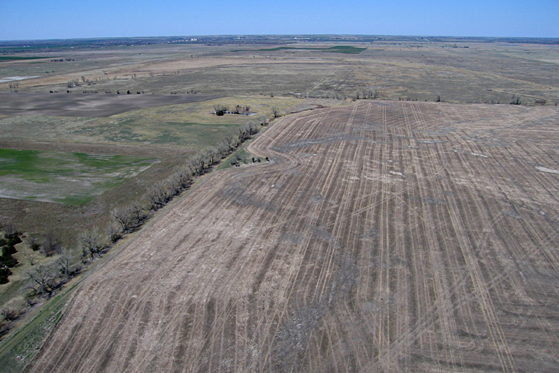
The wet cycle of the previous year continued through the winter of 2019-20. Kansas received above average precipitation for the months December, January, February and March, but April was below average and May was just average. Perhaps this decrease in precipitation signals a change in the weather pattern. Nonetheless, TNC marshes and pools remained full of water for our visit in mid-June.

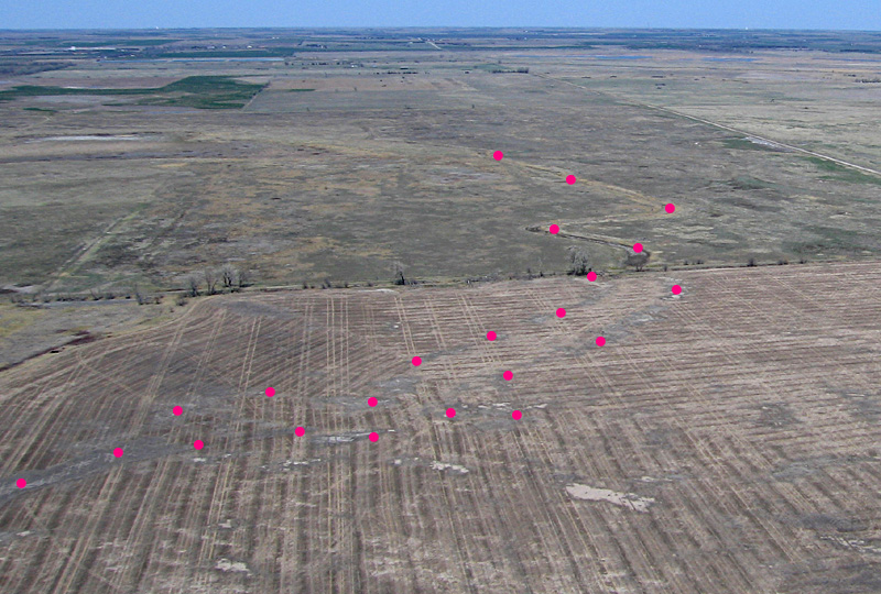
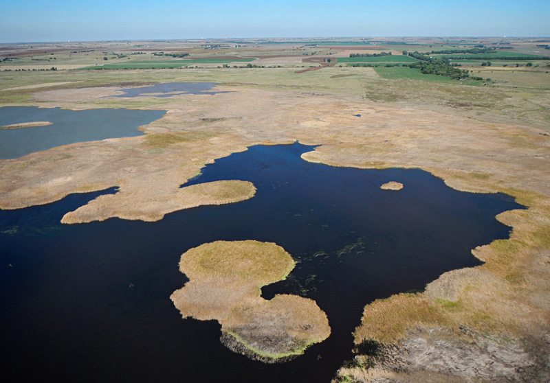
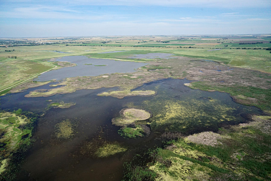
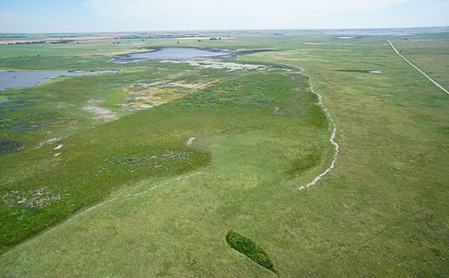
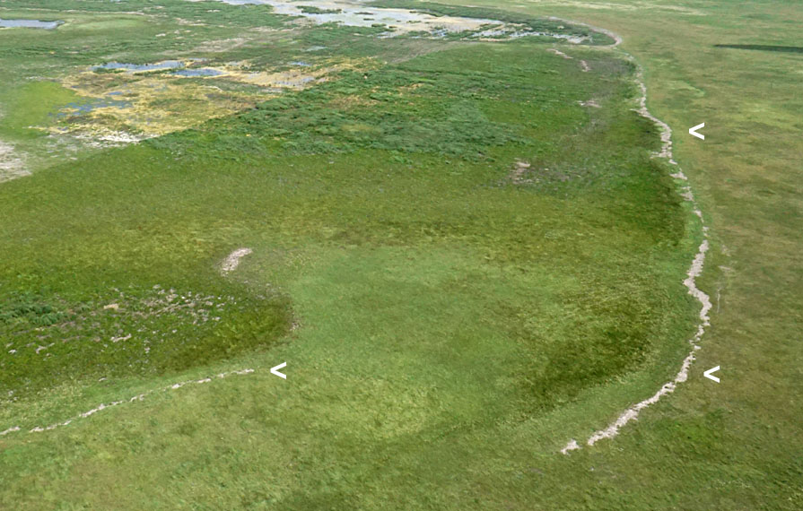
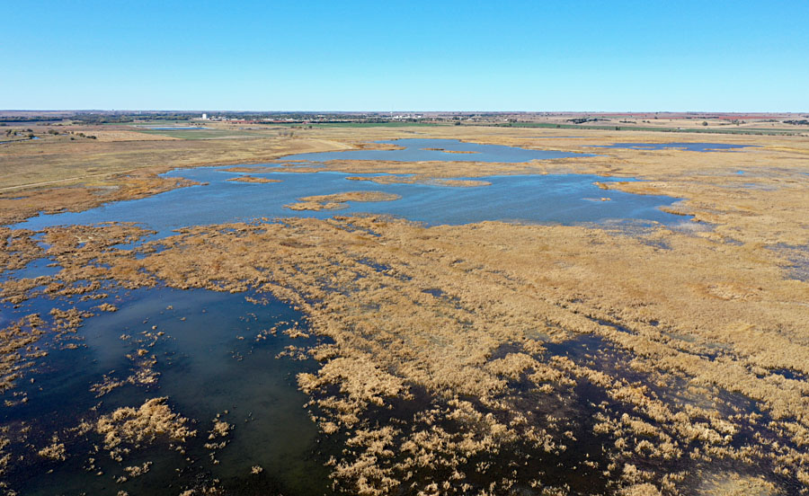
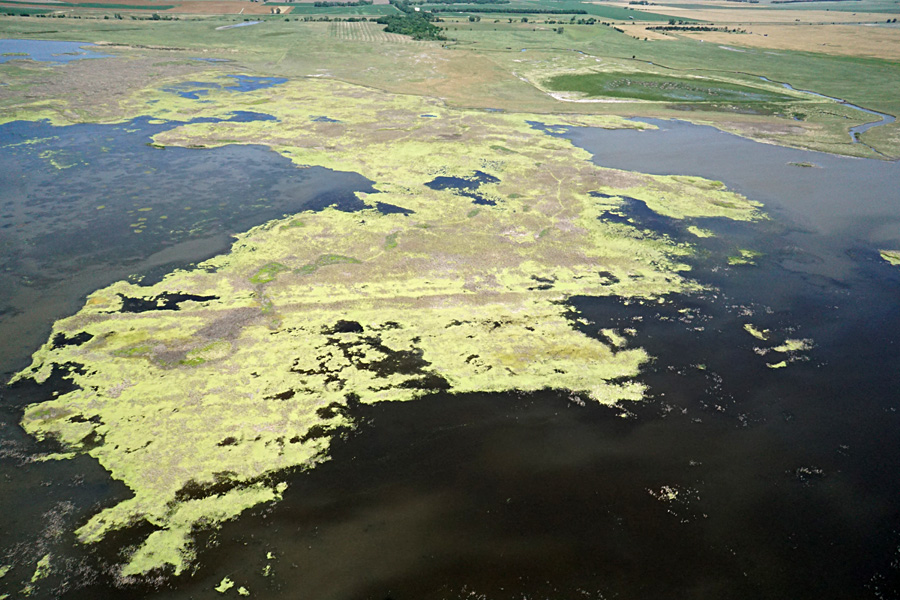
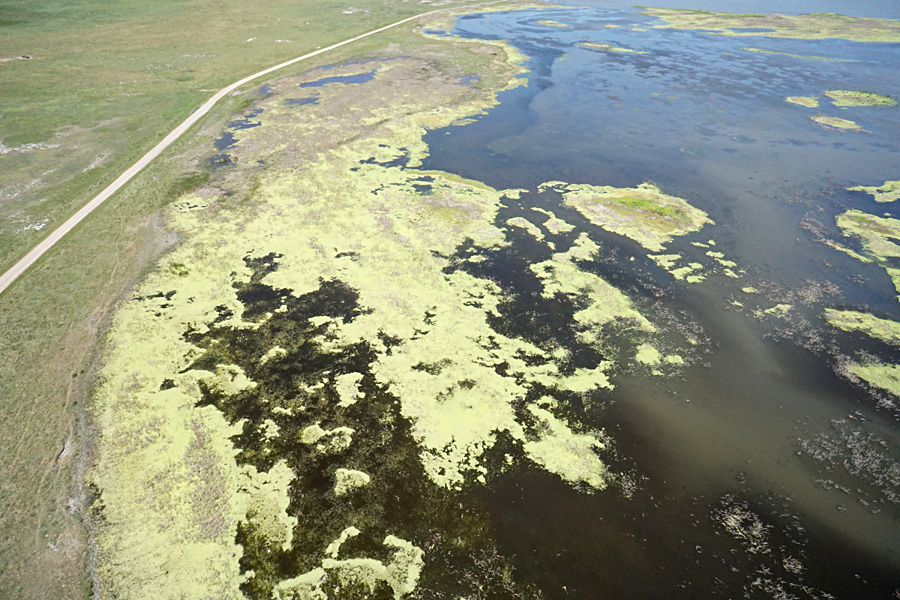
We conducted kite aerial photography from the nature trail site next to the observation tower. The impact of aquicide spraying in 2018 was still quite evident with extensive patches of dead cattail thatch in the water-filled pools. What surprised us, however, was the spread of duckweed throughout the thatch areas. As seen from above the duckweed creates a bright yellow-green surface. Common duckweed (Lemna minor) resembles split green peas. It is the smallest and simplest of all flowering plants and is also one of the most common plants worldwide. Duckweed is an important food resource for birds and other wetland wildlife.

June kite aerial photographs
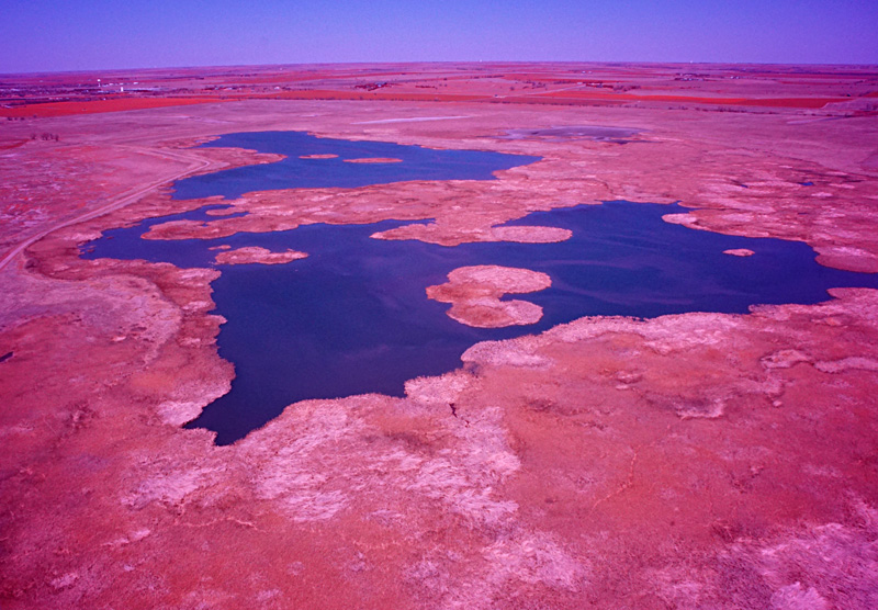
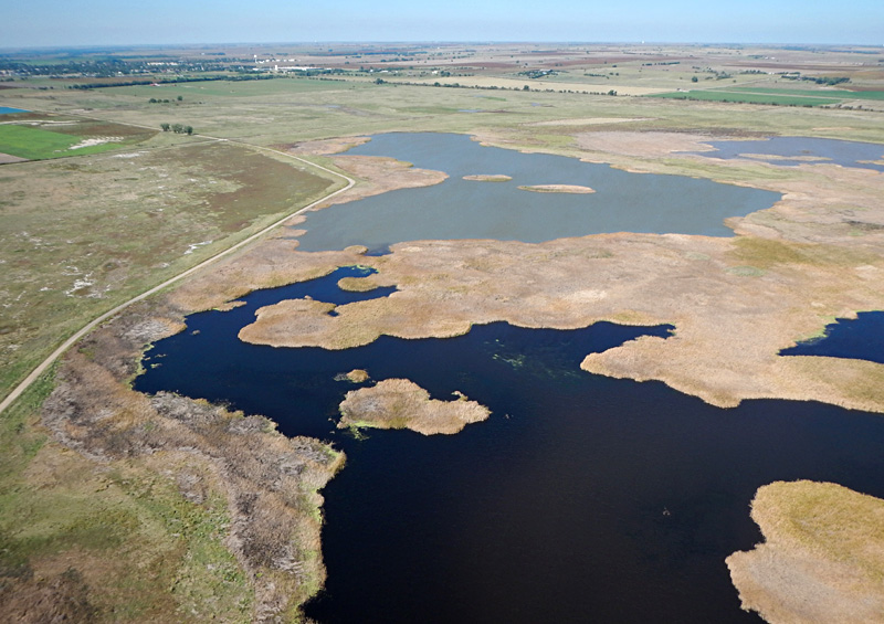
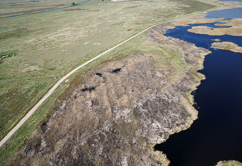
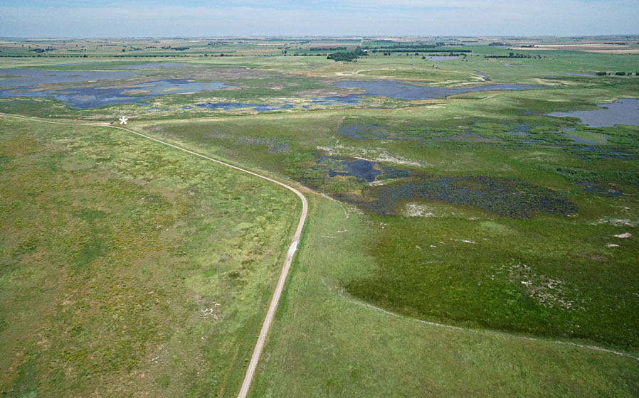
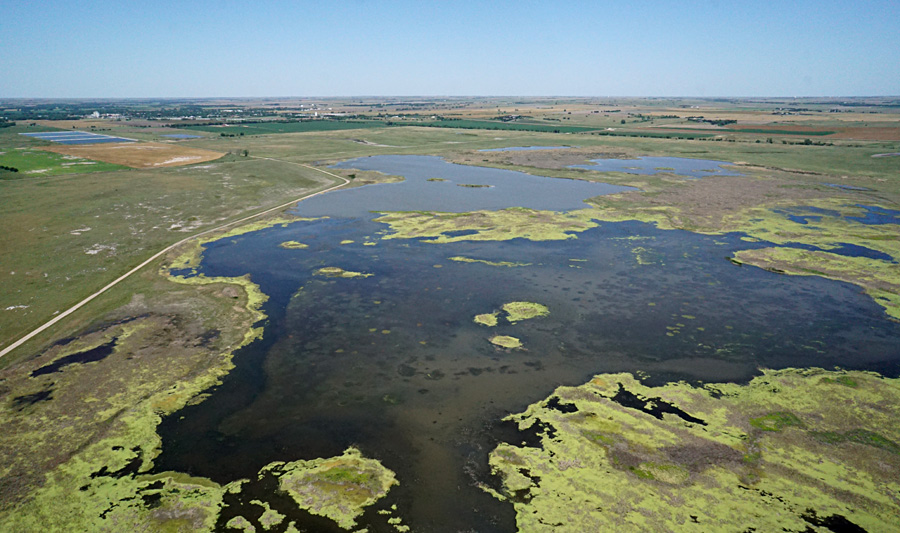
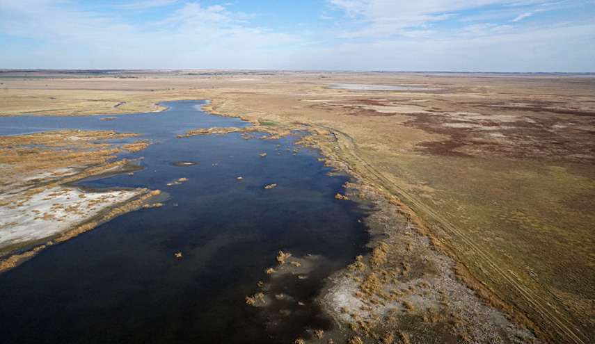
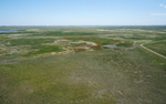
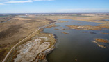
Overviews looking toward the northwest with Hoisington in the background (left) and northeast with Deception Creek (right). Clear water appears black; silty water is tan-brown in color.
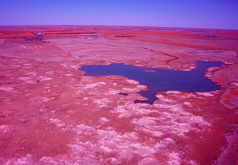
Overviews of wet meadows looking toward the southeast with the state wildlife area in the distance (left) and south showing Blood Creek (right).
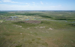
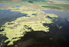
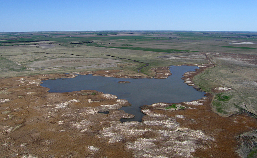
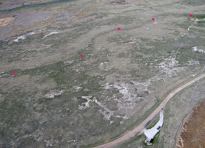
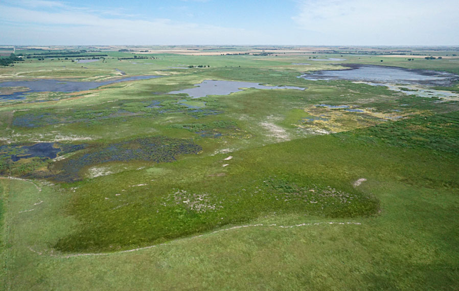
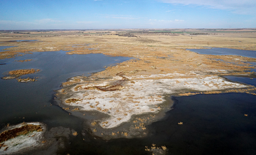
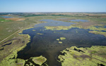
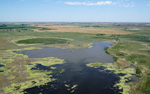
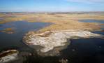
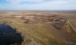
Closer views of marsh looking toward the north (left) and west (right). The bright yellow-green areas are duckweed covering the water surface in areas of cattail thatch.
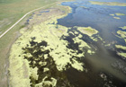
Ground views
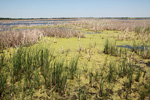
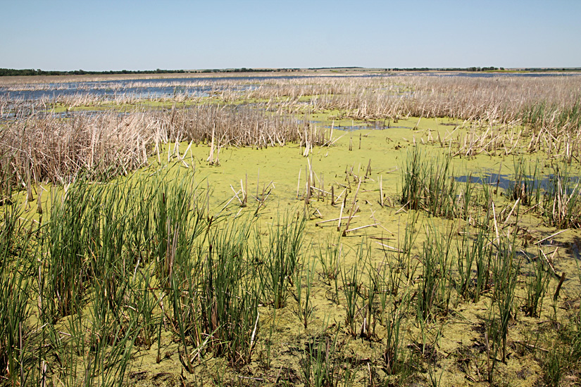
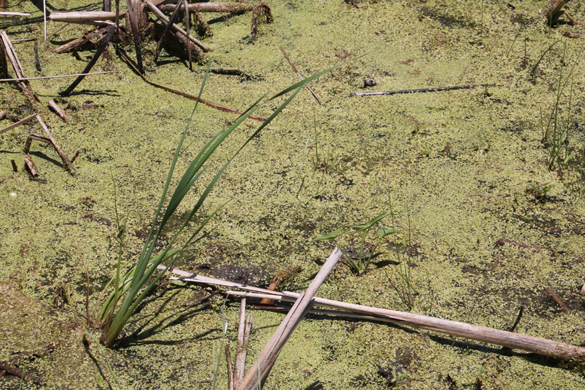
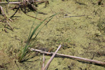
Left: live cattail in foreground and dead thatch in background with duckweed on water surface. Right: close-up view of duckweed covering water surface in thatch area.

November KAP overviews

View to northwest

Looking northward

View to northeast

Looking to southeast

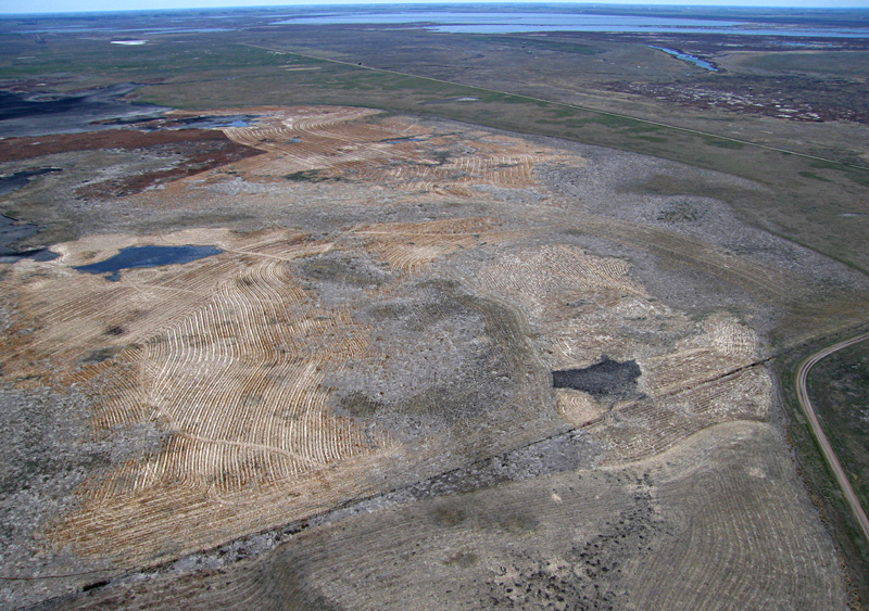
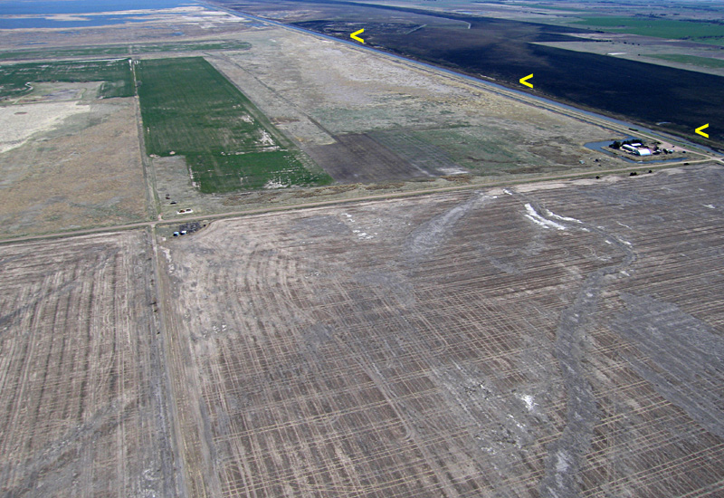
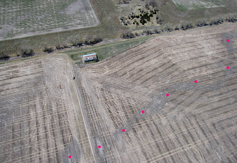
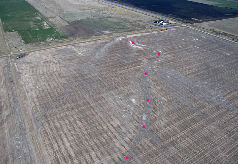
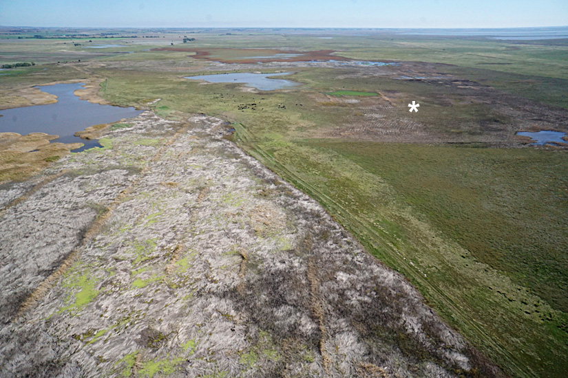
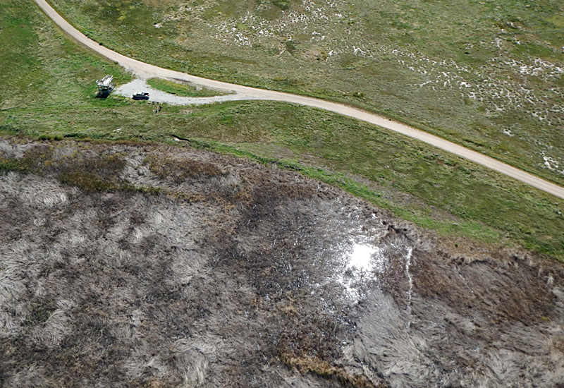
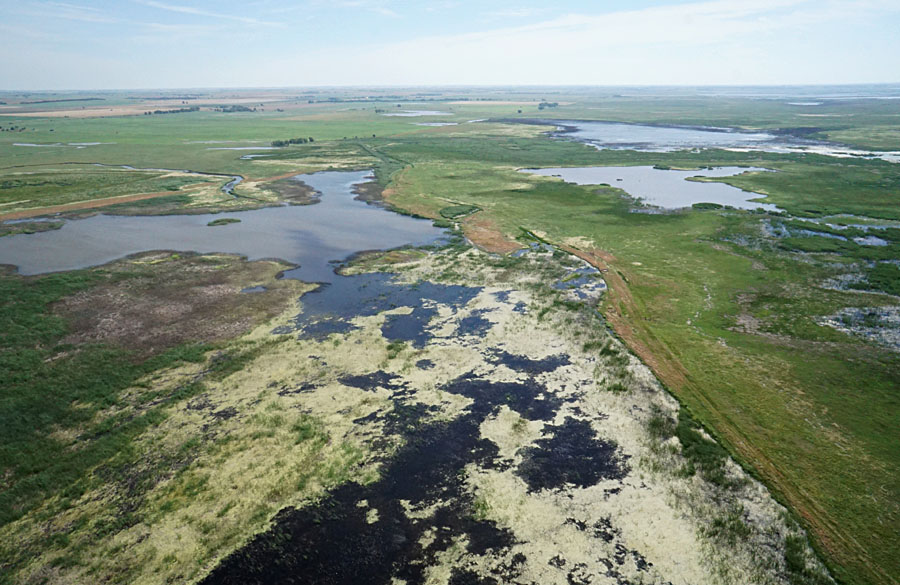
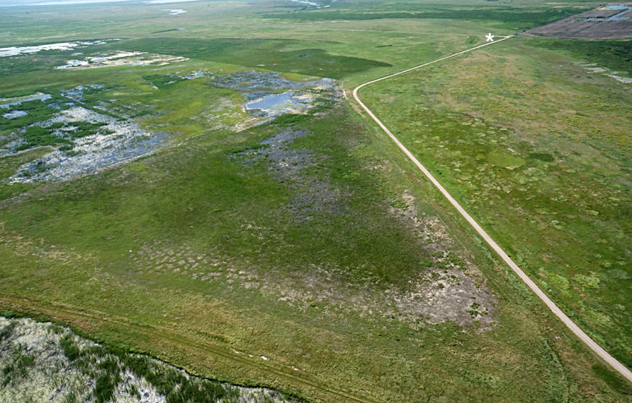
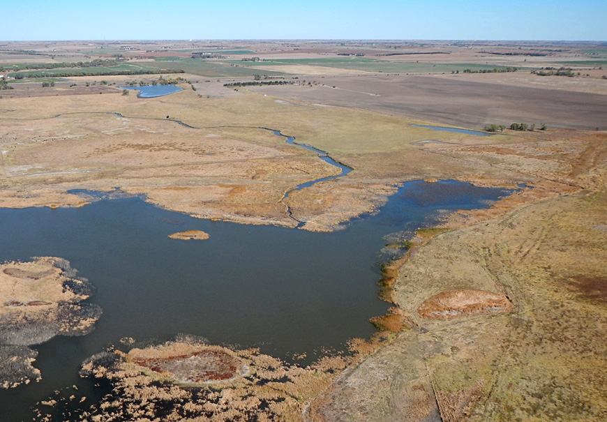
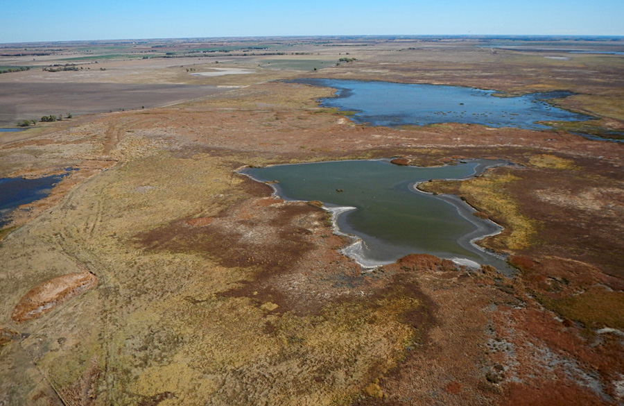
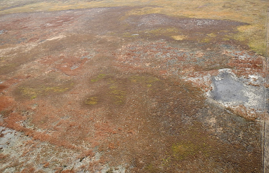
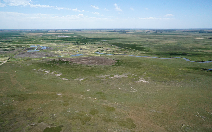
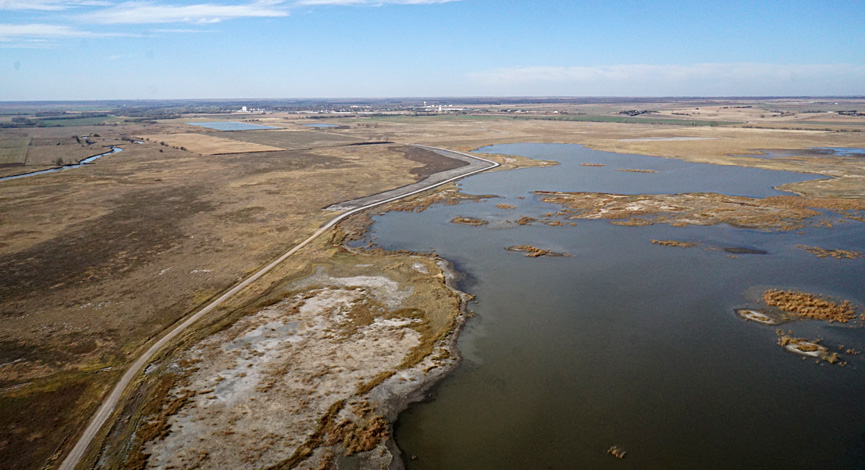
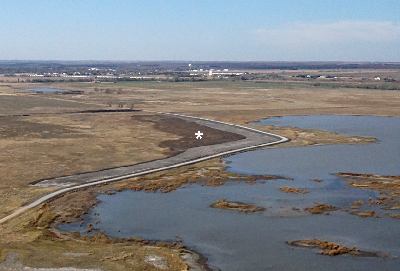
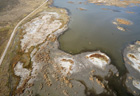
We visited again in early November, and acquired kite aerial photography on a warm and sunny day. The weather shift noted in June had continued with a relatively dry summer and autumn. Water level was down with extensive mudflats exposed in the marsh/pool complex. The dry weather had allowed the Nature Conservancy to reconstruct the access road, improvements were made on the adjacent county road, and some mudflat areas were disked to improve habitat. However, a budget cut prevented aerial spraying this year.

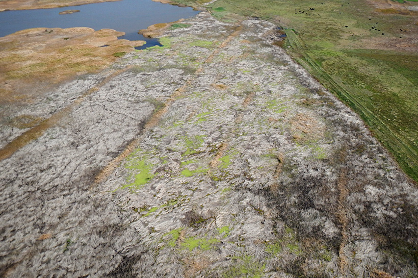
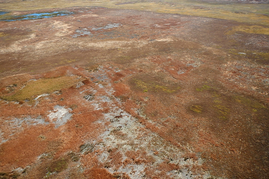
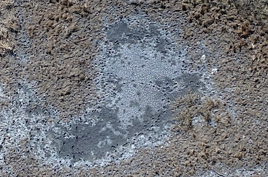
Areas of aerial spraying in 2017, 2018, and 2019 were quite evident especially for mudflats. Mudflats just above water level and still moist have a gray appearance; whereas, slightly higher and drier mudflats were covered with a lime crust and appear light gray to almost white.

Closer views
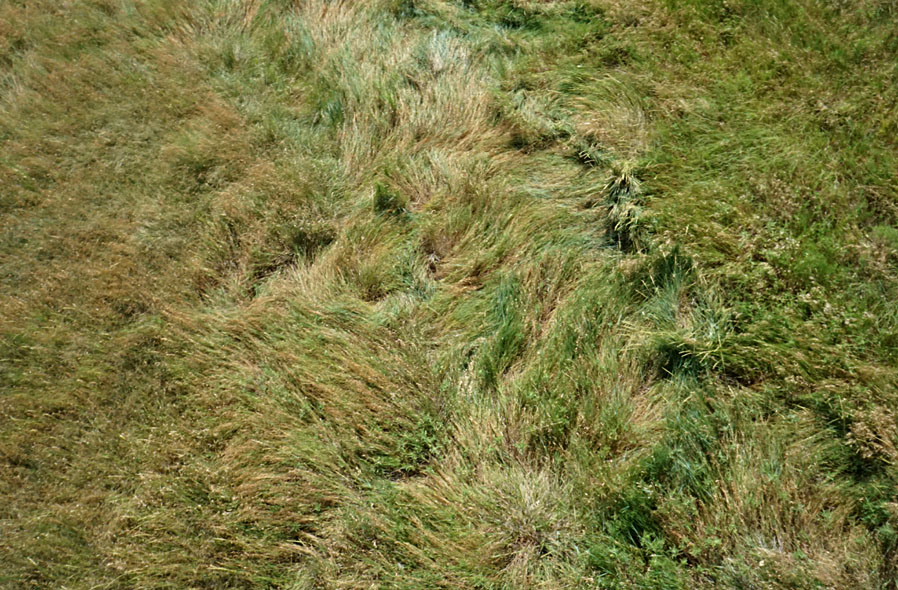
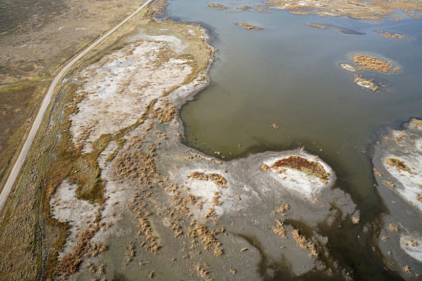
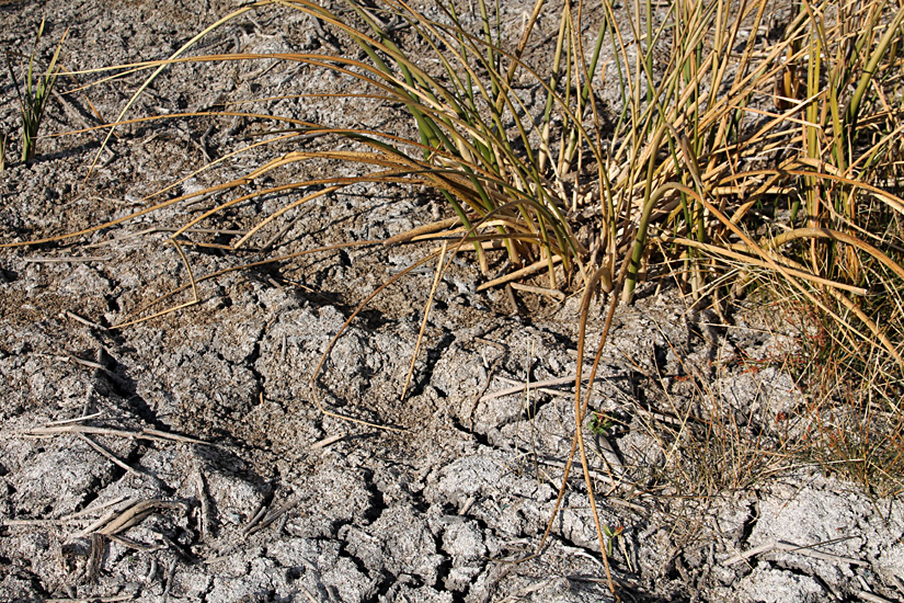
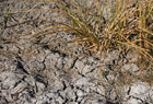
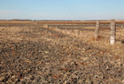
Pool and mudflats next to access road (left). Ground shot of bulrush at margin of mudflat (right). The chalky gray color is a lime crust left by evaporating water.
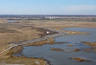
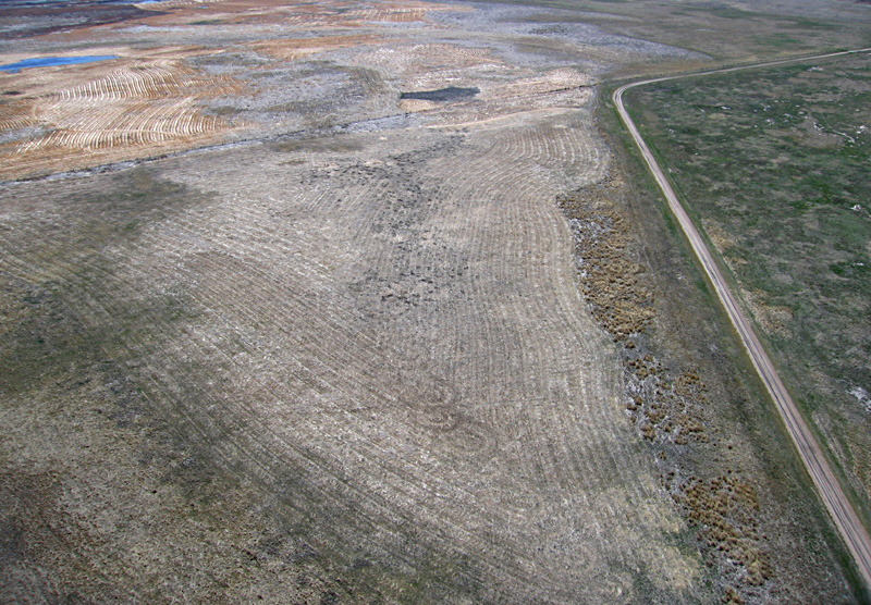
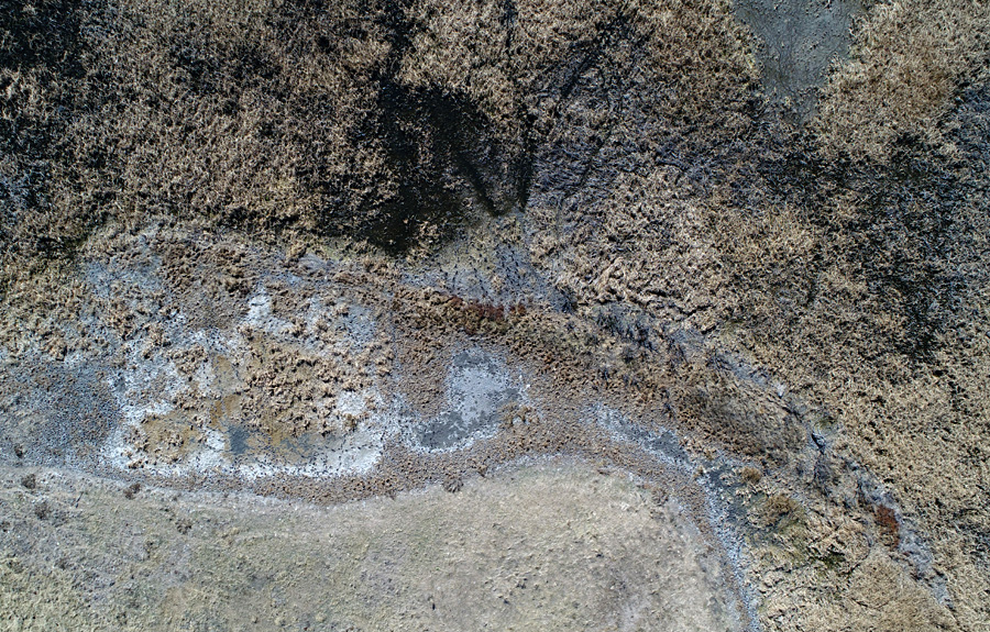
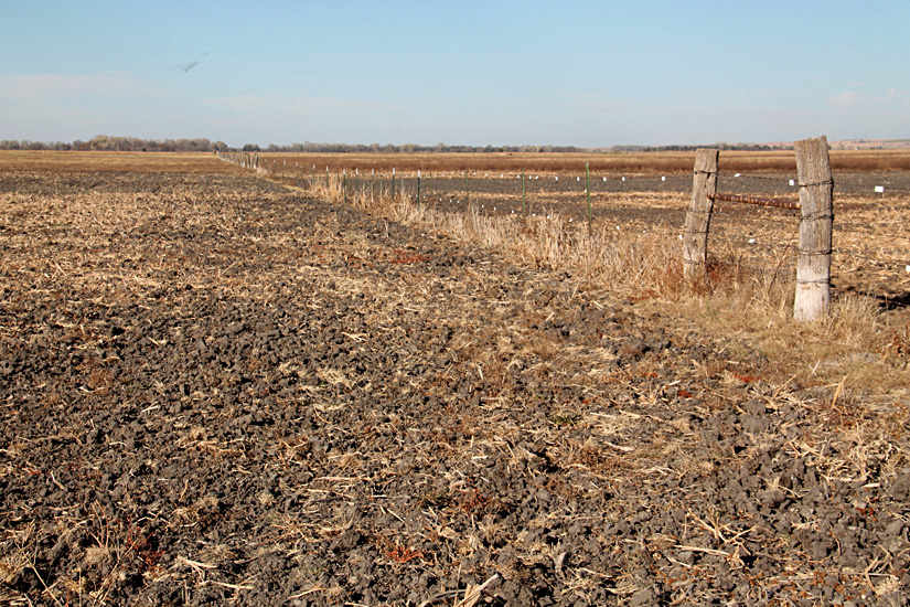
Reconstructed access road and disked mudflat (*) at scene center (left), and ground shot of recently disked mudflat (right).

Return to beginning.

Return to Cheyenne Bottoms homepage.
All rights reserved © (2020).