Environmental Research
Cheyenne Bottoms, Kansas

2008 through 2011

Further developments in 2008

Flooding finally began to recede during the winter and spring of 2008. Roads became passable, although water levels remained high in pools and marshes, and we were able to reach our usual Nature Conservancy study site in May and June of 2008. The experiment to simulate heavy buffalo grazing, conducted in fall 2006, seems to have been successful for creating open marsh conditions, as shown in the following pictures.

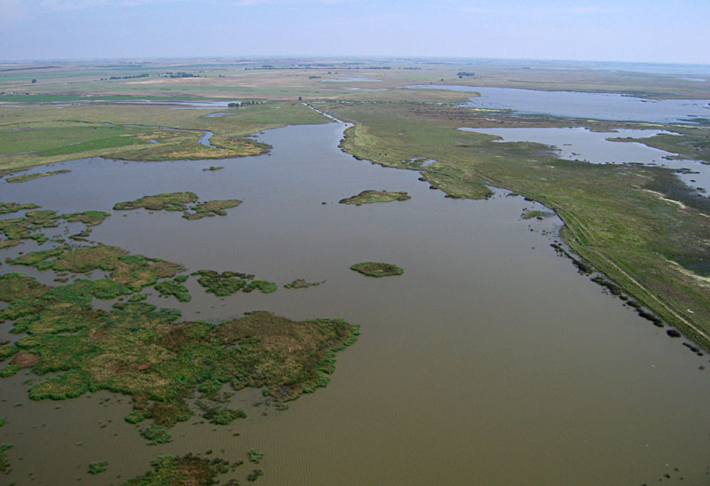
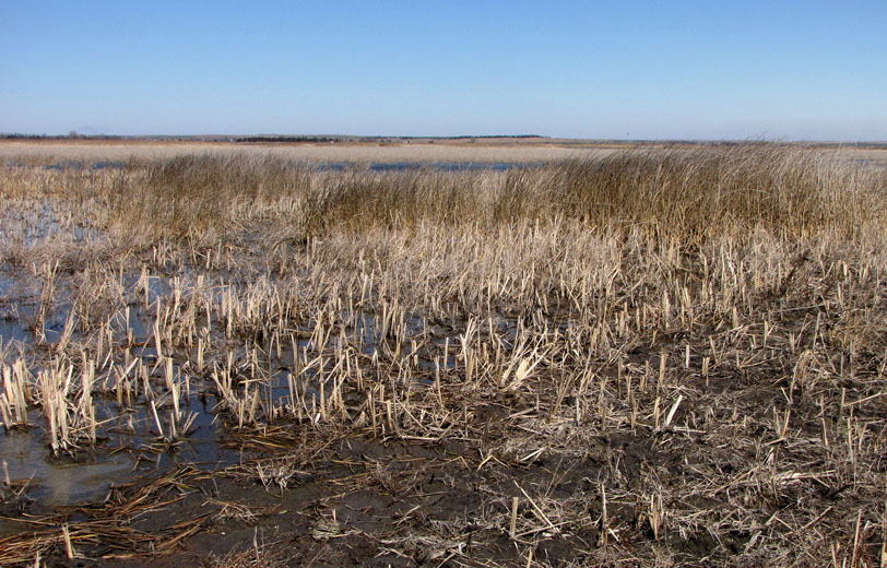
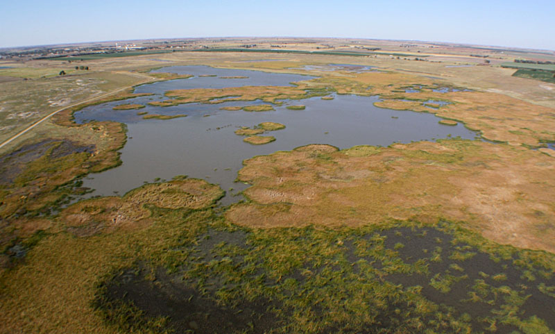
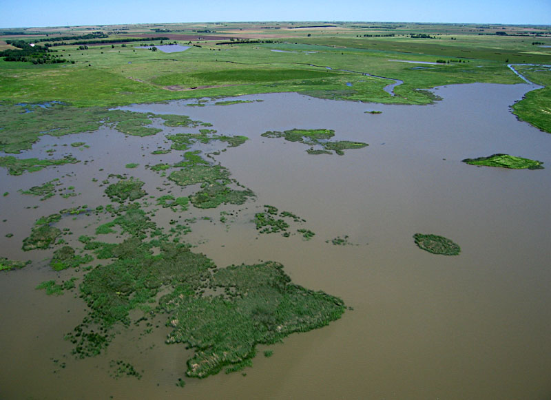
Standard view toward the north in early May 2008. Extensive open water remains in the marsh complex. Emergent marsh vegetation is mostly dormant at this time of year.
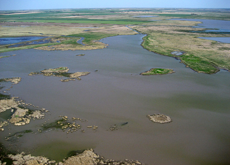
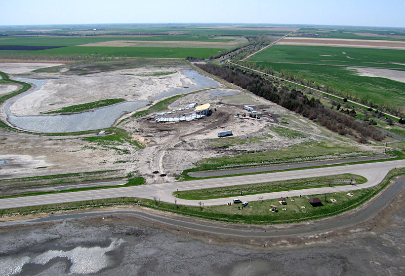
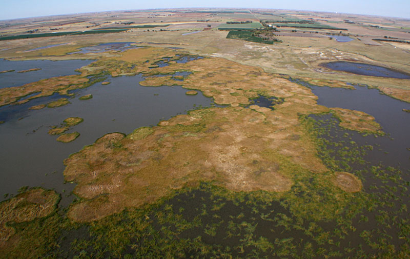
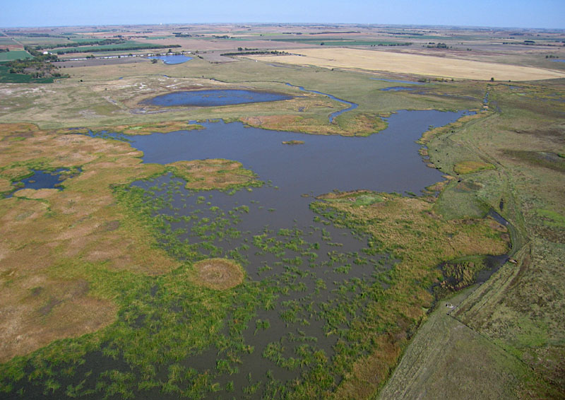
Standard view toward the northeast in early May 2008. Deception Creek and its small delta are visible in the left background.
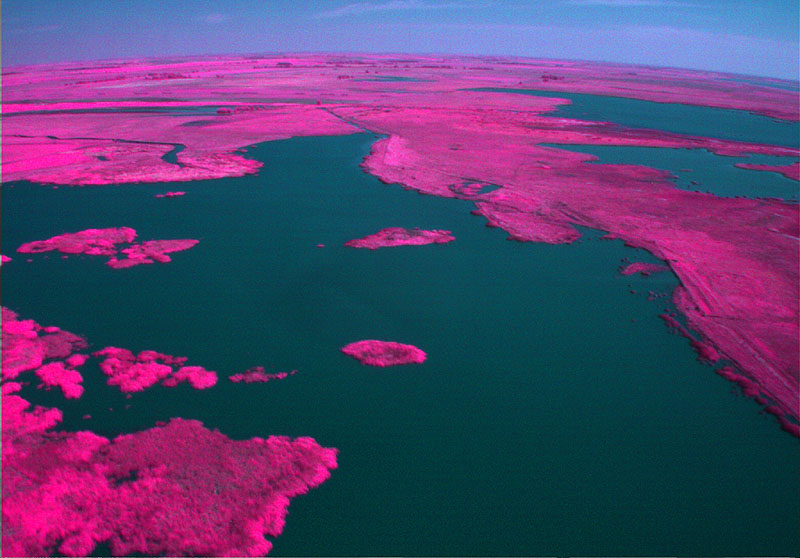
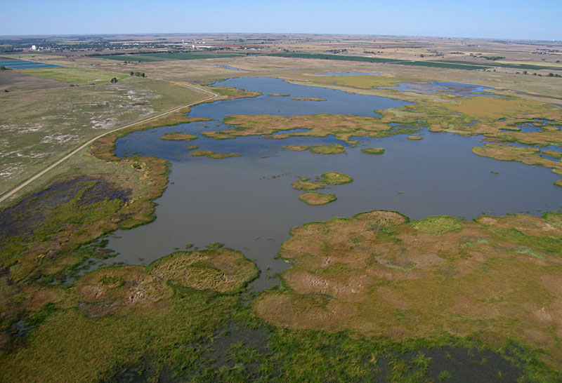
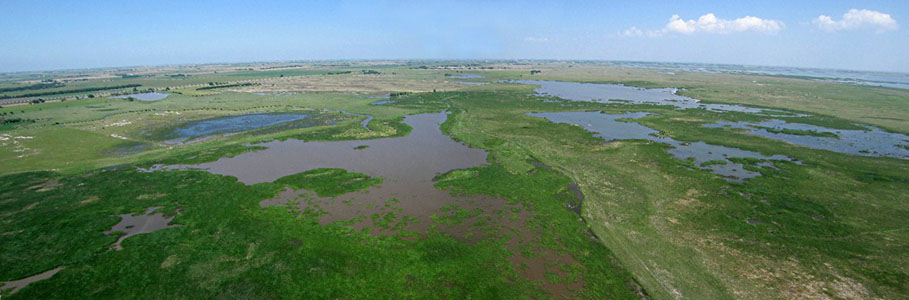
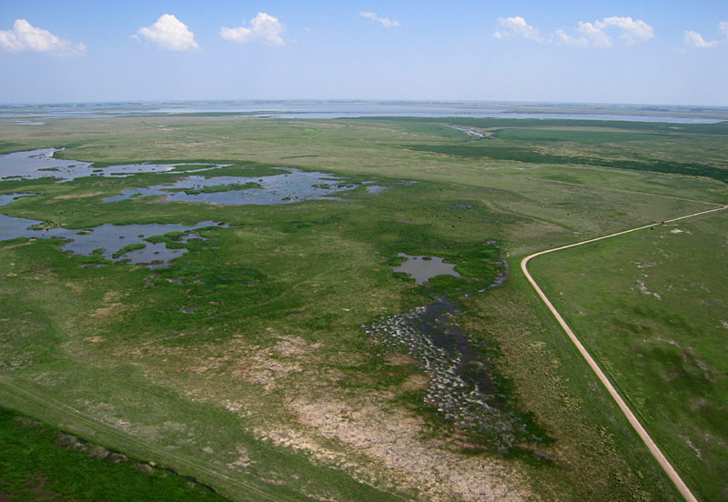
Wide-angle view toward the northeast in mid June 2008. Emergent marsh vegetation is active and consists mainly of bulrush with small patches of cattail.
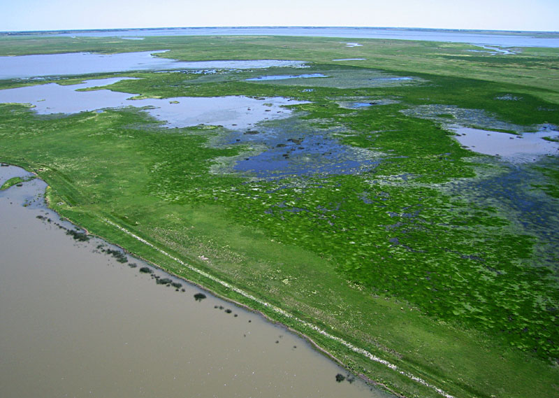
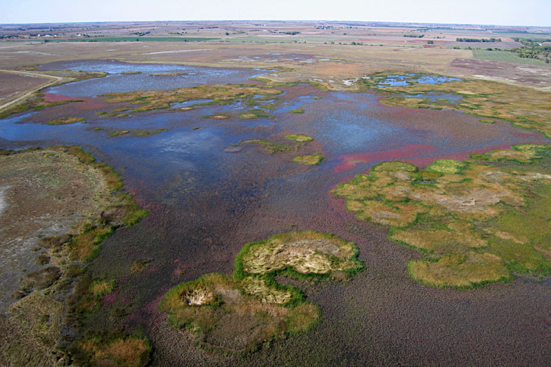
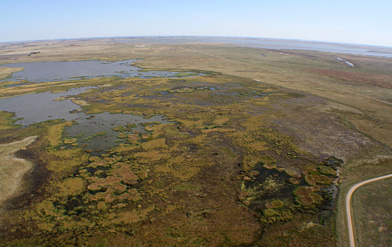
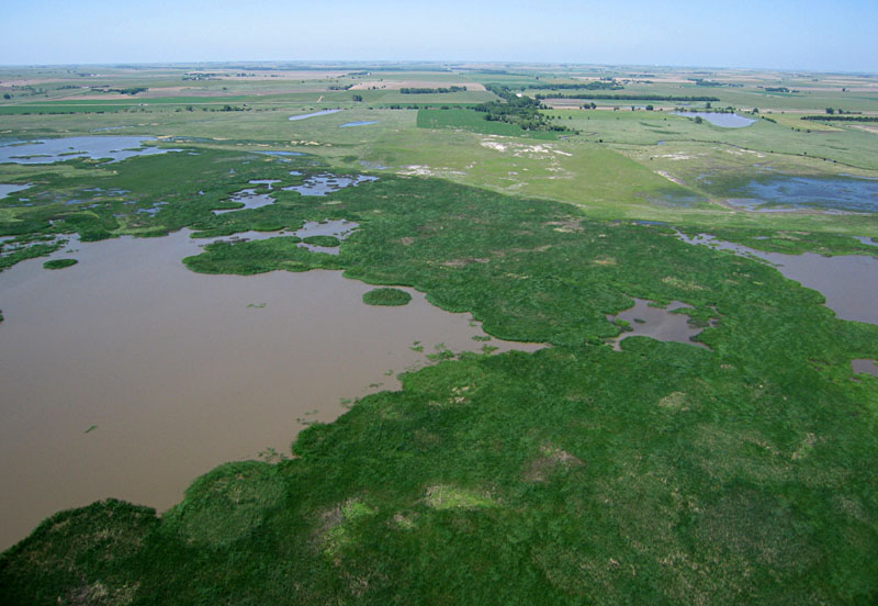
Wide-angle view toward the east in mid June 2008. Nature Conservancy marshes in foreground and flooded pools of the state wildlife area in the background.

The Kansas Wetland Education Center (KWEC) is under development as a joint venture between the Kansas Department of Wildlife and Parks, Ducks Unlimited, and Fort Hays State University. Located on the southeastern edge of the state wildlife area, construction was delayed because of flooding in 2007. After raising the site base construction by two feet, the building began to take shape in the spring of 2008. It openned officially in the spring of 2009.

Overview of KWEC looking toward the southeast. Highway K-156 crosses the foreground, and a picnic area is visible in lower right portion. Outlet canal of the State Wildlife Area is toward upper right side. Photo date May 2008.
Closer view of KWEC showing the semi-circular plan of the building and the demonstration marsh behind the building. Photo date May 2008.


Our final visit in 2008 took place in late September, when water level still remained high following a relatively wet and cool summer. Color-visible (left) and color-infrared (right) views over Nature Conservancy marsh toward the northeast with delta of Deception Creek in the upper left portion (Aber et al. 2009).

Return to beginning.

Azolla bloom in 2009

We conducted routine aerial photography in early October 2009 and were surprised to find distinctive maroon-colored vegetation over substantial portions of the marsh complex. We soon identified the plant in the genus Azolla, most likely the species A. cristata (Aber et al. 2010).

Aerial views. Left: wide-angle shot looking toward the northwest. Right: closer view toward the northeast. Cattle in lower right corner for scale. Note patchy distribution of Azolla (maroon) over the marsh surface.

Azolla is a small aquatic fern, commonly called
mosquito fern, fairy moss or water fern, typically described as a delicate, mosslike plant that floats or is stranded on the edge of quiet water bodies such as ponds, marshes and ditches. It often grows in large floating mats composed of masses of tiny ferns. Color varies from gray-green to bright red-purple; the reddish color is intensified by exposure to sunlight, especially in winter. Several common names include mosquito fern, water fern, fairy moss, water velvet, duckweed fern, and floating fern.

Ground pictures. Left: oblique shot, about one yard across. Right: closeup vertical shot, about one foot across. Azolla is light pink to dark maroon just above water level with bright green algae below water.

We have not recognized Azolla before in Nature Conservancy marshes; see for example the Sept. 2008 picture just above, in which Azolla is not visible anywhere. How it was transported into this environment is not known. Azolla spores could be carried on the feet of waterfowl and shorebirds coming northward during their spring migration. The historic flood of 2007 may have washed in spores or plant fragments from other sources either within or outside Cheyenne Bottoms. Still other means of dispersal are possible. In any case, the bloom of Azolla in 2009 was remarkable.

It was not possible to predict the long-term consequences of Azolla in Nature Conservancy marshes at that time. On the beneficial side, Azolla is considered a good food source for waterfowl and provides cover for small invertebrates, which could enhance the value of these marshes for migrating waterfowl. On the other hand, Azolla spreads rapidly by vegetative reproduction and may form extensive mats. It should never be introduced intentionally, as it quickly may overspread a water body and become quite a nuissance.

Return to beginning.

2010 Update

A relatively cold and wet winter set the stage for Cheyenne Bottoms in 2010. We vistied in mid-March when some early-season vegetation was just beginning to green up, but most wetland plants were still dormant in the Nature Conservancy marshes. We conducted kite aerial photography at the usual study site at the Nature Conservancy observation tower, and controlled burning was underway nearby at the state wildlife area.

Kite aerial photographs
Wide-angle view toward the northwest with Hoisington in the background. The new observation tower, built in 2009, may be seen in the lower right portion, and students operate the kite and camera from the lower right corner of this scene.
Looking toward the southeast with pools of the state wildlife area in the background. A large smoke plume drifts southward from a controlled burn on the northern side of the state wildlife area.

Ground photographs
Marsh vegetation. Left: cattle ate cattail down to stumps the previous fall (foreground), but did not graze on bullrush (behind). Right: algae is among the first plants to thrive in the early spring conditions.
Controlled burning in the state wildlife area. Fires are set to remove dead vegetation thatch, which returns nutrients to the soil, allows new vegetation to grow up rapidly in the spring, and restricts woody vegetation from becoming established.

On a return visit in mid-October, we conducted kite aerial photography with a new Canon EOS Rebel XS 1000D camera with a 10.1-megapixel sensor and a wide-angle lens. We added a 0.7X auxiliary lens to create a focal length of 12.6 mm (20 mm film equivalent) for superwide-angle views.

Superwide-angle overviews

View to northwest

View northward

View to northeast

View to southeast

Our aerial and ground observations revealed that emergent vegetation had spread over parts of the marsh area, and the Azolla bloom of the previous year had dissipated into small patches along the marsh edge. We also observed plenty of wildlife, especially frogs and snakes.

Emergent vegetation covers substantial areas of the marsh, and the maroon color of Azolla is hardly visible. Left: view toward northwest with Hoisington in the background. Right: view toward northeast showing the small delta of Deception Creek and grazing cattle.
American bullfrog (Rana catesbeiana). Left: adult frog sits in a patch of Azolla. Right: Plains gartersnake (Thamnophis radix) has caught a small bullfrog; the snake already has swallowed the entire right hind leg of the frog, which has ceased to struggle.

Return to beginning.

2011 Events

We conducted kite aerial photography in late May 2011, marking our tenth year of annual aerial observations at the Nature Conservancy marsh. Following a week of heavy spring rain and runoff in central Kansas, the marshes and wet meadows were full of water, and emergent vegetation was well along with its seasonal growth. Most remarkable, cattail thickets are recovering and overspreading substantial portions of the main pools. In fact, the cattail coverage is beginning to resemble that of 2002, the first year of our observations.

Panoramic image looking to northeast at center, east toward right, north toward left. Assembled from two wide-angle shots.


View westward

View northward

View to southeast

Left: JSA and SWA setting up to conduct kite aerial photography next to the observation tower. Note cattle grazing on wet meadow in background. Right: closeup vertical shot of cattails growing in the marsh. Note muddy water from recent runoff.

Return to beginning.
Continue to 2012 – 2013.

Return to Cheyenne Bottoms homepage.
All rights reserved © (2020).