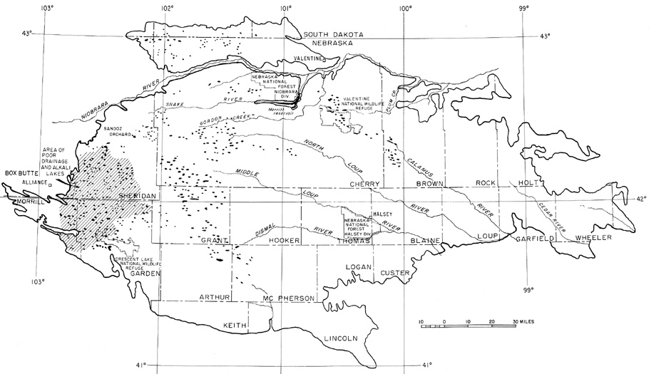
| Central Great Plains
Chapter IV
Emporia State University Emeritus |
|
| Central Great Plains
Chapter IV
Emporia State University Emeritus |
 Sketch map of the Nebraska Sand Hills showing major drainage features. Adapted from Keech and Bentall (1978). | 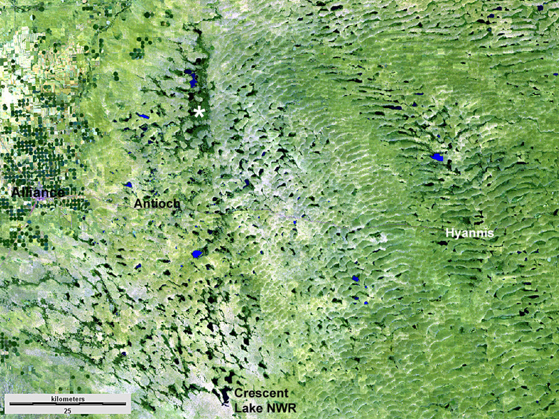 False-color satellite image of the western Nebraska Sand Hills. The eastern side of this scene displays massive transverse dunes, and barchan dunes are found to the west. The most active vegetation appears dark green; less active vegetation is pale green. Numerous lakes (blue to black) occupy the troughs and swales between dunes. Asterisk (*) marks a paleovalley (see below). Landsat TM, 10 August 2010.
| |
The Nebraska Sand Hills has been described as resembling a vast sea with gigantic waves frozen in place; the NSH is comparable to other great sand seas in Africa, Arabia, Asia, and Australia. The region remains sparsely populated. Cattle ranching and hay production are the primary land uses based on lush prairie grass and abundant surface water and shallow groundwater. In spite of its austere nature, the NSH has become a destination for ecotourism including hunting, fishing, and bird watching. The sand hills are located along the principal route of the North American central or Great Plains flyway for migrating waterfowl and shorebirds, which find food, shelter, and rest in the myriad wetlands and lakes of the region.
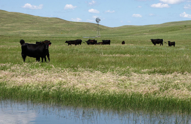
| Animal life in the Nebraska Sand Hills. Cattle grazing in a wet meadow (left). White-faced ibis (Plegadis chihi) stalks through a shallow marsh (right). | 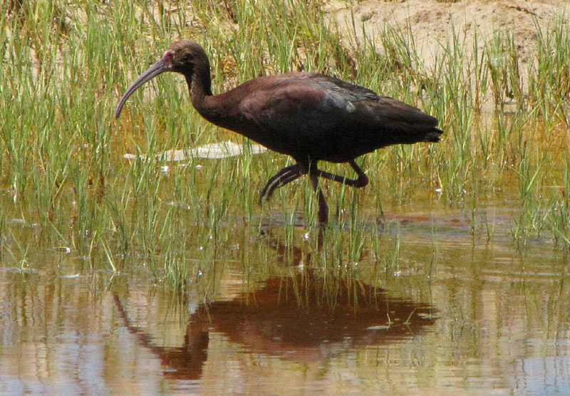
|
 Return to beginning.
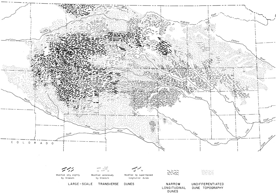 Sketch map of dune types within the Nebraska Sand Hills. Adapted from Keech and Bentall (1978).
| |
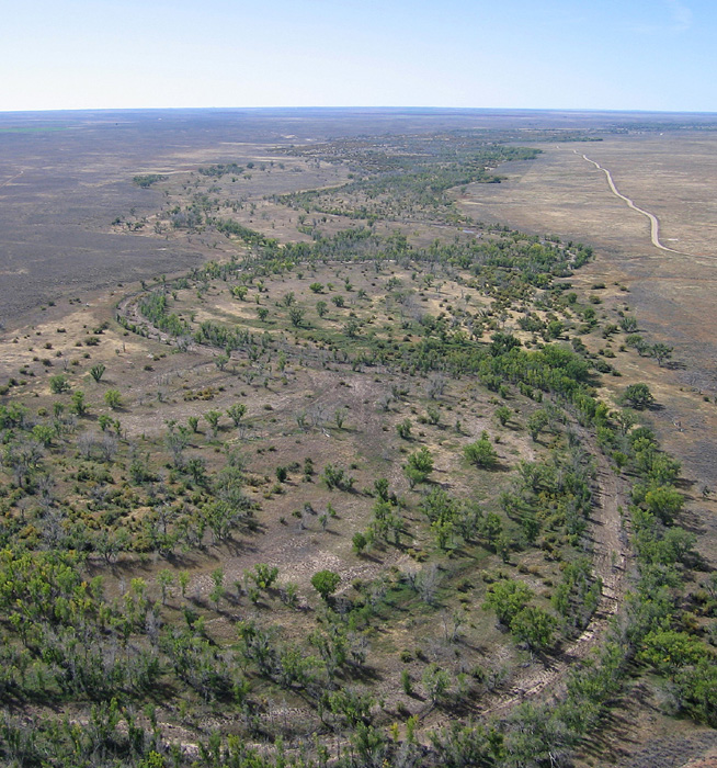
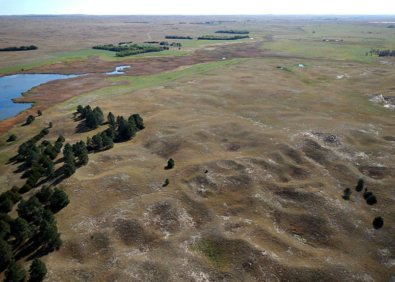
| Large transverse dunes, covered by smaller blow-out dunes, and stablized by prairie grass. Lakes fill the elongated troughs between dunes. Note the great length of these dunes and troughs in the distance. Valentine National Wildlife Refuge, Cherry County. Kite aerial photograph. |

| Large barchan dunes in the western portion of the sand hills near Lakeside, Sheridan County. Lakes of irregular size and shape occupy swales between the dunes. Kite aerial photograph. |
Parabolic and barchan dunes of large to intermediate size prevail in the western portion, and small blow-out dunes are found throughout and around the margins of the sand hills. At the boundary between large transverse dunes and barchan dunes, north of Lakeside, a broad valley extends north-south and contains a series of large lakes (see satellite image above). These lakes are drained northward by Pine Creek in a paleovalley that was partly buried by migrating sand dunes.
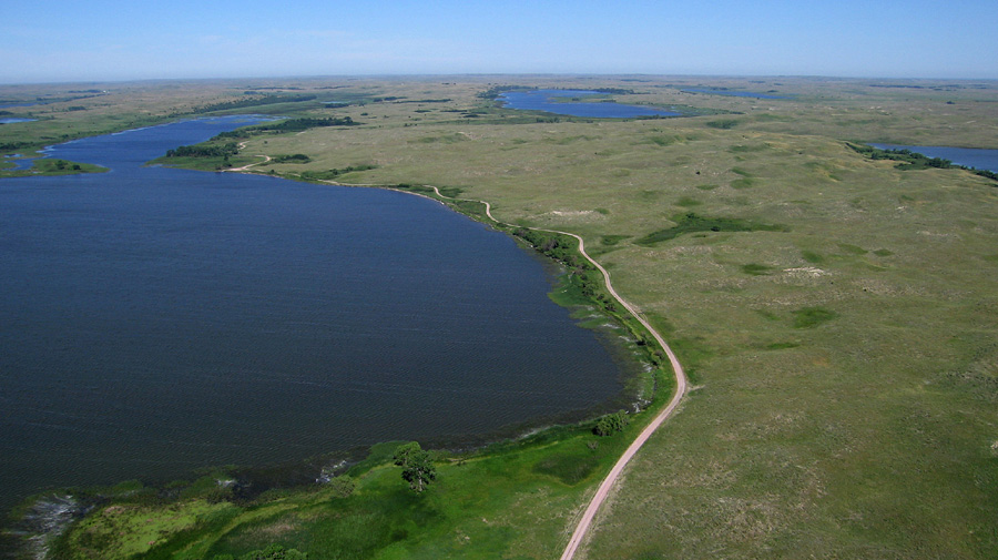
| Smith Lake State Wildlife Management Area. Looking southward (left). Smith Lake is fed by Pine Creek draining through a broad valley with numerous lakes. View westward (right) showing windbreaks of cedar (green) and deciduous trees around the lake. | 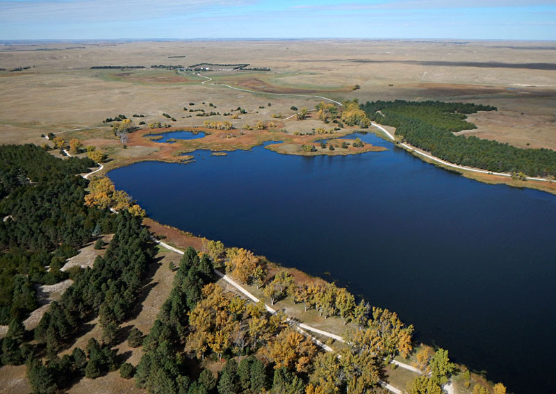
|
The dunes appear to have been active several times during the past 10,000 years, most importantly during the mid-Holocene climatic optimum, some 8000 to 5000 years ago, and again from about 3000 to 1500 years ago (Swinehart 1990). Beyond the dune area, wind-blown dust settled over the landscape in a blanket of loess 5 to 20 m thick. The region immediately southeast of the NSH to the Platte River valley has the thickest loess and is known as the Loess Hills. South of the Platte River valley to Kansas, loess thickness diminishes; this region is the Loess Plain (see landscape maps).
Thick dune sand rests on unconsolidated alluvial sand and gravel that cover poorly consolidated Ogallala strata. Extensive test drilling has revealed the great depth of the sub-dune sediments, which locally reach nearly 300 m in thickness. Dune sand is derived from this underlying source, which demonstrates a general principle that wind-blown dunes remain close to the sand source. This great mass of pre-dune sediment was delivered from the Rocky Mountains via rivers that drained across what is now the central and northern NSH. These streams were ancestral to the modern Platte and Niobrara rivers.
 North-south cross section through the central Nebraska Sand Hills. Note the great thickness of alluvial (QTa and Tpa) and Ogallala (To) strata beneath the sand hills. Adapted from Swinehart and Diffendal (1990). | 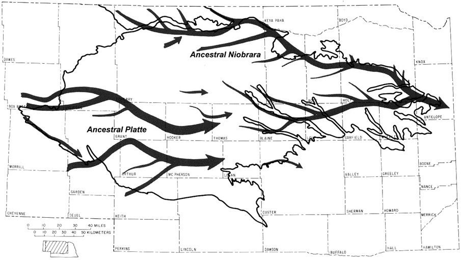 Probable Ogallala paleovalleys and inferred drainage of the ancestral Platte and Niobrara rivers. Adapted from Swinehart and Diffendal (1990).
| |
Return to beginning.
This immense groundwater reserve is sustained by precipitation that averages about 0.5 m (20 inches) per year through the central portion of the sand hills (Wilhite and Hubbard 1990). Toward the west precipitation declines to less than 17 inches per year, and to the east it increases to more than 22 inches per year. This transition in available water gives rise to different hydrologic zones (see above). In the central and eastern portions, perennial streams display remarkably constant discharge fed by groundwater baseflow; these streams rarely flood or dry up.
Sand hills streams are slightly alkaline (pH 7.7-8.1), low in dissolved solids (100-200 ppm), and low in hardness (Bentall 1990); in order words, excellent water quality. To the north and west, countless shallow lakes occupy enclosed basins. Most of these are slightly alkaline, freshwater lakes associated with extensive marshes and wet meadows that follow elongated swales between large transverse dunes.

| Niobrara River (left) looking downstream, as seen from above near Valentine, Nebraska. Sand bars are well displayed in the shallow, clear water. Steverson Lake (right) with marsh and wet meadow in the foreground, situated amid large transverse dunes. Part of the Cottonwood-Steverson Wildlife Management Area in western Cherry County. Kite aerial photograph. | 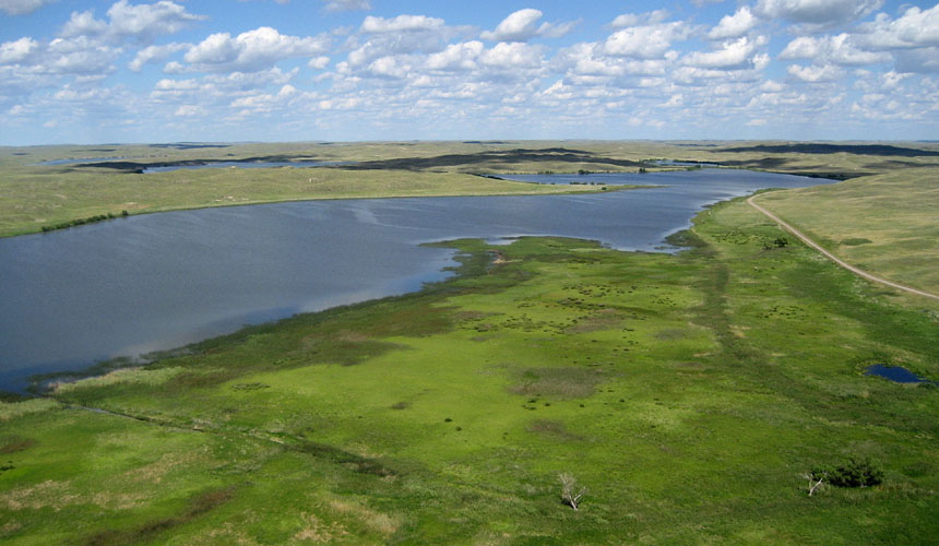
|
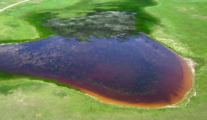
| Marsh-pond complex in the sand hills near Lakeside in Sheridan County. Bright maroon and golden-orange colors in this pond are presumably caused by carotenoid pigments of invertebrates, such as brine shrimp, brine flies and rotifers, in the hyperalkaline water typical of the westernmost sand hills region. Kite airphoto. |
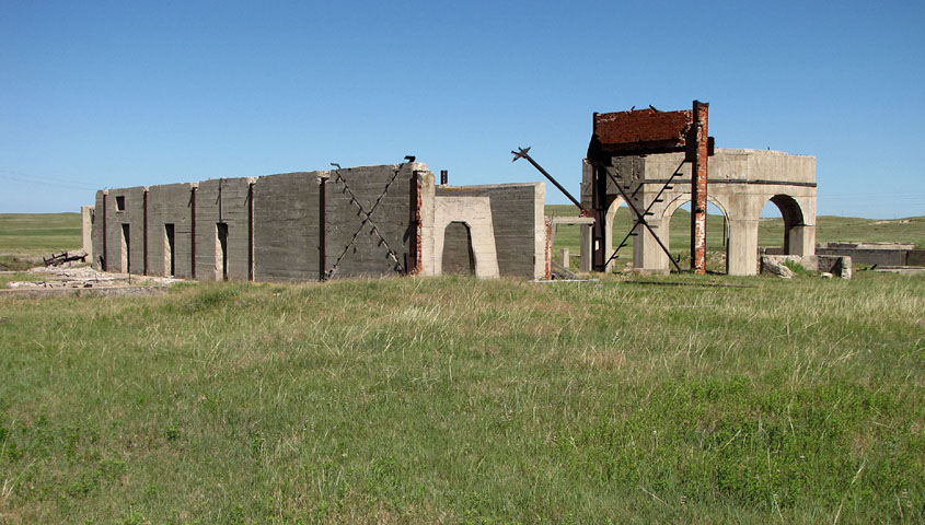
| Ruins of a potash-processing plant at Antioch, Sheridan County, Nebraska. The plants were shut down in 1920 following World War I, and few remains of this industry are preserved today. |
Return to beginning.
 Combined references.

Return to Landscapes table of contents.
All text and images © by the authors (2022).