|
Landscapes of the Central Great Plains
Chapter X Conclusions, Acknowledgments
and Combined References
James S. Aber and Susan W. Aber
Emporia State University Emeritus
|
Conclusions
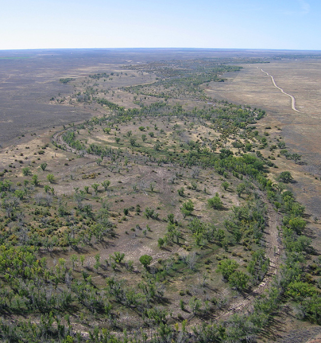
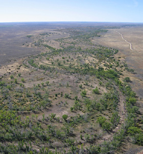
Each of the natural regions of the central Great Plains has distinctive, indeed unique expression in the landscape. Viewing these landscapes from the bird's-eye perspective enables greater appreciation of the bedrock, landforms, soils, drainage, ecology, resources, and human activities. The central Great Plains region contains surprisingly diverse assemblages of geomorphic features and spans a broad range of environmental conditions across an elevation gradient of several 1000 feet. The monotony of vast flat plains gives way in many places to hilly and steep topography in which local relief exceeds 300 feet (90 m). Shaping of the central Great Plains was conditioned by three primary geomorphic factors (Aber and Aber 2009).
- Geologic foundation – surficial bedrock ranges from well-consolidated Paleozoic strata to loose Holocene sediment, the physical and chemical properties of which vary greatly. Underlying these sedimentary strata, ancient basement structures may be projected upward through the overlying sequence as a consequence of the impact of glaciation and continuing tectonic movements.
- Process – wind, water, and glacier ice have all played roles for erosion, transportation, and deposition of materials in different parts of the central Great Plains. The general west-east climatic gradient imposed by the rain shadow from the Rocky Mountains strongly influences available surface water. Runoff from the Rockies and glacial meltwater diversions are the primary factors that led to establishment of past and present drainage systems.
- Time – modern landscapes came about primarily during the Neogene and Quaternary periods, based on combinations of locally variable foundations and processes that operated for longer or shorter intervals. Some of these processes, such as ice-sheet glaciation, clearly were episodic events that no longer take place in the region today. Others, such as wind erosion, groundwater solution, and storm runoff, continue now as in the past.
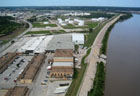
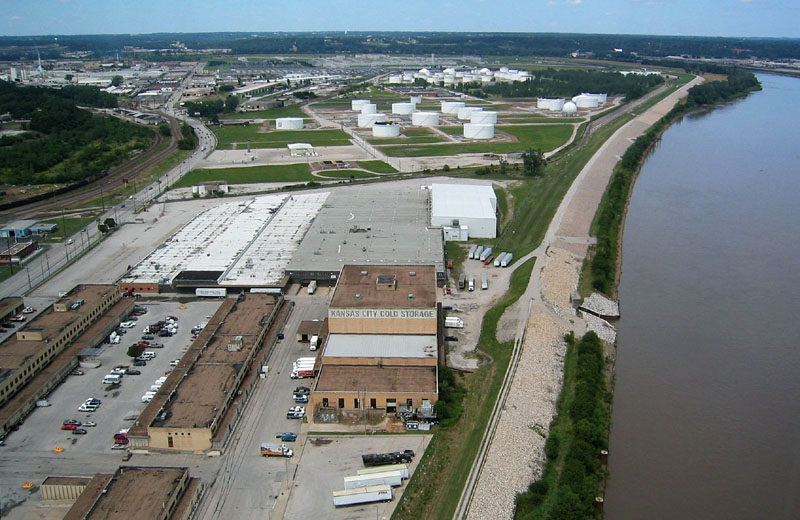
| Kansas City, Kansas near Kaw Point, the junction of the Kansas and Missouri rivers. View northward over the Fairfax industrial district in the Missouri River valley, which was the principal meltwater spillway during several glaciations. The floodplain is protected by a stone-faced levee. Valley sides are visible to left and in the far background. Helium-blimp airphoto.
|
Static landscapes do not exist, but a new factor has appeared and spread across the region, namely human activities. In the central Great Plains, agriculture is the most widespead human enterprise. Mining, industry, transportation, and urban growth likewise contribute to the modern landscape. The mosaic of colors, patterns, and textures exhibited by each region is a reminder that human land use is dependent upon natural resources—air, water, soils, minerals, vegetation and wildlife. Lessons learned from past exploitation of resources may be applied for sustainable management for our own benefit and that of future generations as well as conserving the natural environment on which native plants and animals depend.
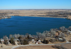
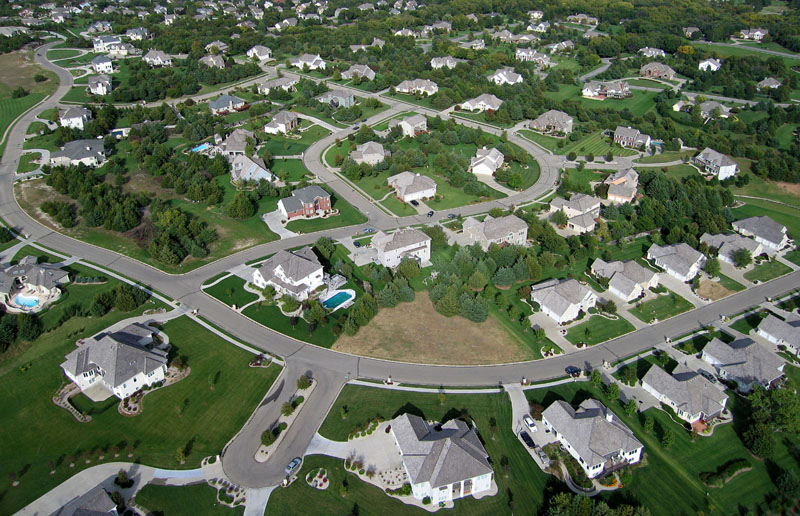
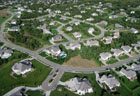
| Human land use in the Flint Hills region. Left – Lake Kahola and surrounding recreational houses. Winter view looking toward the dam and spillway; Chase and Morris counties. Right – recent housing development in the Flint Hills upland on the western side of Manhattan, Kansas. Kite and helium-blimp airphotos.
| 
|
Acknowledgments
These lectures are an outgrowth of our earlier work Kansas physiographic provinces: Bird's-eye views (Aber and Aber 2009). The present work includes much new material and is expanded geographically to include Nebraska and portions of adjacent states. Scores of people have assisted us with aerial photography in the region over the years, in particular Gayla Corley, Jim Schubert, and Brenda Zabriskie. Materials for the book have been developed also via numerous class field trips for various courses we have taught at Emporia State University (KS) and Chadron State College (NE). These trips often involved many students, too numerous to mention individually.
Our ideas about geomorphology, landscape regions, and environmental conditions of the central Great Plains were shaped by several mentors and colleagues including Pieter Berendsen, Louis Dellwig, Wakefield Dort, Jr., Michael Everhart, Elmer Finck, David Grisafe, Rebecca Jim, Paul Johnston, Dan Merriam, Marcia Schulmeister, Rodney Sobieski, William J. Wayne, and others. Financial support was provided over the years by various organizations including NASA, Kansas Geological Survey, William T. Kemper Foundation, Emporia State University, and Chadron State College. To all these individuals and institutions we offer our thanks.
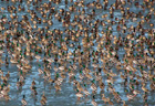
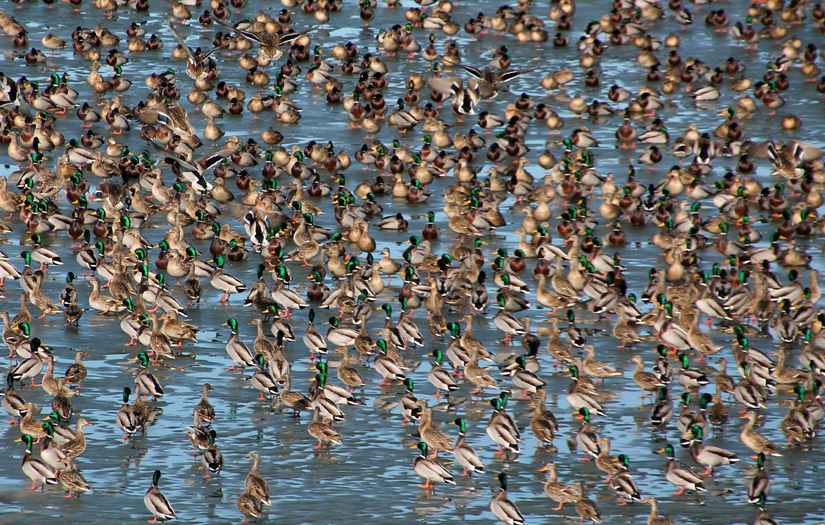
| Scores of mallards (Anas platyrhynchos) rest on the ice of Lake Kahola during their winter visit.
|