| Central Great Plains
Chapter II
Emporia State University Emeritus |
|
| Central Great Plains
Chapter II
Emporia State University Emeritus |
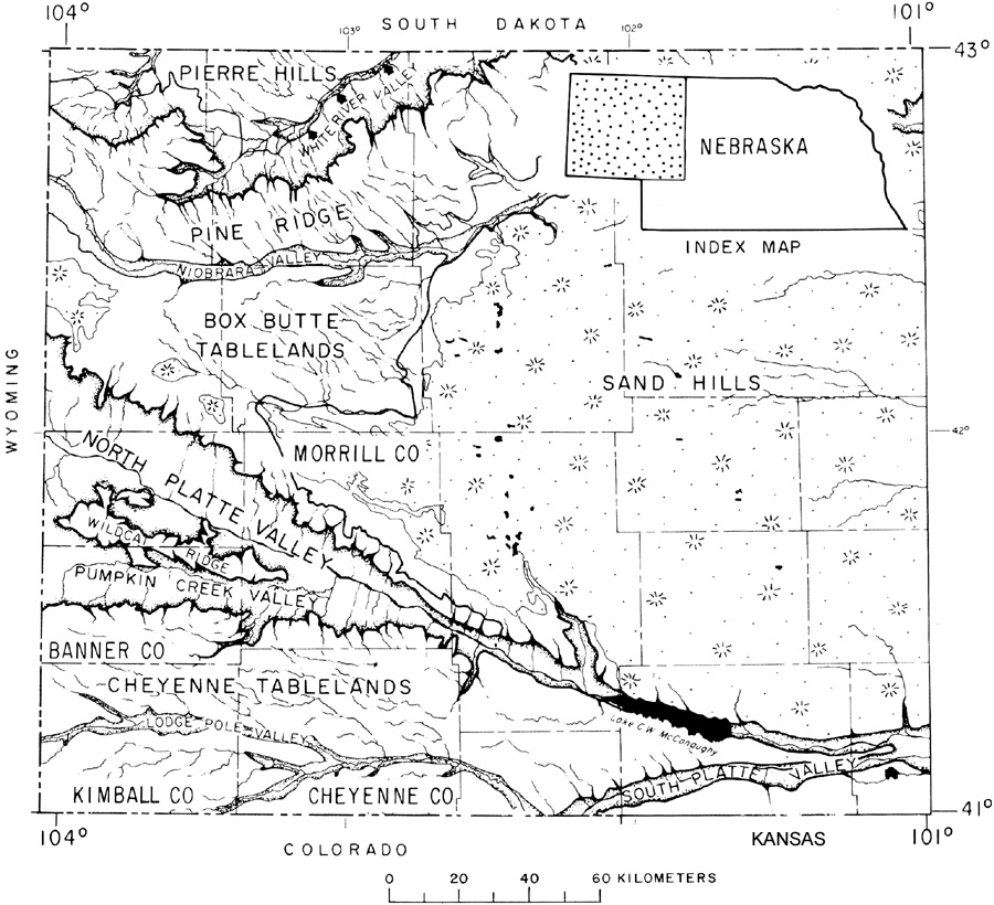 Main topographic features of the Nebraska Panhandle region. The Cheyenne Tablelands, Box Butte Tablelands, and Pine Ridge are parts of the High Plains. Adapted from Diffendal et al. (1985).
| |

| The edge of the High Plains upland is marked by the plowed field (lower right) with deeply eroded Pleistocene loess of Arikaree Breaks beyond. The dark green stripe in the distance is the North Fork Republican River valley in Nebraska, some 400 feet lower in elevation. Kite airphoto in Cheyenne County, Kansas. |
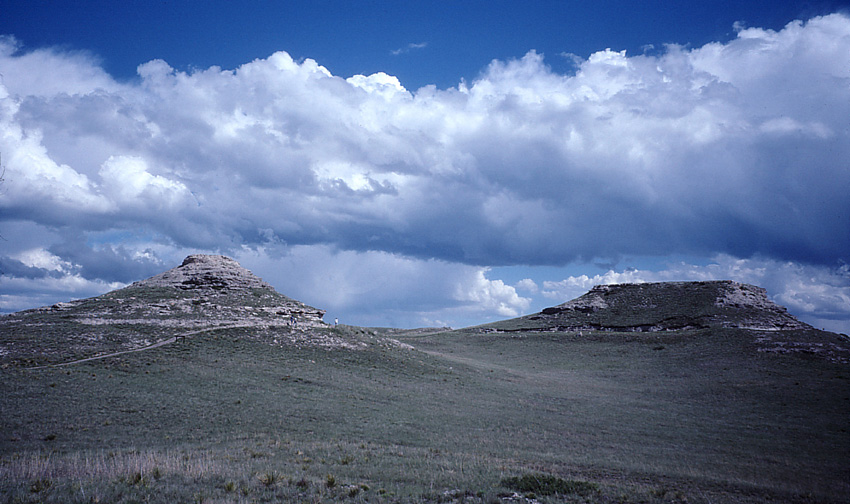
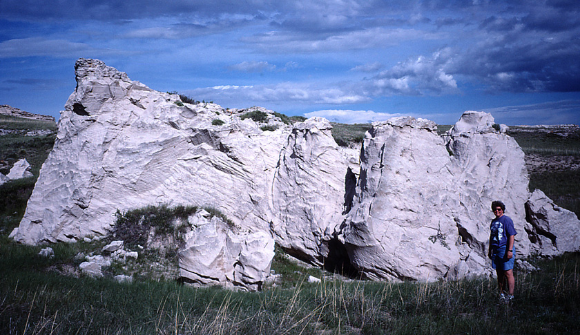
| Buttes at Agate Fossil Beds National Monument, Sioux County, northwestern Nebraska. The Arikaree Group is Miocene in age, ~20 million years old (Howard 2017). Note people in distance for scale. |
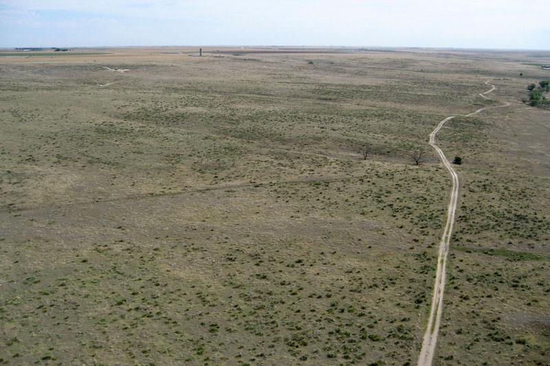
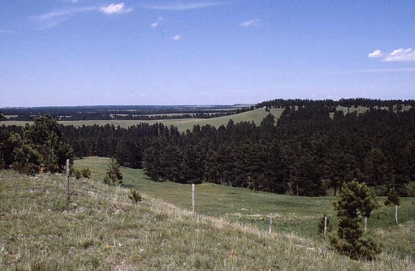
| This relatively austere view of dry rangeland is the general impression most people have for the High Plains in southwestern Kansas. Near Wagon Bed Spring, Grant County. Kite aerial photograph. |
 Return to beginning.
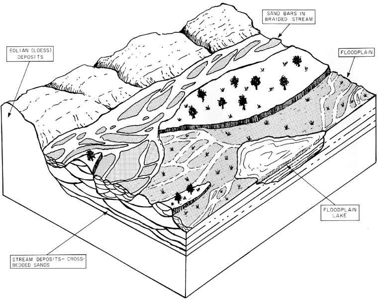 Schematic model for accumulation of alluvial and aeolian sediments during the Miocene in the Nebraska Panhandle. Adapted from Pabian and Swinehart (1979).
| |

| Typical exposure of mortar beds in the Ogallala Formation near Dodge City, Kansas. Overview of cemented pebbly, coarse sandstone (left) and close-up shot (right). Comb for scale is 5 inches long. | 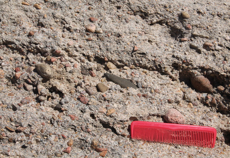 |
| Left – fossil sand dune exposed in the Arikaree Group at Agate Fossil Beds National Monument, Sioux County, Nebraska. Right – green opaline quartzite from the basal Ogallala Formation in the Hill City Hall, Graham County, Kansas. | 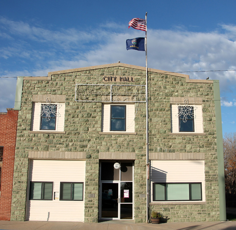
|
Return to beginning.
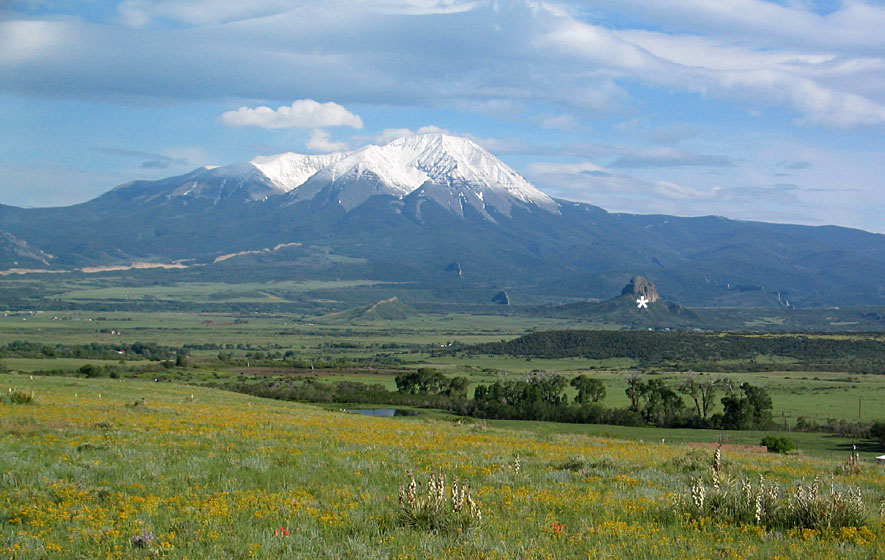
| West Spanish Peak, dikes, and Goemmer Butte (*) at the western edge of the High Plains near La Veta, Colorado. The intrusion of West Spanish Peak took place underground in the late Oligocene and Miocene in connection with the Rio Grande Rift zone. Since then, uplift and erosion have removed vertically at least 7000 feet (>2 km) of the surrounding Cuchara Formation sediment. |
The modern elevation and slope of the High Plains upland is, thus, a reflection of this tectonic uplift and regional tilting. At the same time, sea level was lowered worldwide as a consequence of increasing polar glaciation, and climate became cooler and drier. These factors in combination led to increased rates of erosion by streams and large rivers, which etched their valleys across the High Plains. In this manner, the Cimarron, Arkansas, Smoky Hill, Republican, Platte, Niobrara, White, and other smaller stream valleys came to resemble their current expression in the landscape. The Ogallala Formation was partly removed by erosion toward the east, which exposed underlying Cretaceous and Permian bedrock of the Red Hills, Chalk Buttes, Blue Hills, Smoky Hills, and Flint Hills regions. The modern High Plains is, therefore, a mere remnant of the much larger Plio-Miocene plain.
During the Pleistocene, glaciation waxed and waned several times in the Rocky Mountains (Richmond 1965, 1986). With each glacial expansion, torrents of meltwater flushed sediments into rivers across the High Plains. Freshly deposited outwash was easily eroded by glacial winds, which carried dust far and wide. The accumulation of dust through several millennia during and after Pleistocene glaciations built up the loess blanket on High Plains uplands eastward from the Rocky Mountains (Gutentag et al. 1984; Matthews et al. 2003).
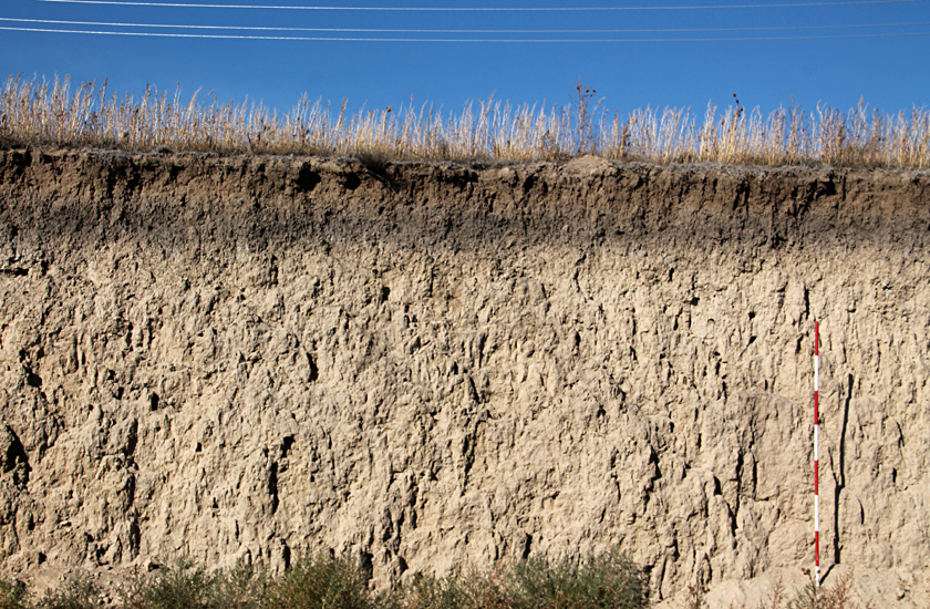
| Peoria Loess of late Pleistocene age (left). Note the well-developed Holocene soil at top. Scale pole marked in feet. Wallace County, Kansas. Sand hills (right) stabilized by vegetation and used for cattle grazing. Kite airphoto near Scott City, Kansas. | 
|
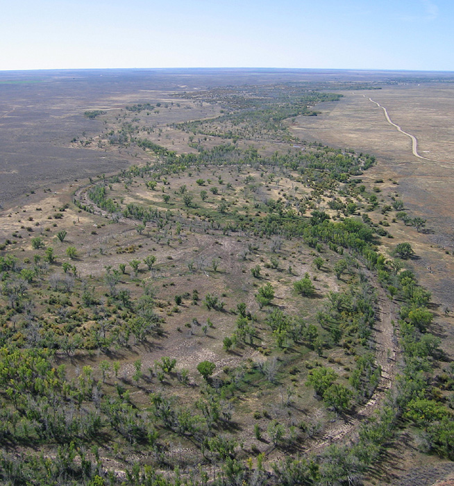
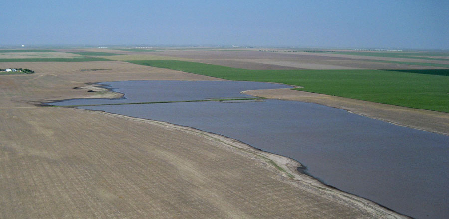
The semiarid climate of the High Plains means that surface water is generally lacking away from major rivers draining the Rocky Mountains (see title image). In the uplands between major river valleys, surface water is particularly scarce. Many thousands of playas dot the southern High Plains of the central United States. These shallow depressions are dry more often than not, but may contain water following heavy rains or snow melts. Playas are especially important for migrating waterfowl and shorebirds and may be key points for groundwater recharge (Steiert and Meinzer 1995). Many opinions have been advanced concerning the origin of playa depressions, ranging from subsurface solution to wind erosion or buffalo wallows.
| Ephemeral lake in a playa basin surrounded by winter wheat (green) and fallow fields. An abandoned county road runs across the far end of the lake. Seen here in 2007, a particularly wet year. Kite airphoto near Scott City, Kansas. |
| Views looking over the western portion of Dry Lake. Wet year (left), full of water, and dry year (right) with lake floor covered by salt. Dry Lake occupies an enclosed drainage basin. Kite photographs near Scott City, Kansas. | 
|
Subsequent erosion, namely by the White River and its tributaries, has cut deeply into the northern margin of the Pine Ridge and exposed the underlying White River Group of Oligocene age (NGMDB 2022). The group is made up of the Chadron Formation and overlying Brule Formation, which consist primarily of claystone and mudstone with thin sandstone layers. Like the Arikaree Group, these strata were laid down by streams draining eastward from the Rocky Mountains. The poorly consolidated sediments have eroded into badlands in the White River valley. Erosion is rapid as demonstrated by collapse of pedestals and other forms during the past few decades.
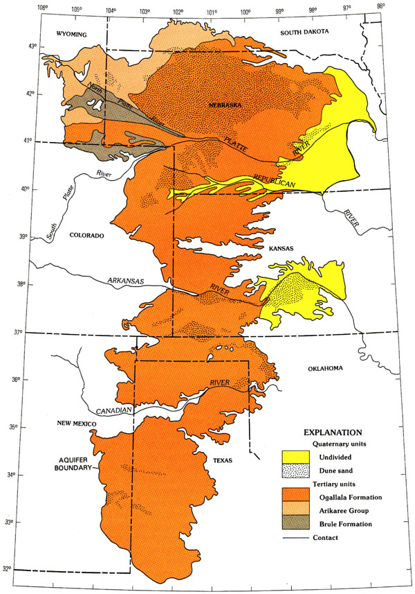
Map of the High Plains Aquifer system. Most of the aquifer consists of the Ogallala Formation (orange); younger Quaternary sediment (yellow) forms the aquifer in central Kansas and eastern Nebraska. Sand hills are indicated by dotted pattern. Adapted from Weeks et al. (1988).
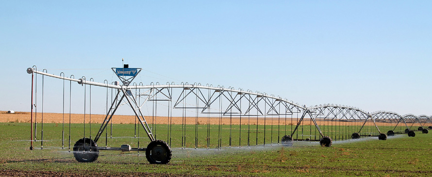
Center-pivot irrigation of newly emergent winter wheat in the autumn on the High Plains in western Wallace County, Kansas. Irrigation in this vicinity is based on pumping groundwater from the High Plains Aquifer with unmuffled engines powered by natural gas. Note the low sprinkler heads, just above the ground, to minimize wind loss.
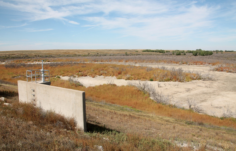
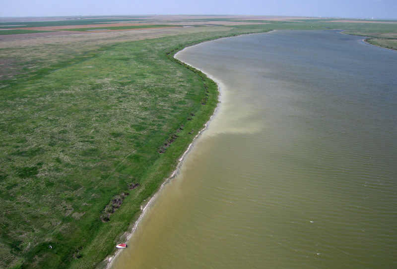
Hamilton State Fishing Lake and Wildlife Area on Plum Creek near Syracuse, Kansas. It dates from the 1950s. Dam and outlet tower in left foreground with dry lake basin in background. Given average annual precipitation of only 18 inches, the lake basin is usually dry, although it may hold a shallow pool of water in some wet years.
Return to beginning.II.4 Pine Ridge and White River Badlands
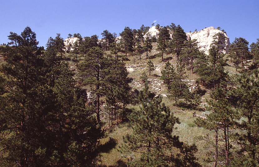
The Pine Ridge marks the northwestern margin of the High Plains (see above), where it forms a prominent escarpment above the White River valley to the north. This vicinity has the greatest local topographic relief of any portion of the central Great Plains. Elevations on the crest of the ridge at Harrison exceed 4800 feet (~1460 m), and the escarpment descends more than 1400 feet to below 3400 feet (~1040 m) in the White River valley at Chadron. The north-facing slopes are relatively cool and wet compared with the High Plains upland; these slopes support a native forest of Ponderosa pine (Pinus ponderosa), for which the ridge is named. Parts of the Pine Ridge are protected in the Nebraska National Forest.
Pine Ridge of Nebraska. Left – escarpment in the foreground drops steeply toward the White River valley. Near Chadron, Dawes County. Right – ponderosa pine covers the steep slopes of Smiley Canyon beneath a rim of resistant bedrock. Oglala National Grassland, Sioux County.

White River Badlands with the Pine Ridge escarpment on the far left horizon. Note the intricate erosion of the badlands in the foreground. Kite aerial photograph by ESU students.

Toadstool Geologic Park, Nebraska. In 1978 a large sandstone block perched precariously on an eroded pedestal of mudstone (left). Sometime before 1997, the sandstone block had broken apart and collapsed (right – adapted from Wikimedia Commons). Oglala National Grassland, Sioux County.


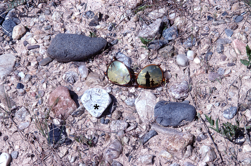
Overview of eroded badland topography in Oligocene strata (left), and close-up shot of Neogene gravel preserved on butte top (right). Pebbles include anorthosite (*) derived from Rocky Mountains in Wyoming. Sunglasses for scale. Badlands National Park, South Dakota
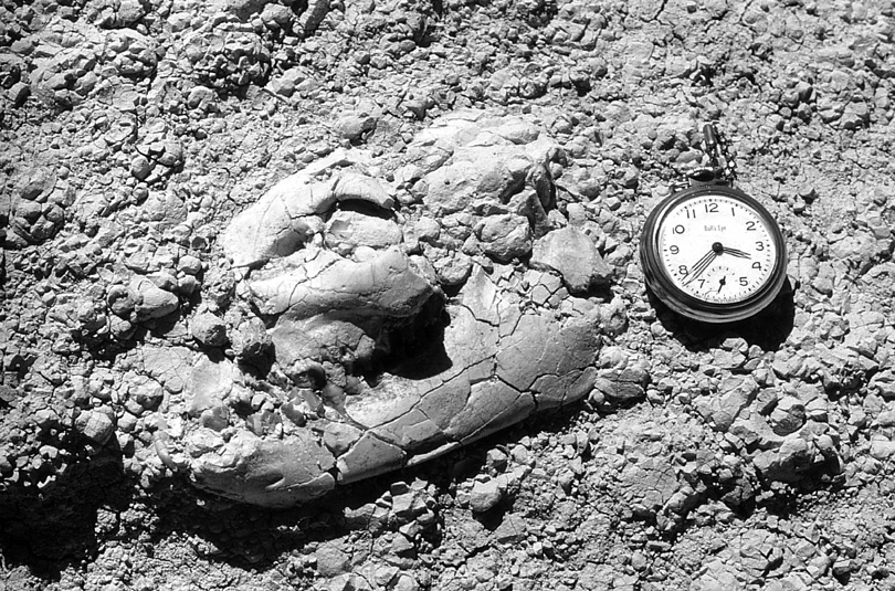
Nearly whole skull of a fossil oreodont exposed in mudstone of the Chadron Formation at Toadstool Geologic Park. Oreodonts were herbivores similar to modern sheep and goats that populated the lush prairie wetlands during the Oligocene. Pocket watch is about 2 inches (~5 cm) in diameter.
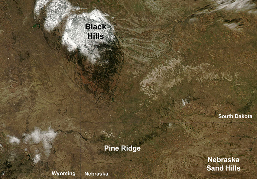
Satellite image of the Black Hills-Pine Ridge region with partial snow cover. True-color MODIS image taken on Oct. 16, 2013. Adapted from NASA Earth Observatory (early blizzard).
Return to beginning. Combined references.
 Return to Landscapes table of contents.
All text and images © by the authors (2022).