| Central Great Plains
Chapter VI
Emporia State University Emeritus |
|
| Central Great Plains
Chapter VI
Emporia State University Emeritus |
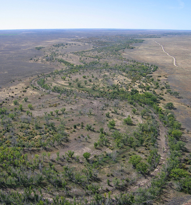
In contrast to the adjacent, relatively flat regions, the Red Hills display substantial relief as a consequence of widespread stream and gully erosion. Lowest elevations are along the Chikaskia River valley about 1400 feet (425 m) in southeastern Kingman County; highest elevations reach 2400 feet (730 m) in southeastern Meade County. Much of the Red Hills consists of ravines, gullies, small channels and valleys that display intricate drainage patterns. Isolated buttes and mesas stand 100 to 200 feet (30-60 m) above the surrounding terrain, for example southwest of Medicine Lodge. In many ways, the Red Hills resemble parts of the Colorado Plateau or Arizona Painted Desert.
 Overview of typical Red Hills terrain. Red beds of the Flower-pot Shale are eroding to form badlands in the foreground. The light-colored butte near scene center is capped with gypsum of the Blaine Formation. View northeast toward Medicine Lodge, central Barber County. Panorama assembled from two kite airphotos (Aber and Aber 2009).
| |
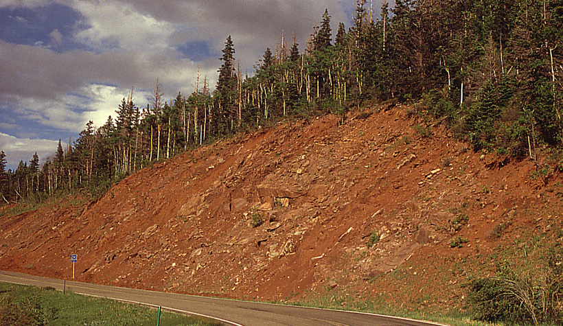
| Upper portion of the Sangre de Cristo Formation, a thick sequence of red beds exposed in the Culebra Range, south-central Colorado. These strata accumulated as alluvial fans on the flanks of the Ancestral Rocky Mountains during the early Permian. |
Underground solution of thick salt and gypsum layers has led to collapse of the surface in many places. Big Basin and Little Basin are well-known sinkholes in Clark County. Big Basin occupies about one square mile (2.6 km2) and is more than 100 feet (30 m) below the surrounding upland. Little Basin is equally deep but much smaller in area. A perennial pool, known as St. Jacobs Well, is located in Little Basin. The Englewood-Ashland Lowland in southern Clark County is thought to be a still larger example of surface collapse by underground solution (Wilson 1978).
| Large sinkholes in upper Permian red beds in the western portion of the Red Hills. Big Basin (left) is the large depression in the center distance. Only the north half of the basin is visible in this view. Little Basin (right) in the foreground. Clark County; kite aerial photographs. | 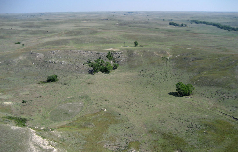
|

| Collapse of a Red Hills natural bridge in western Barber County, caused by erosion of an intermittent stream, as documented with ground photographs taken from the same vantage point. 1955 (left) and 1962 (right). Adapted from Charlton and Merriam (2003). | 
|
In the subsurface, gypsum is mined near Sun City to produce drywall and other plaster products. Numerous oil and gas fields have been discovered beneath the Red Hills, especially in Barber County. Intensive drilling and development of oil fields has led to numerous small to moderate earthquakes in recent years, most likely because of injection of oil-field waste brine in deep disposal wells (Rubenstein 2022).
The eastern margin of the Flint Hills is a steep, rugged escarpment that rises abruptly above the Osage Cuestas to the east. In contrast, the western side of the Flint Hills is a broad cuesta that slopes gradually downward toward the Smoky Hills and Arkansas River Lowlands. Thus the crest of the Flint Hills stands higher than terrain on either side. The Flint Hills are deeply dissected by numerous stream valleys. The northern and central Flint Hills are transected by the Blue, Kansas and Neosho-Cottonwood drainages which divide the uplands into several distinct segments. The southern Flint Hills, however, forms a continuous ridge along the divide between the Verdigris-Fall drainage to the east and Arkansas-Walnut basin to the west.
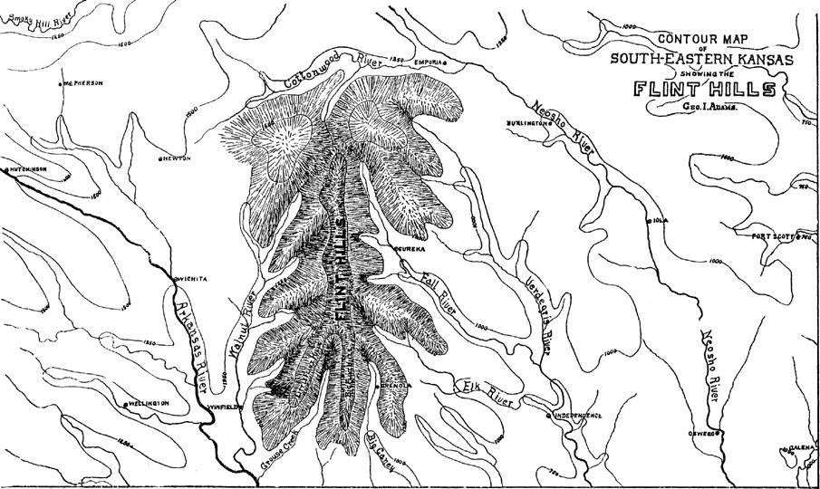 Sketch map of southern Flint Hills, south of the Cottonwood River valley in east-central Kansas. The ridge-like crest of the Flint Hills forms the drainage divide between the Verdigris-Fall basin to the east and Arkansas-Walnut basin to the west. Adapted from Hayworth (1896).
| |
| Typical stone lines in the eastern Flint Hills. Stone lines are particularly distinctive in May as tallgrass greens up following April prairie burning. Near Dunlap, Morris County, Kansas. Kite aerial photograph. |
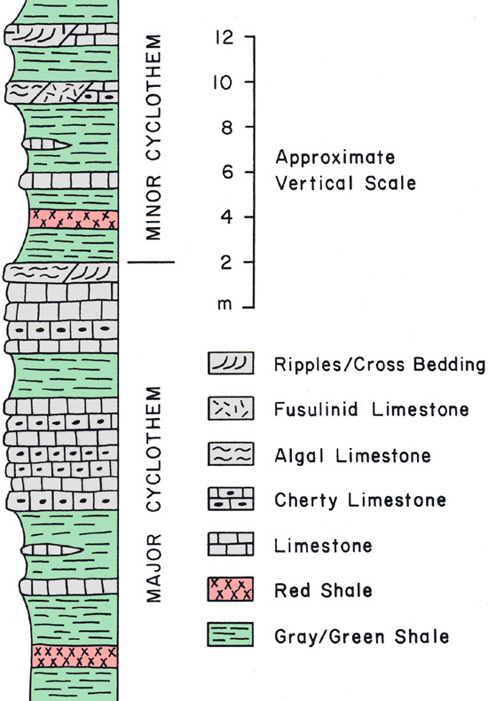
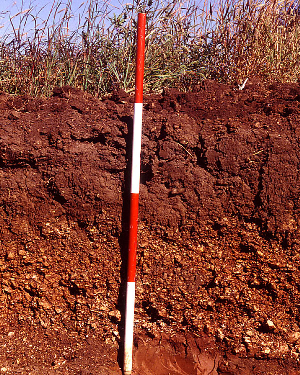
| Schematic model (left) for lower Permian cyclothems of the Flint Hills region. Exposure of the Florence Limestone Member (right) displaying interbedded limestone, chert, and shaly limestone. Weathering has concentrated chert fragments in residual red soil at the surface. Scale pole marked in feet, | 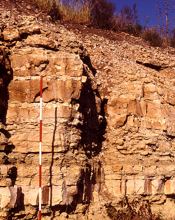
|
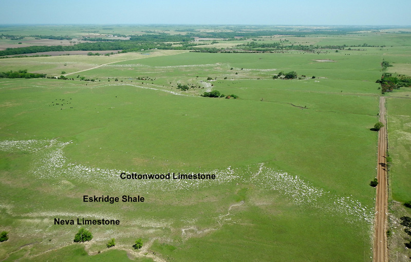
Some limestone layers lack chert, are relatively homogeneous, and form thick beds that are ideal for quarrying dimension stone (Aber and Grisafe 1982). Several such limestone beds have been exploited since the nineteenth century and used for stone structures throughout the Flint Hills and beyond. For example, Alma and Marion are well known for their stone architecture. Among several such layers, the Cottonwood and Fort Riley limestone members are most important. Many famous buildings were constructed with these stones.
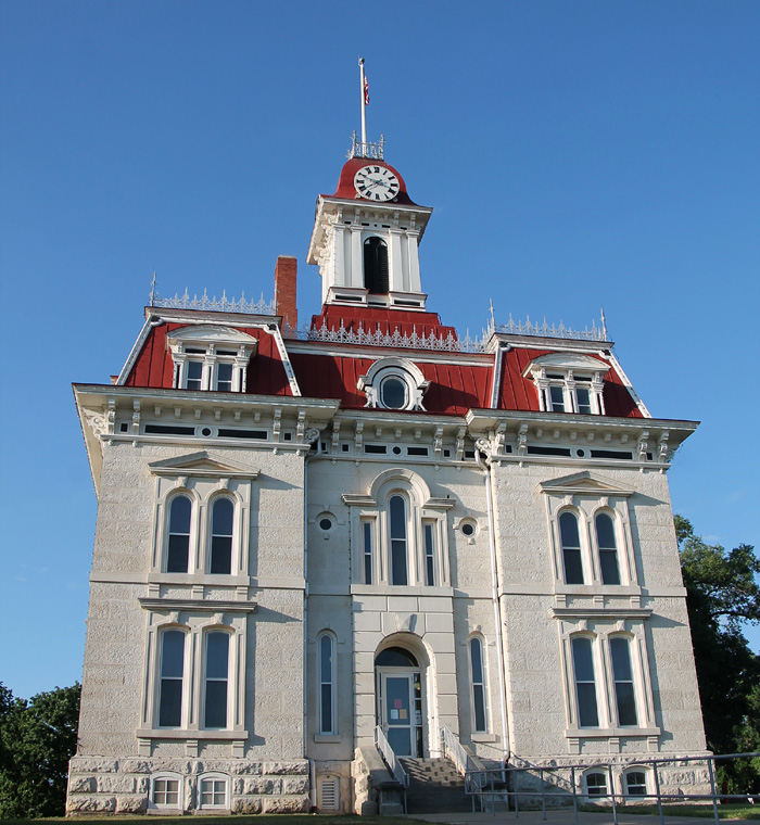
| Cottonwood Limestone architecture. Chase County Courthouse (left), one of the iconic symbols of the Flint Hills. Built in 1871-72 in a French Renaissance style, it is the oldest county courthouse still in use in Kansas. Atchison Post Office (right) built in 1890 in a Richardsonian Romanesque style of native stone imported from the Flint Hills. | 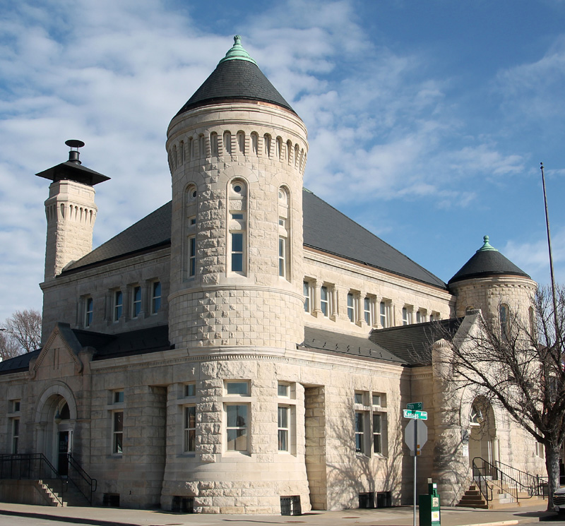
|
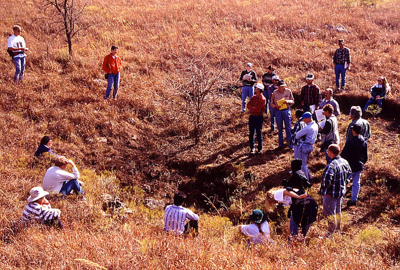
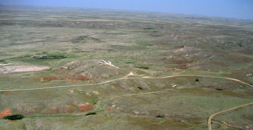
| Sinkhole (left) in Fort Riley Limestone; Kansas Academy of Science fall fieldtrip. This sink connects directly to Smith Cave in the subsurface. Entrance to Spring Cave (right), one of the few Flint Hills caves large enough to walk into. Both in central Butler County. | 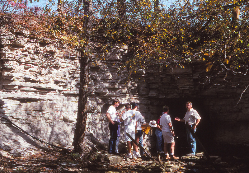
|
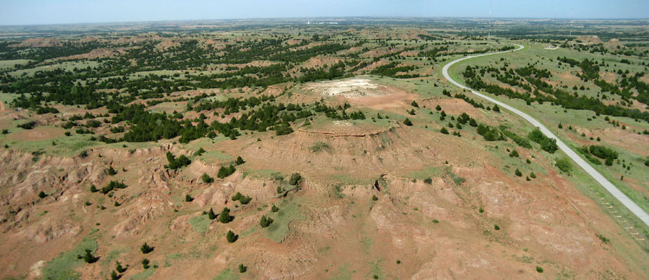
 Map of the southern Flint Hills region showing zones with numerous sinkholes and chert gravel deposits on high terraces and hill tops. Asterisk indicates location of the Elk River Wind Farm. Adapted from Aber (1992).
| |
| Section in Olpe Soil on a drainage divide in southern Butler County. Leon Gravel in lower portion was deposited in a Neogene stream channel; upper portion is younger loess. Scale pole marked in feet. |
| Fractures in Cottonwood Limestone revealed by low water in winter on lake margin. Such fractures in well-consolidated bedrock guide stream erosion at the surface and groundwater movement in the subsurface. Lake Kahola, Chase County, Kansas; kite aerial photograph. |
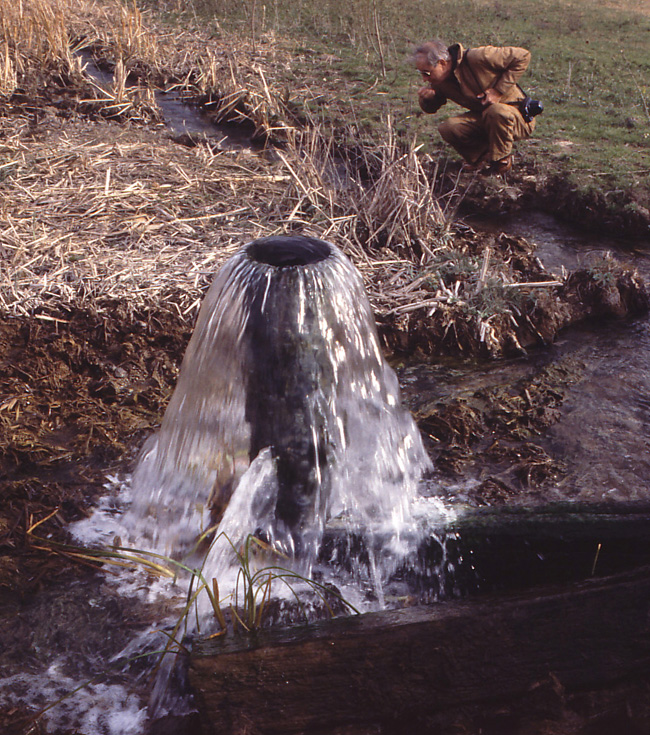
| Artesian well produces sulfur-rich water from the western side of the Flint Hills in Marion County. |
Based on the relatively unmodified condition of the landscape, the Nature Conservancy has acquired considerable acreage, including the Flint Hills Tallgrass Prairie Preserve, Konza Prairie, and most of the Tallgrass Prairie National Preserve. The Flint Hills embody the archetype of the American prairie, and as such the region has become a destination for ecotourism and focal region for scientific research and restoration.
Given the topographic prominence of the Flint Hills, especially its eastern escarpment, the region has high potential for wind energy. Early in this century, two wind farms were constructed in Butler and Elk counties. In 2004, Governor Sebelius proposed the Heart of the Flint Hills Area, in which wind-farm development would be discouraged through voluntary restraint in order to protect the tallgrass prairie ecosystem.
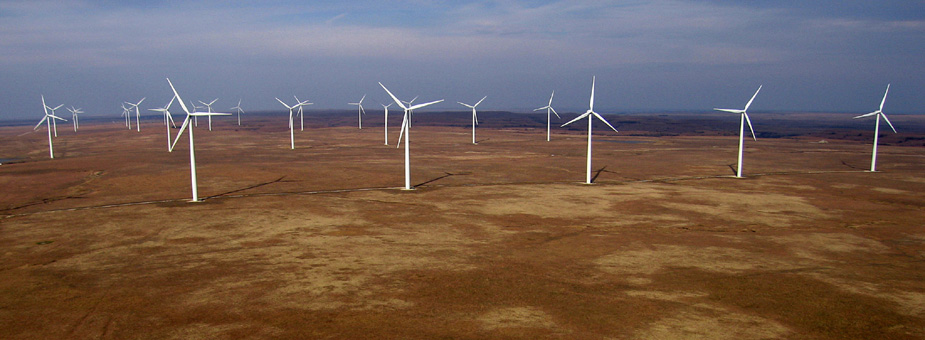 Elk River Wind Farm occupies the drainage divide at the crest of the Flint Hills near Beaumont in southeastern Butler County (see map above). Elevation exceeds 500 m here. Kite aerial photograph.
| |

| A portion of the Caney River Wind Project located on the Americus Limestone cuesta of the Flint Hills escarpment west of Howard in Elk County. Vestas V90, 1.8 MW turbines; towers stand 262 feet tall, and rotor diameter is 295 feet. This wind farm began operation in 2012 (Aber and Aber 2016). |
The Flint Hills generally are perceived as little modified by human activity, but there is, in fact, considerable development. Oil and gas are produced from structures along the buried Nemaha Uplift and Humboldt Fault zone, particularly in the El Dorado Oil Field. The region is criss-crossed with major highways, pipelines and electrical transmission lines. Large and small reservoirs have been constructed, and military training takes place at Fort Riley. Radio and telephone towers cluster on the higher ridges. Last, but not least, trees and woodlands are encroaching on the grassland (Applegate et al. 2003; Peterson et al. 2004). The reality is that few unspoiled prairie vistas remain.
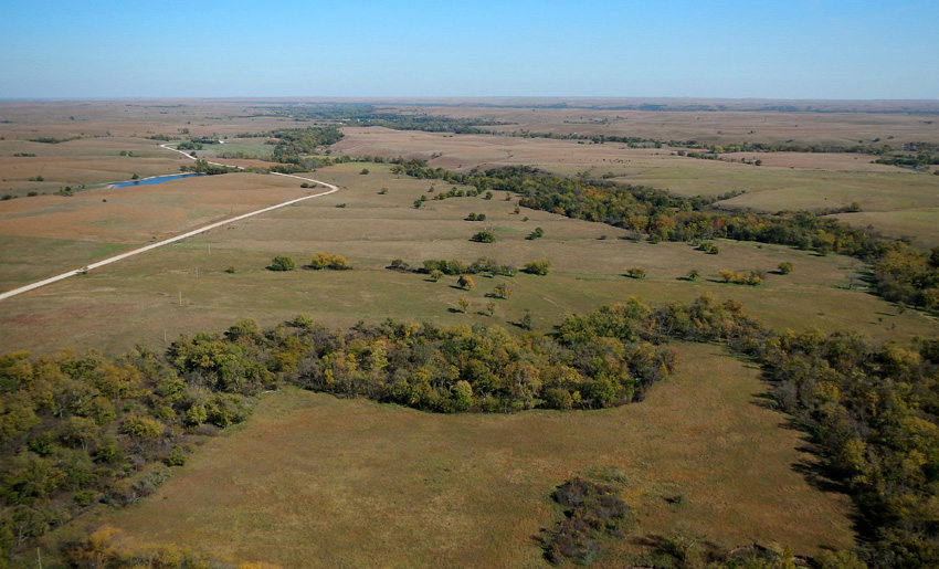
| Typical rural Flint Hills vista in central Chase County. In spite of the largely natural character of this autumn prairie scene, encroachment of trees along Rock Creek and its tributary valleys is evident. Kite aerial photograph. |

| Electrical transmission lines and substations detract from the scenic vistas in many parts of the Flint Hills. | 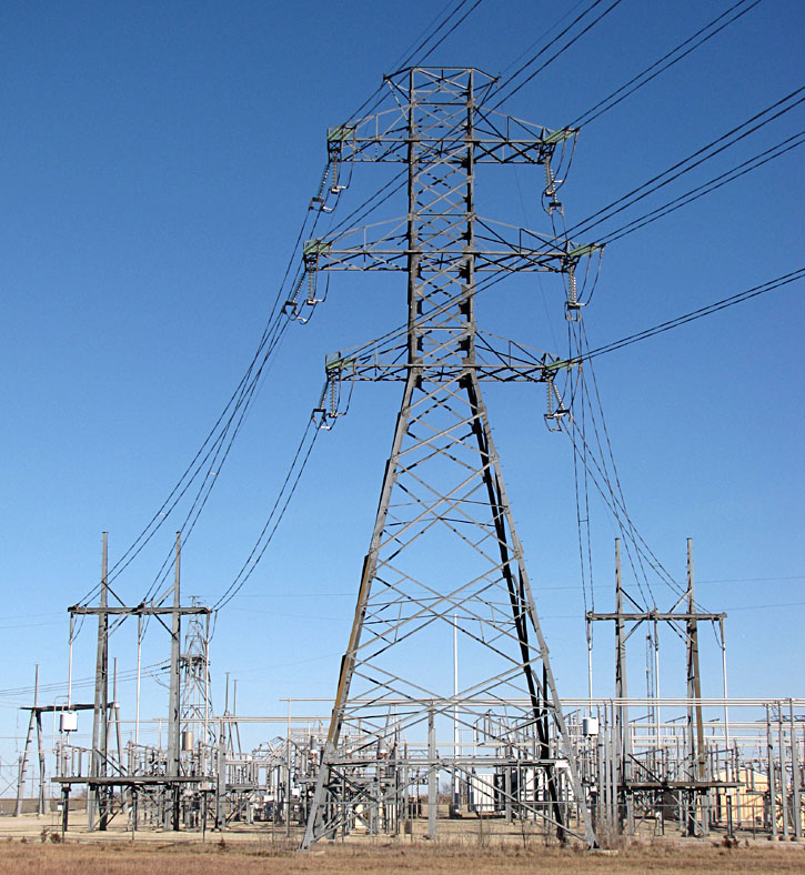
|
 Return to beginning.
 Combined references.

Return to Landscapes table of contents.
All text and images © by the authors (2022).