| Central Great Plains
Chapter V
Emporia State University Emeritus |
|
| Central Great Plains
Chapter V
Emporia State University Emeritus |
| Cretaceous strata of southeastern Colorado. Gobblers Knob (left) is sandstone eroded into columns and pedestals in the Dakota Sandstone and Purgatorie Formation. Exposure of chalky limestone (right) in the basal Niobrara Formation (NGMDB 2022). | 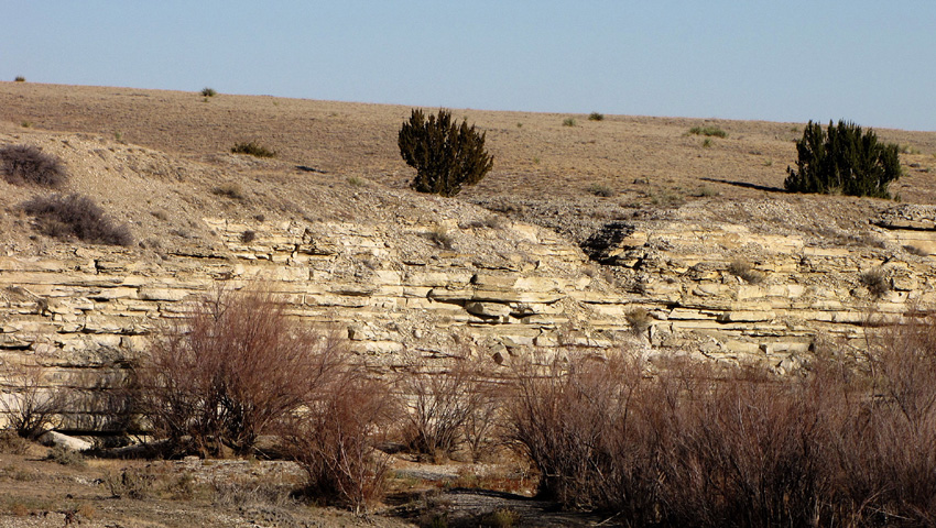
|
 Landscape maps.
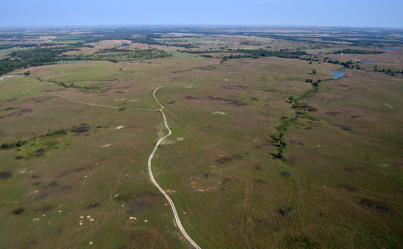
Lowest elevations are about 1750 feet (535 m) near Mankato in Jewell County, and highest elevation is around 2750 feet (840 m) at its westernmost extension along the Smoky Hill River valley in Logan County. Upland areas comprise subtle hills and undulating plains, in which local relief is generally less than 50 feet (15 m). But where the upland is dissected by small streams, relief may be as much as 100 feet (30 m). Greatest local relief is found along the Smoky Hill River valley, exceeding 300 feet (90 m), where small tributaries have cut numerous steep-sided ravines and eroded badlands along the sides of the main valley in Logan, Gove, Trego and western Ellis counties. In this section, the Smoky Hill River has excavated one of the deepest valleys in the state with little accumulation of alluvial sediment (Haworth 1897).
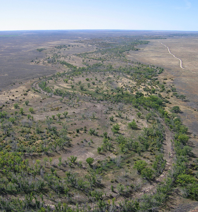
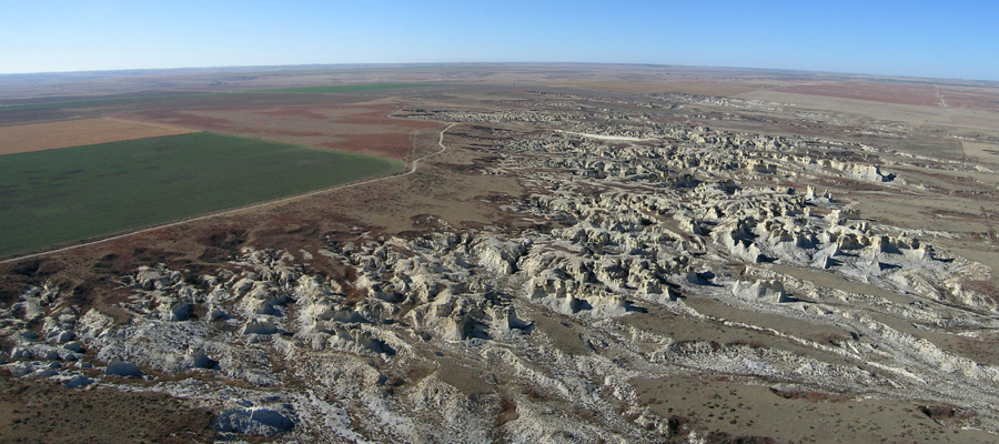 Little Jerusalem is considered one of the crown jewels of Kansas geology. An area of erosional badlands in the Chalk Buttes on the southern flank of the Smoky Hill River valley, Logan County. Intricate erosion has sculpted a labyrinth of ravines, gullies, and buttes in the Smoky Hill Chalk. High Plains upland surface to left. Panorama assembled from two kite airphotos.
| |
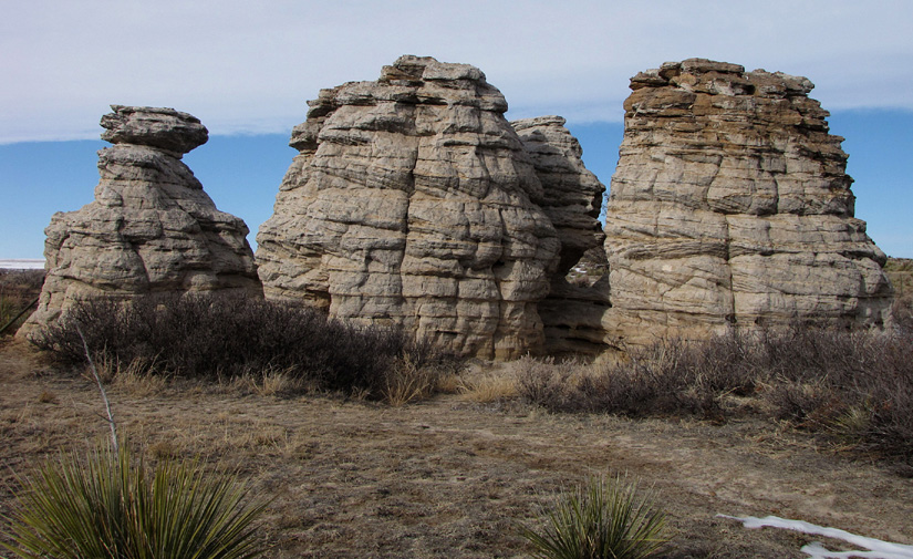
Where deeply eroded along the Smoky Hill River valley, chalk remnants form buttes, towers, and pinnacles above the valley floor in several places, particularly in Gove and Logan counties. Among the best-known geologic landmarks in Kansas are Castle Rock and Monument Rocks. At Monument Rocks, the residual chalk stands as narrow partitions or walls rising above the surrounding shortgrass prairie like ruins of a prehistoric fortress. This site has been used for movie sets, as it captures the public imagination of the "wild west." Unfortunately the soft chalk is gradually weathering and eroding away, which has led to collapse of several famous landmarks. Both the "Cobra" near Castle Rock and the "Sphynx" at Monument Rocks disappeared in this manner during the past few decades (Charlton and Merriam 2003).
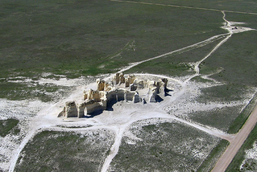
| Monument Rocks in the Smoky Hill River valley of western Gove County. Oblique view (left) showing cluster of buttes with an arch. Individual buttes stand 25-30 feet (8-10 m) high. The chalk knob at upper right corner is the eroded stump of the Sphynx, a former pinnacle. Vertical view of butte cluster (right). Note shadows and light coming through the arch in the butte wall. Kite aerial photographs (Aber and Aber 2009). | 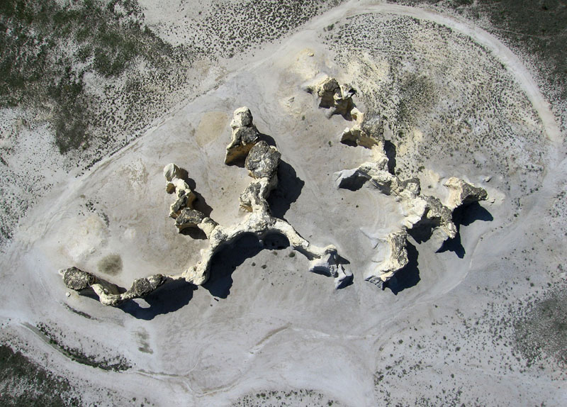
|
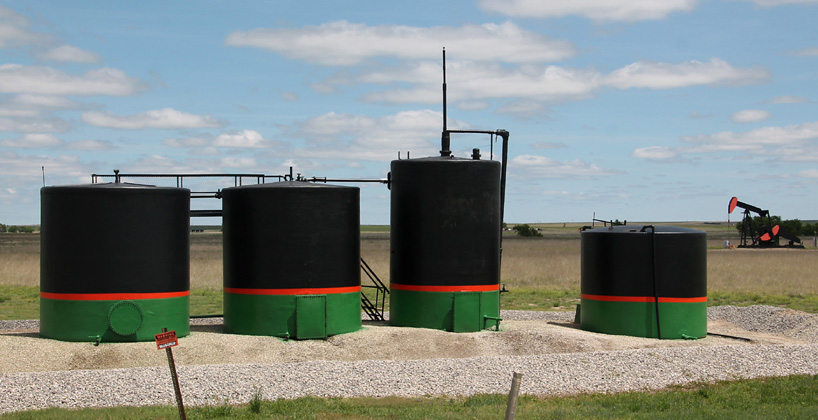
| Oil storage tanks and pump jack in Ness County, west-central Kansas. |
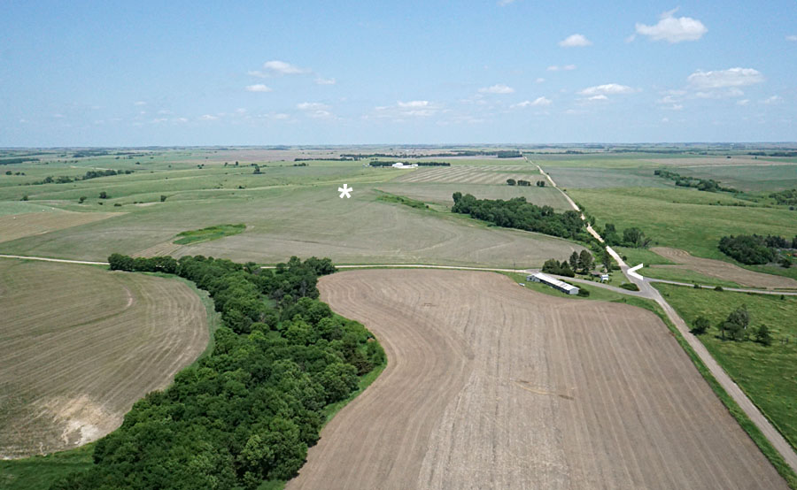
| Geographic center of the contiguous (48) United States. View northward (left) showing the actual center (*) and public park (<). View toward east (right) over agricultural fields with Lebanon in the right background. Kite airphotos. | 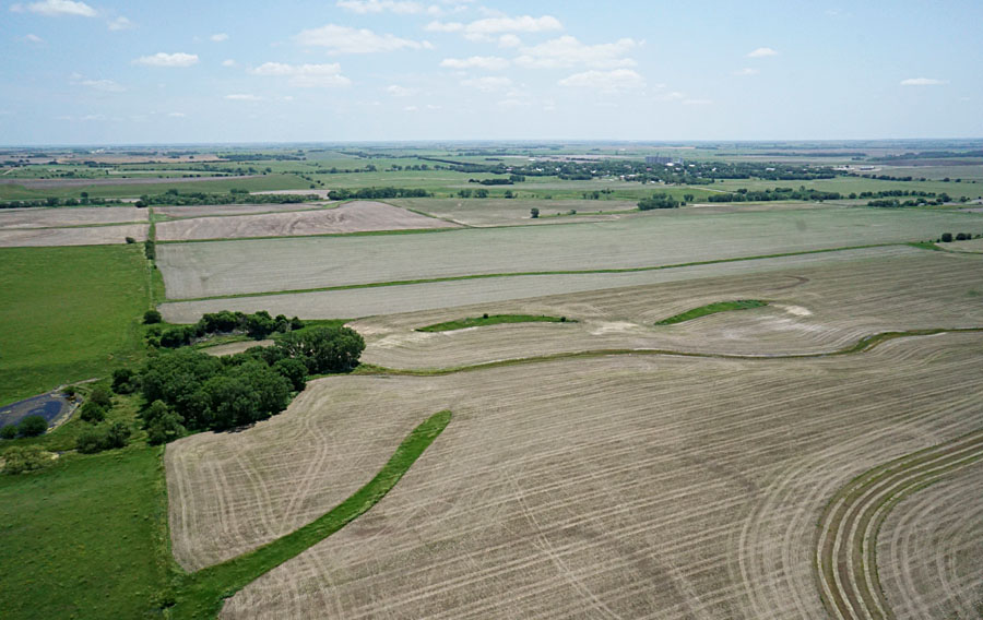
|
 Return to beginning.
Elevations range from lows about 1440 feet (440 m) in the Saline River valley to more than 2600 feet (790 m) at its boundary with the High Plains in northeastern Finney County. Most of the Blue Hills consists of gently rolling hills and undulating plains with slight local relief; however, a steep escarpment marks the eastern margin of the Blue Hills in places, where local relief exceeds 300 feet (90 m), for example northeast of Ellsworth. Likewise steep slopes and high local relief are found along the edges of some river valleys that are incised into the Blue Hills, such as the Smoky Hill River valley in Russell and Ellsworth counties and Buckner Creek in Hodgeman County.
The Blue Hills are underlain by upper Cretaceous marine shale, chalky shale, and thinly bedded chalky limestone. Formations include from the bottom up the Graneros Shale, Greenhorn Limestone, and Carlile Shale. Blue-gray color of the latter is probably the origin of the name for this region (Buchanan and McCauley 2010). Undoubtedly the most famous geologic feature is the Fence-post limestone bed that marks the top of the Greenhorn Limestone (Muilenburg and Swineford 1975). This thin, chalky limestone bed was widely quarried in the late ninteenth and early twentieth centuries. A similar fossil-rich limestone bed, called the "shell rock," was quarried from the middle Greenhorn Limestone (Wilson 1978). Both were utilized for everything from fenceposts to cathedral-style churches.
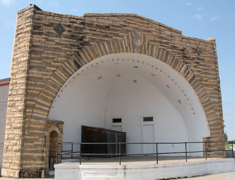
| Fence-post limestone buildings. Bandstand (left) in Spearville, built by the Works Progress Adminstration in the 1930s. The Cawker City Museum (right) was built in the Kansas venacular style as the Public Library in 1884. It is listed on the National Register of Historic Places. | 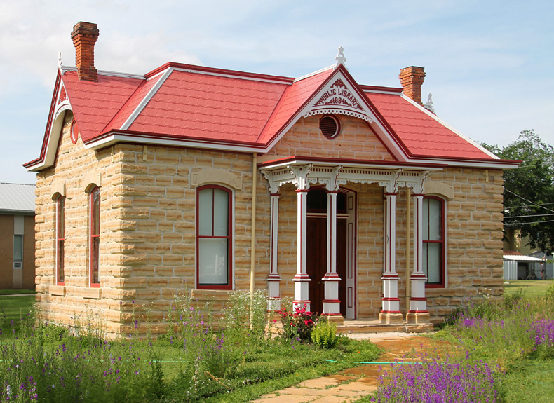
|
Because of the topographic prominence of the Blue Hills escarpment, several wind farms have been erected during the past two decades to take advantage of the wind-energy potential (Aber and Aber 2020). Like the Chalk Buttes, the Blue Hills spans a buried structure known as the Central Kansas Uplift, which has been a prolific source of oil production since the 1920s.
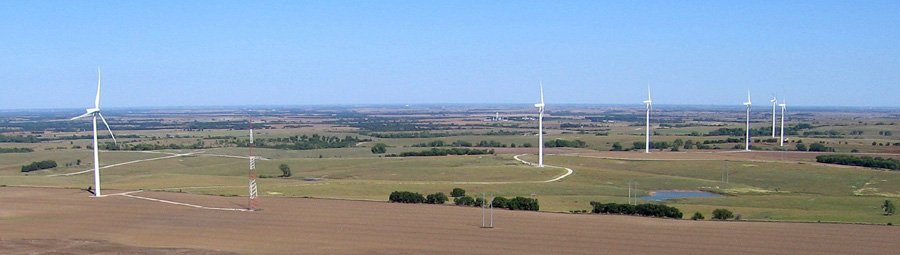 Overview of Meridian Way Wind Farm on the Blue Hills escarpment in Cloud County. The eastern end seen here is located on the divide between the Solomon River and Republican River drainage basins. Total height of these Vestas V90 3-MW turbines is about 410 feet. Kite airphoto.
| |
During the first decade of the twenty-first century, a new reservoir was constructed on Buckner Creek at Horse Thief Canyon in Hodgeman County. After partial filling in 2010, the lake gradually declined during subsequent drought years. Many people believed the lake would never fill. The spring of 2015 was exceptionally wet, however, and repeated heavy rains during May led to significant runoff and local flash flooding that filled the reservoir to full capacity.
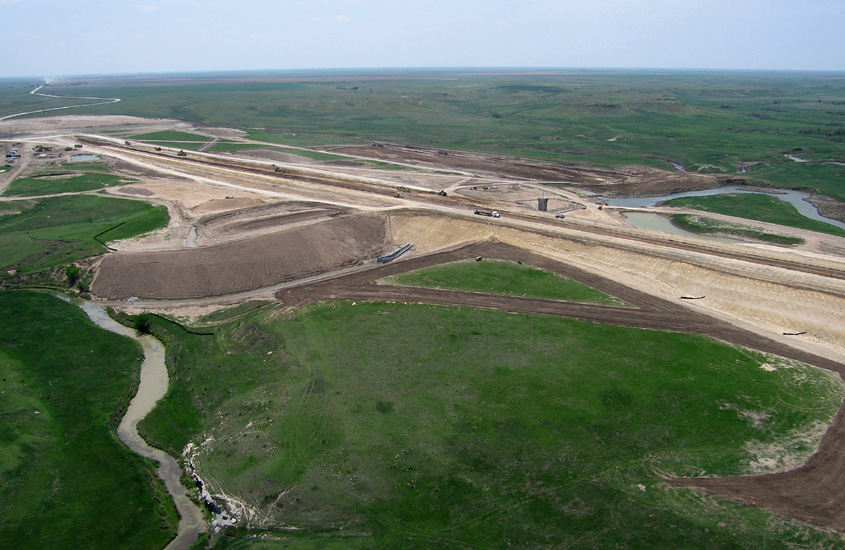
| Horse Thief Canyon dam (left) under construction in 2009. Original channel of Buckner Creek remains visible along with a chalk outcrop at lower left. Reservoir full (right) following heavy rain and runoff in May 2015. Looking east toward the dam with campground in the foreground. Kite aerial photographs. | 
|
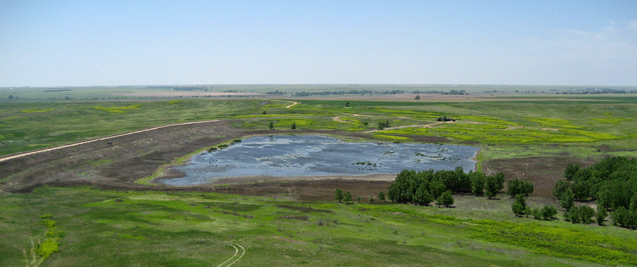 Finney State Lake and Wildlife Area was built in the 1930s for a much larger lake. Upstream groundwater pumping from the High Plains Aquifer and diversion of surface water have rendered this reservoir into a wildlife area in which trees are growing. During wet years, as seen here, a small puddle of water is held behind the high dam on the left, but most years it is completely dry. Kite airphoto.
| |
Return to beginning.
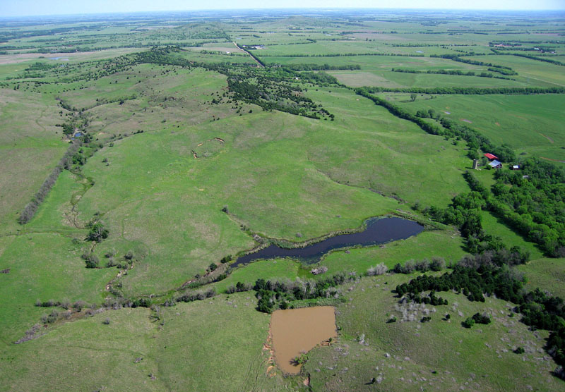
| View northward over Smoky Hill Buttes from Coronado Heights in southern Saline County. The hills in center distance stand more than 200 feet (60 m) above the adjacent terrain. Notice two ponds in the foreground. The near pond trapped suspended yellowish-brown sediment from recent runoff, which prevented the sediment from entering the next pond downstream. Kite aerial photograph. |
Of these formations, the Dakota is most widespread and characteristic of the Smoky Hills. Within the Dakota, sandstone bodies are distributed in various lenses, channels, and sheets, and local lime and iron cementation of the sandstone is highly variable. Well-cemented sandstone is more resistant to erosion than are other poorly consolidated strata and, so, forms the higher mounds and knobs of the region. The patchy distribution of cemented zones in sandstone bodies explains the irregular size, shape, and placement of hills.
Large concretions are among the most distinctive cemented features within the sandstone of the Dakota Formation, as at Mushroom Rock State Park in Ellsworth County and Rock City in Ottawa County. The conventional interpretation is that concretions may have formed around organic matter buried in the sediment, as decay altered the surrounding chemical environment and led to precipitation of calcium-carbonate cement around the organic nucleii (Johnston 1964). More recently, McBride and Milliken (2006) determined that concretions did not grow outward from central nucleii, but rather the cementation took place throughout the spherical bodies, as groundwater from different sources mixed in the formation. Rock City contains about 200 huge spherical concretions that Wilson (1978) likened to giant bowling balls.
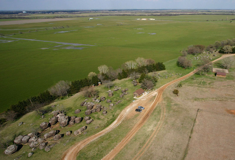
| Rock City near Minneapolis in Ottawa County. Superwide-angle overview (left) toward the northeast with Rock City in the foreground and the Solomon River valley in the background. Vertical close-up view (right) of large sandstone concretions on the surface. Most are nearly spherical in shape; some are joined to create double and triple spheres. Helium-blimp aerial photographs | 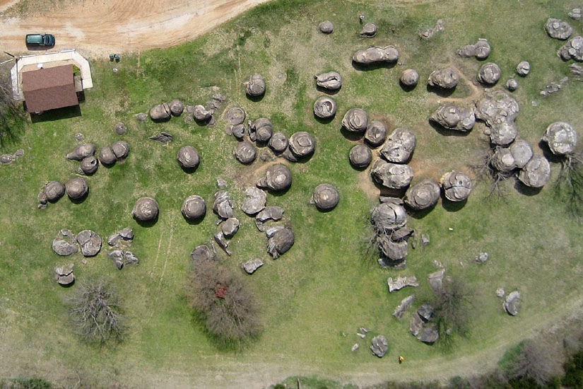 |
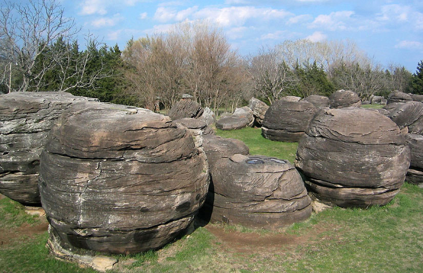
| Ground view of concretions at Rock City. The single spheres in this cluster are 15-25 feet (5-8 m) in diameter. |
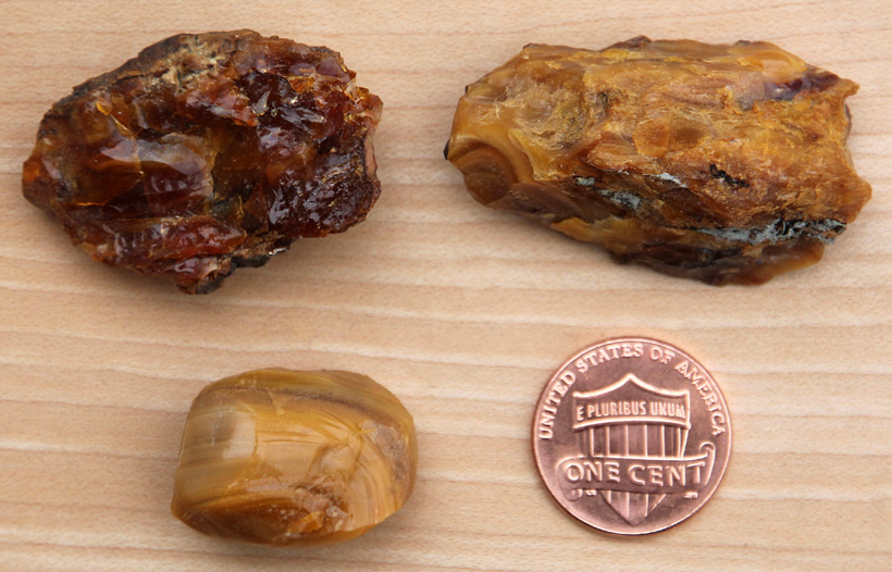
| Samples of Kansas amber, known as jelinite, showing typical color variations and texture. Jelenite is the Kansas state gemstone; however, it is quite brittle and cannot be used for jewelry. The jelenite source locality is now underwater in Kanopolis Lake. Penny coin for scale. |
| Oil pumps (left) and storage tanks (center) of a small oil field amid mixed agricultural land use. Rice County; helium-blimp aerial photograph taken by ESU students. |
| Buffalo grazing range in Smoky Hills upland at Maxwell Wildlife Refuge in McPherson County. Trees line small stream valleys, and several ponds are visible in the distance. View toward north; kite airphoto (Aber and Aber 2009). |
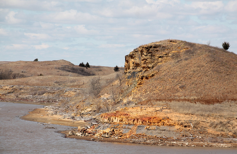
| High bluff of resistant sandstone in the Kiowa Formation stands in the Horsethief Canyon area on the north shore of Kanopolis Lake, Ellsworth County. |
Return to beginning.
Combined references.

Return to Landscapes table of contents.
All text and images © by the authors (2022).