|
James S. Aber, Professor Emeritus |
| Planar and cross-bedded sandstone of former river channel and overbank environment. Overview (left) and close-up (right). Small channel filled with clay fragments; channel is cut into plane-bedded sand. Camera lens cap for scale. Brule Formation, early Oligocene, northwestern Nebraska. | 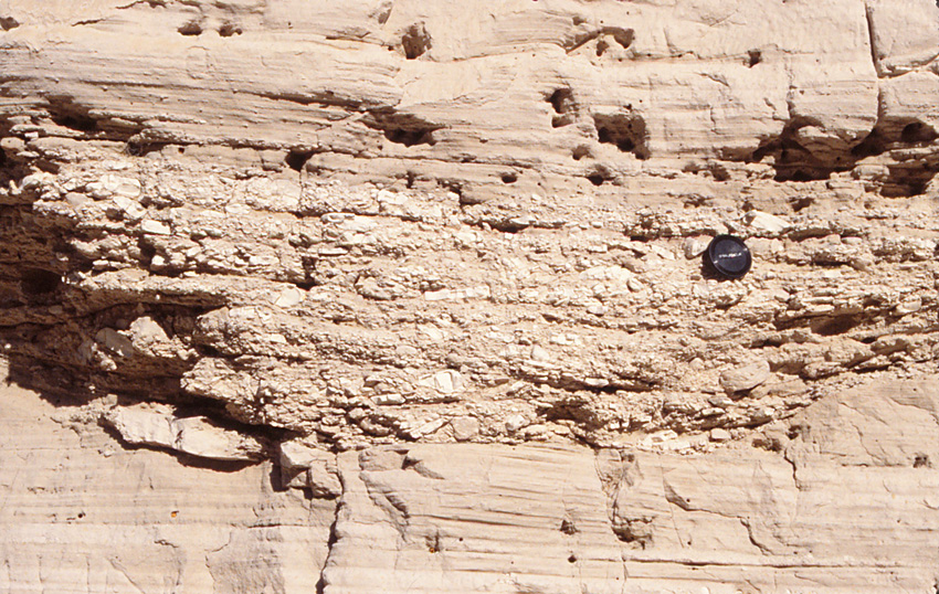 |
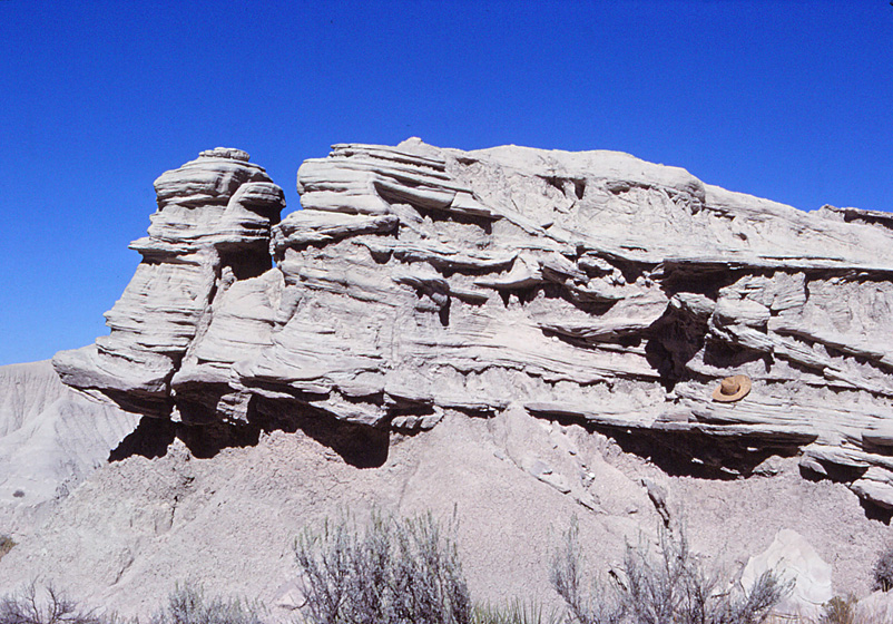
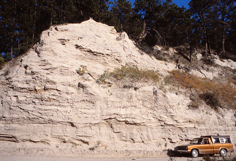
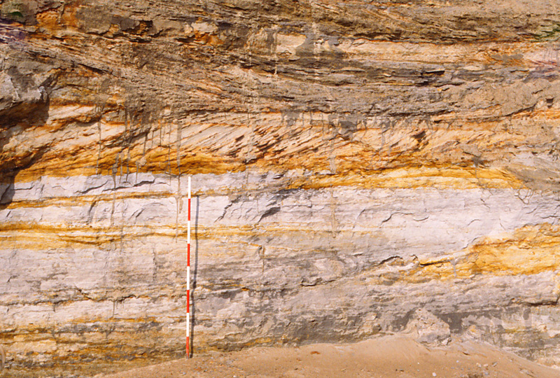
| Cross-bedded sandstone layers alternate with fine silty beds. Sand was deposited in river channels, and silt accumulated on floodplains. Overview (left) and close-up (right). Base of channel fill contains coarse sand and fine gravel. Camera lens cap for scale. White River Formation, Paleogene Period, Toadstool Park, northwestern Nebraska. | 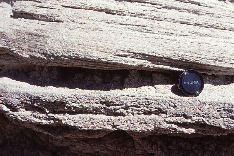 |
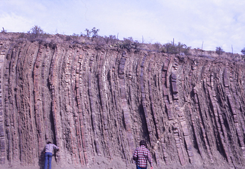
| Coarse-grained conglomerate (left) with cobbles and small boulders. Note inclined bedding from deformation as the gravel accumulated. Collings Ranch Conglomerate, Pennsylanian age, Arbuckle Mountains, Oklahoma. Cross bedding in Brazos River conglomerate channel deposit (right). The conglomerate consists mainly of chert pebbles. Pennsylvanian, northern Texas. |  |
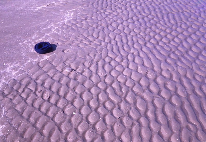
| Beach at Galveston, Texas (left). Two sets of ripples cross to form an interference pattern. Ripple sets represent swash and backwash of waves on the beach front. Knit hat for scale. Well-preserved ripple marks (right) in sandstone of the Kiowa Formation, lower Cretaceous, central Kansas. Comb for scale. | 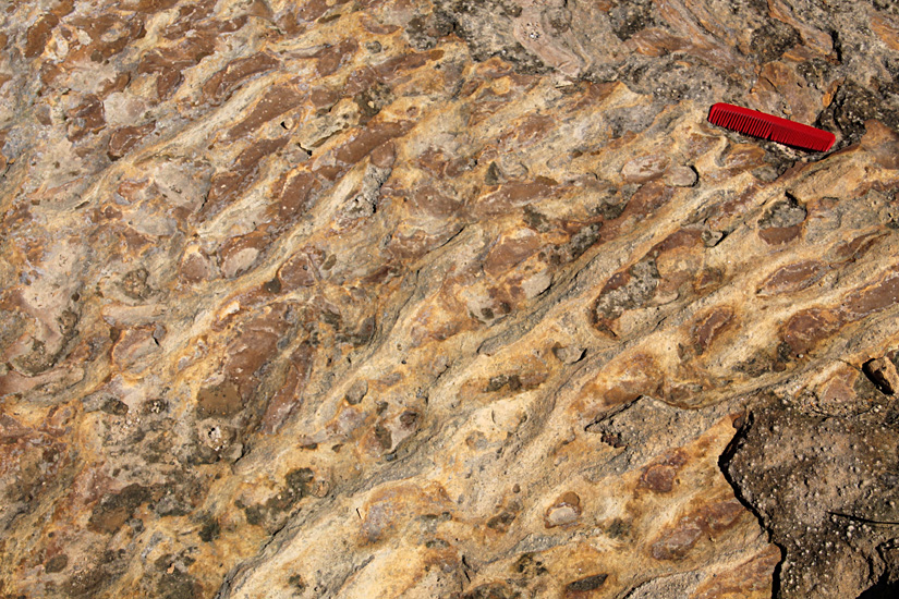 |
| Cross-bedded sand filling tidal channels (left). Scale pole marked in 20-cm stripes. Interbedded sand and clay (right) deposited in a tidal environment. Wavy and "flaser" bedding is typical of the ebb and flow of tides. Pooly consolidated Jurassic sediment, Gallřkken, island of Bornholm, Denmark (Rolle 1977). | 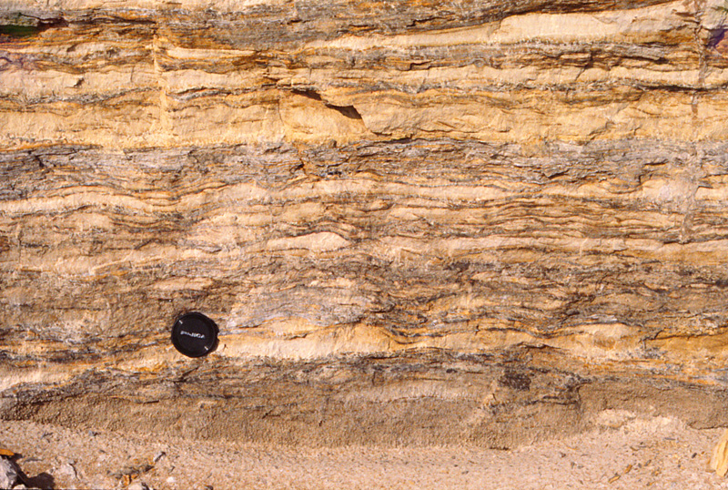 |
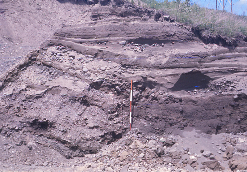
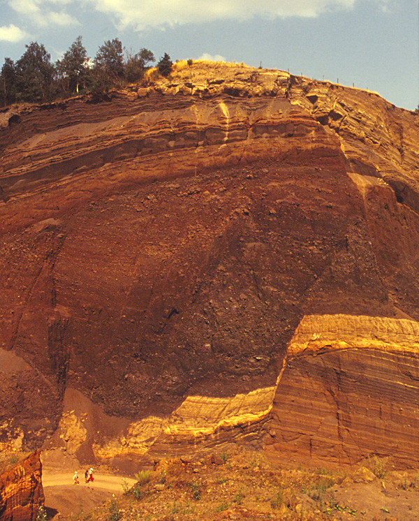
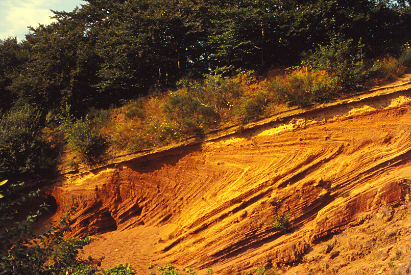
| Glaciolacustrine deltas. Note steeply inclined bedding on the delta foreslope and rapid changes in sediment size and sorting from layer to layer. Scale pole marked in feet. Unconsolidated sand and gravel, late Pleistocene age from upstate New York. | 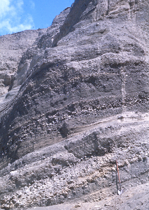 |
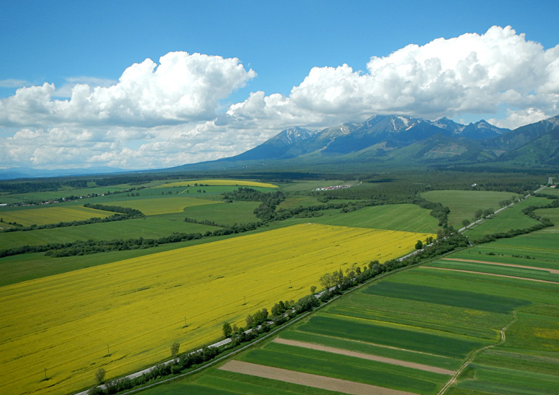
| Pleistocene alluvial fans against uplifted mountains. Tatry Mountains (left) in Slovakia and Blanca Peak, Colorado (right). The long slopes in the foreground are alluvial fans composed of sand and gravel washed out of the mountains. Kite airphotos. | 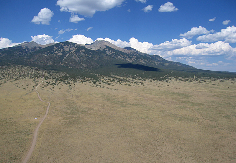 |
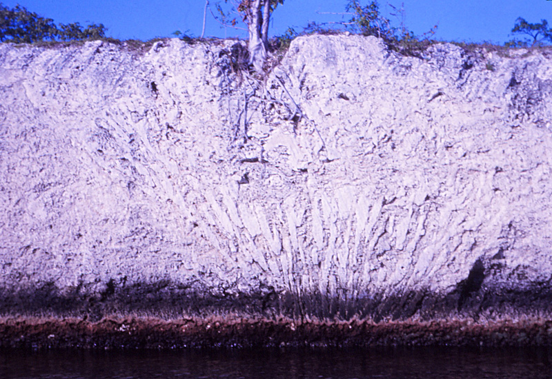
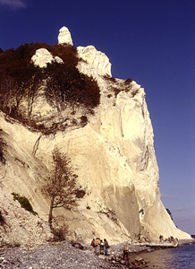
| Pleistocene coral reef of the Florida Keys. Canal section in Key Largo (left) displays a large branching coral (Acropora palmata) in growth position. Quarry on Windley Key (right) shows corals in growth position as well as loose chunks in the porous limestone. Key Largo Limestone dates to ~120,000 years ago, when global sea level was 5-8 m higher than today. | 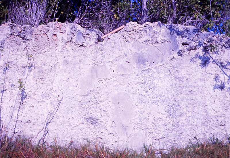 |
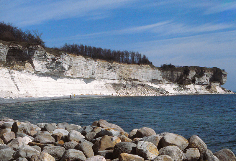
| Overview of Stevns Klint (left), eastern Denmark. Upper Cretaceous chalk (Maastrichtian) below, and lower Paleocene limestone (Danian) above. Close-up shot of the K/P boundary (right); scale pole marked in 20-cm stripes. The thin "fish-clay" shale seam at center is the infamous K/P boundary layer that is known in many localities around the world. | 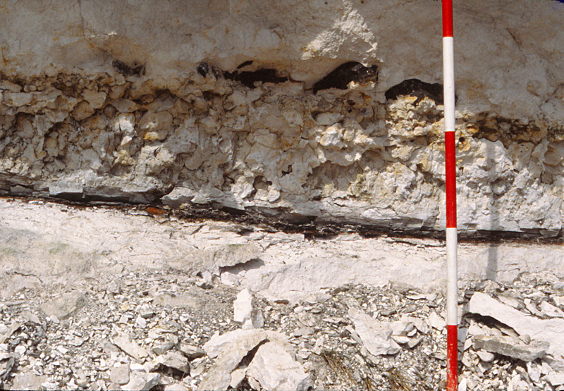
|
 Primary structures in sedimentary strata


| Mćlifell (left) a nearly perfect, conical, small volcano in Iceland. Most eruptions in Iceland spread out as lava flows, but in this case an ice cap cooled the lava and prevented it from flowing. It stands more than 200 m (650 feet) above the surrounding terrain. Casa Grande (right), a flat-topped butte in Big Bend National Park, Texas. The flat top is a thick lava flow. Note the vertical dikes exposed on the hill side below. | 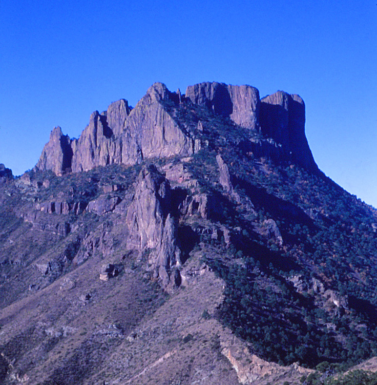 |
| Wannenköpfe scoria cone (left). A complete section through the cone is visible in the scoria mine. Dike on the side of the scoria cone (right). Dikes formed when superheated groundwater erupted through tephra deposits. Pleistocene volcano, Eifel region, western Germany. | 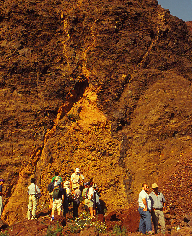 |
| Tephra rim of Leyendecker volcano (left). Note the evenly bedded, gently inclined layers of tephra. Peridotite (olivine) xenoliths (right) derived from the mantle in the Leyendecker volcano. Pleistocene volcano, Eifel region, western Germany. | 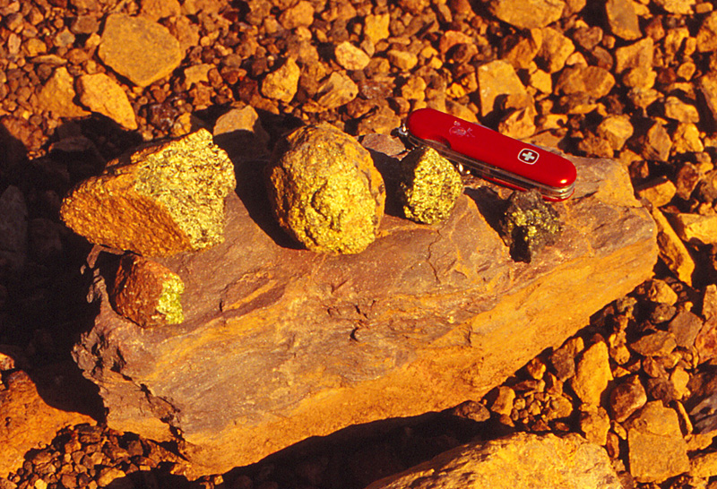 |
| Growth faults in Eppelsberg scoria cone (left). Growth faults are caused by internal collapse during continued surficial deposition of tephra. Note people at bottom for scale. Tree molds (right) in tephra near top of Eppelsberg scoria cone. Pleistocene volcano, Eifel region, western Germany. | 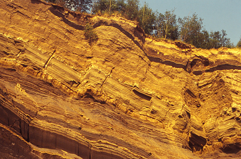 |
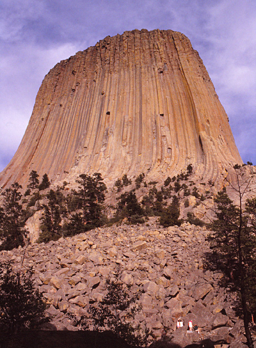
| Devils Tower, Wyoming (left), one of the most famous examples of columnar jointing in the neck of a former volcano. Note people at bottom. Niedermendiger lava flow (right) with columnar jointing exposed in a quarry. Pleistocene volcano, Eifel region, western Germany. | 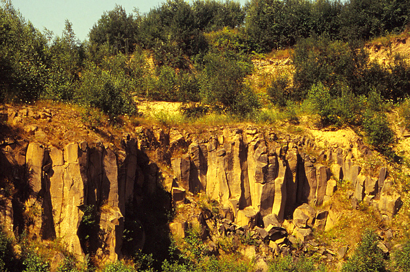 |
| Dike of Profile Rock, Colorado. View end-on (left) shows the dike aligned with West Spanish Peak in the background. Side view (right) looks like a person lying down. Magma intruded into a crack that radiated from an intrusion under West Spanish Peak. Softer adjacent strata later weathered and washed away leaving the dike standing like a wall in the landscape. |  |
| Side view of a small dike (left) of intermediate composition as indicated by the medium-gray color. The light-colored strata on the side of the dike are contact metamorphic rocks. Close-up shot (right) of contact metamorphic rocks of the Cuchara Formation (sandstone). Near West Spanish Peak, Colorado. | 
|
 Primary structures in volcanic/intrusive rocks
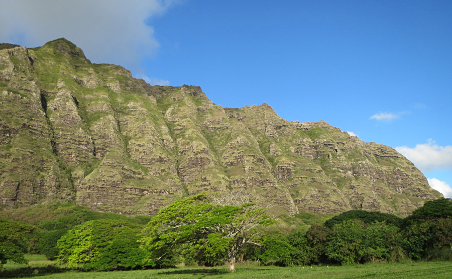
| Overview (left) and close-up shot (right) of the Koolau Range on the eastern side of O'ahu at Ka'a'awa. Note multiple basalt flows of Neogene age exposed in the cliff face, which is about 300 m (>1000 ft) high. | 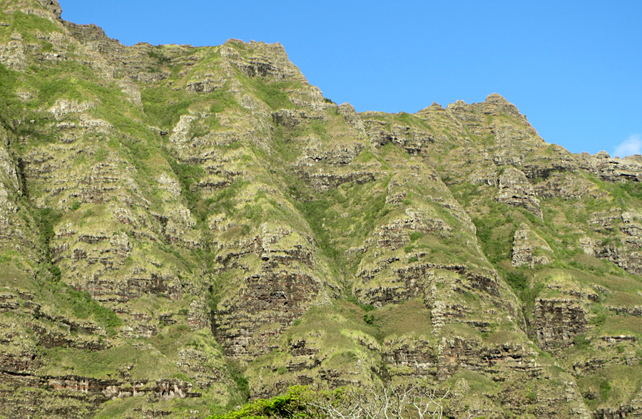 |
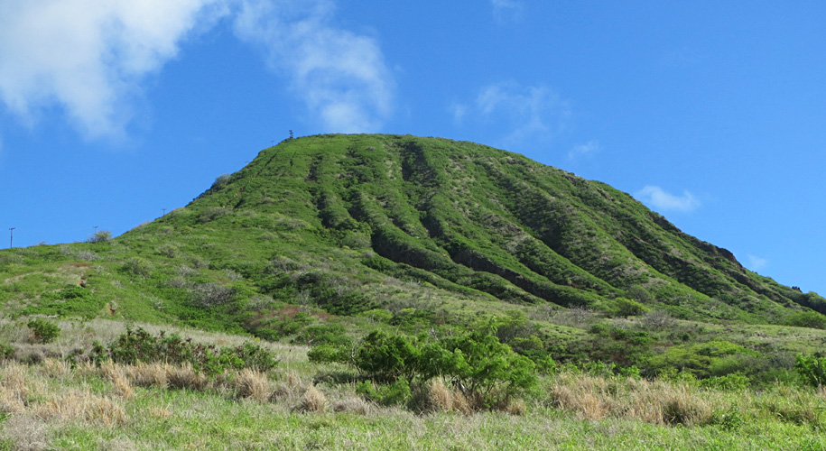
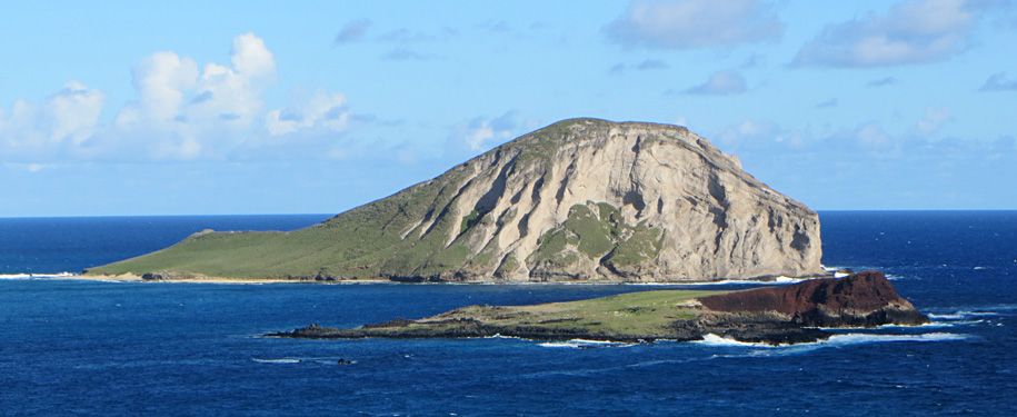
| Koko Head seen from below (left) The high point exceeds 350 m (>1150 ft). View from the top of Koko Head looking southwest over Hanauma Bay (right). Hanauma Bay is the eroded center of a small volcanic cone in the Koko rift system. | 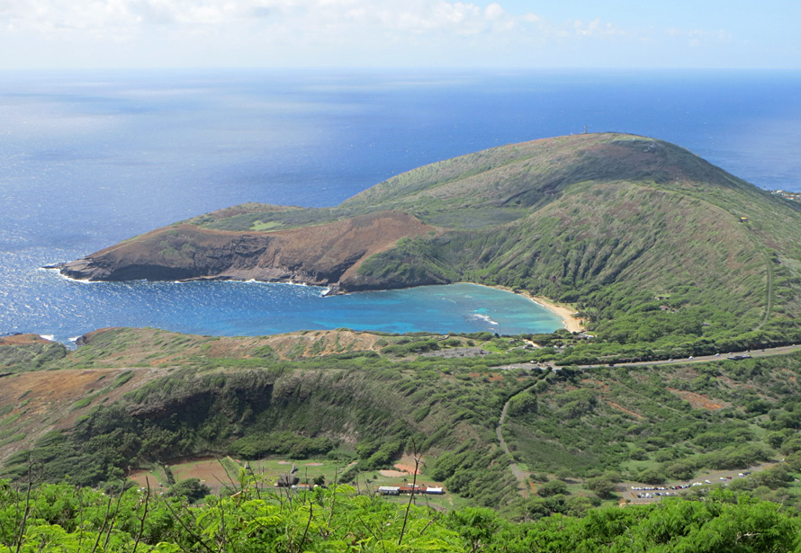 |
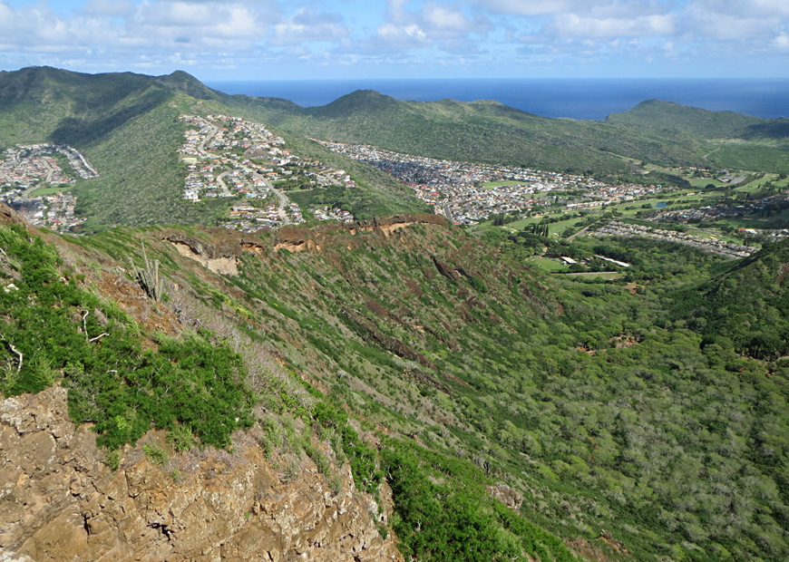
| Views from the top of Koko Head showing the rims of the cone looking toward the northeast (left) and southeast (right). The bowl between the rims is the Koko Crater Botanical Garden. | 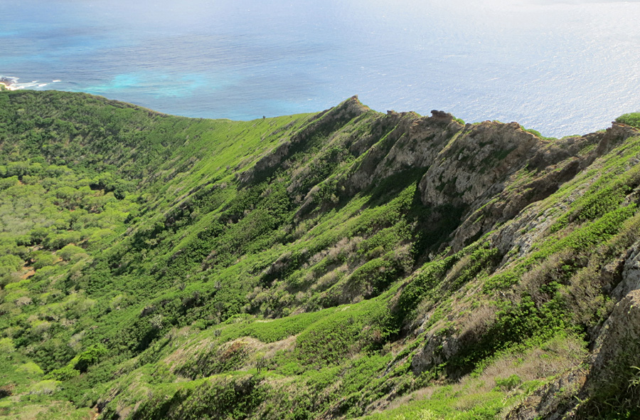 |
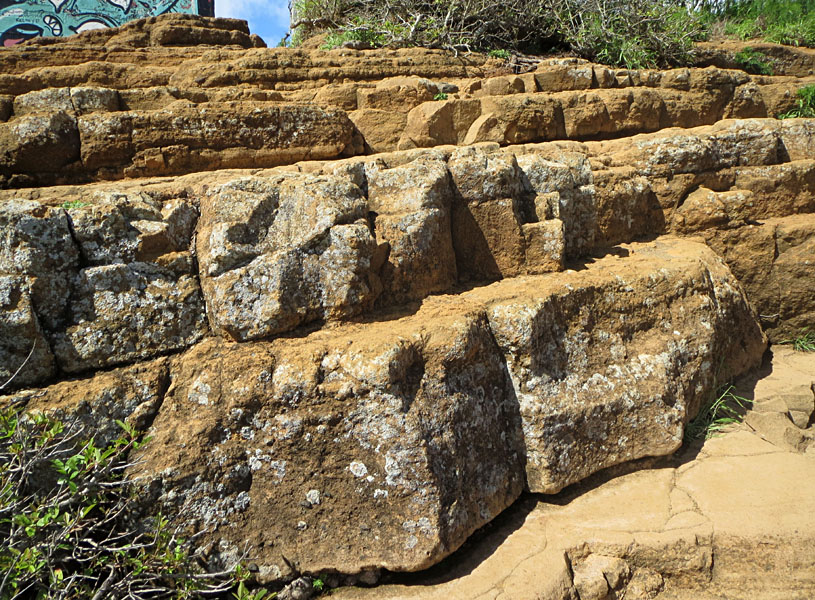
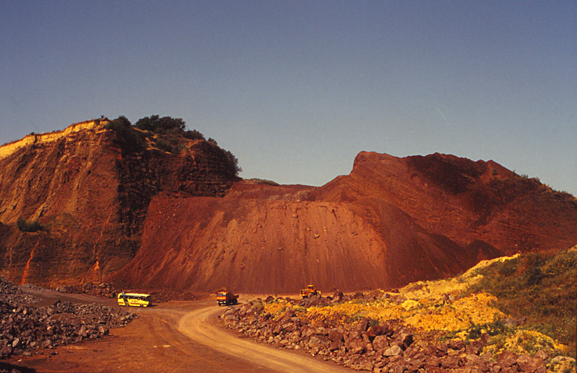
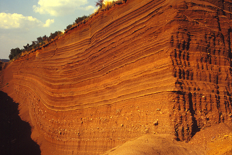
| Close-up views of tuff that form the rims of Koko Head volcano. Tuff is an agglomeration of fragmental debris and ash laid down in layers on the flanks of the cone. Sulfur stains the rock yellow in places. | 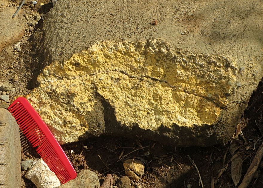 |
| Left: Kaohikaipu Island in the foreground and Manana Island behind, offshore from Makapu'u at the southeastern tip of O'ahu. Both are small cinder cones at the northeastern end of Koko rift system. Right: close-up view of Manana Island displaying steeply inclined tuff beds. | 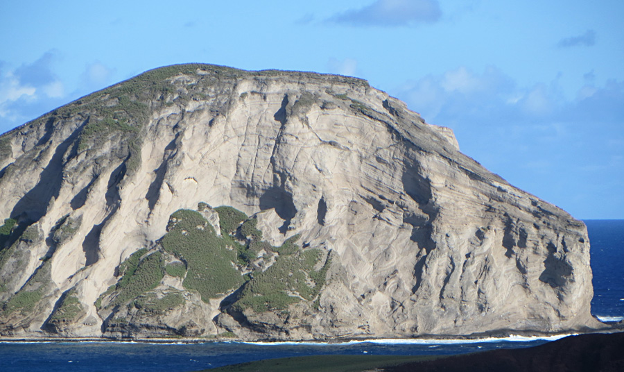
|
| Soil creep is downslope (to right) in uppermost portion of section. This gives the illusion of folding but is really only a surficial phenomenon. Steeply tilted turbidite beds, Marathon Basin, West Texas. |
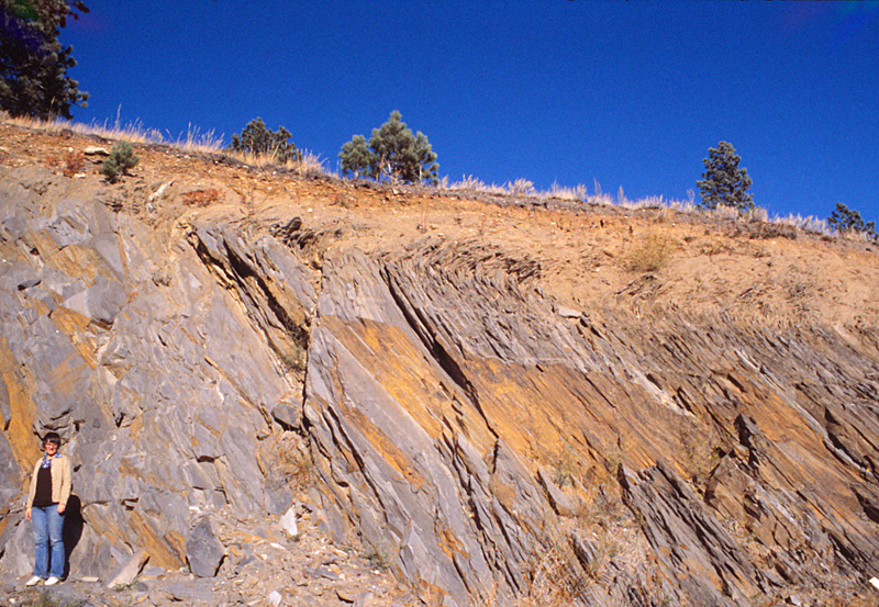
| Rock creep in garnet-bearing schist, Black Hills, South Dakota. Even "hard" rocks are subject to downslope creep in the weathered zone. |
| Soil-creep fold in tephra on side of volcanic cone, Eifel region, western Germany. Extreme, near isoclinal, folding is seen on the side of this extinct Pleistocene volcano. |
 Rock/soil creep
 Return to