| Missouri and Kansas |
| Introduction | Lewis and Clark |
| Landsat images | Kite aerial photos |
|
| Missouri and Kansas |
| Introduction | Lewis and Clark |
| Landsat images | Kite aerial photos |
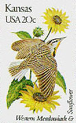
| The ecological transition in the Kansas City vicinity is demonstrated by the state birds--western meadowlark for Kansas and eastern bluebird for Missouri. | 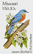 |
From the time of earliest French and Spanish penetration into the mid-continent region, the Kansa Indian villages were an important stopping point for explorers and traders. The region was the most productive source of high-grade beaver furs, which were in great demand in Europe (Hoffhaus 1984). Beginning early in the 18th century, French-Canadian voyageurs ascended the Missouri River to Kawsmouth and beyond on a near-annual basis.
One of these early Frenchmen was Etienne Veniard, Sieur de Bourgmont. He undertook a remarkable journey in 1713 to explore the Missouri River as far as the Platte. Following his return to France, he was given a charge to establish a permanent post on the Missouri River in order to make peace and to trade with native Indians. This was accomplished in 1723 with construction of a small stockcade, known as Fort Orleans, near the modern town of Brunswick in central Missouri. In 1724, de Bourgmont once again ascended the Missouri River to the Kansa villages near modern Fort Leavenworth. There was much feasting and many speeches during his visit (Hoffhaus 1984). De Bourgmont continued westward onto the plains accompanied by about 1000 Indians! However, he was struck down with fever and had to return to Fort Orleans.
At Kawsmouth, Lewis noted, the waters of the Kansas is verry disigreeably tasted to me. Although he did not elaborate, there is a good physical explanation. In late June, the Missouri River would have carried considerable fresh runoff from melting snow in the northern Rocky Mountains. In contrast, the Kansas River has its headwaters in the Great Plains region and does not reach the mountains. In central Kansas, subsurface salt beds contribute high salinity to springs and streams that feed the Kaw River. Water of the Kansas River indeed would have tasted poor in contrast to the Missouri River.
The Missouri and Kansas rivers seen by Lewis and Clark were quite different from the rivers of today. The river channels were wide, shallow, and filled with sand bars and small islands. The character of the old Missouri River is indicated by the map below from the late 19th century, prior to management by the U.S. Corps of Engineers. The modern Missouri River is a single, deep channel flanked by levees and maintained by dredging. In the 20th century, bottomland was reclaimed for airports, railyards, and other industrial development.
Throughout most of its length from the Mississippi into the Dakotas, the Missouri valley is a
broad avenue, in many places more than five miles (8 km) wide. However, near Kansas City, the
valley is quite narrow--see images. Stream erosion of the valley bluffs is restricted
by resistant limestone bedrock, and the valley is only about two miles (3 km) across. The
limestone has been exploited in many underground quarries, which now are utilized for storage
and office space in several parts of the the city. Click on the small images below to see
full-sized versions (app. 220 kb each).
Lewis and Clark
The Corps of Discovery reached the Kansas City vicinity in late June, 1804. They camped at the "Mouth of the Kansies" River on June 29th. Court martials of John Collins and Hugh Hall were held on charges of taking whiskey and getting drunk. Both were found guilty. Collins received "one hundred Lashes on his bear Back,"
and Hall got 50 lashes. While these punishments may seem severe today, they were entirely in keeping with the times.
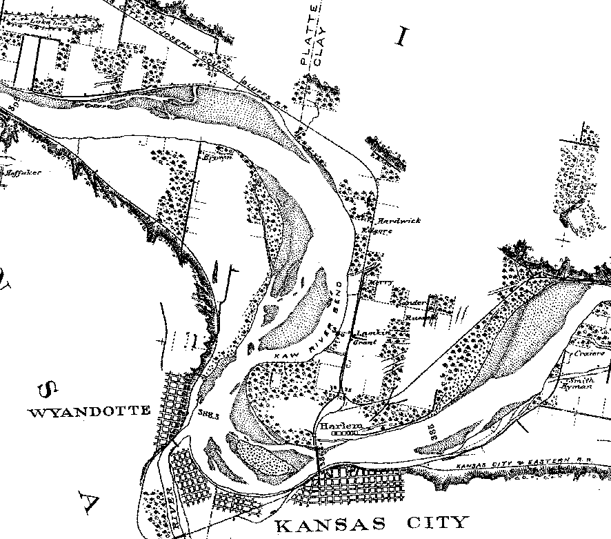
Portion of Map of the Missouri River compiled by the U.S. Army Corps of Engineers (1878-81, plate XIV). Notice the extensive sand bars and islands in the Missouri River channel. Click on the small image to see an enlarged version (36 kb). Landsat Images of Kansas City Vicinity
The following Landsat thematic mapper (TM) images depict the greater Kansas City region
of northwestern Missouri and northeastern Kansas. The region supports around one million
people today and is a transportation, agricultural, and manufacturing center. Kansas City,
Missouri is home to the Kansas City Royals, Kansas City Chiefs, American Royal, and Nelson-Atkins
Museum of Art. The metropolitan region remains a gateway to the Great Plains of the central
United States.

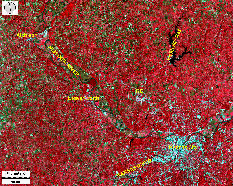
| Natural color composite. Landsat image consisting of blue, green, and red visible light portrayed in a natural manner. Active vegetation appears green, bare soil and fallow fields are brown, and urban structures are white. Clean water bodies appear black, whereas the Missouri River displays a muddy brown color. KCI is Kansas City International Airport. Image date 28 Sept. 1994; TM bands 1, 2, 3; image processing by J.S. Aber ©. |
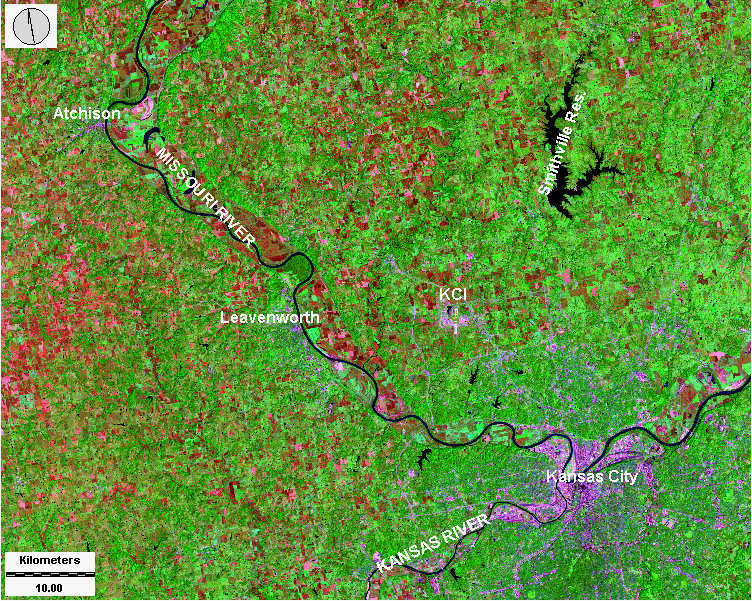
| Standard false-color composite. Landsat image consisting of green, red, and near-infrared light portrayed in a false-color manner. Active vegetation appears red, bare soil and fallow fields are green, and urban structures are bluish-white. Most water bodies are black in this composite, whereas the Missouri River appears greenish-brown. KCI is Kansas City International Airport. Image date 28 Sept. 1994; TM bands 2, 3, 4; image processing by J.S. Aber ©. |
| Special false-color composite. Landsat image consisting of green, near-infrared, and mid-infrared light portrayed in a false-color manner. Active vegetation appears green, bare soil and fallow fields are red-pink, and urban structures are purple. All water bodies, including the Missouri River, are black in this composite. KCI is Kansas City International Airport. Image date 28 Sept. 1994; TM bands 2, 4, 7; image processing by J.S. Aber ©. |
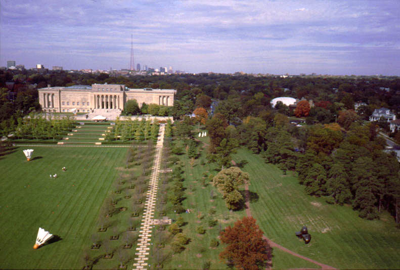
| The Nelson-Atkins Museum of Art is a cultural icons of Kansas City. The gallery has world-renowned collections of European and Oriental art. Seen here is part of the sculpture garden, in which monumental works are displayed outdoors. The skyline of downtown Kansas City is visible on the horizon, with the landmark televison tower of station KCPT. Photo date 10/98; © J.S. Aber. |
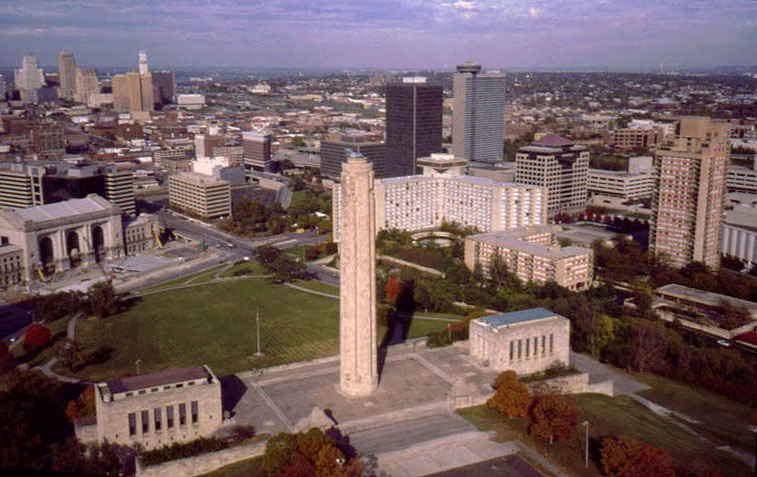
| Liberty Memorial complex in the foreground with downtown Kansas City visible in the background. The Liberty Memorial was built in the 1920s to celebrate the peace which followed World War I. Note a whisp of steam from the top of the tower, which symbolizes an eternal torch. The Liberty Memorial tower is 217 feet (66 m) tall and is one of the best known landmarks in the city. Photo date 10/98; © J.S. Aber. |
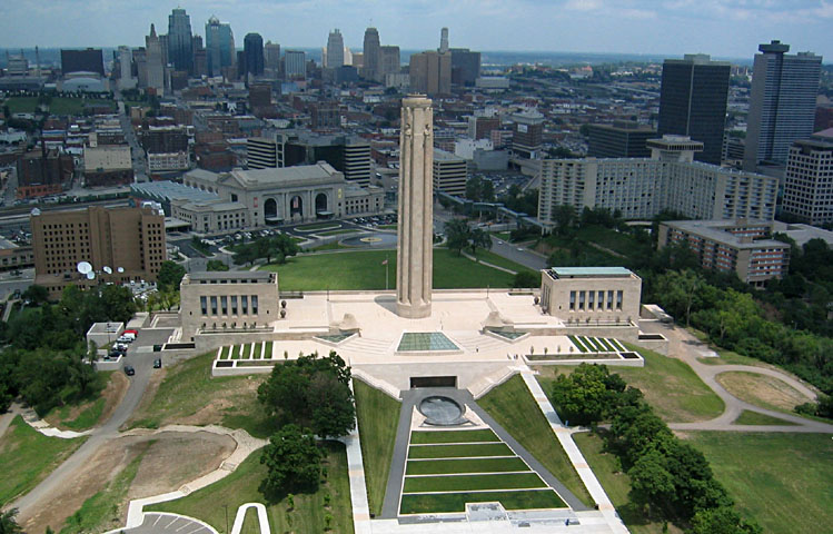
| Liberty Memorial following reconstruction. Extensive repair, rebuilding, and remodeling were undertaken in the late 1990s and early 2000s. Exterior work is largely completed in this view from 2003, while interior construction continues. Digital-camera image; photo date 6/03; © J.S. Aber. |
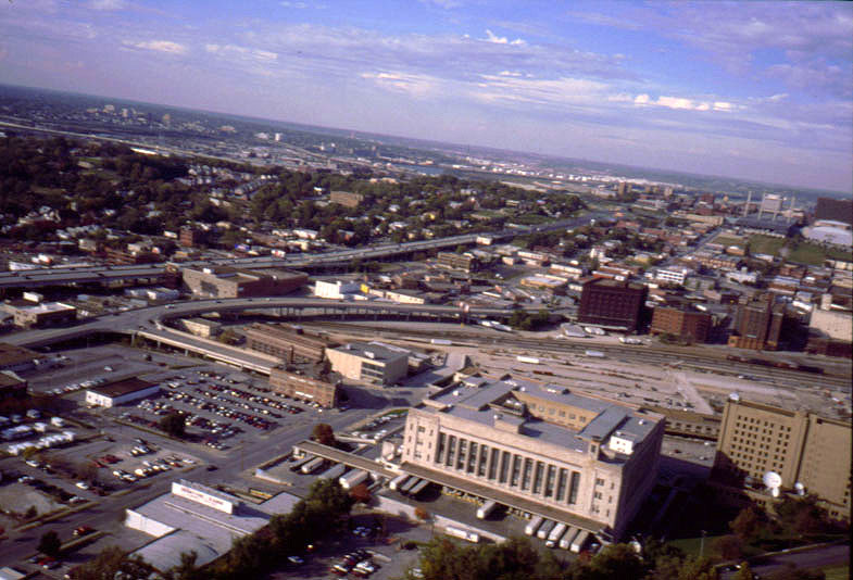
| The square building to lower right is the main post office. Elevated roadways and commercial activities dominate landuse in this part of the city. I-35 highway and Broadyway pass across the left-center of view. The Missouri and Kansas river valleys are visible in the distance, and the Missouri River can be seen in the center background. Photo date 10/98; © J.S. Aber. |

| Crown Center complex in downtown Kansas City, Missouri. Hotel, office buildings, apartments, restaurants, and a shopping center are contained in this redevelopment project. Crown Center is the international headquarters of Hallmark Cards, Inc. |
All text and images © J.S. Aber.
Last update: Mar. 2005.