Denmark
Green-energy tour 2023
Kite aerial photography

James S. and Susan E.W. Aber

Table of contents
Introduction Northwest Denmark
Ramme Dige Oddesund Nord
Southeast Denmark Ristinge Klint
Nørre Frenderup Bornholm
Dueodde References

Introduction

Denmark is a world leader in so-called green energy. Denmark has already reached more than half of electricity production from renewable sources—wind, solar, and hydro power, and the country has the goal to achieve self-reliance on renewable energy by 2050—see
Danish energy model. The main reasons for our trip in 2023 were to tour historic windmills, to observe modern wind, solar and hydro facilities, and to conduct kite aerial photography at scenic locations, of which many abound in coastal and inland settings. We also investigated many geological and archaeological sites.

Denmark is a kite-friendly country and one of our favorite places to visit. We have, in fact, conducted kite aerial photography (KAP) in Denmark twice before—see 2005 and 2013. For these earlier visits we had exceptionally nice weather, but the late summer and early autumn of 2023 were relatively cool with cloudy sky and frequent rain. This limited our KAP opportunities. Nonetheless, we had good success at five sites—two each in the northwestern mainland and the southern islands, as well as one site on the island of Bornholm to the east.

Northwestern Denmark

We spent our first KAP session in late August on the mainland portion of Jylland that faces the North Sea in northwestern Denmark. This region has the best onshore wind resource in the country and has a long history of traditional windmills, some of which are preserved and restored. The region is also home to many modern wind turbines and solar farms. So, of course, wind surfing, hang gliding, and kite flying, are quite popular today.

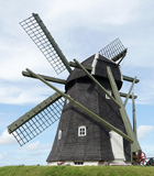
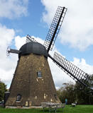
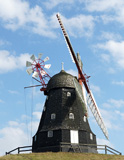
Selected historic windmills in northwestern Jylland

Kloster Mølle
Vestervig

Refsbøl Mølle
Hurup
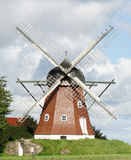
Heltborg Mølle
near Hurup

Ramme Dige

Ramme Dige is a well-known site for archaeologic remains located in western Denmark near the North Sea coast. It includes a cluster of burial mounds dating from the Neolithic (New Stone Age) and Bronze Age, as well as a wall-ditch structure (dige) that extends more than 2.5 km (~1½ miles) long. The wall and ditch were built during the middle Iron Age, presumably A.D. 200-400 interval. Many more burial mounds once existed, but several have been removed over the years.

This was our third time to conduct kite aerial photography at Ramme Dige, so clearly this is our favorite place in Denmark for KAP. Also of interest here are nearby wind turbines and a new solar farm.

The Ramme wind farm has experienced significant changes since we first visited in 2005. It currently has 12 operational Vestas turbines—six have capacities of 2.0 megawatts (MW), and six are 3.3 MW each for a total of 31.8 MW electric-generating capacity. These are large modern turbines. However, 21 older and smaller turbines were dismantled during the period 2002 to 2014—see Ramme. This demonstrates the results of governmental incentives to replace many smaller, older turbines with fewer, larger turbines.

Ramme Dige KAP
Ramme wind farm viewing to the northeast in 2005 (left) and 2013 (right). Trace of the Iron Age wall is marked (*). In 2005 five turbines are visible, and six turbines appear in 2013.
Ramme wind farm viewing to the northeast in 2023. Overview (left) and closer shot (right). Trace of the Iron Age wall is marked (*). Solar farm of dark panels surrounds the northern end of the wind farm.
Ramme Dige burial mounds looking to the southwest (left) and west (right) with the North Sea in the far background. Kite flyers on the right side.

Oddesund Nord

Oddesund is a narrow finger of land that separates Nissum Bay from the Limfjord in northwestern Denmark. A narrow gap allows water flow and ships to pass, and the gap is bridged for railroad, highway, bicycle, and pedestrian traffic. An observation tower provides good views and historical information about the area.
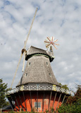
Oddesund observation tower
Observation tower (left) and view from top of tower northward (right) over remains of fortifications built during World War II to guard the entrance to the Limfjord. Village of Oddesund Nord in the background.
Bridge over the channel at Oddesund. Overview (left) and closer shot (right) of draw-bridge up for a sailboat to pass through. Nissum Bay in the right foreground, and Limfjord in the left background.

The northern peninsula at Oddesund is underlain by sand and gravel that were deposited as beach ridges to form the narrow spit. This area is now a nature preserve, part of the
Geopark Vestjylland. But this vicinity once appeared quite different. In 1986, Vestas and Bonus built the first wind farm in Europe. Twenty wind turbines were erected here, and another 25 turbines were placed on the southern side of the Oddesund.

Former wind farm at Oddesund. The turbines stood for more than two decades, but in 2008 they were considered obsolete and were removed. The truss towers looked quite industrial. Picture adapted from a display at the Oddesund tower.

We were most interested in documenting the conversion of the former wind farm into the current natural area. Traces of the former turbine sites are still visible in places. Wind and sun were perfect for KAP, but we suffered some camera issues. Nonetheless, we managed to acquire some good shots over the natural area.

Oddesund kite aerial photos
Overview of the Oddesund peninsula looking westward (left) and closer shot of the shore and older beach ridges (right). Kite flyers in lower right corner.
Views to the northwest (left) and north (right). Former wind turbines sites are marked (*), and a concrete bunker from World War II stands on far right side (>). Village of Oddesund Nord in the background.

Southeastern Denmark

We spent our second KAP session in mid-September in the islands of southeastern Denmark, namely Langeland, Lolland, Bogø, and Møn. This region is slightly warmer and more sunny, but has somewhat less wind resource compared with northwestern Jylland. In spite of these minor differences, historic windmills as well as modern wind turbines and solar arrays are scattered across the landscape.

Selected historic windmills in southern islands

Lindelse Mølle
Langeland

Skovsgaard Mølle
Langeland
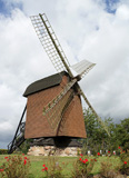
Østofte Stubmølle
Lolland

Ristinge Klint

Ristinge Klint is a cliff along the southern side of Ristinge peninsula on the island of Langeland, part of the
Geopark South Fyn Archipelago. This site is quite popular for tourism, and it has considerable significance for geology of the Ice Age. Several sedimentary deposits represent glacial and interglacial intervals and are exposed in the cliff face. These strata were thrust and stacked together by glacier shoving into a tilted, overlapping pattern. As a classic locality, many geologists have investigated this site over the years (Sjørring 1983).

Ristinge Klint kite aerial photos
Overview (left) and closer shot (right) of Ristinge Klint looking toward the west. The cliff face is mostly covered by vegetation, so the geological strata are not readily visible.
View toward east (left). The building on the left is a former resort hotel built originally in 1926 and expanded in the 1950s and 1960s. This structure will be replaced soon, as approved and revised—see Ristinge Strandhotel. Kite flyers at lower center. Sun glint on water (right) highlights wave patterns.

Nørre Frenderup Jættestue

The Nørre Frenderup Jættestue is a passage-grave type of burial mound in the western part of the island of Møn. The passage grave dates from the Neolithic (New Stone Age) about 5200 years ago, approximately the same age as the earliest phase of Stonehenge in England. The interior of the mound consists of giant boulders that form a burial chamber. Stone walls support huge capstone slabs to form the roof, which is covered with clay to make a water-tight structure. More than 100 megalithic structures are known on Møn. Several, including this one, are open to the public to observe and crawl inside, as we did.

Nørre Frenderup Jættestue kite aerial photos
Overview looking southward (left) displays undulating hills and agricultural landscape. Burial mound at lower left. Close-up view (right) of burial mound and kite flyers.
Solar-energy array for generating electricity. Overview looking to the northwest (left) and closer shot of the solar panels (right).
Overview looking eastward (left) with a prosperous farmstead in the lower right corner. Close-up view of farmstead (right). Note solar panels behind the barn.

Nørre Frenderup Jættestue ground photos
Burial mound (left); the entrance is marked by the dark shadow in center. Entrance (right) is a stone-lined passageway; the door is only about two feet high. Crawling is the only way inside!
Interior of burial chamber is about 4-5 feet tall and 8-10 feet wide. Note huge size of stones in the walls and roof. These stones were moved from the surrounding landscape and put in place entirely by human labor.

Bornholm

Bornholm is an island in the Baltic Sea midway between Sweden and Poland. As the easternmost part of Denmark, its geology is quite different from the rest of the country. The northern two-thirds of the island is mostly ancient granite and gneiss that form hills, high cliffs, and rocky shores. The southern one-third is underlain by younger sedimentary formations at lower elevation with sandy shores, especially along the southeastern coast.

Like the rest of Denmark, Bornholm has a large variety and long history of windmills. Bornholm today is developing into an energy island that will become the hub for electricity generated by wind turbines in the surrounding sea. This electricity will be sent to the rest of Denmark and exported to Germany via high-voltage undersea cables—see Energy Island Bornholm.
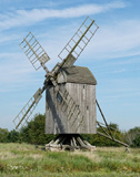
Selected historic windmills on Bornholm

Egeby Stubmølle
Built 1787

Agricco framework
Østerlars, ~1920
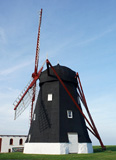
Kuremøllen
Built 1861

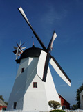
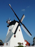
Aarsdale Mølle is a fully functional Dutch-style mill with flap blades and fantail that dates from 1877. Flaps closed (left) and open (right); note shadow on mill side. The blades rotate counterclockwise when flaps are closed and stop turning with open flaps. Originally equiped with canvas-sail blades, these were replaced by flap blades beginning in 1919, and the fantail was added. Flap blades are much easier to control. See Årsdale Mill.
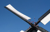
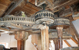
Detail of flap blade (left) with flaps in closed position. Note curvature of the blade. Interior wooden gears (right). Large gear on left drives smaller gears on right that turn mill stones.

Dueodde

Dueodde, located at the southernmost tip of Bornholm, is noted for its miles-long beach and wide zone of drifting dunes comprised of fine, quartz-rich, white sand, which was once considered the "finest sand of the world," and was used in hourglasses (Byrum et al. 2010). The large area was planted with pine trees and grasses in the eighteenth century to stabilize the sand. Some 850 hectares (~2100 acres) are protected since 1936 as a natural area. The modern lighthouse was built in 1962 and stands 47 m (154 feet) tall, the highest lighthouse in northern Europe.

Dueodde kite aerial photos
Looking northward to the Dueodde Lighthouse near scene center. Wide-angle overview (left) and closer shot (right). The lighthouse stands at the edge of the forested zone with active sand dunes in the foreground.
Broad overviews of the sea, beach, dunes, and forest looking toward the west (left) and east (right).
Shore zone showing shallow, offshore sand bars that parallel the beach. Inland is a belt of grassy beach ridges followed by dunes with bushy vegetation and bare sand. Overview (left) and closer view (right).

Dueodde ground operations
Kite line and reel (left) are anchored to a solid branch of driftwood buried in the sand. Large rokkaku kite (right) in flight with a 20-foot (~6 m) long tube tail. Our most-reliable kite-tail combo was quite stable in the sea breeze.

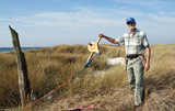
Kite flyers tending the kite line and reel. SEWA (left) and JSA (right).

References


Text and images © J.S. and S.E.W. Aber

Return to KAP gallery or KAP home.
Last update: October 2023.