 Cordova Mesa and Rattlesnake Buttes, Colorado J.S. and S.E.W. Aber |
| Introduction | Wind farms |
| Kite aerial photos | Environment |
| Geology | Wind potential |
| References |
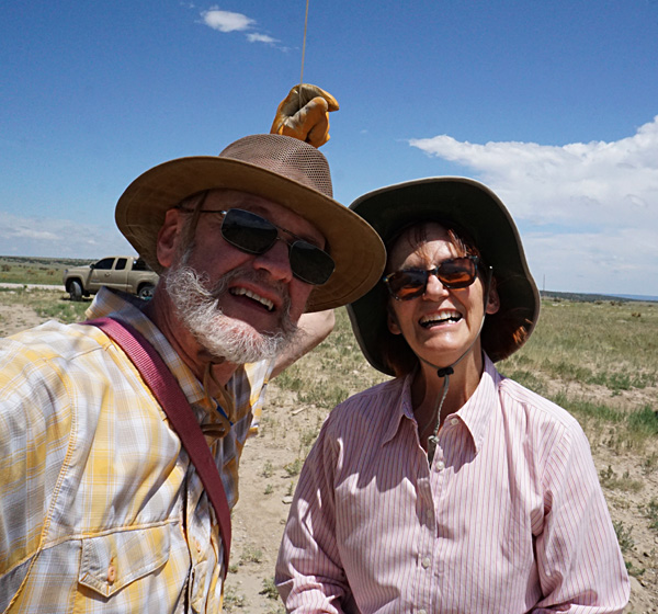
On a relatively cool day in July 2023—high temp 87 °F, we conducted kite aerial photography (KAP) in the wind-farm vicinity east of Walsenburg. Our KAP site was located south of CO highway 10 along county roads 220 and 77 at the boundary between Las Animas and Huerfano counties. Prominent landscape features include Cordova Mesa, just over a mile to the west, and South Rattlesnake Butte, about 2 miles to the northeast.
Upon arrival in mid-morning, sun was brilliant, but wind was too light for kite flying. We went on to explore the Apishapa State Wildlife Area and lunch, then returned to the KAP site in early afternoon as cloud cover began to increase. An easterly wind was quite gusty and variable in the 10-25 mph range. Sudden updrafts and downdrafts, abrupt changes in wind speed, and thin air at high altitude made for dicey kite flying. We utilized our large rokkaku with a long tail and 300-pound dacron line. The kite took some dives and did a couple loops, but we maintained control. The Sony autoKAP camera rig performed quite well, in spite of such turbulent wind.
Introduction
Cordova Mesa and Rattlesnake Buttes are the sites for three wind farms on the High Plains of southeastern Colorado. We have followed the development of these wind farms for more than a decade (Aber et al. 2015). They are part of a major shift in generating electricity in Colorado and the United States as a whole away from coal and toward renewable energy—solar and wind. Overall, Colorado ranks seventh in the nation for wind energy with a total installed capacity of 5195 megawatts (WINDExchange 2023).

Gusty wind caused the camera rig to swing wildly at times. Highly tilted image (left) looking northward along Huerfano County Road 220. Overturned image (right) viewing southward along Las Animas County Road 77.


KAP site on the public right-of-way next to Las Animas County Road 77. The bright spot (<) at bottom center is the hot spot, where the camera and sun are directly aligned with the ground, so that no shadows are visible. The dark patch beside the hot spot is the kite shadow, and kite flyers are standing next to the truck nearby. In this position, we had to look almost straight toward the sun to view the kite and camera.
Wind farms and turbines
Our primary target for this KAP venture was the Peak View Wind farm located on the eastern edge of Cordova Mesa. Nearby the Busch Ranch and Busch Ranch II wind farms are located at North and South Rattlesnake Buttes, also known as Twin Buttes, along CO highway 10. Peak View Wind began operation in 2016 and is equiped with 34 GE Wind turbines that stand 130 m (426 feet) tall. Total rated generating capacity is 61 megawatts (MW). The Busch Ranch wind farms include 43 Vestas turbines of 130 m and 140 m (460 feet) height. These began operating in 2012 and 2019 with a total rated capacity of 88 MW (USWTD 2023).

Left: GE Wind turbines in the Peak View Wind farm on the edge of Cordova Mesa with a traditional Aermotor windmill for pumping groundwater in the lower foreground. Right: Vestas V100 turbines in the Busch Ranch wind farm with North Rattlesnake Butte in the background. The butte top is 6400 feet in elevation.


Towers for the Busch Ranch turbines were built at the Vestas Towers America factory near Pueblo, Colorado. Factory and Vestas V100, 1.8 MW turbine, the first of this model erected in North America. The V100 model is specifically designed for light wind and/or high altitude land sites at temperatures from -30 to 40 °C (-22 to 104 °F).

Primary substation of Busch Ranch wind farm (left), and transmission lines (right) with turbines of the Busch Ranch wind farm in the background. Seen from public access along Huerfano County Road 125.

![]() KAP overlooking Cordova Mesa and surroundings
KAP overlooking Cordova Mesa and surroundings
Overview looking toward the south (left). Turbines of the Peak View Wind farm stand on the edge of Cordova Mesa on the right side, about 3 miles away. Closer shot (right) of turbines silhouetted on the edge of the escarpment, about 1.3 miles from the KAP site. These turbines are each rated 1.79 MW capacity with 100-m-diameter rotors.


Overview to the northwest (left) with turbines of the Peak View Wind farm on the mesa at far left. Huerfano County Road 220 on the far right with an abandoned parallel road. Overview to the northeast (right) shows Rattlesnake Buttes in the distance. Turbines of the Busch Ranch wind farms are barely visible on the horizon.


Looking to the southeast (left) along Las Animas County Road 77 across lower terrain east of Cordova Mesa. Typical High Plains scenery. Kite flyers (right) retrieving the camera at the end of our airphoto session.
Climate and environment
Climate in this part of the High Plains is semi-arid with 15-20 inches average annual precipitation, a combination of winter snowfall and summer thunderstorms—see Colorado climate. However, precipitation varies greatly from year to year, and drought is common. Temperature also fluctuates greatly due to dry air and high altitude. Spring and early summer had been relatively cool and wet when we visited in early July.
Vegetation consists of sparse grasses, yucca, and cholla over the plains with juniper trees on steeper slopes and valley sides. Our greatest ground hazard was cholla bushes that are quite numerous in some areas. Profuse flowering of the chollas indicated significant previous rainfall, but the soil surface was quite dry for our KAP venture. When we returned a week later, all flowers were already gone! Land use is primarily for grazing cattle and horses. Mule deer and pronghorn (antelope) also forage on the meager vegetation. Environmental impacts of turbines on vegetation and wildlife appear to be minimal.

| Left: Cholla (Grusonia sp.) bushes scattered across the plain east of Cordova Mesa and the Peak View Wind farm. Right: close-up shot of flowers and long thorns. Best to avoid these painful needles while kite flying! |  |

| Horses (left) grazing on shortgrass prairie with turbines of the Busch Ranch II wind farm in the background. Pronghorn (Antilocapra americana) on right. Two individuals on alert to our approach in the wind farm vicinity. | 
|

| Turbines appear to be quite close behind this farmstead on the Busch Ranch, Huerfano County Road 130. In fact, the nearest turbine (on right) is about 3600 feet (2/3s of a mile or 1.1 km) beyond the farmstead. |

| Tall radio and cell-phone tower standing in the Busch Ranch II wind farm and clearly visible from Colorado highway 10. |
Geologic setting
The crest of Cordova Mesa reaches 6500 feet elevation and stands 400 to 500 feet above lower terrain to the east. The mesa is capped by resistant limestone layers that form a steep and conspicuous escarpment along the eastern edge of the mesa. Originally called the Timpas Limestone from nearby Timpas Creek, this formation is now recognized as the Fort Hays Limestone, which is the basal member of the Niobrara Chalk of late Cretaceous age (NGMB 2023).Cordova Mesa is located on the western flank of the Apishapa anticline, a structure in which rock layers are domed upward into a broad arch. An escarpment capped by the Fort Hays Limestone surrounds the oval-shaped anticline. The crest of the anticline is marked by Rattlesnake Buttes, which also are capped by Fort Hays Limestone (Johnson 1969). Older rocks of early Cretaceous age are exposed in the center of the uplift, noteably the Dakota Sandstone and Purgatoire Formation.

| Sketch map of the Fort Hays Limestone escarpment and Niobrara Chalk (diagonal lining) in the vicinity of Rattlesnake Buttes. Older rocks (gray) are exposed in the eroded center of the Apishapa anticline. Cordova Mesa (*) and KAP site (^) are marked in red. Map is approximately 70 km (44 miles) across; adapted from Stose (1912, fig. 10). |

| Fort Hays Limestone exposed along CO highway 10 on the flanks of the Apishapa anticline. Left: section revealed in Saunders Arroyo on the eastern flank of the anticline. Note layers dipping down to right (east). Right: close-up view of chalky limestone layers on the western flank dipping to the left (west). Geology pick is 26 inches tall for scale. |  |

| Dakota Sandstone exposed near the center of the Apishapa anticline. This formation is older than and lies below the Fort Hays Limestone. Peak View Wind farm in background (left), and near Busch Ranch wind farm (right). | 
|

| Topographic map of the North Rattlesnake Butte vicinity. The Hogback is a dike that forms a narrow ridge about one mile east of the butte. Portion of the North Rattlesnake Butte Quadrangle, Colorado, 7.5-Minute Series (2022). Map obtained and adapted from (NGMD 2023). |

| Hogback dike in the Busch Ranch II wind farm. Left: end-on view from the west looking east. Right: side view looking toward the north. The dike is the long hill on the right side. | 
|
Wind potential
Cordova Mesa and Rattlesnake Buttes are the most prominent topographic features in the vicinity and form the divide between the Cucharas River and Apishapa River drainage basins. Drainage divides are typically the highest points in the local landscape and, thus, catch the most near-surface wind. Nearly all wind farms in neighboring Kansas, for example, are situated on drainage divides—see Kansas windscape.The locations of the Cordova Mesa and Rattlesnake Buttes wind farms take advantage of this situation for the greatest potential wind energy. Average annual wind speed at 80 m (260-foot) height is 8.0-8.5 m/sec (18-19 mph). This average annual wind speed is rated excellent for generating electricity with large turbines.

| Wind map for Colorado showing average annual wind speed at 80 m (260-foot) height. Approximate location of Cordova Mesa and Rattlesnake Buttes (*) east of Walsenburg. Wind speed given in meters per second. Map obtained and adapted from Colorado Wind. |

Tattered U.S. flag attests to strong wind typical of Rattlesnake Buttes and Cordova Mesa vicinity. Front Range of the Rocky Mountains in the background.
| |
References
![]()
![]() Return to airphoto gallery
or Great Plains airphoto homepage.
Return to airphoto gallery
or Great Plains airphoto homepage.
All text and images © by the authors (2023).