Satellite Image of Mýrdalsjökull and Eyjafjallajökull
Satellite image of Mýrdalsjökull and Eyjafjallajökull ice caps
and surroundings, south-central Iceland. False-color composite of visible (band 1)
and short-infrared (bands 3 and 4). Color coding: snow/firn (clouds) = bright white;
glacier ice = light blue/cyan; vegetated land = olive and reddish brown; bare ground and
water bodies = dark blue/black. Landsat multispectral scanner (MSS) data, Sept. 84; image
processing by J.S. Aber.
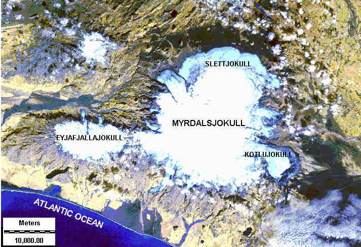 Eyjafjallajökull occupies a volcanic plateau, and two outlet glaciers descend
into valleys on north side of the ice cap. Mýrdalsjökull is situated on top of
the caldera of Katla, an active volcano. Sólheimajökull is the outlet glacier
on its southwest side. Sléttjökull and Kötlujökull are major outlet
glaciers on the north and southeast margins.
Return to Ice Age lecture 7.
Eyjafjallajökull occupies a volcanic plateau, and two outlet glaciers descend
into valleys on north side of the ice cap. Mýrdalsjökull is situated on top of
the caldera of Katla, an active volcano. Sólheimajökull is the outlet glacier
on its southwest side. Sléttjökull and Kötlujökull are major outlet
glaciers on the north and southeast margins.
Return to Ice Age lecture 7.