2007 Summer Slovakian AdventureS.W. and J.S. Aberwww.geospectra.net/slovakia/slovakia.htm |
|
I do not really know our address here, and we have no post box in any case. If anyone wants to send a letter to us, Jeremy and Amy, Sarajane and Ken will all be leaving the US around August 7 and a letter could come with them to us via hand delivered airmail!
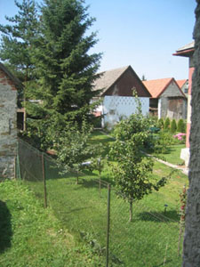
The image left shows our view out the bedroom window at the neighboring yard to the west. They have a big yard with fruit trees, beautiful flowers and lush grass. The grass is cut with a small electric lawn mower, which seems to be typical for this village.
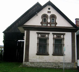
The house shown to the right is down the street from us. The date of construction is 1926.
The image to the right is the same scene as the image above except for the perspective. This image is from the kite, whereas the image above is from the ground.
In natural areas, wild geraniums and fireweed are common. Three years ago, a violent wind storm took out many trees along the High Tatras. The trees were logged but many uprooted stumps remain. The loss of the forest has given an opportunity to establish lush stands of fireweed, Epilobium angustiforium, which grows well in disturbed areas.
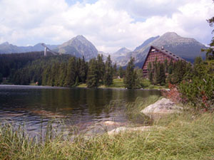
The lake is known as Šrtbské Pleso. The Hotel Patria (right) and high ski jump (left) are visible in this scene. The architecture of the hotel mimics the distant mountains and ski jump.
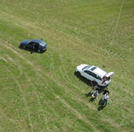
In the image to the right, kite flyers and picture takers are at work. Juraj Janoceko and his student, Branislav, are helping us today!
Copyright 2007. All rights reserved. For more information contact S. W. Aber, e-mail: saber@emporia.edu Thanks for visiting! Webpage created: July, 2007; last update: August 28, 2007.
Introduction to Our Slovakian Adventures
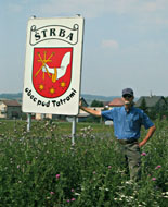
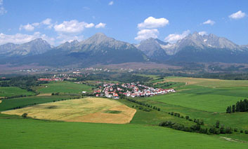
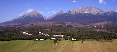
Greetings from Štrba, Slovakia! We are pleased to have an adventure overseas and to add Slovakia as our home, even if it will only be a 7-week stay. The reason for our journey is to document landscapes in Slovakia through kite aerial photography. The image shown to the right is from the perspective of our kite looking toward Vysoké Tatry or High Tatra Mountains. For more images and information on our work, see www.geospectra.net/kite/tatra/tatra.htm.
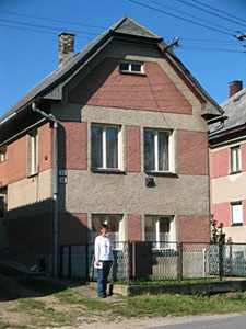
This webpage represents the rest of the story! It was created for family, friends, and any interested individuals who would like to follow along on our trip. Our home base, Štrba, is a village in the north central part of the country, approximately an hour drive from Poland. We are staying in the house shown to the left and Susie is standing in front on the day after we arrived. It has a stucco facade and is located on one of the main streets in the village. It is positioned in a long block of similar looking houses all built in the early part of the 20th century.
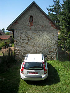
The drive between houses is just wide enough for our car to pass. We park in the fenced backyard. The barn you see in front of the car belongs to another family.
The best way to contact us is via email, saber@emporia.edu. We are pleased to have a modem internet connection. The range for wireless internet from Poprad falls 50 meters short of Štrba! We will add images and text during our visit here and begin Emporia State University teaching online as well. We will return to Emporia September 1 and meet classes on the 4th after Labor Day holiday.
The Slovak Republic is a country the size of Vermont and New Hampshire combined and has an overall population of 5.5 million. So it is less than a fourth the land size of Kansas but over twice the population. Much of the population is concentrated in a few bigger cities such as Bratislava, the capital, which is just across the Danube River from Vienna.
Slovakia is at 49 degrees north latitude, equivalent to southern Canadian cities. It is located in Central Europe and surrounded by Ukraine to the east, Hungary to the south, Austria to the west, Czechia to the northwest, and Poland to the north. Czech and Slovak Republics were joined just after World War I for political convenience and known for many years as Czechoslovakia (�o� is and!). A peaceful separation happened in 1993, and Slovakia joined NATO and the European Union in 2004.
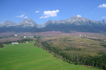
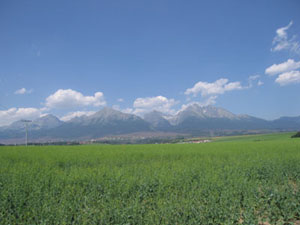
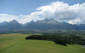
The image above shows a field of rapeseed, which will either be converted into canola oil or used for a biofuel product. Vysoké Tatry or High Tatra Mountains are in the background.
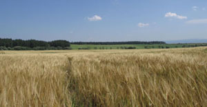
Slovakia has an economic base similar to Kansas. There is oil and gas production and a strong agricultural sector of crops and livestock. Fields of sunflowers and wheat are beginning to be harvested. There is much honey production and bees must be happy with the many fields of wildflowers in this country. Wheat is shown in the left image.
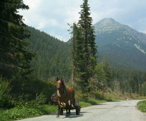
Unlike Kansas, the country raises sugar beets and hops, and while modern farm equipment does exist, you can see huge workhorses pulling wooden wagons. While tractors pull the equipment needed to cut hay, some people rake the mowed hay and pile it into the wagons. So old ways coexist with the new, and when we hear clip clop we look out the window for a visual treat!
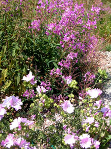
Chickens and roosters live near our house and are quite civilized in that they give the wake up call around 9:30 am. This is great considering the sun is up between 4:30 and 5:00 am! White turkeys reside a few houses away, and everyone has stunning flower gardens with dahlias, mums, roses, begonias, daisies, geraniums, and more.
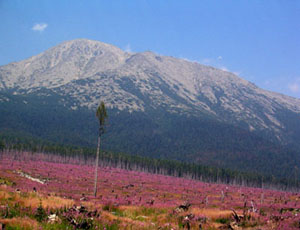
The right image above was taken standing on the ground, while the left image was taken by a camera suspended from a kite line. The perspective of the kite shows the pink flower band between the green forest bands, which easily identifies the wind damaged zone, now three years old. The image on the right shows a surviving, orphaned tree.
Slovakian landscapes vary from high mountains to lowlands, with a elevation difference from 8710 feet to 310 feet. It is the variety of landforms and topographic relief that help to make the country a terrific tourist destination for winter skiing and summer hiking. Rock types vary as well with some areas known for volcanic rocks and other areas, limestone pillars and caves. The rock visible in the foreground is light gray granite.
Štrba is located near to the high Tatra Mountains, which are a part of the Carpathian Mountains and the eastern extent of the Alps. Mountain glaciation is what attracted Jim to the area, and we are documenting these high elevation landscapes using kite aerial photography.
In addition to the U-shaped valley in the background of the image above, the gently rounded terrace of glacial outwash gravels is evident in the foreground of the image.
For more information, visit