Water resources
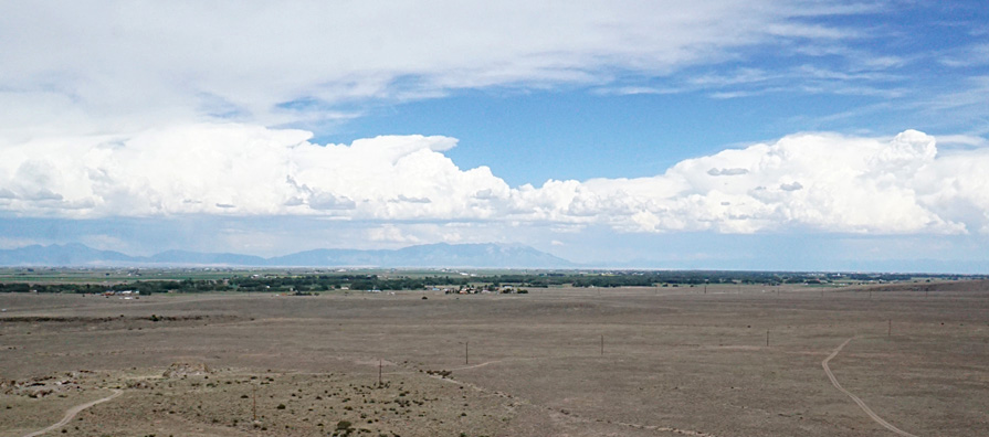
The San Luis Valley is a true desert, receiving about 7 inches (18 cm) of precipitation per year (Simonds 2015). The Río Grande drains the central and southern parts of the valley. The northern SLV valley and the vicinity of Great Sand Dunes, however, remains a closed depression with no surface outlet for drainage. Surface runoff from the adjacent mountains soaks into sand and gravel of alluvial fans, and ground water migrates toward the low point at San Luis Lake. Many other smaller streams flow down from the mountains and disappear into thick sediments below the valley floor. Shallow ground water gives rise to many ephemeral lakes, wetlands, springs, and flowing wells.
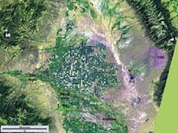
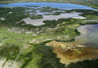
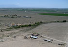
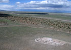
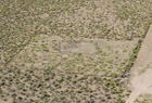
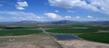
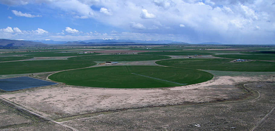
| Landsat satellite image of central San Luis Valley. The region north and east of the Río Grande is an internal basin draining into several lakes. GSD - Great Sand Dunes, RL - Russell Lakes, SLL - San Luis Lake. Active vegetation appears green. Circles represent center-pivot irrigation and most are half a mile (0.8 km) in diameter. Acquired 21 August 2009; image processing by JSA. |
Abundant surface and shallow ground water support considerable irrigated agriculture, particularly in the central and southern portions of the SLV in Colorado. From its San Juan headwaters to the west, the Río Grande is diverted via canals and ditches along with several of its tributaries and other streams, including Saguache Creek, Carnero Creek, Alamosa River, Conejos River, and Río San Antonito. From the Sangre de Cristos on the east, diverted streams include Trinchera Creek, Culebra Creek, and Costilla Creek. In addition, shallow ground water is pumped for irrigation.
Aerial photography
Beginning in 2006, we have conducted kite aerial photography in various parts of the San Luis Valley and Taos Plateau to illustrate the landscape and to show rural human land use and settlements. At this elevation on a warm day, air density is considerably less than at sea level, which reduces kite lift—see high-altitude. Kite aerial photography at this altitude requires a good wind, large kite, light camera rig, and considerable experience.
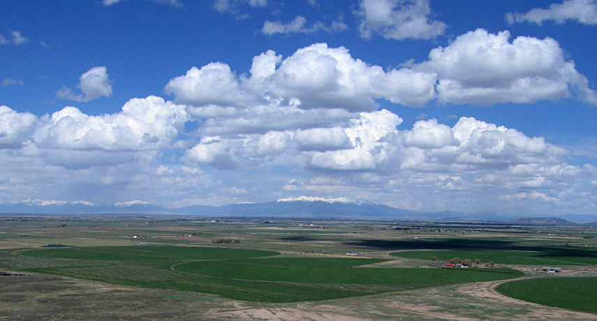
We have found over the years that maximum wind speed on fair-weather days typically happens in the late afternoon. Late afternoon is also the time of day in summer when thunderstorms are most likely, so many of our pictures include clouds or approaching rain. We also have utilized a small helium blimp a few times, and it likewise has much less lifting capacity at this altitude.
All of our kite and blimp aerial photography is conducted from points of public access and, as always, from a height of less than 500 feet (~150 m), according to FAA regulations for unmanned tethered aircraft. Such low-height images in oblique and vertical views provide high spatial resolution and depict the ground in great detail. The following sites are arranged generally from north to south within the San Luis Valley and Taos Plateau.
Return to top.

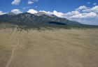
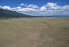
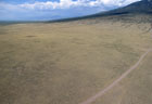
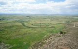
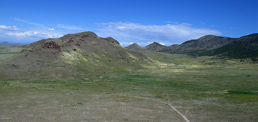
Sangre de Cristo Range
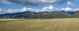
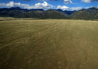
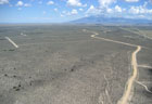
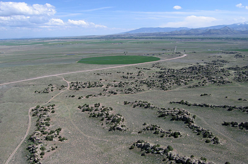
| Northeastern margin of the SLV looking toward the northeast (left) and southeast (right). The Rio Grande National Forest occupies the near flank of the Sangre de Cristo Range. Highest summits in this sector include Cottonwood Peak (13,588 feet), Rio Alto Peak (13,793 feet), and Eureka Mountain (13,507 feet).
| |
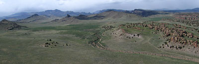
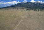
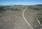
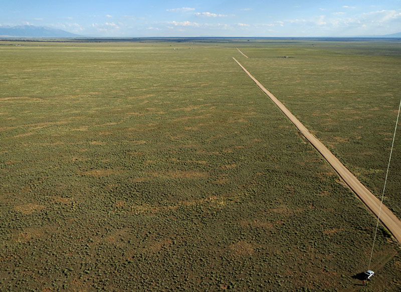
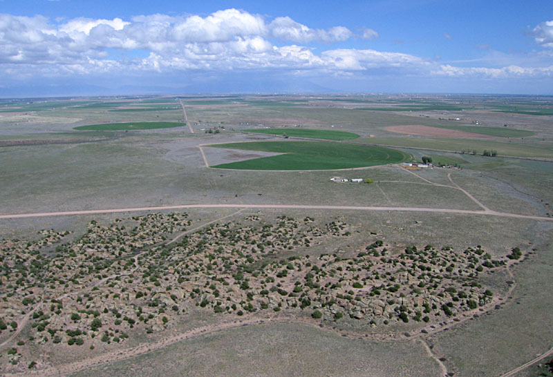
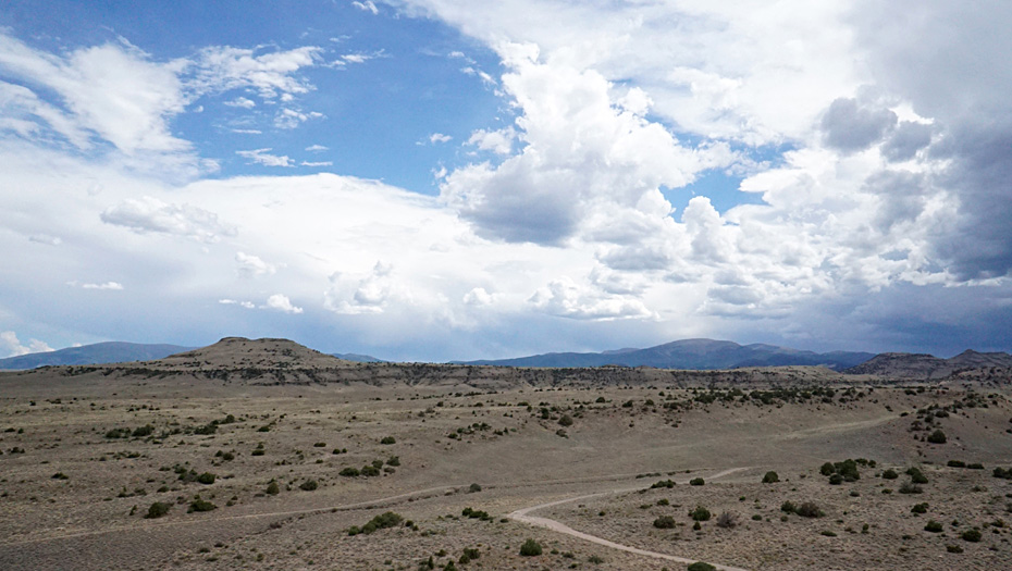
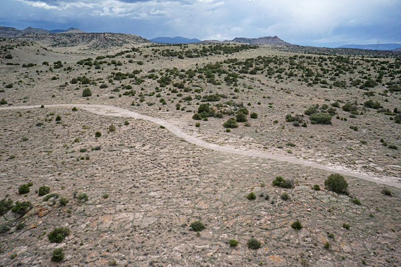
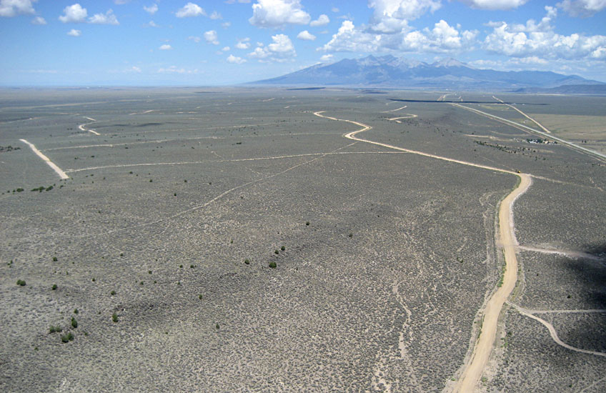
| Extensive alluvial fan/plain flanks the mountain range at ~7800 feet elevation. Views looking northward (left) and southward (right) along Saguache County road 64. Kite flyers on public land in lower right corner of view to south (right).
| 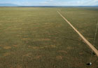 |
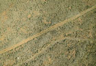
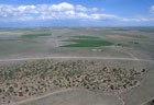
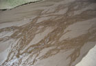
| Left: view toward the mountain front. Note the intricate pattern of braided channels across the alluvial surface. Right: vertical shot showing sagebrush vegetation. Vehicle tracks for scale; light tan spots are ant hills.
| 
|
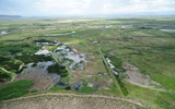
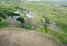
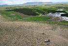
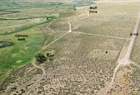
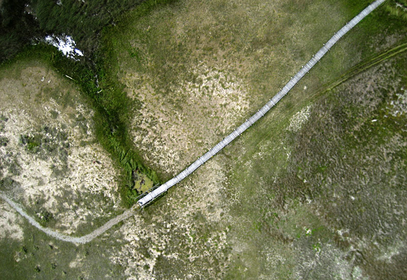
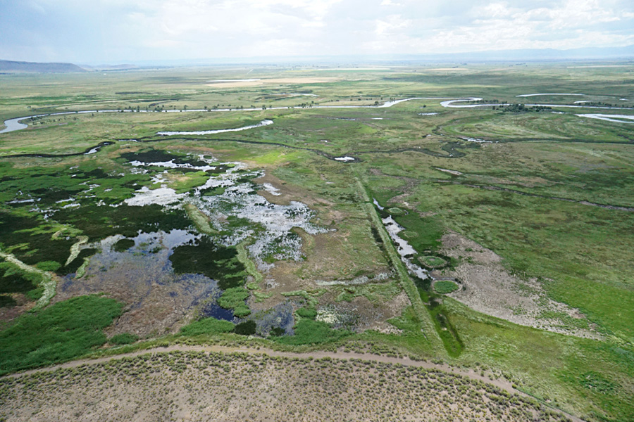
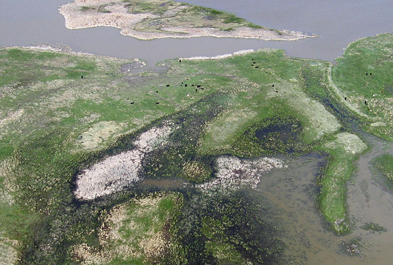
Russell Lakes State Wildlife Area
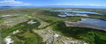
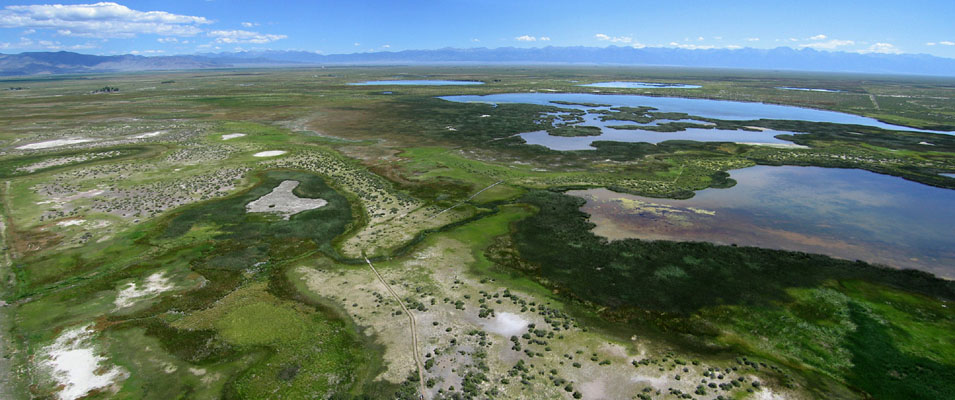
| Panoramic view of the Russell Lakes area in the northwestern SLV. Looking to the north and east with the Sangre de Cristos in the right background. Assembled from two overlapping wide-angle pictures. | |
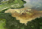
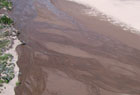
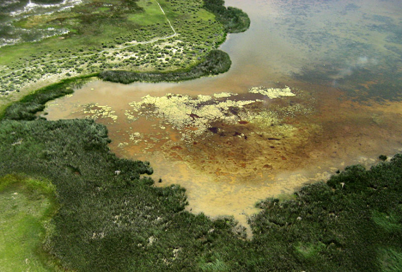
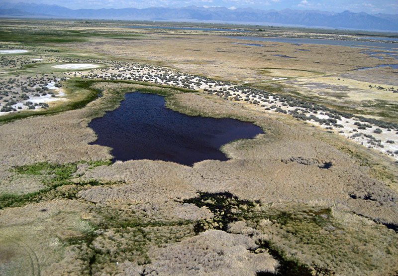
| Left: observation boardwalk and path meander through the wetland complex of pools, marshes, and low dunes. Right: close-up shot of marsh and pool with typical wetland vegetation and algae. Note blood-red color of saline water in patches.
|  |
| Left: view over a clear pool which is fed by water from an artesian well. Right: vertical shot over the pedestrian boardwalk and a small bridge at an artesian well (green pool beside bridge).
|  |
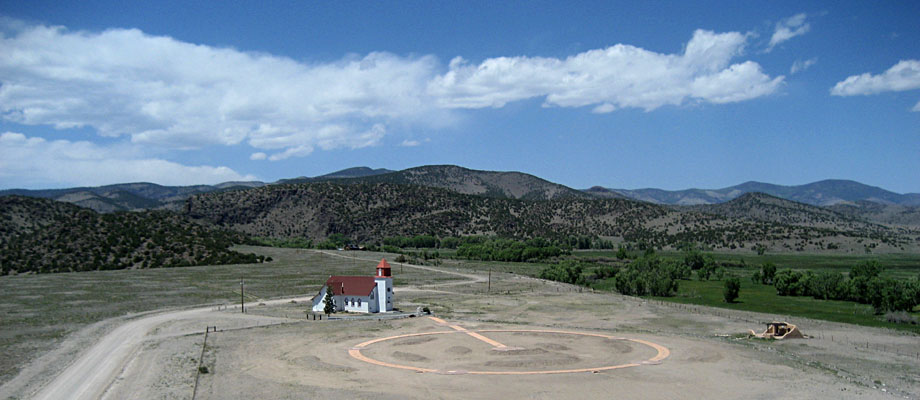
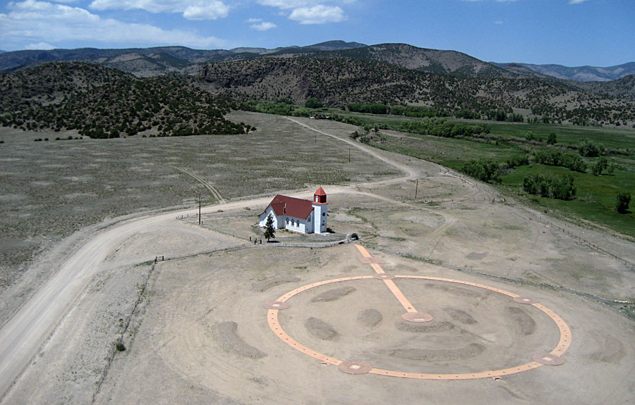
La Garita
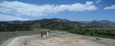 |
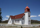
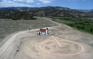
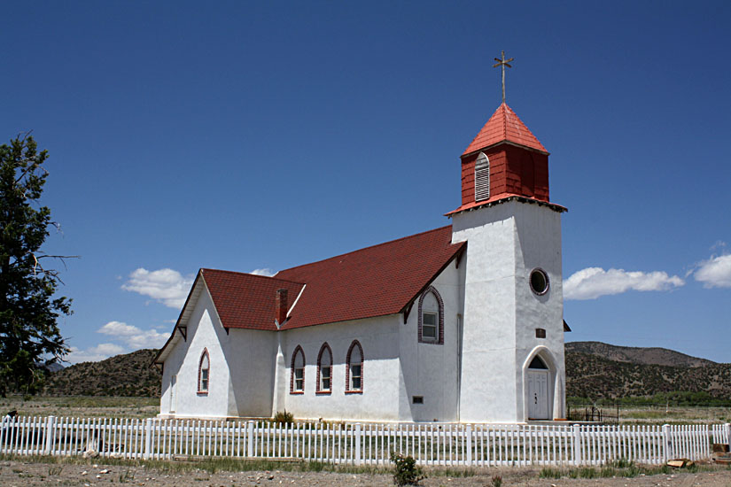
| Low-height overview of San Juan Baptiste Church with the San Juan Mountains in the background.
|
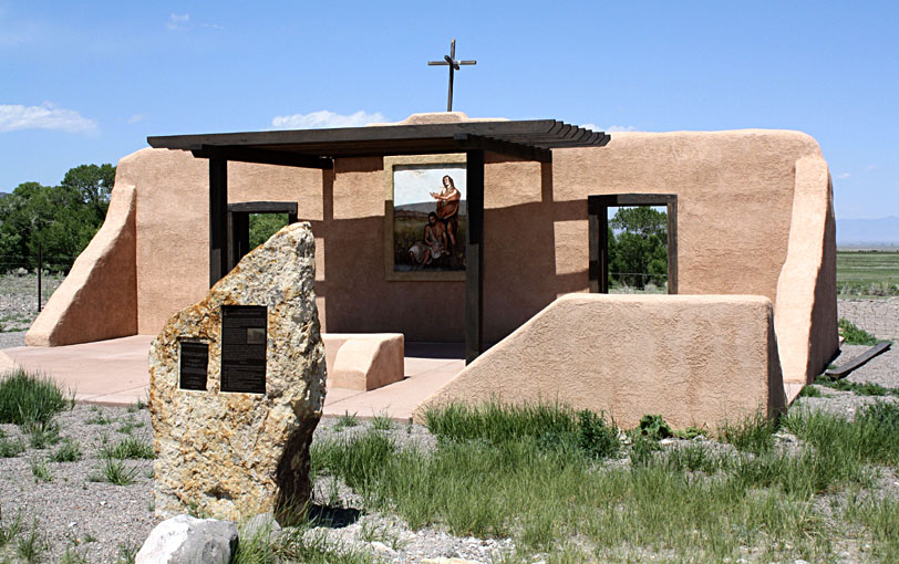
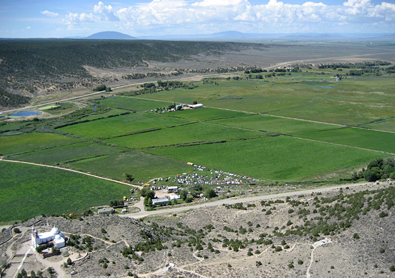
With an elevation just over 7800 feet, La Garita is one of the higher spots on the northwestern margin of the valley. La Garita was established by Spanish settlers in 1858, where Carnero Creek flows from the mountains into the valley. San Juan Baptiste Church (La Capilla de San Juan Bautista) and the Carnero Creek Cemetery are located just west of the present village of La Garita. Land for the church was donated in the 1870s, but the original building burned down in 1924. The present church was constructed in 1926; it is still in use. The church was placed on the National Register of Historical Places in 1980. It has an unusual four-armed cross on the steeple.
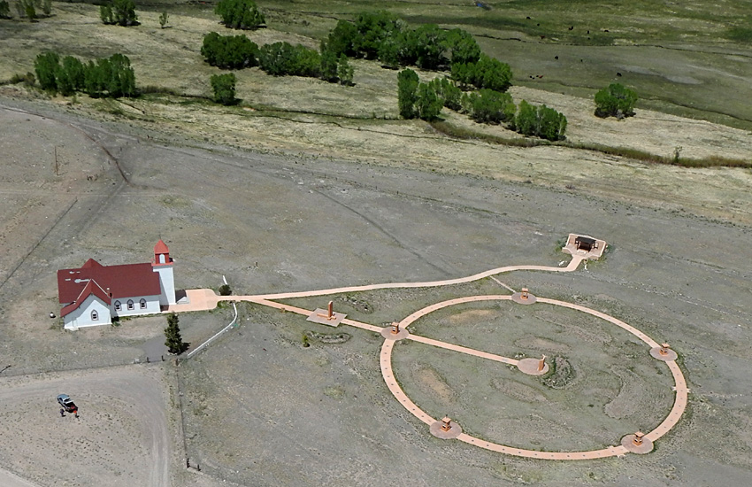
Also present at this site is a preserved fragment of original wall from a rectory built in 1879 to serve Jesuit Priests of the Society of Jesus; later it was converted to a convent for the Sisters of Loretto at the Foot of the Cross. A large circular feature was under construction (May 2012) between the church, rectory wall, and cemetery. Dirt work and drainage were completed along with concrete sidewalks. The Rosary Walk was completed in October 2012 and blessed by Pope John Paul II. We visited again in May of 2017 to rephotograph the site, when Toshiro Nagasako assisted with kite aerial photography.
 Kite aerial photographs

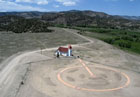
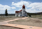
| Overviews of San Juan Baptiste Church, the Rosary Walk, and rectory wall. 2017 after completion of the Rosary Walk (left); kite flyers in lower left corner (JSA & Toshiro Nagasako). 2012 while the Rosary Walk was under construction (right). The green pasture in the right background is watered by Carnero Creek.
|  |
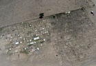
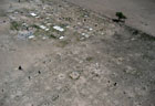
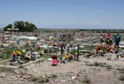
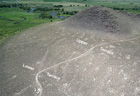
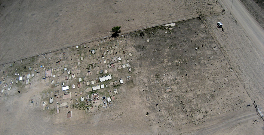
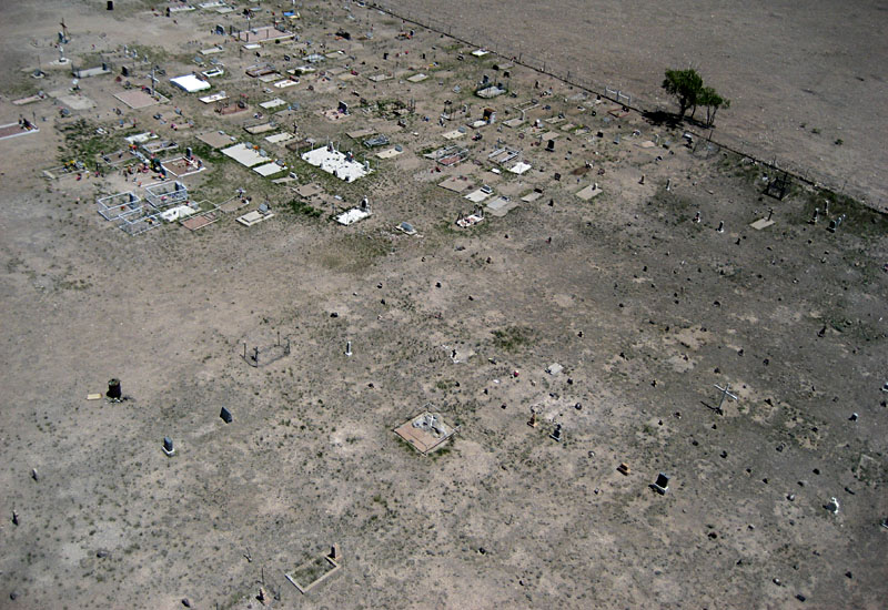
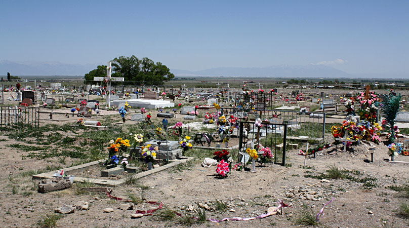
| Carnero Creek Cemetery. Left: overview of the cemetery showing clear division between the potter's field (right side) and more-elaborate graves (left side). Kite flyers in upper right corner (SWA & JSA). Right: closer view of the cemetery with potter's field in foreground.
|  |

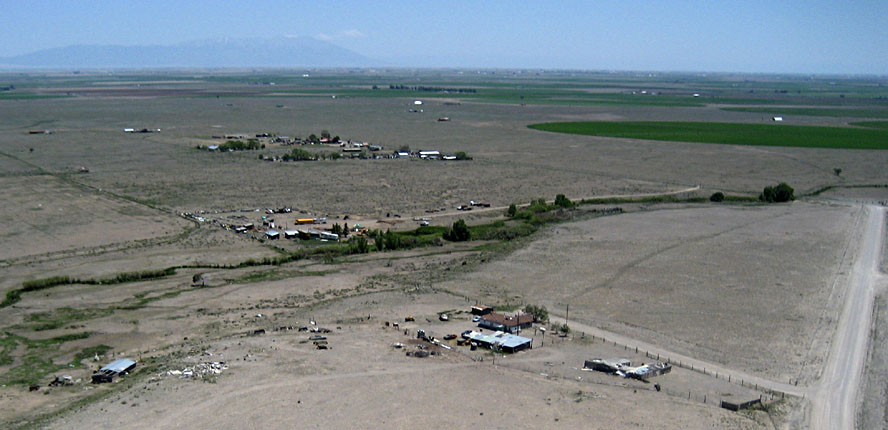
| Left: looking behind the church toward the San Juan Mountains. Small sand dunes cover the surface to left, and Carnero Creek emerges from the mountains to right. Right: La Garita with center-pivot irrigated fields in the background.
|  |
 Ground pictures
| San Juan Baptiste Church. Left: renovated church walls and roof and new white fence. Right: close-up shot of unique four-armed cross on steeple.
|  |
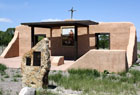
| Left: portion of the concrete walkway and contoured mounds under construction in front of the church. Right: preserved portion of the rectory and convent wall with four-armed cross.
|  |
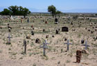
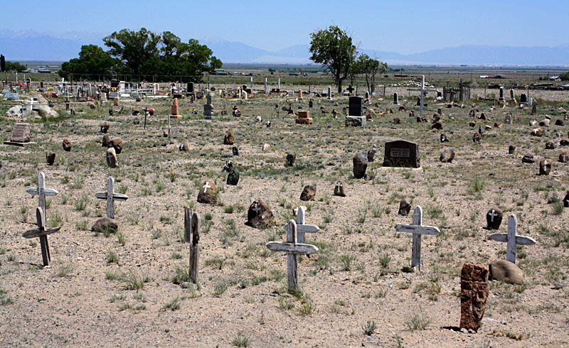
| Carnero Creek Cemetery. Left: decorated for Memorial Day. Right: potter's field section. Most markers are simple stones or wooden crosses without names.
| 
|
Return to top.
Elephant Rocks
Panoramic view with Elephant Rocks in the foreground
and foggy San Juan Mountains in the background. | |

| Left: view toward south. Elephant Rocks in the foreground consist of eroded rhyolite, granite, and volcanic scoria and tuff beds. San Luis Valley in left background with center-pivot irrigation. San Juan Mountains in the right background. Right: looking eastward with Elephant Rocks in the foreground and irrigated fields of the SLV in the background.
|  |
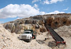
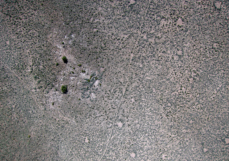
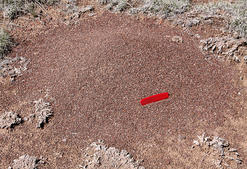
| Left: looking northward. The oval-shaped light feature in lower right is a quarry in tuff, a type of volcanic rock that was erupted along the eastern margin of the San Juan Mountains. Right: near-vertical shot showing ant hills (light patches) and animal trails. The ant hills are about 3 to 6 feet in diameter.
|  |

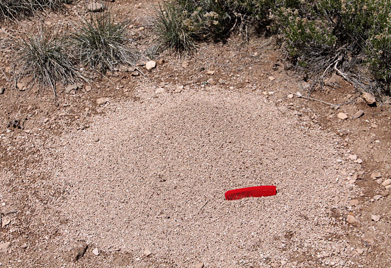
| Ant hills have distinctive colors that resemble the underlying bedrock. Ant hills on light-colored rhyolite (left) and dark-colored scoria (right). Comb is 5 inches long.
|  |
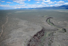
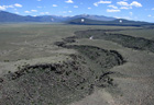
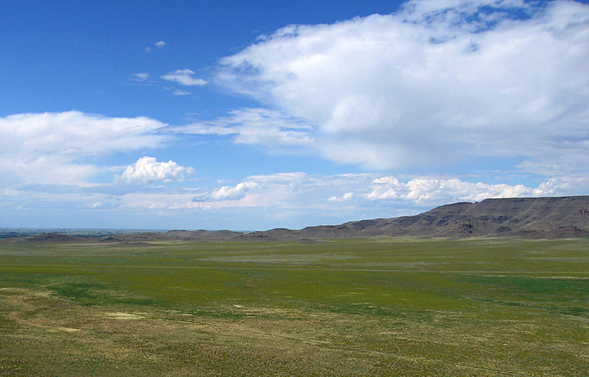
Stone Quarry
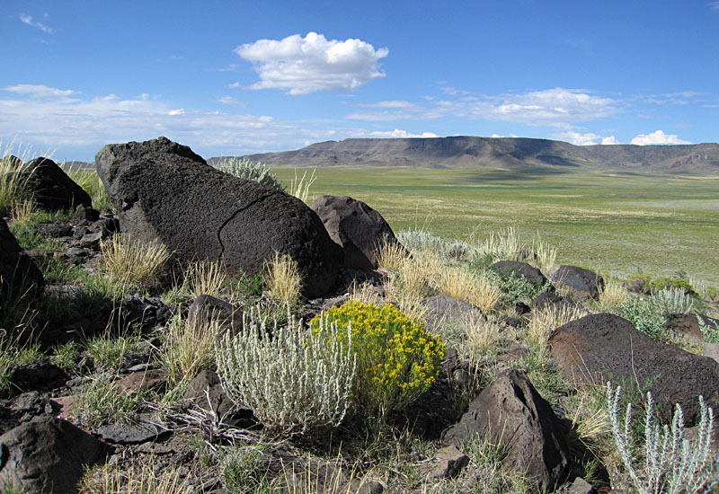
The BLM Stone Quarry locale is located on the western edge of the SLV about halfway between Monte Vista and Del Rio. Both the Elephant Rocks and Stone Quarry sites are situated at the eastern edge of lava and ash flows associated with volcanism in the San Juan Mountains. Most of the bedrock consists of rhyolite erupted during the Oligocene Epoch ~25-30 million years ago. Some younger basalt flows date from the Pliocene and Miocene epoches (~5-20 million years ago).
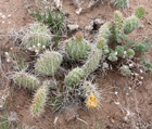
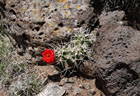
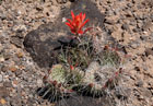
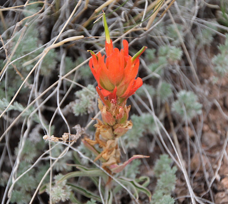
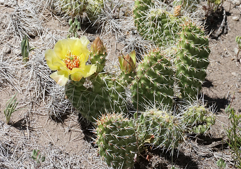
| Typical summer vegetation. Prickly pear cactus with flower,
Opuntia (left), and Indian paintbrush, Castilleja (right).

| |
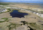
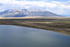
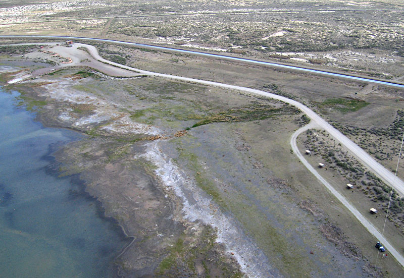
San Luis Lake State Park
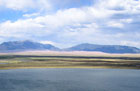
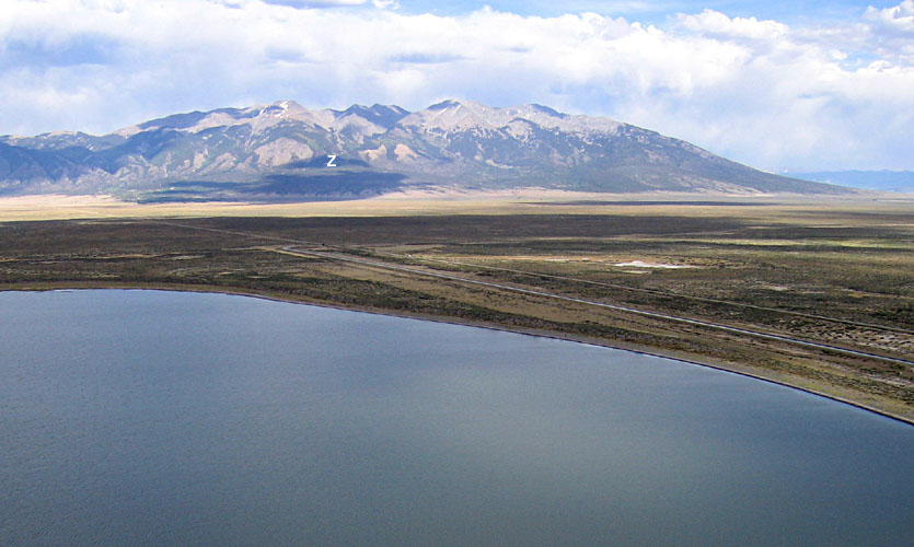
| Left: view toward northeast over San Luis Lake in the foreground with Great Sand Dunes in the background against the Sangre de Cristo Mountain range. Right: Looking southeastward over San Luis Lake with Sierra Blanca in the background with four peaks that exceed 14,000 feet elevation. Zapata Falls (Z) is located at the head of a large alluvial fan on the mountain flank.
|  |
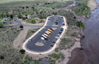
| Left: campground complex at San Luis Lake State Park in the foreground with San Luis Lakes State Wildlife Area beyond. Right: entrance to San Luis Lake State Park (upper left) and close-up view of lake shore. A water-supply canal passes behind the park entrance.
|  |
Return to top.
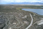
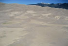
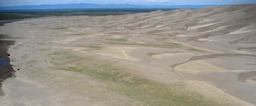
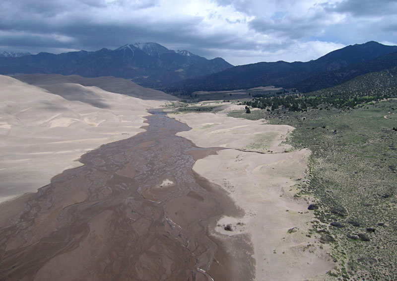
Great Sand Dunes
Overview looking westward with the dunes on the
right and Medano Creek on the left edge.
| |
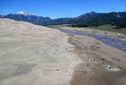
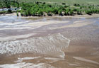
| Overview (left) of sand dunes, Medano Creek, and Sangre de Cristo range in the background. Close-up shot (right) of shallow-water wave surging down Medano Creek. Photos by JWA and students from Middle Tennessee State University.
|  |
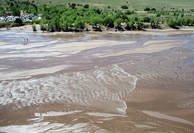
| Left: Detail of the beach, parking, and picnic areas. Kite flyers in lower left corner; the authors were assisted here by Cheryl Unruh and Dave Leiker. Right: people standing on the beach, wading across Medano Creek, and walking onto the dunes.
|  |
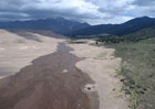
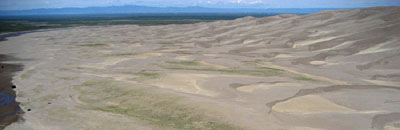
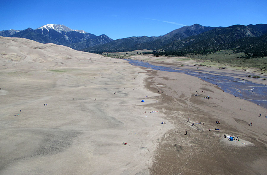
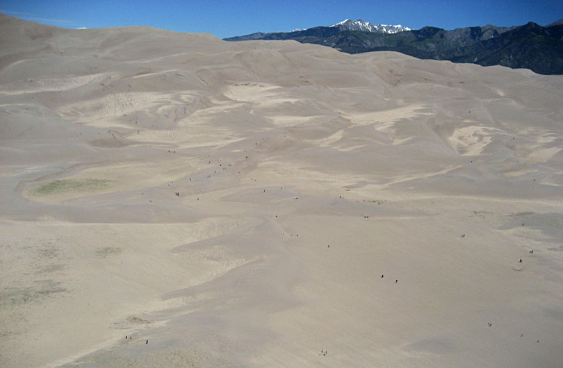
| Left: looking upsteam along Medano Creek on the eastern edge of the Great Sand Dunes with the Sangre de Cristo Mountain range in the background under clouds. Right: the dunes with the Sangre de Cristo Mountains in the background. People move over the sand like ants on a large anthill.
|  |

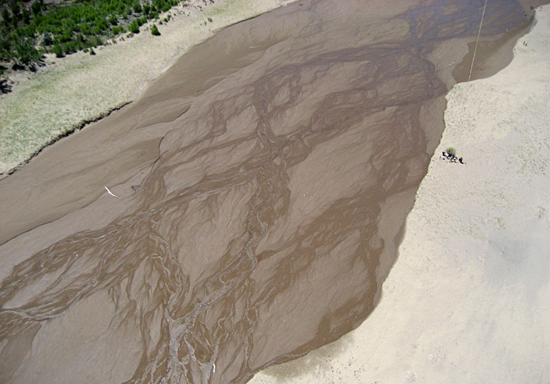
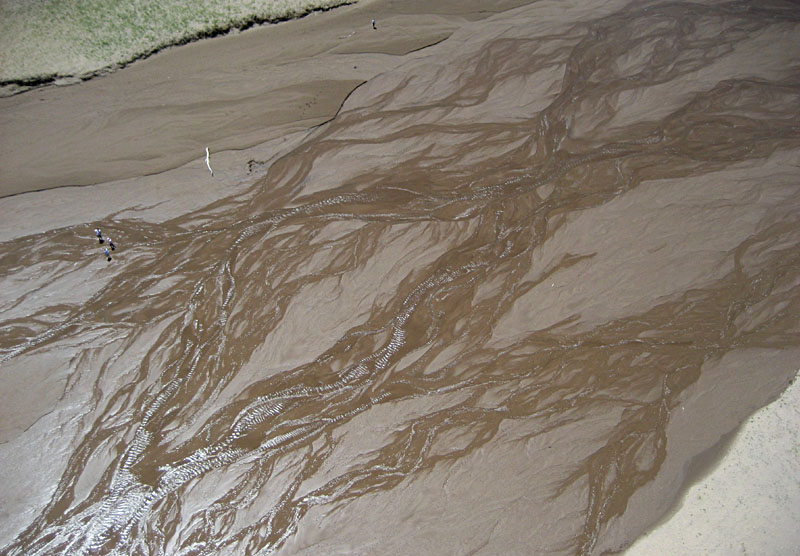
| Close-up shots of Medano Creek showing the kite flyers (left) and sun glint from water in the braided stream channels (right). Photos by JSA and students from Emporia State University.
| 
|
Blanca Peak
Upon entering the SLV from the east on US 160 highway, Blanca Peak appears dramatically north of Fort Garland. At 14,345 feet (4372 m), Blanca is the highest peak in the Sangre de Cristo Mountains and the fourth highest summit in the Rocky Mountains. The first known ascent of Blanca Peak was by the Wheeler Survey in 1874. Three other nearby summits—Mount Lindsey, Ellingwood Point, and Little Bear Peak—also exceed 14,000 feet.
The great height of the Sierra Blanca Massif is supported by uplifted granite approximately 1.7-1.8 billion years old, and the massif is flanked by huge alluvial fans that have coalesced along the southern and western sides (Chronic and Williams 2002). The lower portions of these fans merge into the desert floor of the SLV. The middle and upper portions rise with increasing slope toward the mountain front. These are among the most impressive alluvial fans anywhere in the world and have been the subject of considerable recent research (e.g. Johnstone et al. 2018).
| Seen from the west, Blanca Peak at the crest; alluvial fan in foreground is ~7800 feet elevation. Blanca Peak Road ascends the massive alluvial fan into the Sierra Blanca Massif. Note vehicle and trailer for scale.
|  |
| Views of alluvial fans on the southern (left) and western (right) sides of the Sierra Blanca Massif. Note the slightly concave surface that slopes away from the mountain. Juniper and pińon pine cover the upper portions of the fans.
| 
|
Return to top.
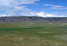
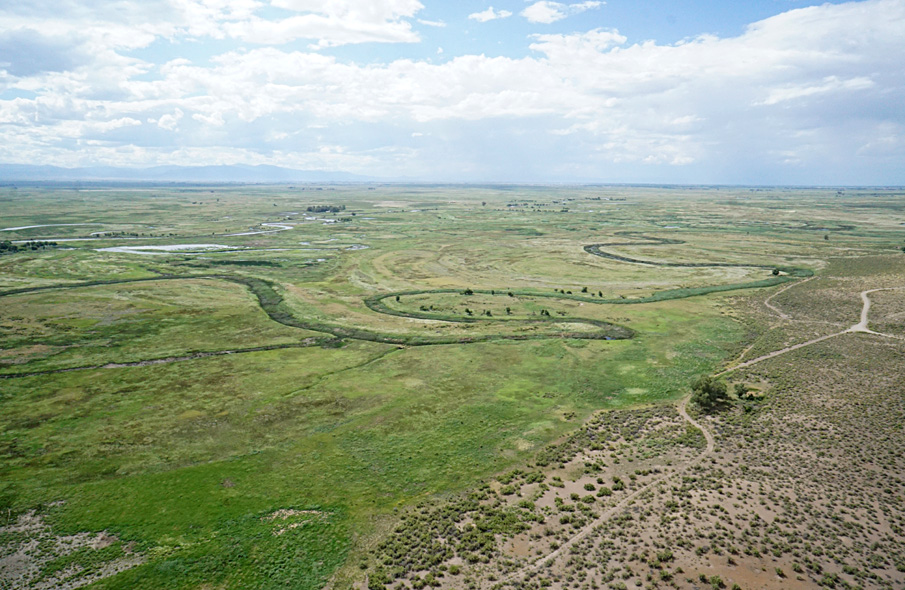
Alamosa National Wildlife Refuge
View westward
View to northwest
View northward | | |
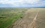
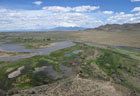
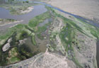
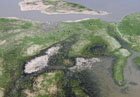
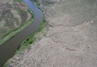
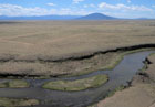
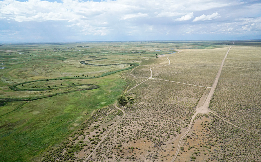
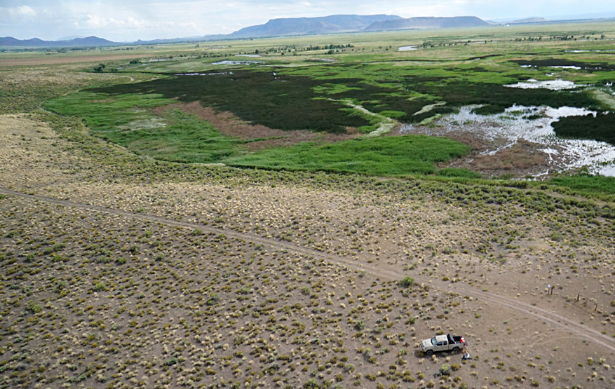
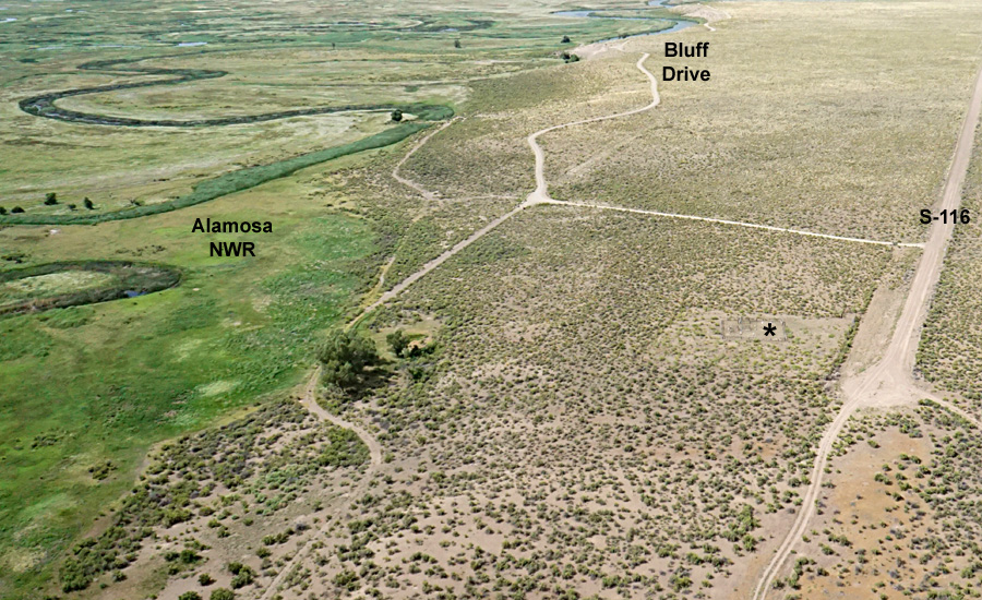
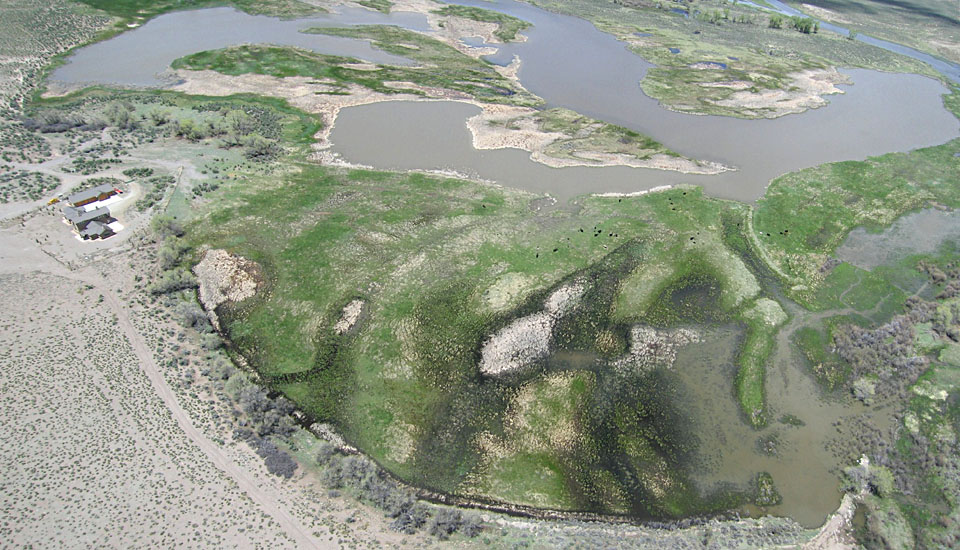
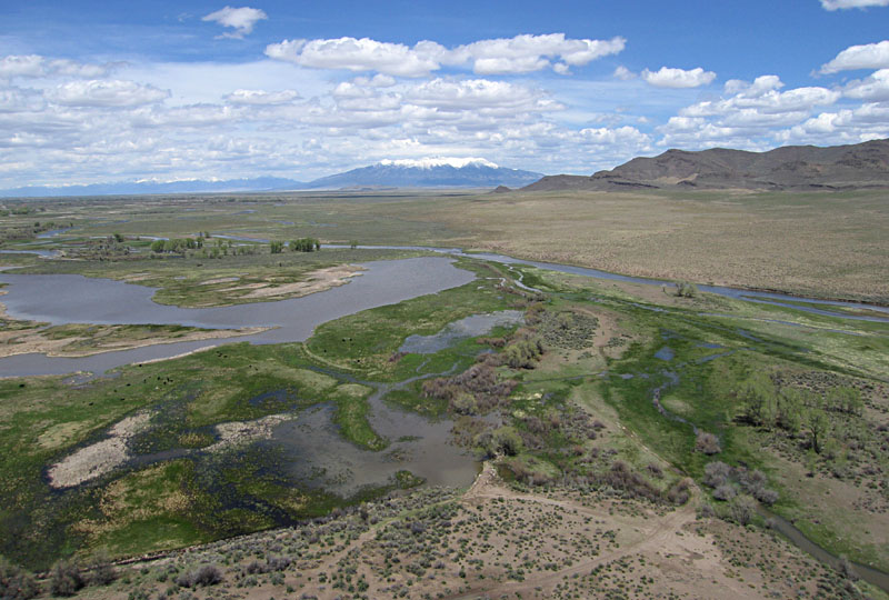
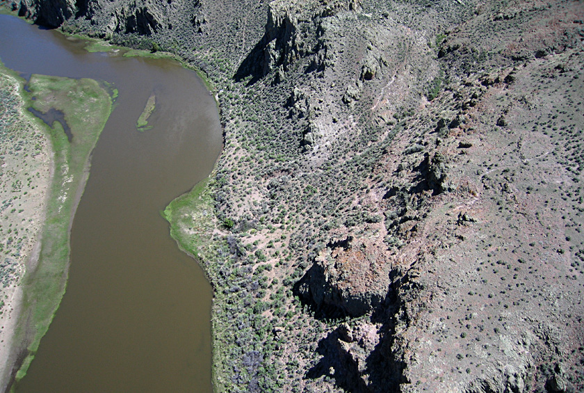
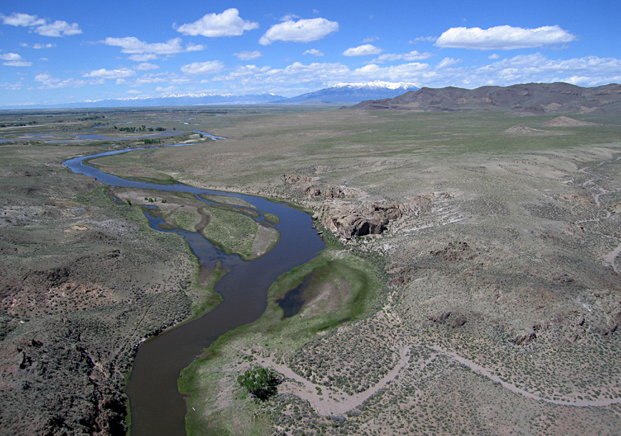
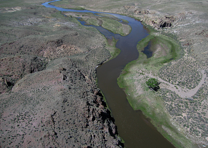
Alamosa National Wildlife Refuge (NWR) includes the Río Grande and adjacent floodplain southeast of the City of Alamosa near the center of the San Luis Valley. In this vicinity, the Río Grande splits into multiple meandering channels. Numerous secondary channels, oxbow lakes, pools, marshes, and wet meadows create a rich wetland environment. The eastern margin of the Río Grande valley is marked by a prominent terrace, known as Hansen Bluff.
Alamosa NWR hosts thousands of shorebirds and waterfowl, of which some migrate through on a seasonal basis and some nest in the refuge. Many species of ducks, geese, and cranes are especially well known—sandhill crane, Canada goose, northern pintail, American avocet, and white-faced ibis. Raptors include the bald eagle and northern harrier as well as various owls and hawks.
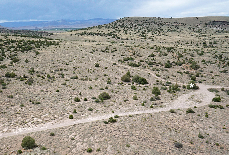
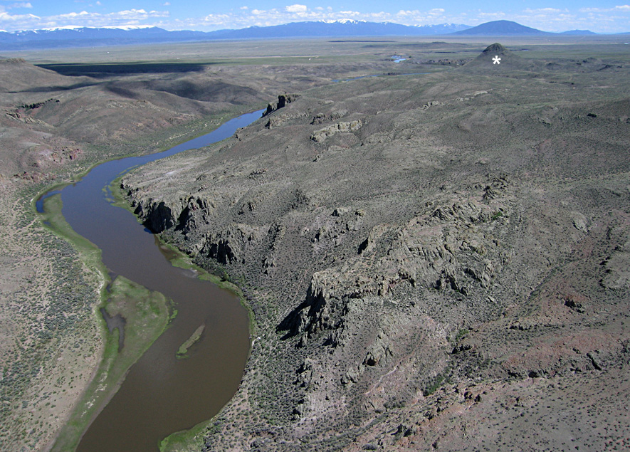
| Southeastern margin of Alamosa NWR. Looking westward (left) with the Río Grande in the background. View southward (right) toward the San Luis Hills; Flat Top at center horizon. Kite flyers are set up on Hansen Bluff at an elevation ~7550 feet (~2300 m) in a BLM area off County Road S-116 just east of the NWR.
|  |
| Bluff drive along the margin of Hansen Bluff overlooking the wetland habitats of the Río Grande valley (left). The asterisk (*) marks the Becker Cemetery (detail, right).
| 
|
| Thunderstorms surround the Alamosa NWR with clouds, rain, lightning, and blowing dust. Looking eastward (left) with the Sierra Blanca massif on the left horizon, and view northward (right). Typical weather conditions during the summer monsoon.
| 
|
City of San Luis
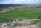
| City of San Luis with Culebra Creek valley and the Culebra Range in the background. Looking eastward (left) and toward southeast (right). San Pedro Mesa in right background. | |
San Luis is the oldest city in Colorado, established in 1851 in what was then the territory of New Mexico. San Luis is known for its acequia (ah-say-kya) system of irrigation ditches. These are community owned based on practices from Spain and northern Africa. All users share in the maintenance and operation with an elected mayordomo (superintendent) who enforces the rules. The first acequia was constructed by hand labor in 1851 to divert water from Culebra Creek. It is the oldest recorded water right in Colorado (1852), and more than 60 acequias are now active in Costilla County.
| Left: view northward over the barren volcanic plateau. Blanca Peak of the Sangre de Cristos appears in the right background. Right: looking toward the southwest over irrigated crops in the Culebra Creek valley. Stations of the Cross Shrine is visible in the lower left corner.
|  |
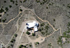
| Near-vertical shots over Stations of the Cross Shrine showing the chapel, bronze statues, and labyrinth. The shrine was created by sculptor Huberto Maestas, a San Luis native, built by volunteer labor, and dedicated in 1990. It now attracts thousands of visitors every year.
|  |
Irrigation near Romeo
Irrigated agriculture is the economic foundation for the San Luis Valley, which began with the "ditch boom" of the 1880s. Water is diverted from numerous rivers and streams that flow into the valley from surrounding mountain ranges. In the vicinity of Romeo and Manassa, water is derived from the Conejos River and channeled northward via the Romero Ditch, Bountiful Lateral, and Romeo Canal. Upstream in the San Juan Mountains, the Platoro Dam and Reservoir regulate water flow downstream for the Conejos Water Conservancy District (Simonds 2015).
View toward northeast
Looking eastward
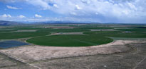
View toward southeast | | |
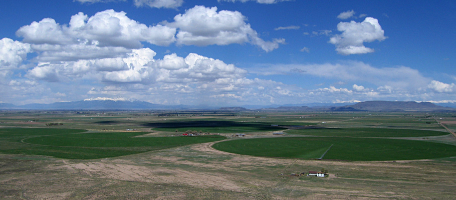
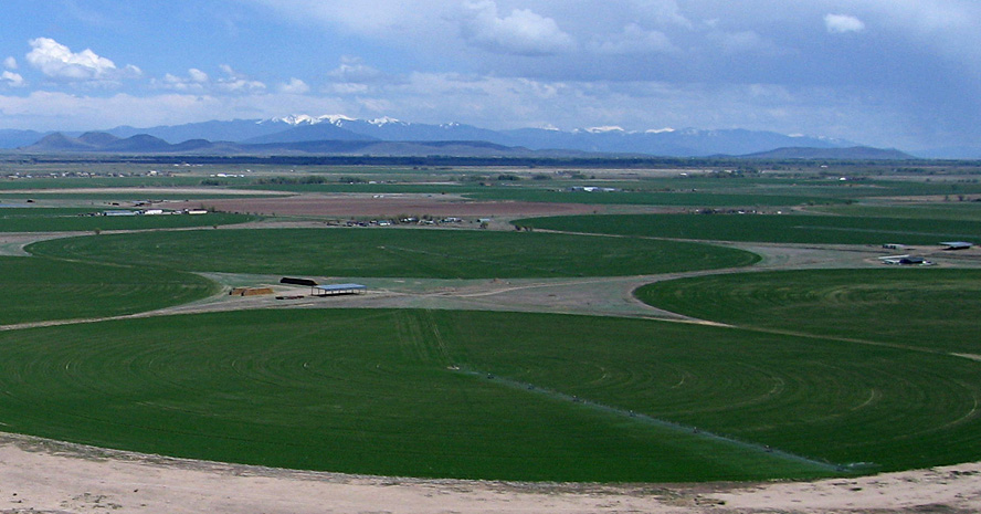
Center-pivot irrigation circles vary typically from a quarter-mile to half-mile in diameter. Major crops include potatoes, alfalfa and hay, wheat, barley and canola, as well as spinach, carrots, lettuce and other vegetables (Dillon 2003). For example, more than 40,000 acres (>16,000 ha) are contracted in the SLV to grow malt barley for the Coors Brewing Co. The environment for growing potatoes is nearly ideal. Cold winters curtail agricultural pests and diseases, which reduce the need for pesticides, and surrounding mountains are a natural barrier for outside insects and diseases.
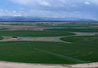
| Left: looking toward the northeast with snow-capped Blanca Peak and the Sangre de Cristo Range in the background. Right: close-up view of center-pivot irrigation with the Culebra Range in the distance.
| 
|
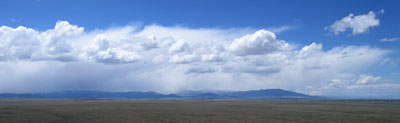
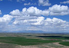
Clouds and rain over the San Juan Mountains.
Snow and rain are the source for irrigation.
Return to top.
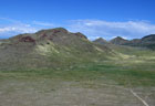
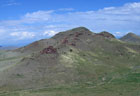
Saddleback Mountain
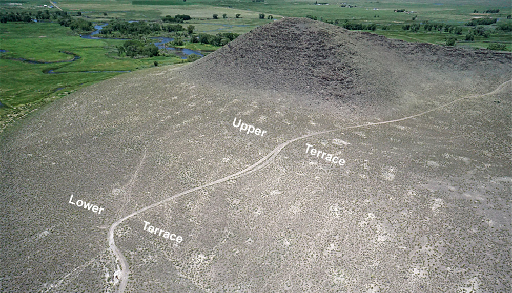
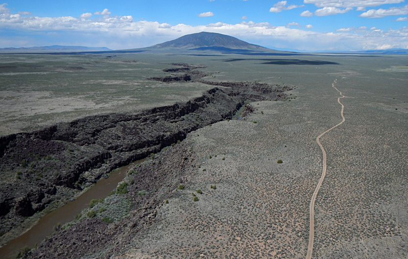
Located east of Sanford at the northern end of the San Luis Hills, Saddleback Mountain is so named because of a sag between two hills that resembles the profile of a saddle. The local bedrock consists of basalt and scoria in nearly horizontal layers of the Hinsdale Formation, which is dated approximately 26 million years old (Machette et al. (2007). The Conejos River flows beside the western and northern margin of Saddleback Mountain and delivers irrigation water to the adjacent valley.
When Lake Alamosa stood at its highest level, Saddleback Mountain was a small island. The lake reached far westward and northward. Storm-driven waves eroded the northern side of the island, and bouldery sediment was transported and deposited as spits of beach gravel on the southern side of the island. These spits are well preserved as terraces or benches at two levels: 7660 feet (upper) and 7640 feet (lower). In fact, this site is a key location for understanding the extent and age of Lake Alamosa (Machette et al. 2007, p. 63).
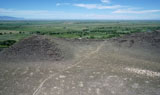
| Looking northward (left) with the central San Luis Valley in the background. The trail leads up to the low saddle between two higher hills. View toward northwest (right) with the Conejos River valley behind western Saddleback Mountain and the San Juan Mountains on the distant horizon.
| 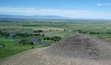
|
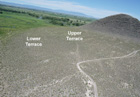
| Two views of gravel terraces on the southern side of western Saddleback Mountain. High terrace is ~7660 feet, and low terrace is ~7640 feet in elevation. The high stand of Lake Alamosa at 7660 feet (2330 m) elevation is now considered to be ~360,000 years old (Ruleman et al. 2016).
|  |
| Looking to the northeast (left) along County Road W with Sierra Blanca in the far left background. View eastward (right) toward the San Luis Hills. The Culebra Range is a faint silhouette on the far horizon. Vegetation consists of mesquite, sagebrush, rubber rabbitbrush, and various cacti.
|  |
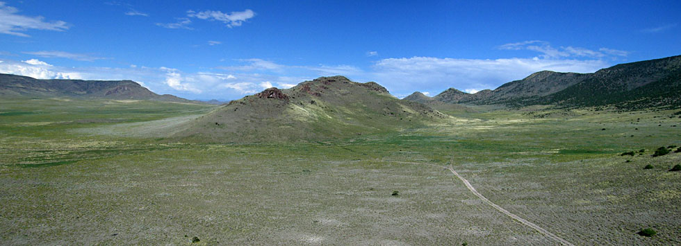
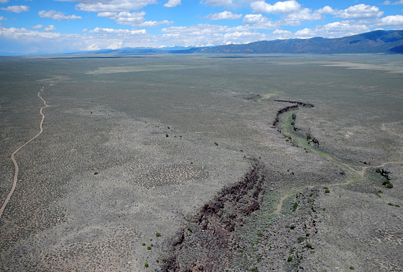
San Luis Hills
The San Luis Hills is an uplifted fault-block of older strata in the center of the valley between Manassa and San Luis and extending southward to near the New Mexico-Colorado border. These hills are composed of various volcanic and intrusive rocks mainly Oligocene in age (Thompson and Machette 1989). Different portions are known as Brownie Hills, Fairy Hills, Flat Top, and Pińon Hills. The rugged terrain, lack of water, and sparse vegetation have limited human settlement and agriculture, although some mining has taken place.

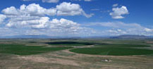
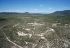
| Panoramic view of the San Luis Hills. Pińon Hills at center and to right. Flat Top hill in left background. Assembled from two wide-angle shots. | |
| Pińon Hills overview (left) and closer shot (right). These hills are irregular in size and shape; they are supported by andesite flows of various types and shallow intrusions of brick-red color.
|  |
| Overview of Flat Top hill (left) which is capped by lava flows of basalt. West of Flat Top hill (right). Notice the yellow color in the desert vegetation (see below). The faint line running across the scene is Colorado highway 142.
|  |
| Left: mine that produced the Manassa Green variety of turquoise (Bauer 2011), and which is still being worked today. Right: basalt boulders on a knob. The small bush with yellow flowers is rubber rabbitbrush (Ericameria nauseosa), a member of the Aster family.
| 
|
Return to top.
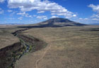
Río Grande del Norte
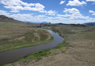
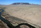
Río Grande at Lasauces
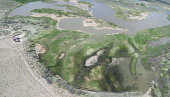
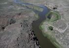
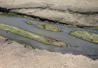
| Río Grande enters a shallow basin that contains numerous channels, lakes, and islands.
| |
Just north of the San Luis Hills, the Río Grande flows into a shallow depression of low gradient. The river here forms a delta with multiple channels, islands, and small lakes. This site is where Lake Alamosa was dammed by uplift of the San Luis Hills immediately to the south. The lake was up to 150 feet deep, as noted above, and covered much of the central and northern SLV. It overflowed and eroded a canyon across the San Luis Hills about 360,000 years ago (Ruleman et al. 2016). Nonetheless, a small basin still exists at Lasauces (the willows) just north of the canyon. The flow of the river is much reduced nowadays by upstream extraction of water for irrigation and municipal usage.
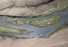
| Left: overview looking northward. The Río Grande enters from upper left and exits to right. Snow-capped Blanca Peak in background. Right: delta form of the Río Grande, which resembles a typical bird-foot pattern of distributary channels.
|  |
| Close-up view of cattle grazing on wet meadows (left), and conducting kite aerial photography on BLM public land beside the Río Grande (right). Note the stark contrast between the sagebrush desert and the river valley.
|  |
| Overview (left) and closer shot (right) looking downstream toward the south. The Río Grande enters a canyon through the San Luis Hills. This section is class I-II (beginner) on the scale of river difficulty for small boats (Bauer 2011).
|  |
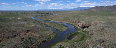
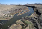
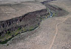
Río Grande at Fairy and Brownie Hills
| Looking north toward Lasauces. Snow-capped Blanca Peak and the Sangre de Cristos are on the far horizon.
| |
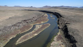
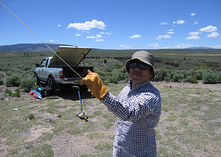
Southward from Lasauces, the Río Grande has cut a canyon across the San Luis Hills, specifically the Brownie Hills to the east and the Fairy Hills to the west. These hills are composed of the Conejos Formation, an uplifted older (Oligocene) assemblage of various lava flows and small intrusions (Thompson and Machette 1989). Canyon walls are highly irregular owing to the complex structure of the igneous rocks. Sugar Loaf is a small but conspicuous conical hill along the western edge of the canyon. This section of the river is rated class I to II for easy canoe trips (Bauer 2011). Toshiro Nagasako assisted with kite aerial photography at this site.
| Looking southward over the Fairy Hills to right of river. Left: overview showing Sugar Loaf (*), a small, dark conical peak. Behind Sugar Loaf is Ute Mountain, a large volcano in New Mexico. Right: steep canyon walls lead down to the Río Grande.
|  |

| Looking northward with the Brownie Hills to right of river. Left: overview with snowy Blanca Peak and the Sangre de Cristos in the distance. Right: entrance to the canyon in the foreground. Note the sparse desert vegetation dominated by sagebrush.
|  |
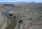
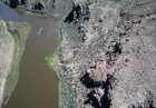
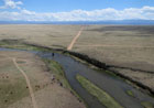
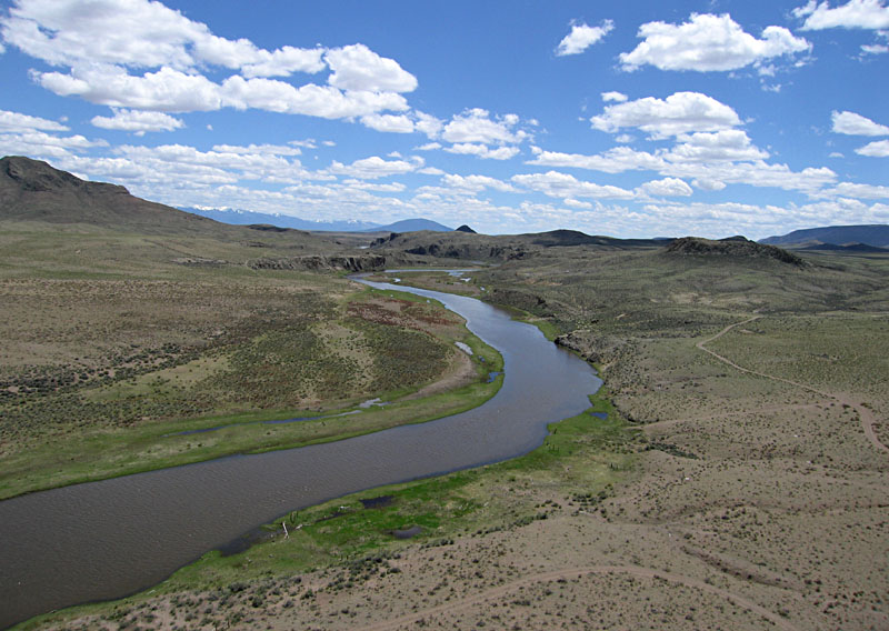
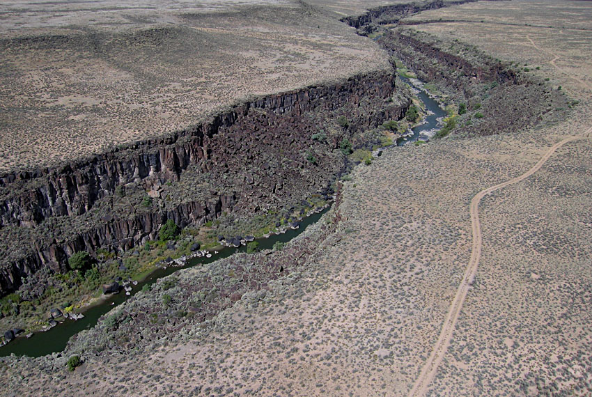
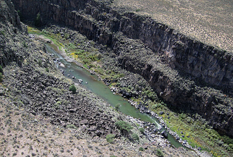
Río Grande near Manassa
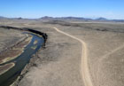
| Río Grande looking upstream (northward). Channel walls are formed by lava flows. The narrow river channel is known as "The Box" here. | |
| Left: view northward over Río Grande Avenue. Brownie Hills in the mid-distance, and Blanca Peak in the far right background. Right: looking to the northwest with Flat Top hill (9211 feet) on left side. Brownie Hills and Flat Top are parts of the San Luis Hills, an older block of crust uplifted in the center of the SLV.
| 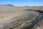 |
| Left: looking downstream to the southwest toward Pińon Hills in center. Right: remains of a former water-control structure; water presumably was diverted into a canal for delivery to irrigated fields downstream. This section is class I-II (beginner) on the scale of river difficulty for small boats (Bauer 2011).
|  |
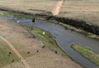
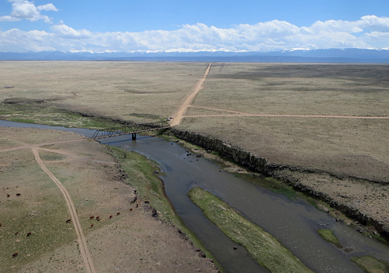
Lobatos Bridge near Mesita
The Lobatos Bridge was constructed in 1892 by Joseph F. Thomas of Manassa. He was a civil engineer and county surveyor. When built, it was the longest and highest double-span steel truss bridge west of the Mississippi (Bauer 2011). The bridge was designated on the National Registry of Historic Structures in 1985. This one-lane bridge is the last crossing over the Río Grande in Colorado. This site also marks the upstream limit of canyon erosion by the Río Grande. Canyon cutting in the vicinity of Ute Mountain began ~250,000 years ago and was largely completed by ~200,000 years ago. The canyon then began to extend northward, and it reached the Lobatos Bridge position around 140,000 years ago (Ruleman et al. 2016).
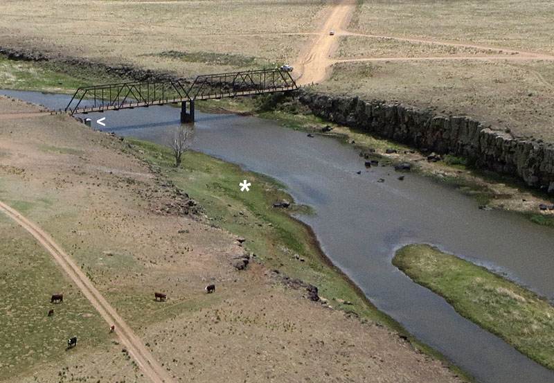
| Lobatos Bridge on county Road G. Overview (left). Culebra Range is covered in snow in the background, and cattle graze on the sparse vegetation. Close-up shot (right). A USGS/Colorado gaging station is located at the left end of the bridge (<), and this is a designated takeout and launch site for river trips (*) on the Río Grande (Bauer 2011).
|  |
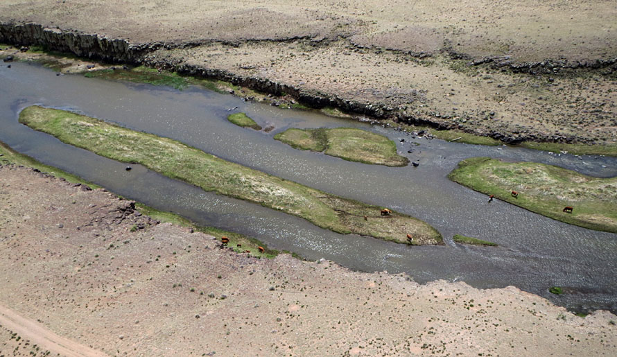
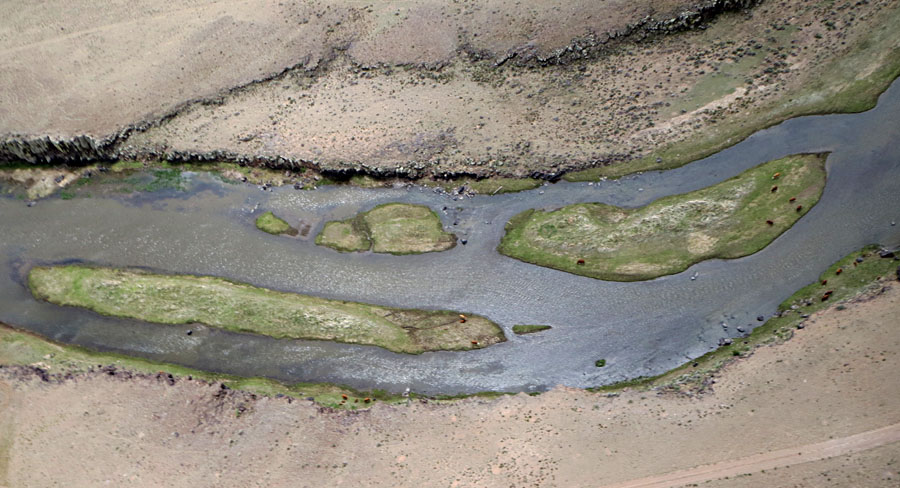
| Close-up shots of cattle grazing on lush vegetation on islands and shoreline in the Río Grande channel. Channel walls are formed by lava flows of basalt, a heavy black rock.
|  |
| Left: looking toward the southeast. The dark conical peak in the distance is Ute Mountain, a young volcano in New Mexico (see below). Right: ground shot of the river, bridge, and cattle.
| 
|
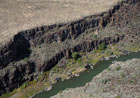
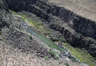
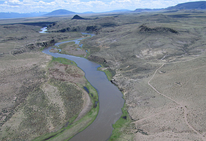
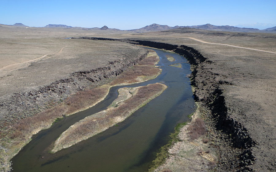
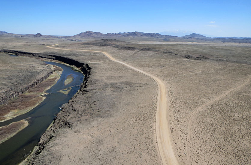
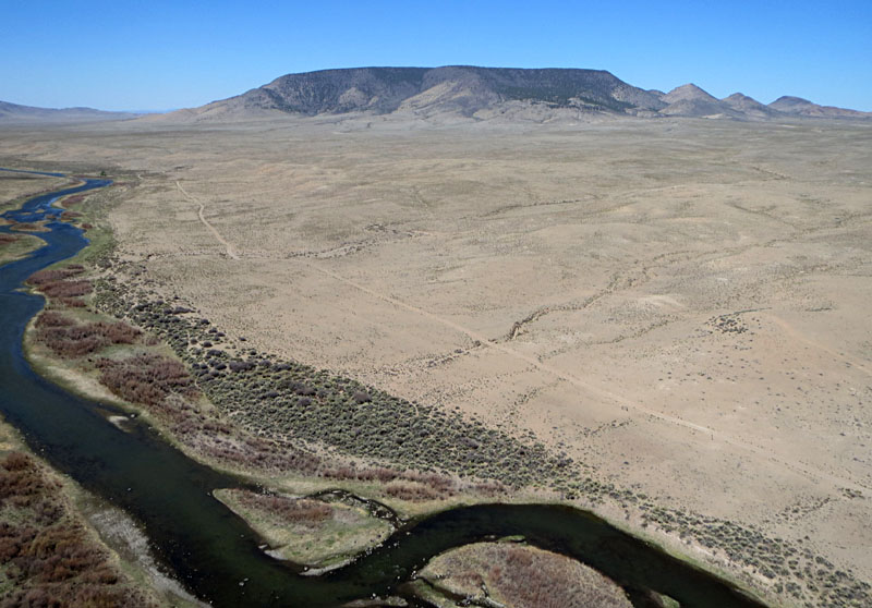
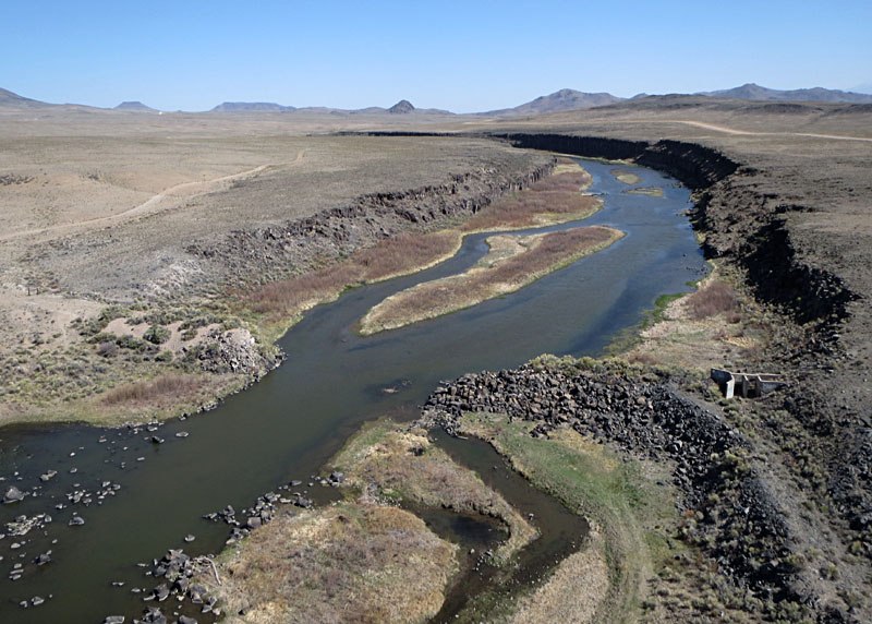
Río Grande near Ute Mountain
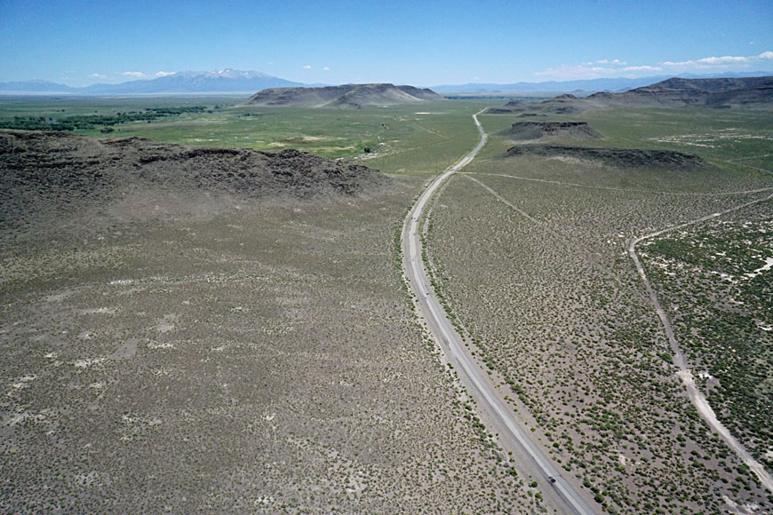
Río Grande del Norte National Monument was established in New Mexico by President Obama in 2013. The monument covers nearly 380 square miles along the river corridor southward from the Colorado border. The monument is operated by the Bureau of Land Management (BLM) as part of the National Conservation Lands. Traditional activities include recreation, grazing, hunting, fishing, and gathering firewood and pińon nuts. All vehicles must stay on established roads.
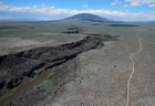
| Overviews of the Río Grande looking northward with Ute Mountain in the background. Ute Mountain is among the youngest, large volcanic features in the SLV dating from the Pliocene (Ruleman et al. 2016). The Río Grande has carved a deep canyon nearby through thick lava flows of basalt.
|  |
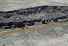
| Close-up shots of the Río Grande gorge. Cliffs display prominent columnar (vertical) jointing. These lava flows are part of the Servilleta Basalt, which was erupted in the Taos Plateau between 4.8 and 2.8 million years ago (Bauer 2011). This section is class II (beginner) on the scale of river difficulty for small boats.
|  |
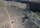
| Conducting KAP beside the Río Grande gorge (left). The canyon is about 200 feet (60 m) deep here. Overview of sagebrush desert, clouds and rain (right). Approaching rain led to rapid departure just ahead of the storm and before the dirt track became impassable.
|  |
Río Grande at Lee Trail
The San Luis Valley is bounded at its southern end by a cluster of large volcanoes west of Questa, New Mexico. These include Guadalupe, Cerro de la Olla, Chiflo Cerro, and Cerro del Arie, among several, that mark the northern edge of the Taos Plateau. At this point, the Río Grande gradient changes dramatically. Between Lobatos Bridge (CO) and Lee Trail the river gradient averages only 6˝ feet per mile, but downstream steepens to 75 feet per mile between Chiflo Trail and the Red River (Bauer 2011). Above Lee Trail river difficulty is class II, but downstream difficulty jumps to IV – V+ suitable only for expert boaters.
Lee Trail is the last access point on the Río Grande canyon in the San Luis Valley; the rough trail descends 215 feet (70 m) from the parking area on the plateau to the river bank below. The canyon walls here are formed in lava flows of the Servilleta Basalt, as near Ute Mountain. Eruption and growth of volcanoes near Questa, beginning about 6 million years ago and continuing to ~1 million years ago, blocked local drainage and led to a lake in Sunshine Valley between Ute and Guadalupe mountains. The lake dried up by 640,000 years ago (Machette et al. 2011). Toshiro Nagasako assisted with kite aerial photography at this site.
| Looking north toward Ute Mountain, Río Grande canyon, and the access road to Lee Trail (left). Close-up shot of the canyon and river showing columnar jointing in lava flows (right). Small, fan-shaped rock falls are visible on the canyon walls (*).
|  |
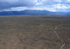
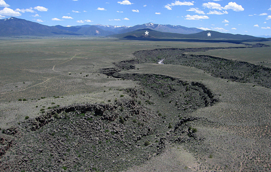
| Sunshine Valley (left) with a small tributary to the Río Grande canyon. Sangre de Cristos in the background. View southward (right) to the Guadalupe Mountains (*) with the Sangre de Cristos on the right horizon. A tributary canyon in the foreground joins the main Río Grande gorge just below Lee Trail.
| 
|
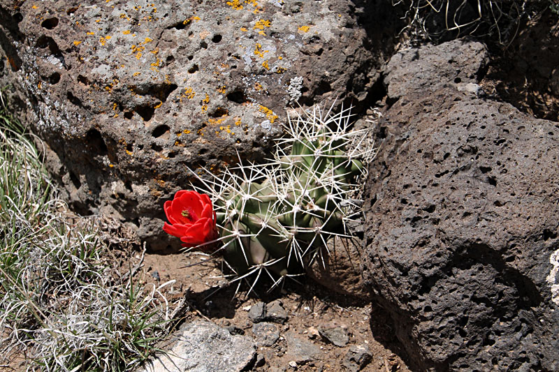
| Beauty and the beast – spring wildflowers
and cactus growing on basalt and gravel.
Left: Hedgehog cactus (Echinopsis).
Right: Indian paintbrush (Castilleja).
 | |
Return to top.


