| Kite Aerial Photography
James S. and Susan W. Aber |
| Fain Lake | Coconino |
| Granite Mountain | Geology |
| Verde River | References |
|
| Kite Aerial Photography
James S. and Susan W. Aber |
| Fain Lake | Coconino |
| Granite Mountain | Geology |
| Verde River | References |
The Verde River and Aqua Fria River are the princpal drainages in the county. Geology of the region consists of uplifted blocks of ancient basement rock in mountain ranges and relatively young volcanic deposits in the valleys. County elevation ranges from over 7900 feet to under 1800 feet. Elevations of our KAP sites are from about 5200 feet to 3900 feet (1600 – 1200 m), which certainly qualify as high altitude in all cases (Aber et al. 2019).
Fain Lake, Prescott Valley (2019)
Fain Lake is a small reservoir in Prescott Valley dammed in a narrow canyon on Linx Creek. Lake surface elevation is 5075 feet (~1560 m). The lake is designated as "community fishing water" by the Arizona Game and Fish Department. Several sport fish include channel catfish, rainbow trout, sunfish, and largemouth bass. Surrounding rocky outcrops consist of granodiorite, which is similar to granite but with a higher portion of dark-colored minerals. Age of the granodiorite is middle Proterozoic, approximately 1680 million years old (Johnson et al. 2013). Tailings piles and gravel pits from old mines are found along Lynx Creek valley nearby.
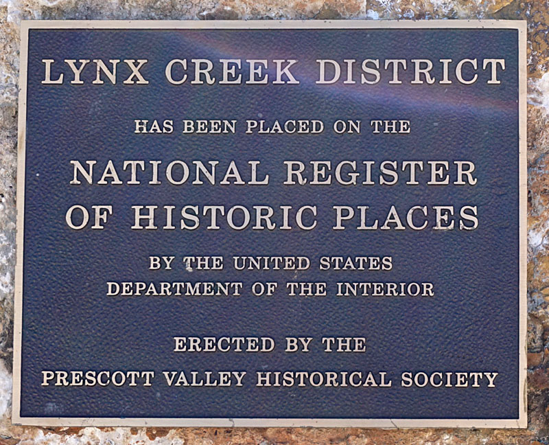
| The Linx Creek District is listed on the National Register of Historic Places. Monument at Fain Park adjacent to our flying station on the ground. |
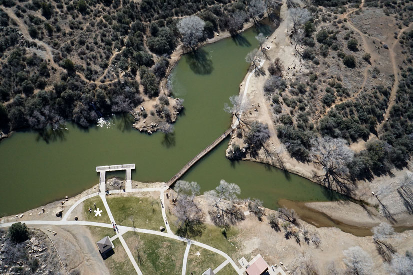
| Fain Lake with picnic area and fishing dock (left). Linx Creek enters the lake at upper right. Kite flyers to lower left (*). Lake and dam (right) with the Chapel of the Valley on the adjacent hill top. | 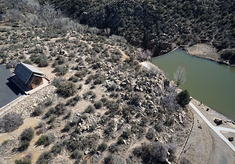 |
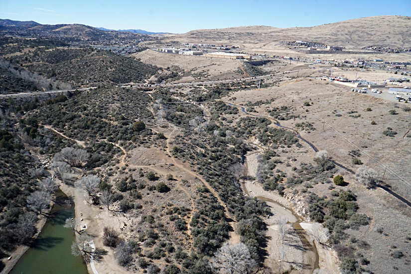
| View westward (left). Linx Creek enters the lake at lower left, another small tributary, Alberson Wash comes in at lower right. The road in background is Stoneridge Drive. Overview looking to south (right). Again, Stoneridge Drive is the road in background. | 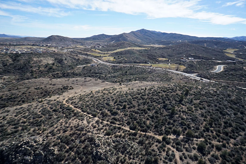 |
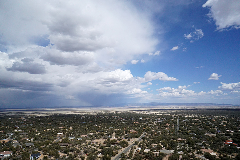
| Overview toward north (left) along 5th Street. Commercial enterprises and residential area beyond. Note the powerline across bottom of view; we set up to avoid this obstacle. Also a water-supply canal is visible. Water is diverted from upstream and feeds into Mesa Reservoir downstream (right). |  |
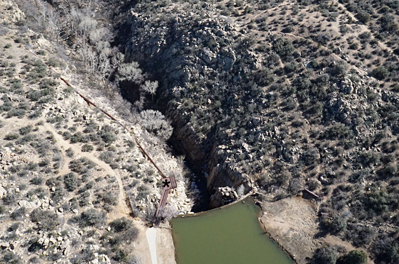
| Close-up shot of the Fain Lake dam (left). An observation deck (*) overlooks the narrow canyon below the dam. Even closer view of granodiorite rock outcrop (right) next to dam. | 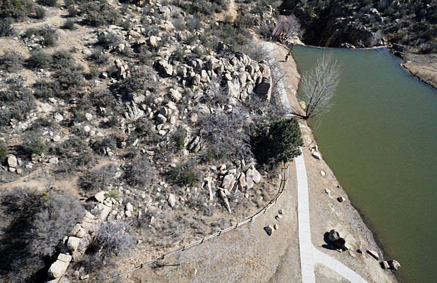
|
 the Hwy 89A Trailhead. Assembled from two wide-angle shots. |
| Overview (left) and closer shot (right) looking northward. Loy Butte Road appears on left and Hwy 89A on right of overview. Red and buff colors of the Mogollon Rim are highlighted in the afternoon sun. | 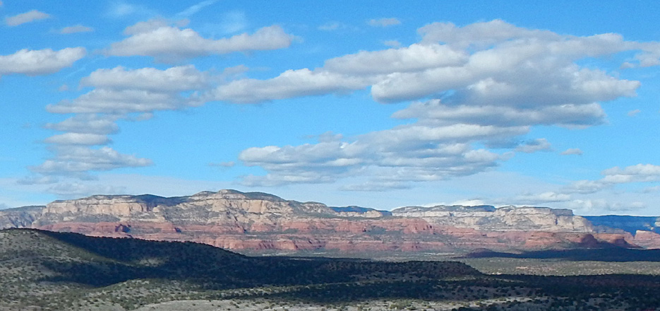 |
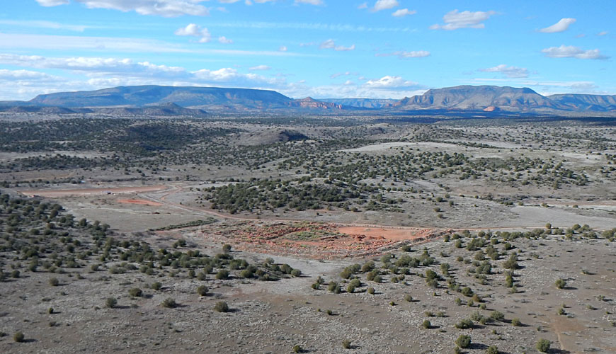
| Left: red patch in the center of view is Dad Jones Tank. The term "tank" refers to a desert water hole, such as a spring, well or depression that may hold water and contain a pond or wetland. Right: close-up view of parking area for vehicles and trailers used for dirt bikes and ATVs. | 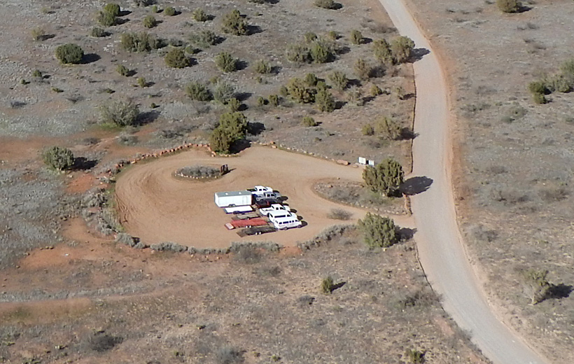 |
| White Flat Tank just east of Hwy 89A appears to be the site of some irritation—note white pipes on ground and water sprays. Overview (left) and close-up shot (right). The purpose of irrigating the desert vegetation is unknown. | 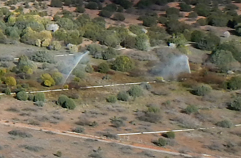 |
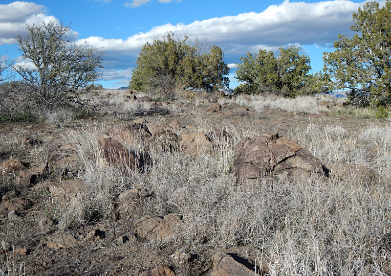
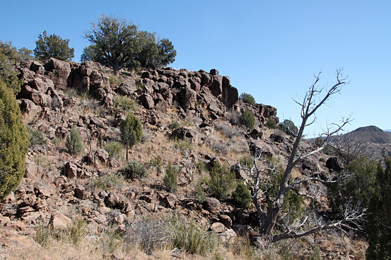
| Ground shots of juniper trees, grass, small flowering plants, and prickly-pear cactus growing on rocky basalt outcrops. We had to step carefully in this terrain. | 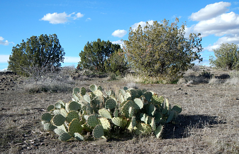
|
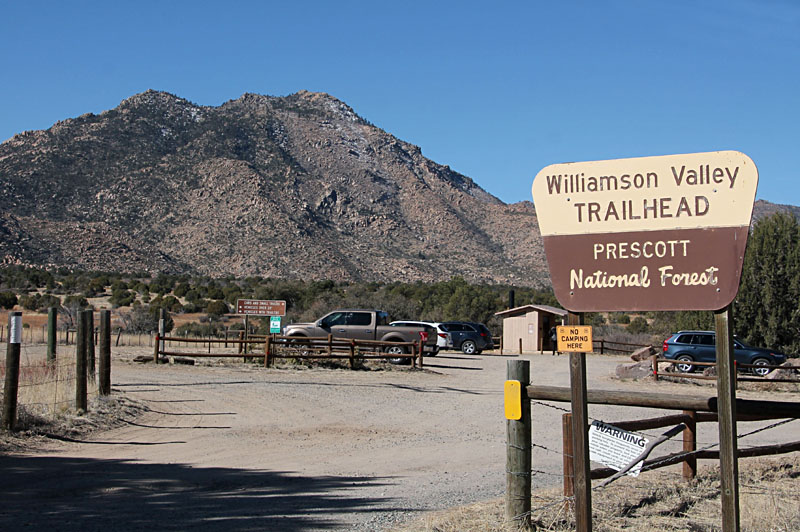
| Entrance to Williamson Valley Trailhead (left) with Granite Mountain in the background. Aerial shot (right) of the trailhead parking area with a storm in the background. | 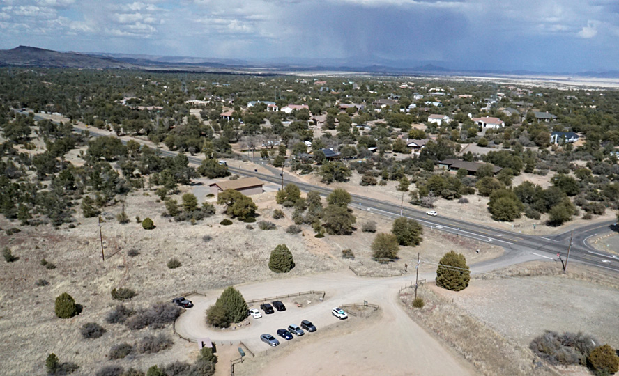
|

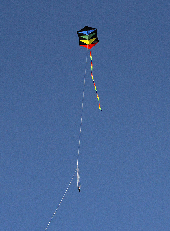
| Kite flyers (left). JSA observes the camera rig with binoculars while SWA handles the kite-line reel. Rokkaku (right) in flight during KAP session. The kite measures 7˝ by 6 feet in size. Photos by J. Schubert. | 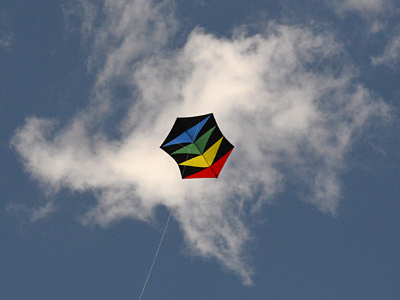 |
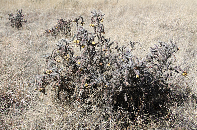
| Ground hazards, especially during takeoff and landing, could snag the line, kite, or camera rig, as well as human skin. Cholla (left), Cylindropuntia, is a genus in the cacti family. Prickly pear (right), Opuntia, is also a genus in the cacti family. The spines of both easily puncture boot leather. | 
|
The Basin and Range Province includes most of Nevada, southern and central Arizona, and parts of adjacent states between the Sierra Nevada and Colorado Plateau. This region underwent tension and was stretched east-west approximately 250-300 km (~150-190 miles) during the past 30 million years; most of this expansion took place within the past 16 million years (Baldridge 2004). Extension of the crust was connected with the North American plate overriding the Farallon Plate and East Pacific Rise along subduction zones on the western margin of the continent.
Two major consequences of crustral stretching were firstly deep-seated faults along which basins (wide valleys) dropped down and intervening ranges of basement rock rose up. The Sierra Prietas is one such uplifted fault block, and the Chino and Prescott valleys to the east occupy a basin. Secondly magma migrated upward along faults and erupted in numerous volcanic centers. For the most part, the magma was derived from the mantle (beneath the crust) and is basaltic in composition. Hyrdothermal fluids from shallow magma led to widespread mineralization including turquoise and copper, for which Arizona is well known.
Lava flows of Miocene and Pliocene age (23 to 2˝ million years old) partly cover the lower flanks of Granite Mountain (Spencer and Young 2012). These lava flows take two forms. Vesicular (bubbly) basalt is dark gray to nearly black in color. Given its high iron content, basalt has a high density and is heavy in spite of its swiss-cheese texture. Scoria has a rust-red (scorched) color and a foamy texture that gives it a lower density. The sand and gravel in ephemeral washes reflect these two sediment sources, namely ancient Granite Mountain and relatively young basaltic lava.
![]() Kite aerial photographs
Kite aerial photographs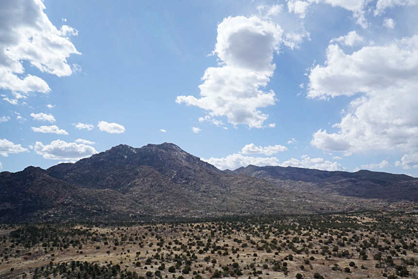
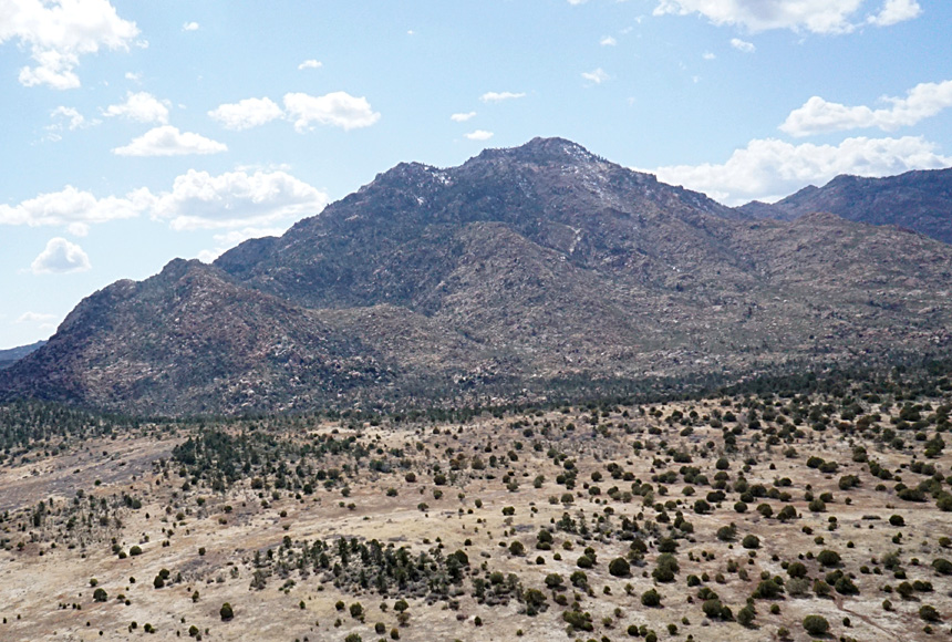
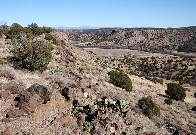
Looking southwest toward Granite Mountain. Overview (left) and closer view (right). Sparse juniper dots the foreground, and patches of snow are visible on the highest peaks.

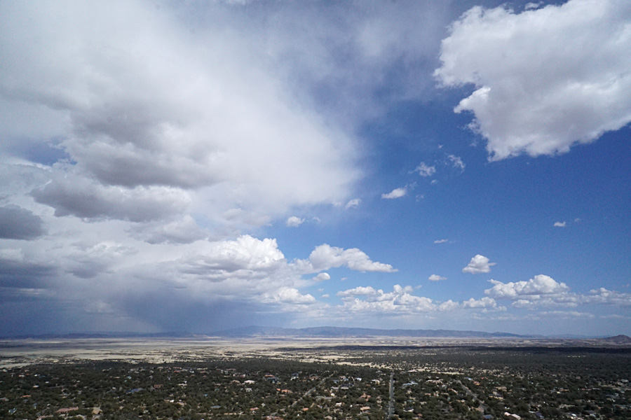
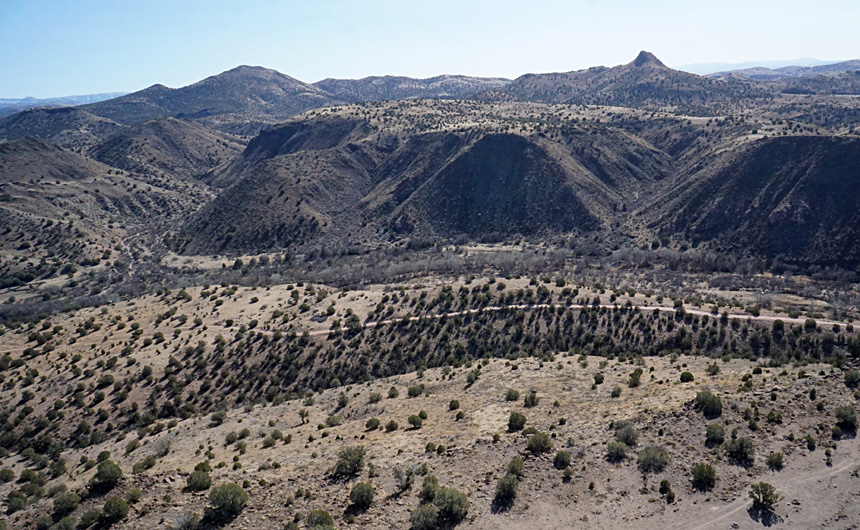
Views eastward over Chino and Prescott valleys. A storm front approaches from the north (left) and comes closer (right). We finished our KAP and packed up equipment just as the first raindrops began to fall.
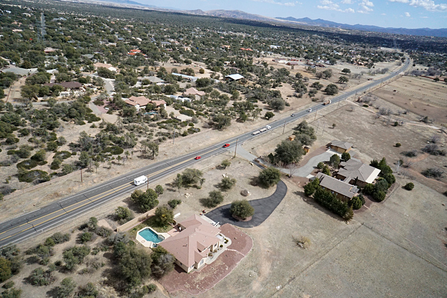
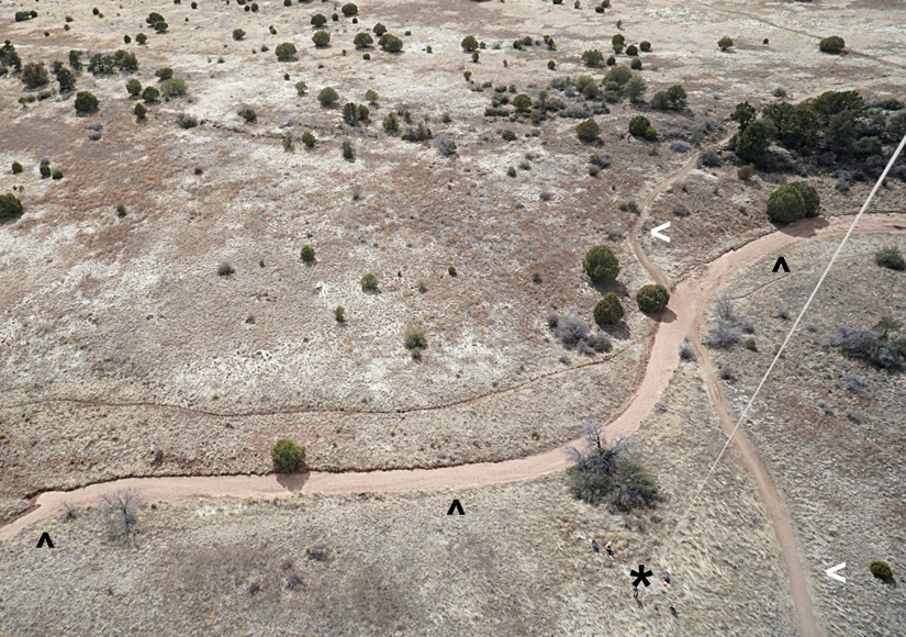
Closer views. Looking toward the southeast (left) over Williamson Valley Road and suburban housing. KAP site (right) with kite flyers at lower right (*). An ephemeral, dry wash crosses the scene (^) and is filled with sand and gravel. Tin Trough Springs Trail (#308) appears on right side (<).
Geology of Granite Mountain
Granite Mountain was once called Mount Gurley after the first governor of Arizona Territory. It is part of the Sierra Prietas, an uplifted fault block of basement crust in the Basin and Range Province. The mountain is made up of the Mint Wash Granodiorite, a hard crystalline rock that varies from granodiorite to granite in composition (Spencer and Young 2012). This rock is dated about 1.7 billion years old. Granite Mountain is part of the Yavapai tectonic province, which extends from northern Arizona across central Colorado, beneath northern Kansas, and all the way to the western Great Lakes (Baldridge 2004).

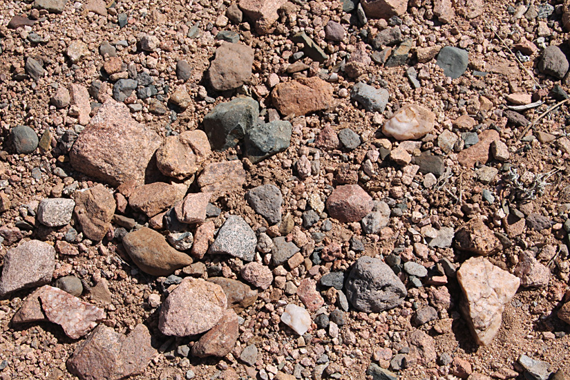
Unnamed wash (left) behind KAP site (see above). Sand and gravel fill the normally dry channel. Close-up shot (right) of coarse sand and gravel including granite, granodiorite, basalt, and quartz pebbles up to about 4 inches long.
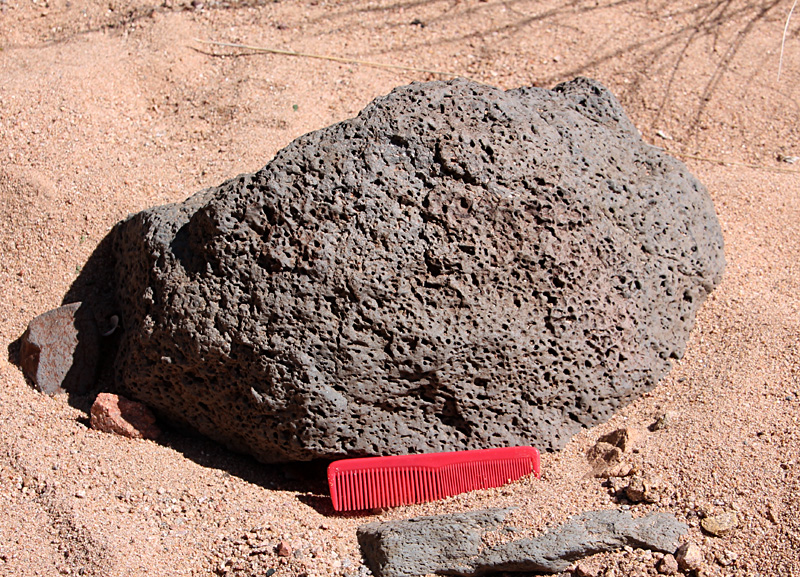
Boulders of vesicular basalt (left) and scoria (right). The latter displays flow bands that solidified as the lava cooled. From the unnamed wash at the KAP site; comb is about 5 inches long.

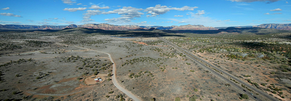
Upper Verde River Wildlife Area (2023)
The Upper Verde River Wildlife Area is more than 1150 acres in the headwaters of the Verde River near Paulden. The landscape is formed by thick lava flows that support a broad relatively flat surface into which the Verde River has cut a canyon. Elevation ranges from about 4200 to 4600 feet. The wildlife area is designated as an Important Bird Area and the river is a Critical Habitat for the endangered spikedace (Meda fulgida) fish (UVRWA 2023), which is restricted to Arizona and western New Mexico.
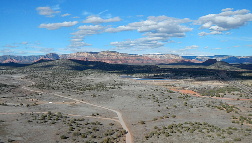
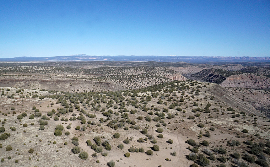
Overview (left) looking eastward and closer ground shot (right) of the Upper Verde River canyon at the KAP site. The cliff wall at the canyon rim is composed of basalt, a dark-gray, high-density, volcanic rock that was deposited in lava flows during the Miocene and Pliocene epochs (Gootee et al. 2010).
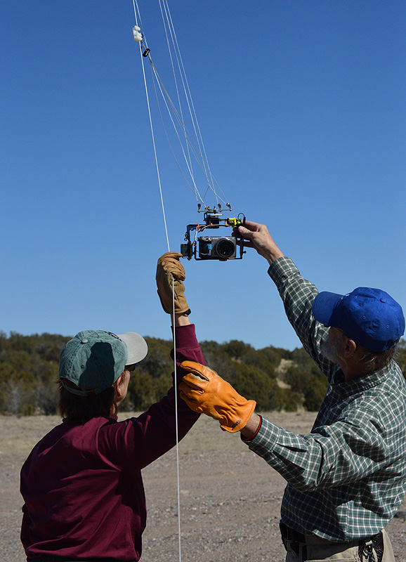
Testing the autoKAP camera rig prior to launching (left), and rokkaku kite and camera rig in flight at the Upper Verde Wildlife Area. Photos by J. Schubert.
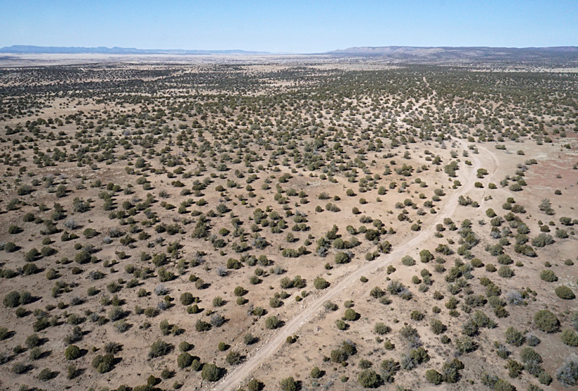
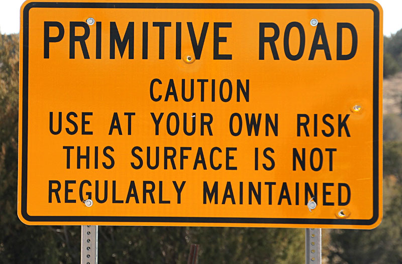
We reached our KAP site in early February via a meandering dirt path about three miles from the end of the paved Verde Ranch Road (USFS 635) east of Paulden. The access road is indeed primitive with numerous boulders, potholes, and deep ruts.
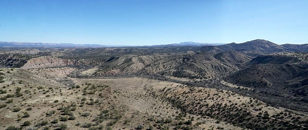 |
| Looking eastward (left) with the Mogollon Rim on the distant horizon (see above). Toward the southeast (right) the viewpoint (*) appears at the canyon edge with the Mogollon Rim in the far background. | 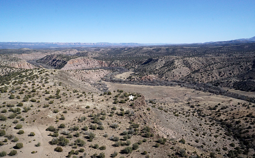 |
| View southward (left) into the deep valley. Upper Verde River canyon looking upstream to the west (right), where the canyon becomes quite narrow. Note the scattered juniper trees on the volcanic plateau. | 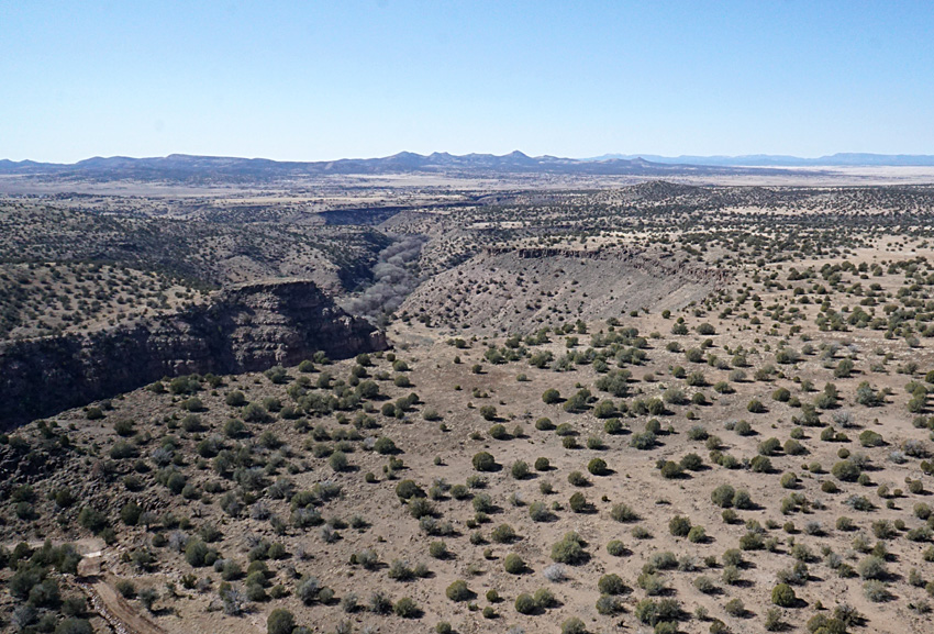 |
References
![]() Return to KAP gallery or KAP home.
Return to KAP gallery or KAP home.
Last update: February 2023.