| Baldwin City, Kansas J.S. and S.W. Aber |
|
| Baldwin City, Kansas J.S. and S.W. Aber |
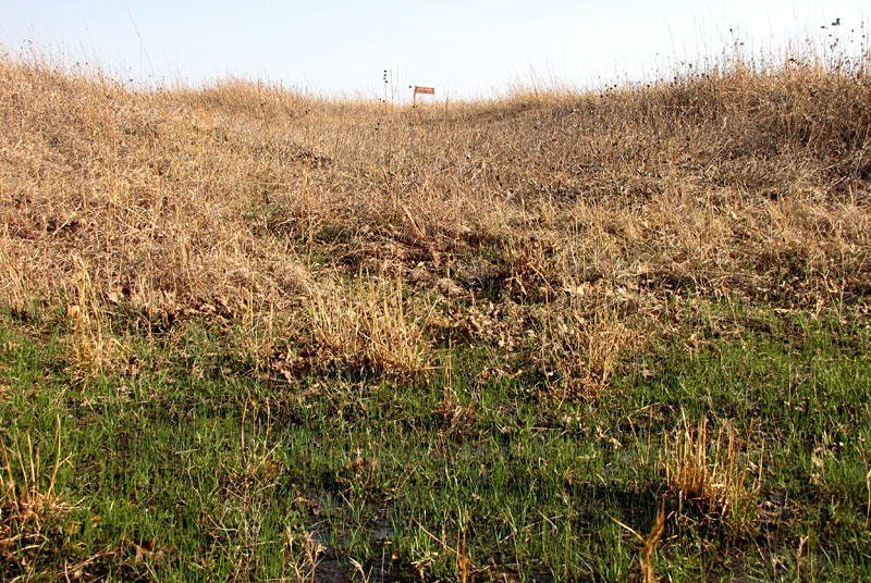
| swales that contain distinctive vegetation and wet spots. 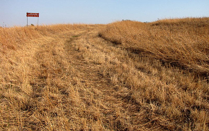
|

| Santa Fe Trail and Black Jack Park. 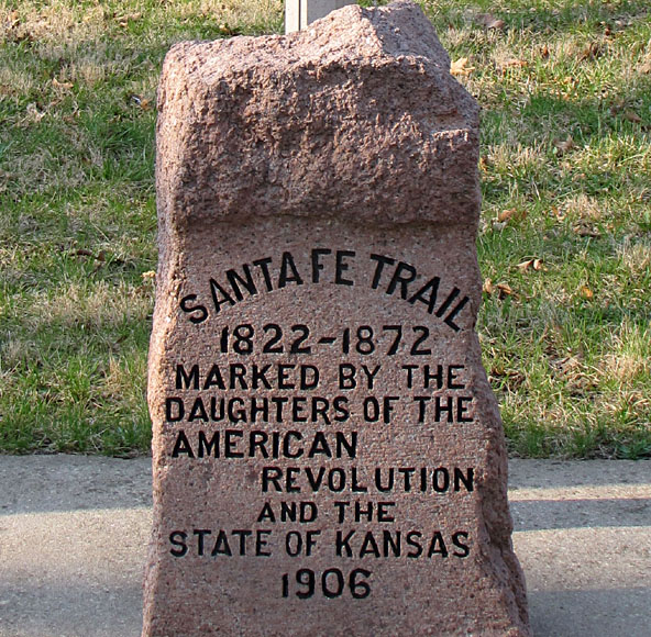
|
We discovered multiple ruts cutting across the hillside; some deep and long, others shallow and short. The main rut extends across the entire site from the southeastern side to the northwestern corner. This rut is mowed, so it's easy to follow. Some shorter ruts run parallel to this main rut, and other ruts angle off farther to the sides. Toward the southeastern end, a stone monument stands near the main rut.

| Wide-angle overview of trail ruts in the prairie preserve. View from northwestern corner looking toward the southeast; conspicuous ruts are lettered from north to south; N-S county road on right side. The central ruts are closely spaced and parallel. The outer ruts diverge to the sides. The mowed strip follows the main, central rut. Kite flyers are standing between ruts b and c. |
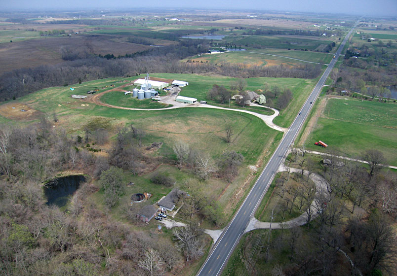
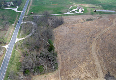
| Looking toward the east along U.S. highway 56. Agricultural land use surrounds the trail site, which is just out of view to the right. The parking circle at lower right includes the historical markers and provides access to the prairie preserve (see title image above). |
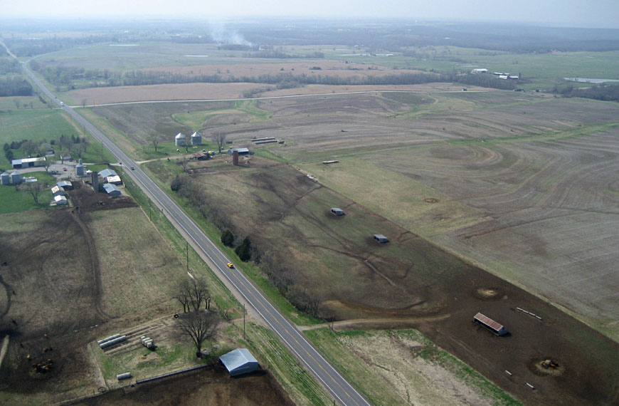
| View westward along U.S. highway 56. The Santa Fe Trail extended diagonally from lower left to upper right across this scene, but no trace is visible in the agricultural fields today. |
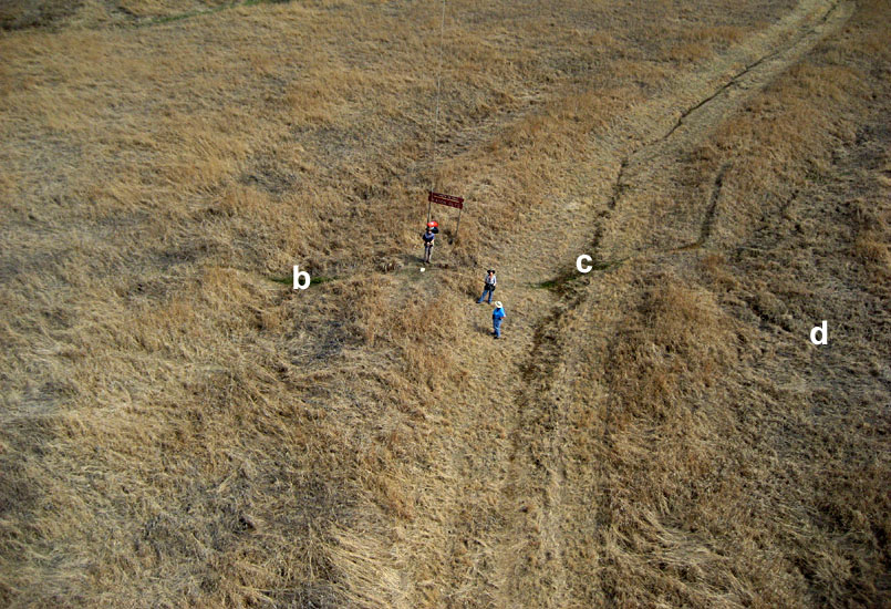
| Low-height, oblique shot of kite flyers standing on the ridge between ruts b and c near the center of the trail site. |
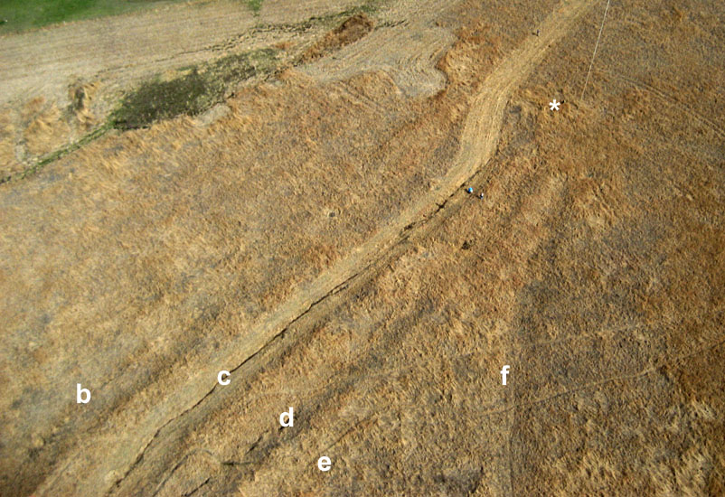
| Oblique view looking toward the southeastern side of the trail site. The beginning of rut f can be seen branching from the central ruts. Asterisk (*) indicates position of the sandstone monument (see below). |

| Vertical shot of the main, central rut (c) and three closely spaced, parallel ruts. Note person in upper right corner and camera cases on ridge between ruts b and c. |
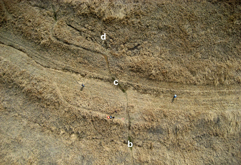
| Low-height vertical view of ruts b, c and d near the center of the site. A foot path crosses from lower center to upper left. Note two people in the main rut (c). |
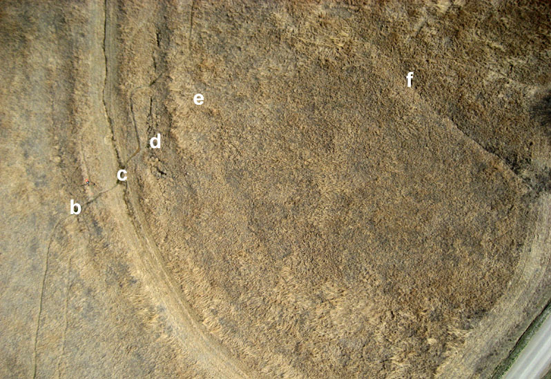
| Vertical view over the northwestern side of the trail site showing the central ruts (b, c, d, e) and the diverging rut (f). |

| Monument of native sandstone erected in the 1960s by Russell Hays. Although vandalized by bullets and paint, some of the original words are still legible refering to the Sibley Survey in 1825. | 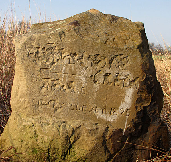
|
Text and images © J.S. and S.W. Aber