Picher, Oklahoma
Legacy of Mining
James S. and Susan W. Aber
| Introduction | Blimp operation |
| Mining history | Mining consequences |
| 2008 tornado | Related sites |
| Introduction | Blimp operation |
| Mining history | Mining consequences |
| 2008 tornado | Related sites |
Introduction
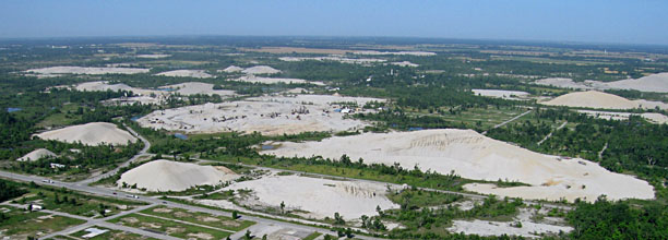
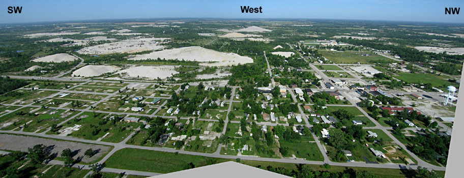
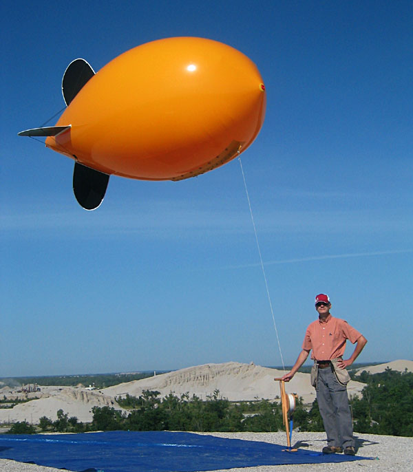
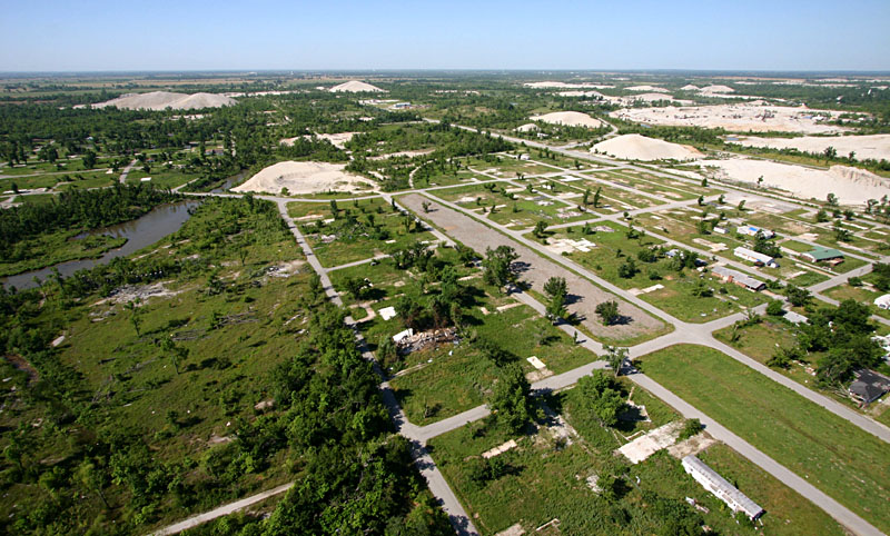
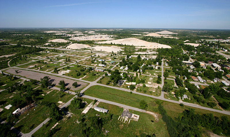
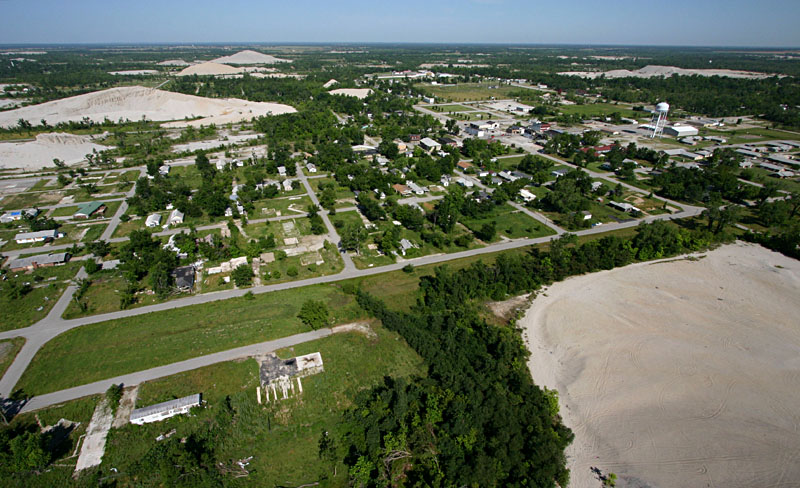
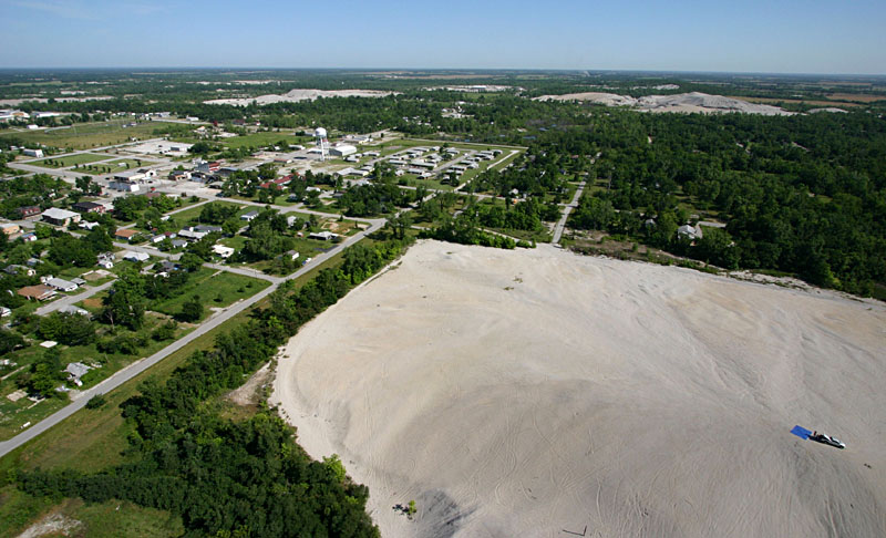
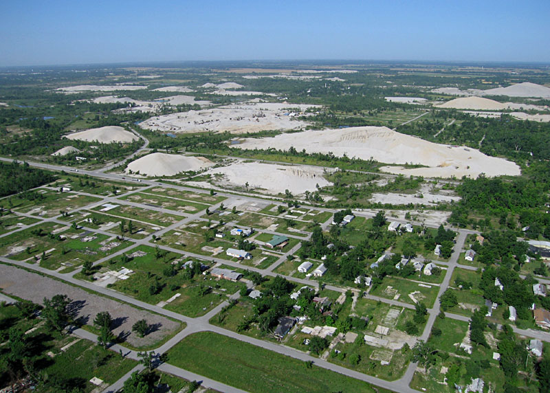
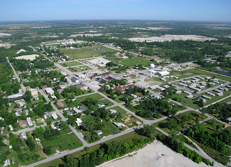
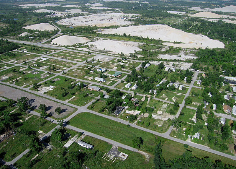
On July 1st, 2009, the authors had the opportunity to conduct blimp aerial photography from the top of a chat pile in Picher, Oklahoma. The word "chat" is a miner's term derived from chert (also known as flint). Chat piles are relicts of lead and zinc mines that operated in the early and mid 20th century at Picher. Large and small chat piles dominate the aerial view of Picher.
Blimp operation
| Left: blimp inflated and ready to attach a camera rig. Right: bringing the blimp down; winding line on a Strato-spool reel. Blimp was sent up to a maximum height of 460 feet (140 m). | 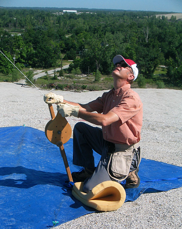 |
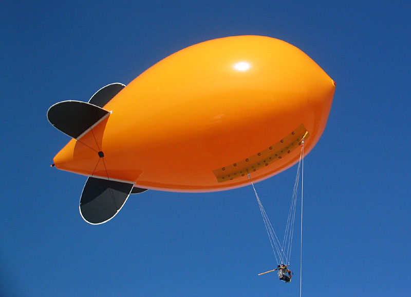
| Left: Canon S70 camera rig attached to the blimp keel. Right: blimp flying with the Canon Rebel camera rig and a superwide-angle lens. |  |
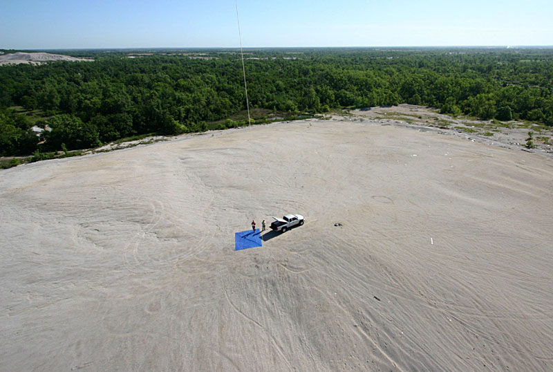
| The authors at the top of Fisher chat pile. The blimp was inflated and launched from the blue tarp behind the truck. |
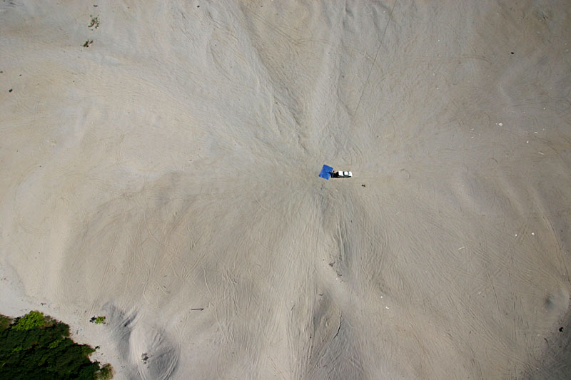
| Superwide-angle vertical view on the top of the chat pile, which displays a pinwheel pattern of erosion and many vehicle tracks. |
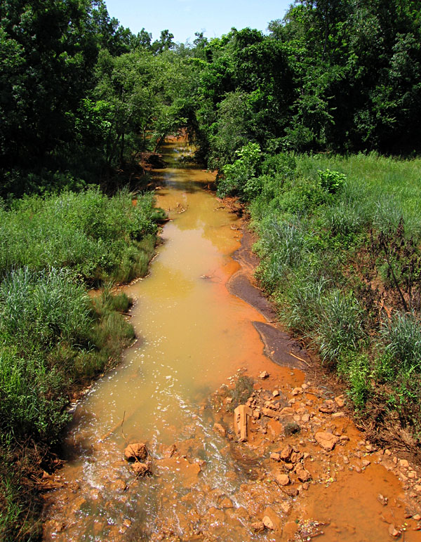
| Tar Creek downstream from Picher, Oklahoma. The rusty orange color is typical of mine-water drainage and indicates a high concentration of iron and other dissolved metals. According to the U.S. Army Corps of Engineers, Tar Creek is highly toxic and, for all intents and purposes, dead. For aerial views of Tar Creek farther downstream, go to Miami, Oklahoma. |
Such contamination led to establishment of EPA superfund sites in Missouri, Kansas, and Oklahoma. Lead poisoning, especially for children, was a special concern for state and federal agencies as well as local residents. The magnitude of surface and subsurface contamination in the Picher vicinity was deemed too great for conventional remediation efforts, so the state and federal governments are in the process of buying out and relocating residents, which began with families with children. Also strongly impacted are Quapaw people who live in the area and own much of the destroyed land. Past policies of the Bureau of Indian Affairs have exacerbated the pollution problems.
As the following blimp aerial photographs illustrate, residential sections of Picher are interspersed in close proximity among and between chat piles. Thus, it would be impossible for residents to avoid lead in the airborne dust and surface water of their neighborhoods.
    |
    |
| Views toward southwest showing area damaged by tornado. Note lack of trees toward left, where all buildings and debris has been removed. | 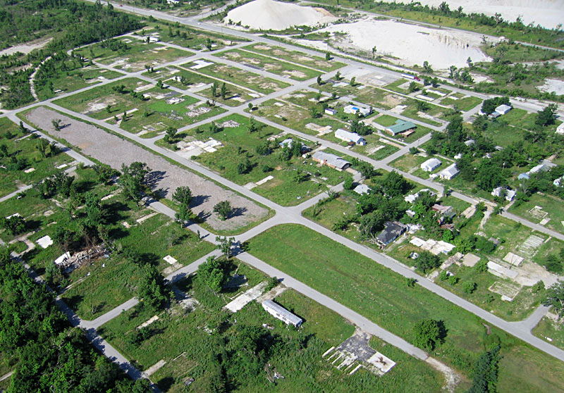 |
Related sites
Reference
![]() Return to KAP gallery.
Return to KAP gallery.
Last update: Sept. 2009.