The authors visited the Portland, Oregon vicinity in May, 1999. We undertook kite aerial photography at several sites related to Lewis and Clark, who with their Corps of Discovery spent the winter of 1805-06 on the lower Columbia River estuary near the Pacific coast. When Lewis and Clark first arrived, they experienced quite difficult and dangerous conditions. After surviving some miserable weeks being pounded by waves and rain on the exposed north side of the Columbia estuary, a permanent log fort was constructed in a more protected location near modern-day Astoria, Oregon. During the long and dreary winter, the men kept busy making moccasins, hunting elk, standing guard, going on occasional forays, and trading with local Indians. Lewis worked on his journal and ethnographic observations of Clatsop and Chinook Indians, while Clark compiled his map.
|
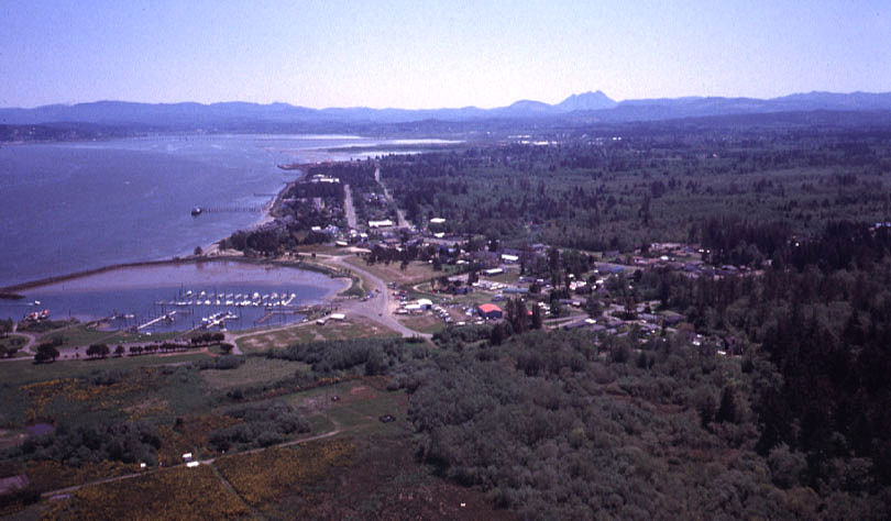
| View toward the southeast over Hammond, Oregon. Fort Clatsop is located in the forest in the right background, and Young's Bay is visible in the left background. The near-circular harbor/marina is quite distinctive at left center of the scene. Photo date 5/99; © by the authors. |
|
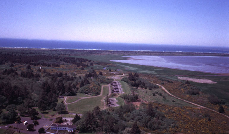
| View toward the Pacific Ocean over Ft. Stevens State Park, Oregon. The line of concrete buildings (scene center) was part of a coastal defense system built around the entrance to the Columbia River. The fort was the only part of the continental United States to come under attack during World War II, when a Japanese submarine fired several shells at the fort. Photo date 5/99; © by the authors. |
|
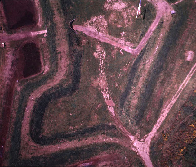
| Near-vertical view of the Civil War remains at Ft. Stevens State Park, Oregon. The main walls are marked by dark green slopes. The entrance and parts of a moat can be seen in the upper left corner, and the American flag stands at upper right of view. This fort was built by Union forces during the Civil War to protect the Columbia River from possible British entry (from Canada). Photo date 5/99; © by the authors. |
|
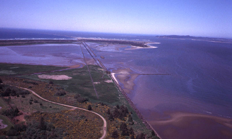
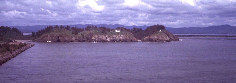
| View toward the Columbia River mouth and Pacific Ocean from Ft. Stevens State Park, Oregon. In the distant center is Clatsop Spit, and beyond that Cape Disappointment can be seen in the right background. The passage between these two landmarks connects the lower Columbia estuary (right) to the Pacific Ocean. Photo date 5/99; © by the authors. |
|
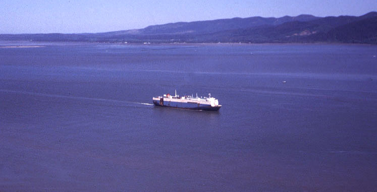
| Large freighter sails into the Columbia River estuary, near Ft. Stevens State Park, Oregon. Baker Bay is visible in the left background. This bay was a favored anchorage for fur trading ships to reside, April to October, while dealing with Indians. Photo date 5/99; © by the authors. |
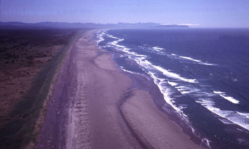
| View southward along the Pacific coast from Ft. Stevens State Park toward Tillamook Head, Oregon. Note the thin cloud over Tillamook Head in this view. These small clouds are formed as onshore wind is lifted over the cliff. Photo date 5/99; © by the authors. |
| Ecola State Park and Tillamook Head, Oregon, as seen from Canon Beach to the south. Ecola State Park, with rugged hills and the Sea Lion Rocks, is considered by many to be the most beautiful of Oregon's coastal parks. Photo date 5/99; © by the authors. |

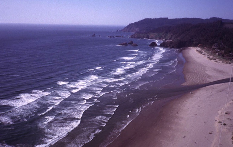
| Southward view over Canon Beach, Oregon, with Haystack Rock visible to the right. This is the site where a great whale washed up in Dec. 1805. By the time Clark arrived, little of value was left. He was able to trade with the Indians to obtain about 300 pounds of blubber and few gallons of oil. Canon Beach is the farthest south reached by Lewis and Clark along the Pacific coast. Photo 5/99; © by the authors. |
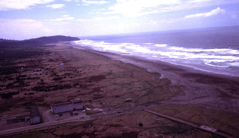
| View southward from Long Beach toward Cape Disappointment (headland in distance). Lewis and Clark ventured northward along this beach, which was the westernmost point reached during their journey. Photo date 5/99; © by the authors. |
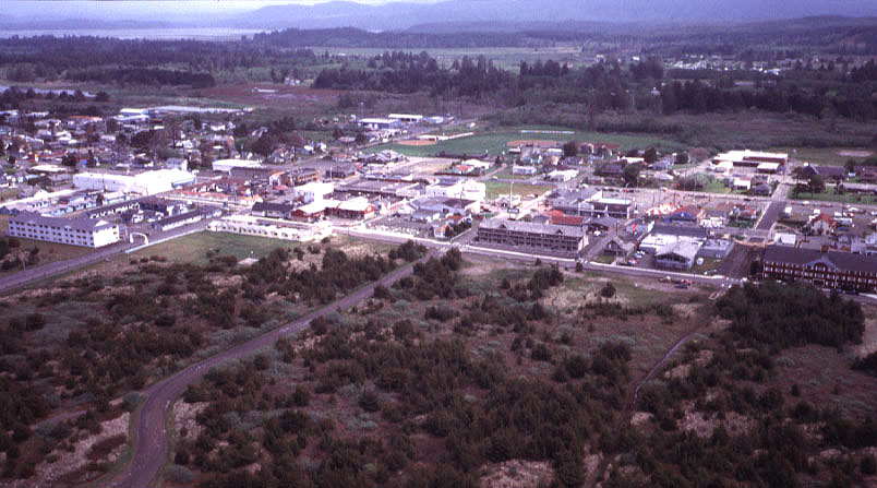
| Modern city of Long Beach, Washington is a major tourist destination, with numerous hotels, restaurants, gift shops, and other tourist attractions. Known as the kite capital of the world, Long Beach hosts a major kite festival every August. Photo date 5/99; © by the authors. |
![]() Return to Great Plains KAP gallery.
Return to Great Plains KAP gallery.
Last update 20 Dec. 2000.