
| Tromsø region, northern Norway |
|
| Tromsø region, northern Norway |
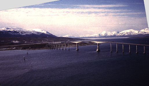
| High-oblique view toward Tromsø, northwestern Norway. High, arched bridge crosses the Sandnessundet (fjord). The great height of this bridge is designed to allow cruise ships and offshore drilling rigs to pass underneath. The Tromsø airport is visible at far end of bridge, which carries traffic for highway 862. |

| High-oblique view over coastal islands of northwestern Norway. Village in foreground is Hillesøy on the large island of Kvaløy, west of Tromsø. Several pleasure boats are visible in the small harbor. High, arched bridge in background leads to Sommarøy, where many vacation homes are located. |
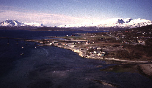
| View south over Kvaløysletta, northwestern Norway. This city is connected to Tromsø by the bridge (to left). The city provides suburban residential living for people who work in Tromsø. |
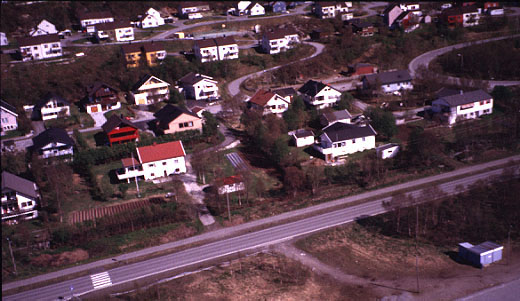
| Low-oblique view of residential housing on the hillside in Kvaløysletta, northwestern Norway. Highway 863 crosses the lower portion of view. |
![]() Return to KAP gallery.
Return to KAP gallery.