| J.S. and S.W. Aber |
| Introduction | Nebraska Sand Hills |
| White River Badlands | References |
|
| J.S. and S.W. Aber |
| Introduction | Nebraska Sand Hills |
| White River Badlands | References |
In 2010 and again in 2015, we had opportunities to conduct kite aerial photography (KAP) in the Nebraska Sand Hills and at Toadstool Geologic Park in the White River Badlands. Western Nebraska usually has ample sun and wind for kite aerial photography. We utilized primarily rokkaku and delta kites with various radio-controlled and autoKAP camera rigs.
Back to top.
Back to top.
Introduction
Nebraska is ranked 15th in state size (total area), 38th in human population, and 43rd in population density (US Census 2015). Population density is especially low in the west, where there is a lot of land and few people. Once upon a time, long ago, we lived in Chadron in the northwestern corner of Nebraska. Since then we have visited several times and led Emporia State University (ESU) geology field trips in the western portion of the state. Nebraska Sand Hills
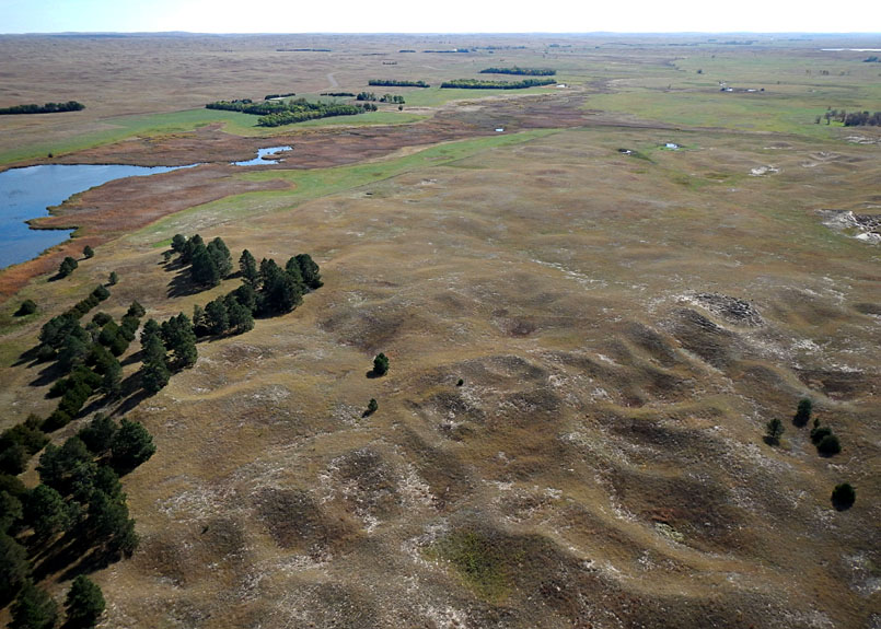
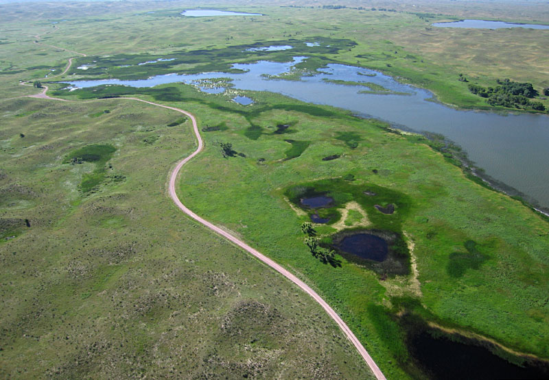
The Nebraska Sand Hills (NSH) region covers most of north-central Nebraska and extends a short distance into South Dakota. The NSH stretches roughly 265 miles (~425 km) east-west and covers approximately 19,300 square miles (~50,000 km2). This is by far the largest area of sand dunes in North or South America (Bleed and Flowerday 1990), bigger than New Hampshire and Vermont together, and one of the largest areas of native prairie in the Great Plains (Labedz 1990). Most of the dunes are now stabilized by prairie grass, and lakes abound in many swales between dunes.
Panoramic overview of lakes and dunes near Valentine, Nebraska. Small blow-out dunes cover larger transverse dunes, and lakes occupy the troughs between large dunes. Assembled from two wide-angle shots.

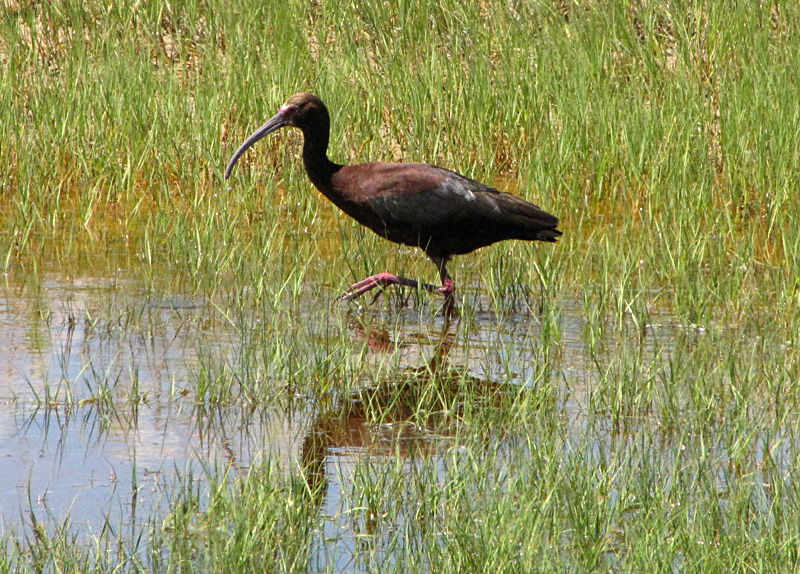
(Plegadis chihi) wades in shallow water searching for food (right).

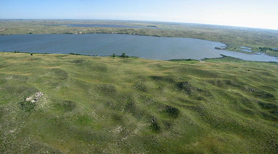
Lakeside vicinity, Sheridan County, western sand hills region. Left: lakes occupy troughs between large dunes with sparse grass cover. Right: close-up shot of lake nearly filled with emergent vegetation and large dunes in the background.
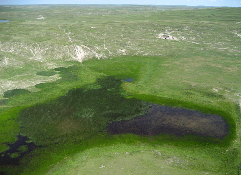
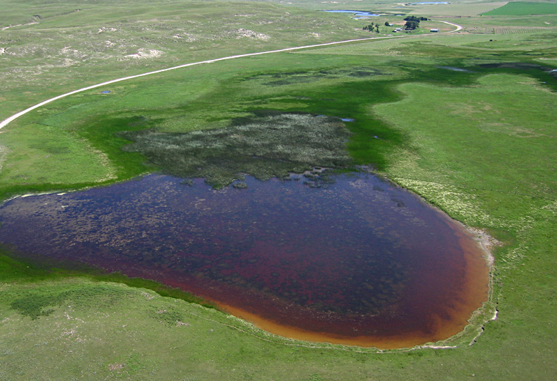
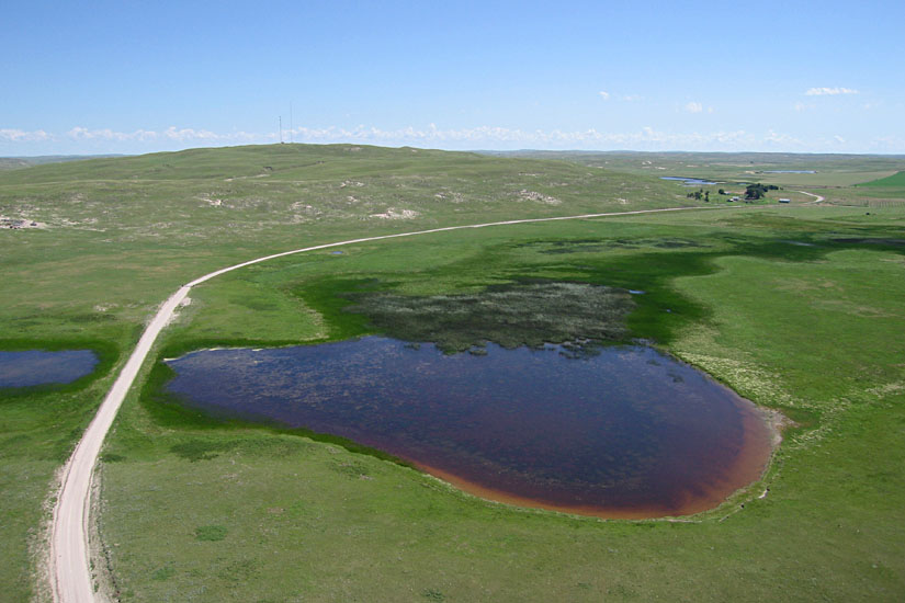
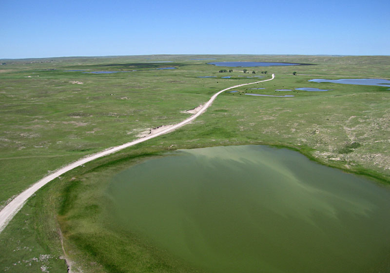
Lakeside vicinity. Left: maroon and gold colors in the lake are results of micro-organisms that thrive in hypersaline water (see title image). Right: lake in foreground has algae and sediment that color the water shades of green.
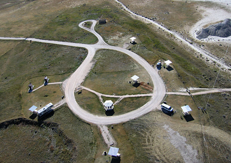
Overviews of Smith Lake State Wildlife Management Area looking toward the west (left) and north (right) with kite flyers on right side. Sheridan County, western sand hills region. This fresh-water lake is popular for fishing and camping.
Left: Smith Lake is fed by Pine Creek that drains through a broad valley with numerous lakes. View toward southeast. Right: line of cedar (juniper) trees meandering across small blow-out dunes south of Smith Lake. Trees were planted presumably to form a windbreak.

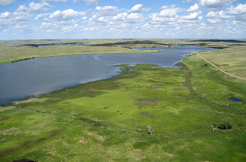
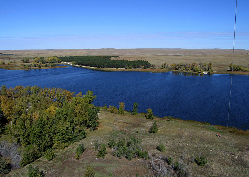
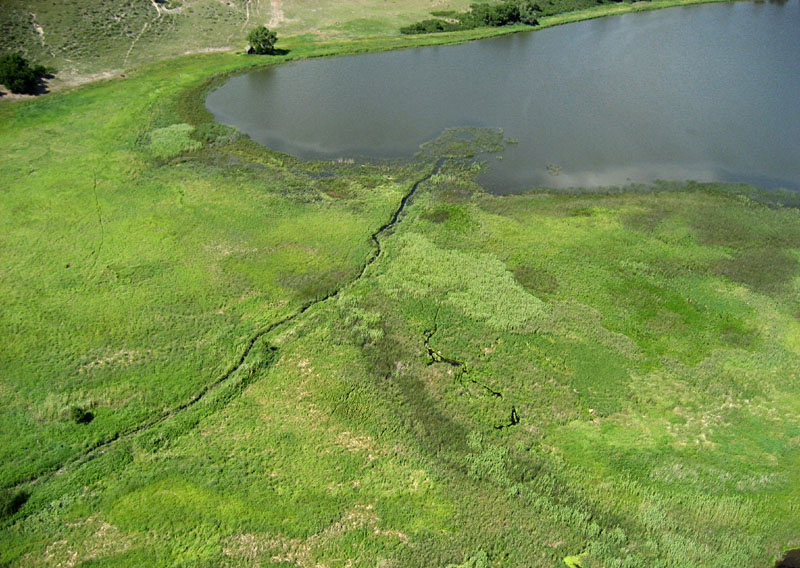
Steverson Lake overview (left) and close-up shot of inlet creek and delta (right). Part of the Cottonwood-Steverson State Wildlife Management Area, western Cherry County, north-central sand hills region.
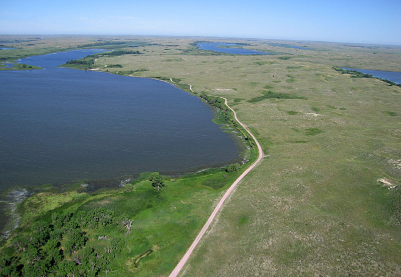
Overviews of Dewey Lake toward the west (left) and southeast (right). One of several fresh-water lakes that occupy troughs between large dunes. Near Valentine, Cherry County, north-central sand hills region.
White River Badlands
The White River Badlands (WRB) terrain is situated between the Pine Ridge in Nebraska and the Black Hills in South Dakota. The White River and its tributaries have cut deeply into the northern margin of the Pine Ridge and exposed underlying bedrock of the White River Group, including the Brule and Chadron formations. This bedrock consists of poorly consolidated mudstone and sandstone layers that have eroded into badlands. Toadstool Geologic Park is one such place, located near Crawford in Sioux County, where unusual erosional forms resemble giant toadstools. Erosion is rapid as demonstrated by collapse of pedestals and pillars during the past few decades.
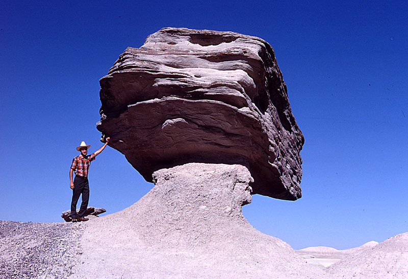
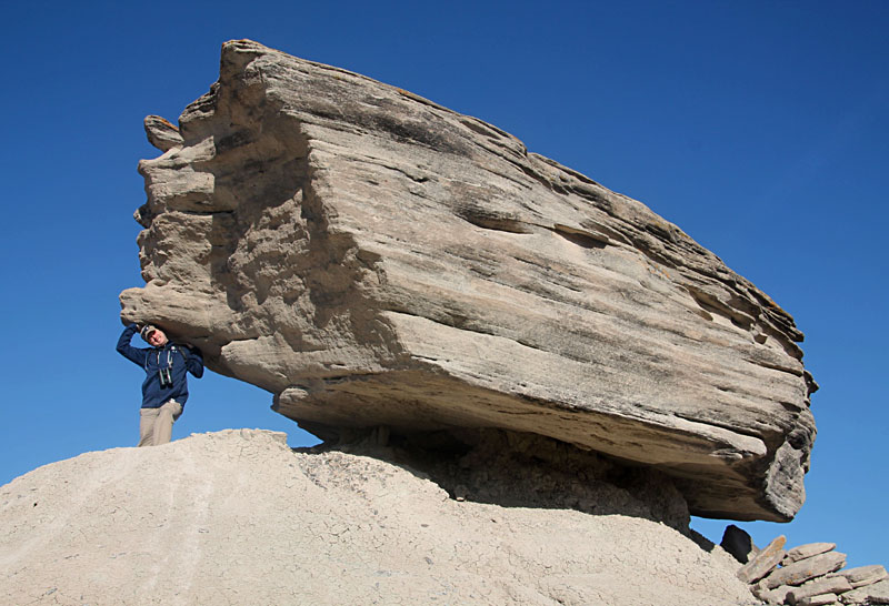
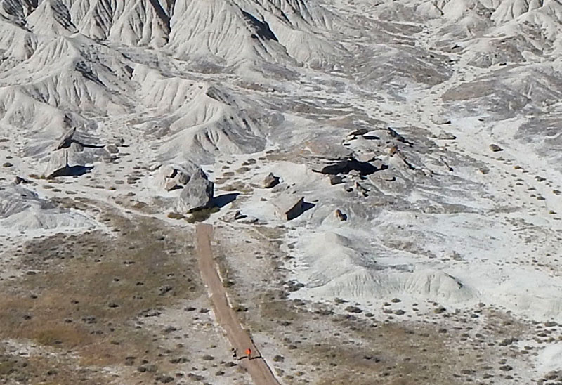
Large toadstool block of sandstone supported by a narrow pillar of mudstone as it appeared in 1978. The same block, broken and partly collapsed in 2015. Mudstone is worn away by rain and wind, and freezing breaks up sandstone.
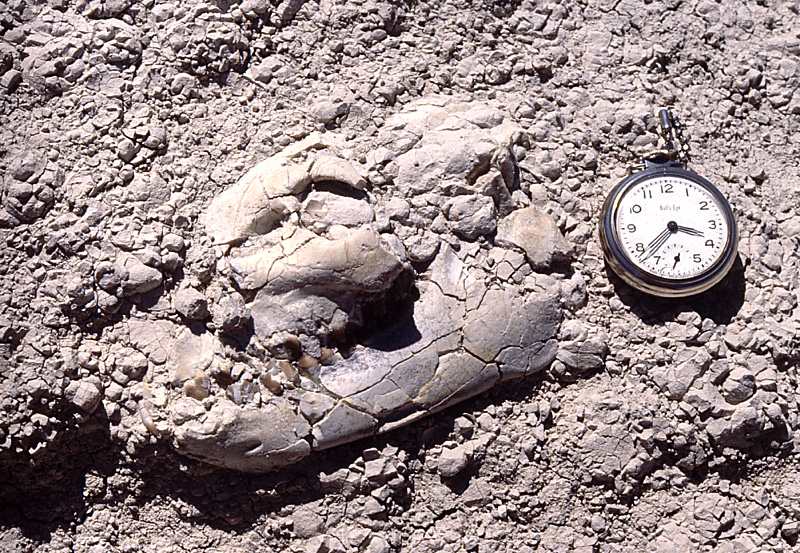
Nearly whole skull of a fossil oreodont exposed in mudstone of the Chadron Formation. Oreodonts were herbivores similar to modern sheep and goats that populated the lush prairie wetlands. Pocket watch is about 2 inches (~5 cm) in diameter.

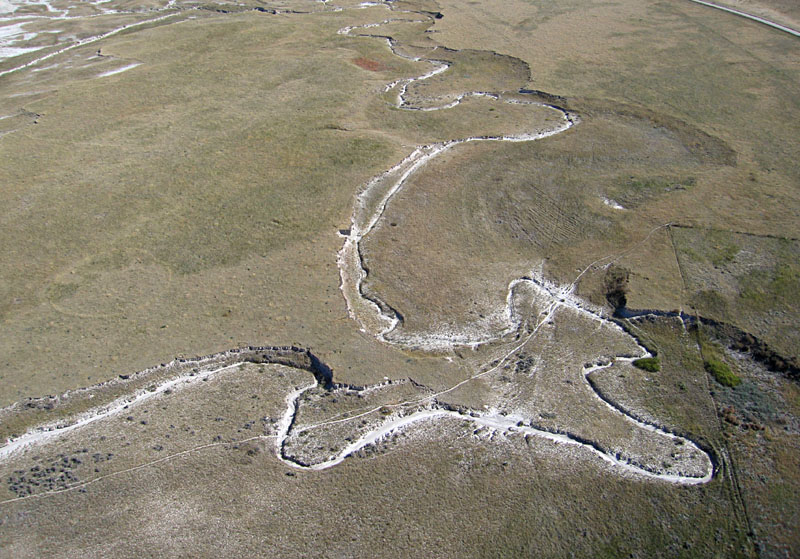
Overview of White River Badlands (left), which here expose poorly consolidated mudstone and sandstone of the Chadron Formation. Right: close-up view of highly meandering stream channel incised into the prairie surface.
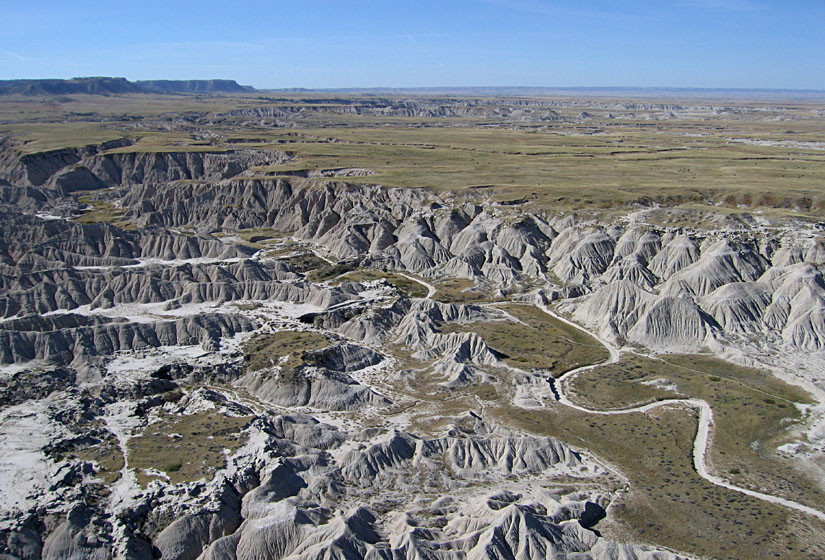
Escarpment formed by sandstone in the Brule Formation. Overview (left) with the Pine Ridge in the far left background. Close-up shot (right) reveals intricate patterns of gully erosion on steep slopes of the escarpment. Sandstone of the Brule Formation is more resistant to erosion compared with mudstone of the Chadron Formation.

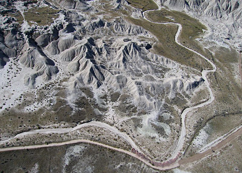
Close-up shots show erosional details in the Chadron Formation (left) and a cluster of large, collapsed toadstools (right). Note people on the gravel path in both of these views.
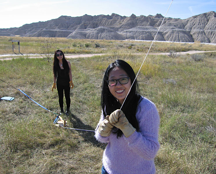
Left: small campground and picnic area with kite flyers on right side. Right: international ESU students from China, Yuanyuan Zhou (left) and Zhilin Li, test the Canon S70 autoKAP rig prior to flight. Note leather gloves to handle kite line.
References
![]() Return to KAP home or gallery.
Return to KAP home or gallery.
All text and imagery © by J.S. and S.W. Aber.
Last update Dec. 2015.